The Silent Survey: Mapping the Battlespace Beneath the Waves
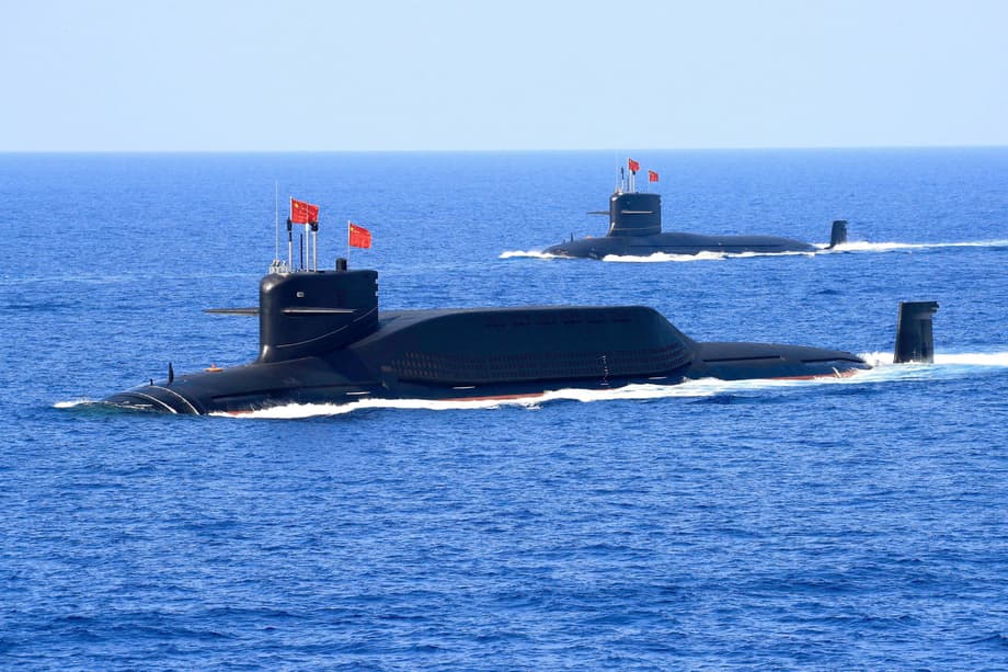
China has launched an expansive undersea reconnaissance campaign across the Pacific, Indian, and Arctic oceans, deploying dozens of research vessels to map the ocean floor and monitor water conditions near United States military installations and strategic maritime chokepoints. This operation represents one of the most comprehensive seabed surveying efforts in recent naval history, collecting detailed data on underwater terrain, temperature, salinity, and currents that naval experts say would prove crucial in future submarine warfare scenarios.
- The Silent Survey: Mapping the Battlespace Beneath the Waves
- A Fleet of Watchers
- Why the Seabed Matters
- The Transparent Ocean Initiative
- Targeting Strategic Chokepoints
- Extending Reach to the Indian Ocean
- Civil-Military Fusion in Practice
- Regional Pushback and Sovereignty Concerns
- Next Generation Undersea Capabilities
- The Bottom Line
The scale of this endeavor has alarmed Western defense analysts who note that for decades, the US Navy maintained an asymmetric advantage in understanding the undersea battlespace. Ryan Martinson, an associate professor specializing in Chinese maritime strategy at the US Naval War College, described the magnitude of Beijing’s marine scientific research as frankly astonishing. China’s efforts now threaten to erode that long-standing advantage, creating a more contested environment beneath the waves where American submarines have traditionally operated with relative impunity.
A Fleet of Watchers
At the center of this operation sits the Dong Fang Hong 3, a research vessel operated by Ocean University of China that spent 2024 and 2025 conducting repeated surveys near Taiwan, the American stronghold of Guam, and critical stretches of the Indian Ocean. Ship-tracking data reviewed by Reuters shows the vessel sailing back and forth in tight lines, a pattern indicative of systematic seabed mapping. In October 2024, it inspected powerful ocean sensors capable of identifying undersea objects near Japan, returning to the same location in May 2025. By March 2025, the ship was crisscrossing waters between Sri Lanka and Indonesia, covering approaches to the Malacca Strait, one of the world’s most critical chokepoints for maritime commerce.
The Dong Fang Hong 3 is not operating in isolation. Analysis of more than five years of movement data from Starboard Maritime Intelligence reveals that 42 Chinese research vessels have been active across the three oceans. At least eight have conducted confirmed seabed mapping operations, while another ten carry specialized equipment capable of such work. These vessels belong to Chinese state entities like the Ministry of Natural Resources or state-affiliated research institutions. While the ships sometimes disable their tracking systems, meaning the full scope likely exceeds what analysts can document, the visible activity alone covers militarily sensitive waters around the Philippines, Hawaii, and US facilities on Wake atoll in the north Pacific.
Why the Seabed Matters
Understanding the strategic value of this mapping requires knowledge of how submarines operate and fight. These vessels navigate and hide within a few hundred meters of the surface, where underwater terrain, water temperature, salinity, and ocean currents determine their visibility to detection systems. Sound waves used in sonar systems bend and bounce differently depending on seabed contours and water density. These acoustic properties create shadows where submarines can conceal themselves or reveal their positions to adversaries with detailed environmental knowledge.
Tom Shugart, a former US submarine commander now at the Center for a New American Security, explained that the movement of sound waves changes depending on the underwater landscape. Temperature layers and salinity variations affect how sound travels through water, meaning that identical submarine operations might remain invisible in one location while becoming exposed in another. Commanders require precise data to avoid collisions with seamounts and to identify optimal hiding positions.
The vessels’ survey data would be potentially invaluable in preparation of the battlespace. Any military submariner worth his salt will put a great deal of effort into understanding the environment he’s operating in.
Peter Scott, former chief of Australia’s submarine force, emphasized this point to Reuters, noting that the data collection serves essential functions for both offensive submarine deployment and anti-submarine warfare operations.
The Transparent Ocean Initiative
Around 2014, Wu Lixin, a scientist at Ocean University, proposed an ambitious project to create what Chinese researchers call a transparent ocean. This concept involves deploying extensive networks of sensors, buoys, and subsea arrays that monitor water conditions and underwater movements in real time. The proposal quickly received at least $85 million in support from the Shandong provincial government, according to official comments by Shandong officials.
The project began in the South China Sea, where Ocean University now claims to have built an observation system covering the deep-sea basin. Records from Chinese government agencies show the network has since expanded to the Pacific and Indian oceans, with hundreds of sensors deployed east of Japan, east of the Philippines, and around Guam. In the Indian Ocean, documents describe a sensor array ringing India and Sri Lanka, including installations along the Ninety East Ridge, one of the world’s longest undersea mountain ranges.
Rear Admiral Mike Brookes, commander of the US Office of Naval Intelligence, testified before a congressional commission that China is building undersea surveillance networks gathering hydrographic data to optimize sonar performance and enable persistent surveillance of submarines transiting critical waterways like the South China Sea. While some naval experts express caution about claims of real-time underwater data transmission given technical challenges, even delayed data provides valuable intelligence about adversary submarine operations.
Targeting Strategic Chokepoints
China has concentrated its most comprehensive ocean surveying east of the Philippines, a region sitting along the First Island Chain. This string of territories, largely controlled by American allies, runs from the Japanese islands in the north through Taiwan and on to Borneo in the south, forming a natural barrier between China’s coastal seas and the open Pacific. Peter Leavy, formerly Australia’s naval attache to the US and now president of the Australian Naval Institute, observed that China appears paranoid about being boxed in by this chain. The extensive mapping indicates a desire to understand the maritime domain sufficiently to break out into blue water.
The tracking data reveals that Chinese vessels have also mapped waters surrounding Guam, where American nuclear submarines are stationed, and around Hawaii, another major regional hub. Ships have examined an underwater ridge north of a naval base in Papua New Guinea to which the US recently gained access, and scouted around Christmas Island, an Australian territory on routes between the South China Sea and a vital Australian submarine base. This pattern suggests Beijing is preparing for operations far beyond its immediate coastline, developing the capability to contest American undersea dominance across the entire Indo-Pacific.
Extending Reach to the Indian Ocean
China’s oceanographic ambitions extend well beyond the Pacific. Chinese vessels have mapped large swaths of the Indian Ocean, a critical route for Chinese imports of oil and other resources from the Middle East and Africa. Jennifer Parker, an adjunct professor of defense and security at the University of Western Australia and former Australian anti-submarine warfare officer, noted that China has key vulnerabilities regarding dependencies on maritime trade. The extensive surveying indicates that Beijing will likely conduct more submarine operations in the Indian Ocean to protect those supply lines while simultaneously monitoring the naval activities of regional powers including India.
The sensor array along the Ninety East Ridge sits astride the approach to the Malacca Strait, through which much of China’s oil supply passes. This positioning allows China to monitor both its own supply route vulnerabilities and potential adversary submarine movements through this essential chokepoint. Chinese vessels have also mapped the seabed west and north of Alaska, an essential sea route into the Arctic where Beijing has declared its ambition to become a polar great power by the 2030s.
Civil-Military Fusion in Practice
The integration of civilian scientific research with military technology development has become a central focus of the Chinese government under President Xi Jinping. Beijing refers to this approach as civil-military fusion, and it features prominently in the operations of institutions like Ocean University of China. The university’s president publicly celebrated in 2021 the institution’s close ties to China’s navy and its commitment to the construction of a maritime power and national defense.
Zhou Chun, an Ocean University researcher who oversees the Indian and Pacific ocean sensor arrays, articulated this connection explicitly in a 2025 press release. He stated that his work had shown him the rapid development of his country’s maritime defense and military capabilities, and he pledged to transform the most advanced scientific and technological achievements into new types of combat capabilities for the military at sea. The mapping program founder Wu now oversees the network through the Qingdao National Laboratory for Marine Science and Technology, whose partners include China’s Naval Submarine Academy.
Regional Pushback and Sovereignty Concerns
This expansive data collection activity has triggered significant responses across the Indo-Pacific as regional powers grapple with questions of maritime sovereignty and security. India, which has long sought to position itself as a regional provider of hydrographic services, maintains particular concerns about Chinese research activities in the Indian Ocean, especially near the Bay of Bengal where India’s nuclear submarine fleet is based.
Sri Lanka implemented a 12-month moratorium on foreign research vessel visits after the presence of Chinese research vessels, most recently the Shi Yan 6 in October 2023, drew loud protests from New Delhi. The Sri Lankan government moved to cancel an agreement between a Chinese institute and a local university that had provided China easy access to Sri Lankan waters and hydrographic data. The government also created a new agency under the Ministry of Defence to supervise hydrographic research, seeking to establish sovereign control over information about its own maritime domain.
Next Generation Undersea Capabilities
Recent technical breakthroughs suggest China is moving beyond mere data collection toward active preparation of the seabed as a battlespace. Chinese scientists have successfully tested solid rocket engine ignition at 200 meters underwater, far deeper than standard submarine-launched missiles which typically fire from around 30 meters. Engineers from the Mechano-Electrics Engineering Institute and the Key Laboratory of Underwater Intelligent Equipment published findings in the Chinese peer-reviewed journal Tactical Missile Technology describing a deep-water environment simulation experiment platform. If developed into operational systems, such technology could enable missile launch facilities fixed to the ocean floor, expanding strategic options for Beijing.
Analysts also warn that detailed seabed knowledge enables capabilities for disrupting undersea infrastructure. Taiwan relies almost entirely on undersea cables for internet connectivity, making the island particularly vulnerable to a digital quarantine through targeted cable cutting. Jason Hsu, a researcher cited in defense analyses, suggests that the People’s Liberation Army could sever key cable clusters to cut bandwidth by up to 99%, isolating Taiwan and disrupting allied coordination. The Tansuo Yi Hao, another Chinese research vessel, has circumnavigated Australia and paused over the Diamantina Trench, where it could potentially service seabed acoustic sensors or gather intelligence on seabed cables. Prime Minister Anthony Albanese stated publicly that he would prefer such vessels were not present in Australian waters.
The Bottom Line
- China has deployed 42 research vessels across the Pacific, Indian, and Arctic oceans to conduct systematic seabed mapping and environmental monitoring in strategically sensitive waters.
- The Transparent Ocean project, funded with at least $85 million from Shandong province, has deployed hundreds of sensors providing data that optimizes submarine detection and concealment capabilities.
- Surveying focuses on militarily critical areas including the First Island Chain, waters near Guam and Hawaii, the Malacca Strait approaches, and routes near Australian submarine facilities.
- Civil-military fusion allows civilian research vessels to collect dual-use data supporting naval operations, seabed weapon positioning, and potential infrastructure disruption capabilities.
- Regional powers including India, Sri Lanka, and Australia are implementing restrictions or enhanced monitoring in response to sovereignty concerns and security threats.
- Advanced testing of deep-sea rocket ignition and sensor networks indicates China is preparing the seabed as an active domain for future military operations.