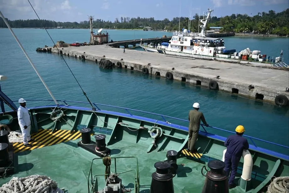
A remote island moves to the centre of India's strategy
India plans to invest approximately Rs 81,000 crore, or US$9 billion to US$10 billion, in transforming Great Nicobar Island into a commercial and strategic hub near the Strait of Malacca. The project brings together a container port, an international airport, a power plant and a township on a remote island whose location gives New Delhi a powerful position beside a vital shipping route.
Contents
- A remote island moves to the centre of India's strategy
- What India intends to build
- Why moving cargo through India matters
- China's dependence on the Malacca route
- China's port network and India's geographic answer
- How a commercial hub could support military operations
- The forest and tribal communities at the centre of opposition
- What the environmental ruling requires
- How the project fits India's regional partnerships
- The milestones behind the debate
- The Essentials
As of May 28, 2026, the Holistic Development of Great Nicobar Island project has become a meeting point for several urgent concerns: India's dependence on foreign cargo hubs, China's reliance on maritime energy supplies, environmental protection and the rights of indigenous communities. Its first operational phase is targeted for 2028, with development continuing in stages over the next 30 years.
Great Nicobar covers 921 square kilometres and lies roughly 1,200 kilometres from the Indian mainland. Dense, prehistoric rainforest covers much of the island, which is home to some of the world's last uncontacted tribes. For decades, this southernmost Indian frontier received relatively little attention compared with its strategic potential.
The island lies less than 150 kilometres from the western mouth of the Strait of Malacca. Its strategic position is also described as roughly 40 nautical miles from the strait's entrance. The waterway carries approximately 30 percent of global maritime trade and up to 80 percent of China's imported oil, making nearby infrastructure valuable for commerce, surveillance and defence.
The effective closure of the Strait of Hormuz, and the resulting global energy crisis, has sharpened the project's urgency. Disrupted supplies of oil, gas and fertilisers have made the security of other maritime chokepoints a pressing concern. Supporters argue that Great Nicobar could give India greater ability to monitor, influence and, if necessary, complicate Chinese supply chains.
What India intends to build
NITI Aayog conceived the project, which is being executed by the Andaman and Nicobar Islands Integrated Development Corporation. Its planned development area covers 166 square kilometres. The investment is intended to create infrastructure that can support civilian activity while also meeting defence requirements.
At its centre is the Galathea Bay International Container Transshipment Terminal. The first phase aims to handle four million TEUs by 2028, with capacity eventually reaching approximately 16 million TEUs. A TEU is a standard measure of container capacity based on a container 20 feet long. The planned mature capacity is four times the initial figure.
Galathea Bay has a natural harbour depth exceeding 20 metres. The project envisages using that depth to accommodate the world's largest container vessels without dredging, the process of removing material from the seabed to make a harbour deeper.
A new international airport is planned with a runway measuring 3,300 metres, suitable for aircraft with wide bodies. A power plant combining gas and solar generation would provide 450 megawatts of electricity. The township is designed to support up to 65,000 residents, including the workers needed to operate the new facilities.
Digital connectivity would be supported by the Chennai-ANI submarine cable, known as CANI. Official planning documents also envisage artificial intelligence, smart port technologies and sustainable infrastructure concepts in future phases. These elements would connect the island's physical facilities with systems for managing cargo, communications and operations.
Why moving cargo through India matters
India currently sends nearly 75 percent of its transhipped cargo through foreign ports such as Colombo, Singapore and Port Klang. Transhipment means transferring cargo between ships, often from a smaller feeder vessel to a larger ship carrying containers over longer distances.
Indian exporters using those hubs pay terminal handling fees in foreign currency and wait for feeder connections to mainline vessels. The process adds days to transit times and costs hundreds of millions of dollars annually in foreign exchange. A domestic hub would bring more of those fees, jobs and cargo handling activity within Indian territory.
Government analysts estimate that a functioning transhipment hub at Great Nicobar could save US$200 million to US$220 million a year by reducing reliance on overseas ports. The financial argument rests on using India's own location to retain business now handled elsewhere.
Cargo information is another part of the calculation. Bringing more cargo handling home would reduce exposure to foreign pricing decisions and potential supply chain pressure from competitors. For New Delhi, the port's value therefore extends beyond the containers passing through it to the information generated by their movement.
The planned terminal combines an unusually deep natural harbour with proximity to a major shipping route. Its commercial ambitions and its strategic role are closely connected: facilities that support trade can also provide logistics capacity useful to defence operations.
China's dependence on the Malacca route
Former Chinese President Hu Jintao gave a name to Beijing's vulnerability in a 2003 address to the Communist Party Central Committee: the "Malacca Dilemma". China depends heavily on a narrow sea passage for supplies that keep its economy running, while that passage could become a point of pressure during conflict.
The Strait of Malacca funnels roughly 60,000 vessels annually through a channel that narrows to just 2.8 kilometres at its tightest point near Singapore. Ships carrying oil and liquefied natural gas use this route as part of the maritime connection between the Gulf and East Asia.
China's strategic petroleum reserve is estimated to cover 40 to 50 days of imports. A naval blockade could choke the economy within weeks. Once reserves were exhausted, factory output would falter, fuel prices would rise and the economic effects would spread internationally.
Beijing has pursued alternative routes, including roads and pipelines, to reduce this dependence. Those routes can carry only a fraction of the volumes transported by sea. Maritime transport remains the only realistic option for the enormous oil and liquefied natural gas flows China requires, helping explain its expanding naval presence in the Indian Ocean.
The Hormuz disruption has made this concern more immediate. A sustained interruption along the shipping artery from the Gulf to Malacca could seriously damage the world's second largest economy. India's proposed facilities near the eastern end of that route are consequently being assessed in a wider security context.
China's port network and India's geographic answer
China's "String of Pearls" strategy involves a network of port investments and infrastructure with civilian and military uses across the Indian Ocean. Indian strategic thinkers have watched that network grow with concern, seeing a maritime architecture developing around India.
Gwadar in Pakistan has been developed under the China-Pakistan Economic Corridor with billions in investment. Hambantota in Sri Lanka is leased for 99 years to a Chinese state company. Kyaukpyu in Myanmar connects Yunnan province to the Bay of Bengal through operational oil and gas pipelines.
China also opened its first overseas military base in Djibouti in 2017. Together, these facilities support Beijing's effort to protect maritime access and reduce vulnerabilities along the routes carrying its trade and energy supplies.
Some Indian planners describe the cumulative effect as encirclement. Great Nicobar is increasingly presented as a structural response, sometimes called a "Necklace of Diamonds" approach. The argument is that India can use its own territory to strengthen its position instead of relying entirely on access negotiated with other countries.
Great Nicobar requires no lease agreement or consent from a host nation. India holds sovereign title to the island, and its territorial status is uncontested. That gives New Delhi a lasting position whose use is not dependent on changing diplomatic arrangements abroad.
Former Chief of Defence Staff General Bipin Rawat used a memorable description for the Andaman and Nicobar Islands, capturing the military value of their permanent location:
unsinkable aircraft carriers
Defence experts also describe the chain as a "natural aircraft carrier". The archipelago stretches nearly 700 kilometres in an arc guarding approaches to the Andaman Sea. Its advantage comes from geography rather than the construction of disputed outposts elsewhere in Asia.
How a commercial hub could support military operations
The Andaman and Nicobar Command, established in 2001, is India's only tri-services command, bringing together the army, navy and air force. It has long sought more resources and infrastructure for forward deployment, meaning the ability to operate closer to areas of strategic interest.
Great Nicobar's proposed airport, port, power supply and communications systems fit a design that blends civilian and military utility. Logistics facilities used to move commercial goods can also serve defence requirements. The project would expand the infrastructure available at a location already valued by military planners.
The Six Degree Channel passes close to the island and serves as a major route for commercial and naval movements entering and leaving the Malacca corridor. Persistent monitoring from Great Nicobar could improve India's understanding of activity across this busy maritime environment.
Maritime domain awareness means knowing which vessels are moving through an area and understanding their activity. The planned surveillance architecture connects with wider Indian efforts to build that picture. Live visibility can influence planning by all competing actors, even when no weapons are used.
Supporters therefore see Great Nicobar as more than a port beside a shipping lane. Its combination of transport facilities, communications and monitoring could make the island a stronger base for sustained Indian activity across the eastern Indian Ocean.
The forest and tribal communities at the centre of opposition
Opposition leader Rahul Gandhi recently visited Great Nicobar and walked through its forests on camera. He accused the government of presenting destruction as progress and vowed to try to stop the project.
Gandhi described the initiative as an attack on the country's natural and tribal heritage:
One of the biggest scams and gravest crimes against this country's natural and tribal heritage in our lifetime
He also challenged the language used to justify the development:
destruction dressed in development's language
The criticism centres on the planned felling of approximately 9.64 lakh trees, equivalent to 964,000 trees, across roughly 160 square kilometres. The account of the proposed clearing also describes it as affecting about 10 percent of the island's total area. These figures sit alongside the project's broader development footprint of 166 square kilometres.
The Shompen and Nicobarese communities are among those facing risks from the changes. For indigenous residents, the debate concerns their rights and welfare as well as the forests and land around them. A township supporting tens of thousands of people would bring a large new settlement to an island long defined by its remoteness.
Great Nicobar also hosts rare biodiversity, coral ecosystems and the endangered leatherback turtle. Its location in Seismic Zone V adds another concern to the construction plans. That classification identifies an area of very high earthquake risk, making the island's physical setting part of the debate over development.
What the environmental ruling requires
India's National Green Tribunal upheld the project's environmental clearance in February 2026 while imposing strict compliance obligations. Those requirements include shoreline preservation measures and safeguards for turtle nesting habitats.
The tribunal specifically ordered the protection of coral ecosystems. The government has also been directed to balance infrastructure development with the rights and welfare of local tribal groups. Environmental clearance therefore comes with continuing duties concerning how the project is carried out.
The competing arguments are sharply drawn. Opponents focus on forest loss, biodiversity, earthquake exposure and the consequences for indigenous communities. Supporters argue that the island's location offers a strategic opportunity that India cannot reproduce elsewhere.
Some veteran military voices warn against allowing ecological objections to halt strategic initiatives. One former officer recalled the rejection of a radar installation on nearby Narcondam Island in 2012 after environmental groups raised concerns about its local hornbill population.
That rejection left maritime surveillance gaps in a sensitive region. The argument drawn from it is that forests can be managed and offset over time, while strategic geographic advantage cannot be recreated once an opportunity closes. The Great Nicobar dispute brings that security argument into direct contact with the tribunal's environmental and community protections.
How the project fits India's regional partnerships
India's Look East policy, upgraded to Act East in 2014, seeks closer integration with Southeast Asia. Political instability in Myanmar has stalled land connections such as the India-Myanmar-Thailand Trilateral Highway, increasing the importance of maritime gateways.
The Andaman and Nicobar Islands have consequently moved from the edge of planning towards its centre. The Andaman and Nicobar Command already supports regional cooperation through Operational Turnaround facilities for friendly navies, which help visiting ships obtain services and prepare to continue their missions.
Coordinated patrols with Indonesia and Thailand provide another connection. Humanitarian assistance after the 2004 tsunami and the 2025 Myanmar earthquake has strengthened ties between peoples, showing a role for the command beyond military competition.
Merchant vessel data sharing agreements and the Information Fusion Centre for the Indian Ocean Region, known as IFC-IOR, link India's monitoring networks with partner nations. Sharing vessel information helps participating countries develop a broader picture of maritime activity than any single monitoring point can provide.
Some analysts suggest that Great Nicobar could eventually host expanded multilateral exercises, including Malabar, a larger MILAN series or ASEAN-India Maritime Exercises. These are proposed possibilities rather than announced commitments; no dates have been given for such activity on the island.
Indonesia's Sabang port, near the entrance to the Strait of Malacca, has been proposed as a complementary development. The idea would reinforce the island chain's position as an economic gateway while connecting India's plans with a nearby regional partner.
The Quad partnership with the United States, Japan and Australia provides another layer of cooperation. Indian planners remain careful to preserve sovereign decision making over Great Nicobar. Its geographic advantage can be developed without requiring a multinational mandate.
The milestones behind the debate
Great Nicobar's current importance has developed alongside changes in military organisation, regional policy and maritime competition. The sequence helps explain why a project involving a remote forested island now attracts attention far beyond its shores.
- 2001: India established the Andaman and Nicobar Command, its only tri-services command.
- 2003: Hu Jintao described China's strategic vulnerability through the "Malacca Dilemma".
- 2004: Assistance after the tsunami strengthened the command's regional humanitarian role.
- 2012: A radar installation on Narcondam Island was rejected following concerns about the local hornbill population.
- 2014: India upgraded its Look East policy to Act East.
- 2017: China opened its first overseas military base in Djibouti.
- 2025: Assistance after the Myanmar earthquake added to regional humanitarian cooperation.
- February 2026: The National Green Tribunal upheld environmental clearance for Great Nicobar with strict compliance obligations.
- 2028: The project's first operational phase is targeted to begin, with the container terminal aiming for capacity of four million TEUs.
The full development programme extends across three decades. Its intended mature port capacity of approximately 16 million TEUs, airport, power plant and township would transform both the scale of activity on the island and its place in India's maritime strategy.
New Delhi's central calculation combines commercial savings with control over logistics and better visibility near a crucial shipping passage. The environmental and political dispute concerns the cost of obtaining those advantages in a place with ancient forests, vulnerable wildlife and indigenous communities.
The Essentials
- The Great Nicobar project is valued at approximately Rs 81,000 crore, or US$9 billion to US$10 billion, with development planned over 30 years.
- Facilities include the Galathea Bay container terminal, an international airport, a 450 megawatt gas and solar power plant and a township for up to 65,000 residents.
- The first operational phase is targeted for 2028. Port capacity is intended to rise from four million to approximately 16 million TEUs.
- Nearly 75 percent of India's transhipped cargo currently passes through foreign hubs. Government analysts estimate potential annual savings of US$200 million to US$220 million.
- The island's position near Malacca gives India commercial, surveillance and logistics advantages beside a route carrying up to 80 percent of China's imported oil.
- Approximately 9.64 lakh trees are marked for clearing, while concerns include the Shompen and Nicobarese communities, coral ecosystems and leatherback turtle nesting habitats.
- The National Green Tribunal upheld environmental clearance in February 2026 with conditions covering shorelines, wildlife, coral and tribal welfare.
- The project connects India's Act East ambitions and regional cooperation with a continuing dispute over the environmental and human cost of development.