A new clash over borders on paper
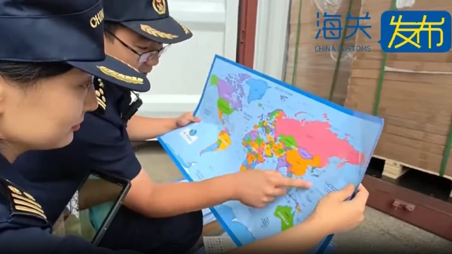
Chinese customs officers in Shandong province seized 60,000 export bound maps they said misrepresented the country’s sovereignty claims. Authorities said the batch mislabelled Taiwan and left off features and boundaries that Beijing regards as non negotiable parts of its official cartography.
- A new clash over borders on paper
- What was missing from the maps
- Why map design is a political issue in China
- Taiwan, sovereignty, and a tense military backdrop
- South China Sea disputes beyond the map
- Maps as flashpoints in cinema, classrooms, and commerce
- What the seizure signals for exporters and publishers
- Regional reactions and the bigger strategic picture
- What to Know
Inspectors in the coastal city of Qingdao found that the maps did not display the nine dash line that outlines China’s claim across most of the South China Sea. Officials also said the charts omitted important islands and did not mark the maritime boundary with Japan or note the Diaoyu Islands, known in Japan as the Senkaku.
China’s General Administration of Customs framed the decision in national security terms, saying the items could not be sold abroad because of the risk they posed to national unity and territorial integrity.
‘The maps endanger national unity, sovereignty and territorial integrity of China.’
Beijing treats cartography as a matter of state. Goods that fail inspection in such cases are destroyed. The scale of the Shandong seizure, authorities said, far exceeds recent actions. In March at Qingdao airport, officials confiscated 143 nautical charts that showed errors on national borders. In August, customs officers in Hebei province seized two maps that included an incorrect depiction of the Tibetan border.
What was missing from the maps
Chinese agencies said the maps failed two central tests of official representation. First, they lacked the nine dash line that Beijing uses to assert sweeping claims over the South China Sea. Second, they omitted features and lines that China expects to see, including islands in contested waters and the maritime boundary between China and Japan near the Diaoyu or Senkaku Islands.
Taiwan labeling under Beijing’s rules
Maps printed in mainland China are expected to present Taiwan as part of China. Publishers often use terms such as Taiwan province or Taiwan, China and align colors to match the mainland. Authorities did not disclose exactly how the seized batch mislabelled Taiwan, but Beijing routinely blocks maps that present Taiwan as a separate country or omit the wording that ties the island to China.
Why the nine dash line is a red line for Beijing
The nine dash line is a series of nine short marks that sweep hundreds of miles from the island of Hainan across the South China Sea. The line traces back to an eleven dash version drawn by the Chinese government in 1947, then shortened to nine dashes after 1949. In Beijing’s view, the line reflects historical practice and gives China sovereign rights to islands and some surrounding waters. Southeast Asian states and many legal experts dispute that claim, arguing that the United Nations Convention on the Law of the Sea gives each coastal state a 200 nautical mile exclusive economic zone from its shoreline. Leaving the line off an export map would likely be read by Chinese regulators as denying Beijing’s position.
Why map design is a political issue in China
China requires all publicly distributed maps and many educational charts to undergo review by the Ministry of Natural Resources. Approved products carry a specific review number. The customs statement in the Shandong case also cited a failure by the producers to obtain the necessary approvals, a common reason for seizures in past cases.
Authorities have carried out similar actions for years. In the same city in 2019, officials destroyed 29,000 maps that presented Taiwan as an independent country. In 2022, customs officers in Zhejiang province confiscated more than 23,000 maps that did not conform to official standards. The consistent message to printers and exporters is that borders on paper must match the borders claimed by the state, even when the goods are destined for foreign markets where different conventions apply.
Taiwan, sovereignty, and a tense military backdrop
The map seizure comes against a sensitive political backdrop across the Taiwan Strait. Taiwan has its own constitution, armed forces, and elected leaders, and most people on the island see themselves as separate from the mainland. Beijing rejects any move toward formal independence and insists there is one China that includes Taiwan.
After the inauguration of Taiwan’s president William Lai in May 2024, China conducted large scale military exercises around the island and its outlying territories. The operations, known in China as Joint Sword 2024A, ringed Taiwan with zones near Taipei, Hualien, Kaohsiung, and the Bashi Channel. The drills showcased blockade tactics, coordinated maneuvers with the coast guard, and the deployment of dozens of People’s Liberation Army Navy ships.
China’s Eastern Theater Command presented the drills as a response to what it calls separatism and foreign meddling.
‘A punishment for separatist acts and a warning against external interference.’
South China Sea disputes beyond the map
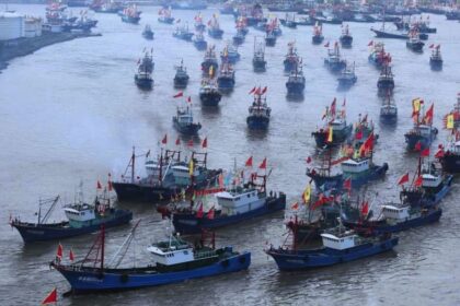
The South China Sea is one of the busiest and most contested waters on the planet. About a third of global maritime trade passes through its straits each year. It holds valuable fishing grounds and potential oil and gas reserves. China, Taiwan, Vietnam, the Philippines, Malaysia, Brunei, and Indonesia have overlapping claims to islands and reefs across the Spratly and Paracel groups and nearby features such as Scarborough Shoal.
What international law says
Modern maritime law is built around UNCLOS. The treaty gives coastal states sovereign rights in a 200 nautical mile exclusive economic zone and continental shelf but does not award full sovereignty over open seas. In 2016, an arbitral tribunal in The Hague found that China’s claims based on historic rights within the nine dash line have no legal effect where they exceed the limits of UNCLOS. Beijing rejected the decision, and the ruling did not settle the question of who owns particular islands or rocks.
In response to expansive claims from all sides, the United States and other navies conduct freedom of navigation operations to challenge what they view as excessive maritime claims. These operations often take place near features occupied by China in the Spratly Islands and around Scarborough Shoal.
Encounters at sea keep tensions high
Incidents between Chinese and Philippine vessels continue to escalate. Over the weekend, Manila accused a Chinese ship of ramming and using a water cannon against a Philippine government vessel during a resupply mission. Beijing said the episode came after repeated warnings and that the Philippine ship approached dangerously. Washington has reiterated its defense commitments to the Philippines as these confrontations accumulate.
Maps as flashpoints in cinema, classrooms, and commerce
Disputes over cartography rarely stay on paper. In 2023, Vietnam banned the Barbie movie for a scene that showed a map with the nine dash line. The Philippines ordered the same scene censored. Similar controversies have touched textbooks, advertising, and video games, as companies discover that a map element acceptable in one market can trigger bans and backlash in another.
These sensitivities shape how global brands and publishers operate. Some produce different map versions for different markets. Others remove maps altogether from marketing or entertainment content to avoid friction. The removal of 60,000 maps in Shandong fits the broader picture, where cartography has become both a legal compliance issue and a public relations risk.
What the seizure signals for exporters and publishers
Despite the export destination, Chinese authorities expect items to meet domestic mapping rules before they leave the country. For businesses that print or package in China, the safest course is to treat maps, globes, wall charts, and even small decorative insets as regulated content that requires careful review and documentation.
- Confirm whether the product qualifies as a map or contains any map inset or schematic.
- Obtain a map review number from the Ministry of Natural Resources when required.
- Ensure Taiwan is labeled in a way that aligns with mainland conventions.
- Include the nine dash line and islands claimed by China on maps that show the South China Sea.
- Mark the Diaoyu or Senkaku Islands and the maritime boundary with Japan as Chinese law expects.
- Work with local printers who understand approval processes and will decline to ship without documentation.
- Prepare separate versions for other markets if the buyer requires a different depiction, and produce those versions outside mainland China when possible.
- Audit packaging, inserts, and instruction manuals as carefully as the main product.
Compliance is not only about avoiding fines. Map mistakes can lead to seizures, missed shipping windows, inventory write offs, and canceled orders. For exporters on tight margins, the cost of a pre shipment review is far lower than the cost of seeing an entire batch destroyed at a port.
Regional reactions and the bigger strategic picture
China’s cartographic stance is part of a larger effort to cement its territorial claims on land and at sea. Across the South China Sea, China has poured sand to build artificial islands, installed runways and radar, and established outposts that extend its reach. The effect is to normalize its presence and to reinforce maps with physical facts in contested waters.
Many Southeast Asian leaders prefer a regional order with ASEAN at its center and remain cautious about endorsing a Sino centric hierarchy. Their governments navigate between deep economic ties with China and unease about coercive tactics at sea and in trade. Regular diplomatic talks with Beijing on a code of conduct for the South China Sea have produced management mechanisms but not a settlement that would end friction.
Tokyo also watches Chinese mapping and maritime actions closely. The East China Sea dispute over the Senkaku or Diaoyu Islands, which Japan administers and China claims, has led to frequent patrols and close encounters. When Chinese authorities insist that export products reflect a maritime boundary with Japan that Tokyo does not accept, it underscores how far cartographic disputes bleed into day to day diplomacy.
The seizure in Shandong is domestic enforcement, yet it also reads as a message outward. On Taiwan, the South China Sea, and the East China Sea, Beijing seeks to control the narrative on what belongs to China and how that must appear in public materials. For companies that trade through China, the stakes are practical and immediate. For governments in the region, the incident lands within a broader contest over law, sovereignty, and the power to define the map.
What to Know
- Customs officers in Shandong confiscated 60,000 export bound maps they said mislabelled Taiwan and omitted features central to China’s claims.
- Officials said the maps did not show the nine dash line, lacked certain South China Sea islands, and left out the maritime boundary with Japan near the Diaoyu or Senkaku Islands.
- China requires map products to carry approvals from the Ministry of Natural Resources, and goods that fail inspection are destroyed.
- Past seizures include 143 nautical charts in March at Qingdao airport, two maps in August with an incorrect Tibetan border, 29,000 maps destroyed in 2019, and more than 23,000 seized in 2022.
- Beijing insists Taiwan is part of China, and maps that present Taiwan as an independent country are regularly blocked from sale or export.
- In May 2024, China conducted large scale drills around Taiwan following President William Lai’s inauguration, describing them as punishment for separatist acts.
- The nine dash line remains the core of China’s South China Sea claims, despite a 2016 tribunal ruling that found it has no legal effect under UNCLOS.
- Recent maritime encounters between China and the Philippines, including ramming and water cannon incidents, add urgency to how maps depict disputed waters.
- Publishers and exporters operating in China face legal and commercial risk if maps do not match Beijing’s requirements, even when products are headed for foreign markets.