A rapidly intensifying Pacific climate event
A rapidly strengthening El Niño in the tropical Pacific could become the strongest observed in modern records, with China already seeing weather patterns linked to the developing event, the National Climate Center said.
- A rapidly intensifying Pacific climate event
- Why El Niño affects weather far from the Pacific
- China is already seeing a complex summer pattern
- Heatwaves and typhoons add pressure
- Autumn and 2027 may bring the largest risks
- Risks extend beyond China’s borders
- Monitoring and preparation become the priority
- The Bottom Line
Ocean temperatures in the central and eastern equatorial Pacific have risen sharply since El Niño conditions emerged in May. The key Niño 3.4 index, which tracks the three month average sea surface temperature anomaly in the region, reached 2.09 degrees Celsius above normal in July. That was an increase of 0.49 C from June. In the first half of August, the anomaly climbed to 2.64 C.
The center expects ocean temperatures to reach their highest point around November or December. If the three month average remains above 2.5 C, the event would meet the threshold commonly used for an extreme El Niño. That would place it ahead of the major events of 1982 to 1983, 1997 to 1998 and 2015 to 2016, based on the historical observation record.
Forecasts still carry uncertainty over the exact peak and duration. The World Meteorological Organization has described the event as at least moderate and possibly strong, with an 80 percent chance of El Niño conditions during June to August 2026 and probabilities near or above 90 percent that they will continue until at least November.
Why El Niño affects weather far from the Pacific
El Niño is a natural phase of the El Niño Southern Oscillation, a climate pattern involving the tropical Pacific Ocean and the atmosphere above it. During an El Niño, unusually warm surface water shifts toward the central and eastern Pacific. This changes air pressure, wind patterns and the position of major rainfall zones.
In the western Pacific, the warm water and rising air that normally support heavy rain can move eastward. The shift can disturb the East Asian monsoon, alter the position of the western Pacific subtropical high and change the tracks of tropical storms. The result is a change in the odds of certain types of weather, rather than a guarantee that every storm or heatwave is caused by El Niño.
The event usually develops between March and June, reaches peak strength between November and February, and lasts around nine to 12 months. Its effects can continue after the ocean begins to cool because the atmosphere, land and ocean do not respond at the same speed.
The WMO has also warned that climate change can make El Niño related heat and rainfall more damaging. There is no established evidence that global warming is making El Niño events occur more often or become stronger. A warmer atmosphere and ocean, however, can provide more heat and moisture for heatwaves and intense rain.
China is already seeing a complex summer pattern
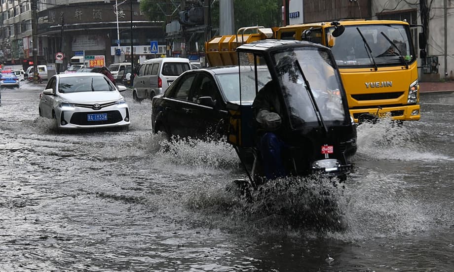
China’s current weather has been shaped by several overlapping systems. Rainfall has gathered in two broad belts across the north and south, producing heavy precipitation in regions separated by thousands of kilometers.
The western Pacific subtropical high has shifted farther north and strengthened. At the same time, upper level cold vortices have repeatedly moved into northern China. When these systems interact, they can keep rain clouds over the same area for long periods and produce powerful downpours, thunderstorms and strong winds.
In southern China and along the lower reaches of the Yangtze River, a stronger summer monsoon and increased typhoon activity have transported additional moisture inland. Tropical storms moving through the western North Pacific and the South China Sea have contributed to rainfall across coastal and river basin areas.
In the north, moisture carried northward by the subtropical high and typhoons has met colder air aloft. This combination is favorable for persistent rain and severe convective weather, including short duration cloudbursts, damaging winds and, in some cases, tornadoes.
The National Climate Center has described the situation as a season of overlapping rain producing systems. That raises the chance of compound disasters, where flooding, landslides, river surges, wind damage and urban waterlogging occur together or in quick succession.
Heatwaves and typhoons add pressure
Heavy rain is not the only concern. Chinese forecasters expect above average temperatures across much of the country, with frequent heatwaves during the summer. Eastern and central China, Southwest China and the Xinjiang Uygur autonomous region are among the areas facing a higher likelihood of unusual warmth.
China’s meteorological authorities have also warned that typhoons affecting the country in August could be more numerous or stronger than usual. Two or three storms may make landfall or produce major effects, with some intense systems able to move farther north than normal.
This creates a difficult balance for disaster planners. Eastern China faces a greater flood risk, while parts of northwest China could experience hotter and drier conditions. A region may also shift rapidly from water shortage to flash flooding when intense rain follows a prolonged hot spell.
High temperatures place extra pressure on electricity networks as households, offices and factories increase air conditioning use. The Southern Power Grid has reported repeated record demand in Guangdong, Guangxi, Yunnan, Guizhou and Hainan. Forecasts have put China’s national peak electricity load at about 1,600 gigawatts during the summer, around 90 GW higher than in 2025.
Water availability is another concern. Drought in northwest China can reduce supplies for farming and communities, while excessive rain can damage crops, contaminate water and disrupt transport in the south. Hydropower production can also become less predictable when rainfall patterns change, potentially increasing reliance on thermal power during periods of high demand.
Autumn and 2027 may bring the largest risks
The effects of the current El Niño are expected to strengthen as the Pacific warming reaches maturity. During autumn, eastern China, South China and Southwest China typically face a higher chance of above average rainfall. Central and northwest China are more likely to be drier.
Rainfall in the south could disrupt the harvest of late season rice and increase the risk of flooding in the Yangtze River basin. Warmer winter conditions may also affect water reserves available for spring agricultural work in 2027.
Chinese climate officials have warned that the most severe effects on the country often appear during the year after El Niño develops, as the event begins to weaken. Current forecasts indicate that the Pacific warming could peak in autumn and winter 2026 before gradually declining through spring and summer 2027.
That timing means the present season may be an early indication rather than the full expression of the event. Officials have urged major grain producing areas in northern and northeastern China to prepare for excessive rain and flooding. Northwestern areas, including Xinjiang, have been advised to strengthen drought planning.
The pattern will vary by location. El Niño provides a broad climate signal, while short term weather depends on local geography, cold air movements, storm tracks and other ocean and atmospheric patterns. A strong El Niño increases the odds of certain hazards, yet it cannot predict the exact date, location or severity of each flood or heatwave.
Risks extend beyond China’s borders
The same Pacific warming is expected to influence weather across Asia and other regions. The WMO has warned of higher risks of heatwaves, drought and heavy rainfall around the world. Typical El Niño patterns include drier conditions in Australia, Indonesia and parts of Southeast Asia, while some areas of the Americas receive heavier rain.
For Southeast Asia, reduced moisture can threaten rice, palm oil and other crops, lower hydropower output and increase the risk of wildfire and smoke pollution. Heat can also raise demand for electricity and strain water supplies in large cities.
South Asia faces a separate concern because El Niño often weakens or delays the summer monsoon. Lower rainfall after intense heat can damage crops, reduce water supplies and increase pressure on electricity systems. These regional effects can feed into food and energy markets, adding costs for households and businesses far from the Pacific Ocean.
Global temperatures are also likely to remain high. El Niño adds natural heat to a climate already warmed by human emissions. Scientists at Scripps Institution of Oceanography have said the combination can push global temperatures toward new records, although individual weather events still require specific atmospheric conditions.
The science is clear: El Niño is arriving on our doorstep in the coming months with 90% certainty. The world must treat it as the urgent climate warning it is.
UN Secretary General Antonio Guterres made that statement in a WMO video message, urging governments to improve early warning systems and protect communities most exposed to extreme weather.
Monitoring and preparation become the priority
The National Climate Center said it will increase monitoring and forecasting as the Pacific event develops. Attention will focus on changes in its strength, timing and effect on China’s regional climate.
Preparedness measures are likely to vary by area. Flood prone regions need to inspect drainage and reservoirs, reinforce river defenses, improve evacuation plans and protect transport links. Cities must prepare for waterlogging and heat stress at the same time. Rural areas need warnings that reach farmers quickly and plans for livestock, crops and drinking water.
Power companies face the task of managing higher cooling demand while dealing with uncertain hydropower conditions. Coordination between weather agencies, water managers, emergency services, health authorities and energy suppliers can help reduce the effect of sudden changes.
Residents can follow official weather warnings, avoid flooded roads, prepare basic emergency supplies and take precautions during periods of extreme heat. Forecasts become more reliable as a storm approaches, so seasonal El Niño guidance should be used alongside short range local warnings.
The Bottom Line
- Pacific Ocean temperatures in the Niño 3.4 region reached 2.64 C above normal in the first half of August.
- The three month average could exceed the 2.5 C threshold for an extreme El Niño.
- China is facing overlapping rainfall systems, heavier storms, heatwaves and stronger typhoon risks.
- Southern and eastern China may receive more rain, while northwest China faces greater drought and heat risks.
- El Niño effects are expected to peak in autumn and winter 2026 and may continue into 2027.
- China and international agencies are strengthening monitoring, early warnings and disaster preparation.