Overnight downpours slow travel across Bangkok and Nakhon Pathom
Heavy rain overnight on October 6 left standing water on roads across Bangkok and nearby Nakhon Pathom, disrupting the morning commute as forecasters warned of further storms. Flooding affected eastern Bangkok districts including Bang Kapi, Ramkhamhaeng, Lat Krabang and Min Buri, as well as routes towards Rangsit. Some roads remained passable with care, while deeper water blocked a U-turn on Suwinthawong Road and forced traffic into fewer lanes.
Contents
- Overnight downpours slow travel across Bangkok and Nakhon Pathom
- Where did flooding disrupt traffic?
- Nakhon Pathom sees water at intersections and near floodgates
- Rainfall eases, while canals and low areas remain under watch
- A wider flood emergency extends beyond the capital
- Forecasts point to another unsettled spell
- More local alerts are planned
- Key Points
Bangkok’s drainage department reported water on sections of Si Ayutthaya, Banthat Thong, Phaya Thai and Pracha Suk roads. In Nakhon Pathom, municipal officials reported water at kerb level at several intersections and advised drivers of small vehicles to avoid the Bangkok-bound frontage road outside Lotus on Phet Kasem Road.
The Thai Meteorological Department forecast thunderstorms across 70% of Bangkok and surrounding provinces, with isolated heavy rain and gusty winds. The forecast called for temperatures of 24–25C to 33–35C and variable winds of 10–20 kilometres per hour. Radar showed light to moderate rain over Bangkok, Samut Prakan, Nakhon Pathom and Samut Sakhon, with rain cells moving southwest.
Officials said water levels were falling at some locations as drainage continued, though low-lying communities and areas near floodgates remained vulnerable. Residents were advised to move belongings to higher ground and relocate vehicles to safer places.
Where did flooding disrupt traffic?
At about 6am, water 5–10 centimetres deep was reported at Bang Kapi intersection, following heavy rain and rising levels in Saen Saep Canal. A similar depth was measured on the inbound carriageway of Ramkhamhaeng Road outside Ramkhamhaeng University. Small vehicles could pass both areas, but drivers were urged to slow down and take care.
Floodwater remained on both sides of Lat Krabang Road outside Lat Krabang Hospital, slowing traffic. At the Lat Krabang Inland Container Depot, water had receded and vehicles were moving normally. Conditions were worse on Suwinthawong Road: deep water prevented vehicles from using the U-turn beneath the bridge in front of Lotus. Near Min Buri intersection, water reached the kerb across two inbound lanes, leaving traffic to use the right-hand lanes. Water was also above the kerb on the outbound side near Phanitchayakan junction.
Flooding was reported on the route towards Rangsit near the National Memorial and Thupatemi. Bangkok’s morning road update listed standing water on Si Ayutthaya Road outside Suan Pakkad Palace and Si Ayutthaya School, Banthat Thong Road at Phet Phra Ram intersection, Phaya Thai Road outside the Department of Livestock Development, and Pracha Suk Road near Inthamara Soi 34.
Further road reports from the Bangkok Metropolitan Administration showed that conditions varied block by block. Sections of Phahonyothin, Krungthep Kritha, Lat Krabang and Luang Phaeng roads had shallow flooding, generally around 5–15 centimetres. On Chalong Krung Road, water reached 15–40 centimetres near King Mongkut’s Institute of Technology Ladkrabang, where small vehicles were advised not to pass. Water levels and passability could change as rain and drainage conditions shifted.
Nakhon Pathom sees water at intersections and near floodgates
Nakhon Pathom Municipality’s early-morning update described waterlogging at several points between 5am and 6am. On the Bangkok-bound frontage road outside Lotus on Phet Kasem Road, small vehicles were advised to avoid the route. At Rachinee Burana School intersection, water on Khwa Phra Road reached the kerb but had begun to recede. Small vehicles could pass cautiously.
Water also reached kerb level at Wat Yai intersection, especially along the wall of Phra Pathom Chedi, and before the bend approaching Wat Klang. At the Soi 7 floodgate, water reached the kerb and overflowed beyond the gate area. A small amount of water had spread in front of Phra Pathom Chedi, while standing water remained at Whale Hotel junction and on Ratchawithi Road.
Municipal authorities were watching Khlong Chedi Bucha outside Wat Huai Chorakhe, where the water had risen to the banks. Conditions around the upper and lower markets were reported as normal, and Lang Phra Road was dry and open. The contrast between passable and flooded streets underscored how local drainage, road elevation and proximity to canals can produce sharply different conditions within the same city.
As drainage crews worked to lower water, the municipality urged residents in low-lying areas and near floodgates to raise household belongings and move vehicles ahead of further rain. A canal reaching bank level does not by itself mean it will overflow, but it leaves less room to absorb additional runoff if another downpour arrives.
Rainfall eases, while canals and low areas remain under watch
Bangkok officials said heavy rain fell across parts of the city between 1am and 3am, producing an average accumulated total of about 50 millimetres. Sai Mai recorded almost 100 millimetres, according to the Bangkok Metropolitan Administration. The rain had moved away by the morning and the administration said main roads had returned to normal, although localised flooding and road-specific problem areas remained in its updates.
The BMA stepped up drainage and efforts to lower water in major canals, including Saen Saep, Prawet Burirom and Prem Prachakorn, to create room for more rain. Water levels in those canals were reported near normal on October 6, while they continued to receive water from smaller canals. Officials also monitored the risk of water overtopping flood barriers along Khlong Hok Wa Sai Lang near the Pathum Thani border, including areas of Khlong Sam Wa, Nong Chok and Sai Mai.
These measures matter because urban drainage depends on more than the amount of rain falling at a given moment. Water must move through street drains into smaller and then larger canals before it can be discharged. When canals are already high or still receiving runoff from surrounding areas, drainage slows and rainwater can remain on roads or enter low-lying communities. Pumping and lowering canal levels can improve capacity, but the result also depends on the volume and timing of incoming water.
On October 7, Bangkok Governor Chadchart Sittipunt warned that the city remained exposed even as conditions improved. High levels in canals and retention areas were limiting the room available for more rain. He said Bangkok can normally handle roughly 60–70 millimetres of rain, but similar rainfall could cause flooding sooner when drainage channels and storage areas are already full. Eastern Bangkok faced particular pressure from water arriving from Lat Krabang and neighbouring Chachoengsao, while slow drainage through Prawet Burirom Canal required close attention in Bang Kapi and Lat Phrao.
A wider flood emergency extends beyond the capital
The flooding is part of a broader period of high water across central and eastern Thailand. A report published on October 8 said 80 communities across several eastern Bangkok districts still had floodwater, even as many main roads dried. Nine districts were identified as having communities still affected: Sai Mai, Nong Chok, Khlong Sam Wa, Khan Na Yao, Bueng Kum, Min Buri, Saphan Sung, Lat Krabang and Prawet. Authorities were directing water from communities through drains and canals towards the Chao Phraya River, while using pumps and temporary barriers in low-lying areas.
That report also described severe conditions in the eastern river basin, which includes Prachin Buri, Nakhon Nayok and Chachoengsao. The National Water Resources Office estimated that about 2.1 billion cubic metres of water was moving through the basin, a volume that officials compared with roughly 10 times the capacity of Khun Dan Prakarn Chon Dam. Water crossing areas around the Bangkok–Chachoengsao boundary added pressure to canals and communities in eastern Bangkok. Officials were coordinating with Bangkok, Samut Prakan and irrigation agencies to move water towards coastal canals and the sea.
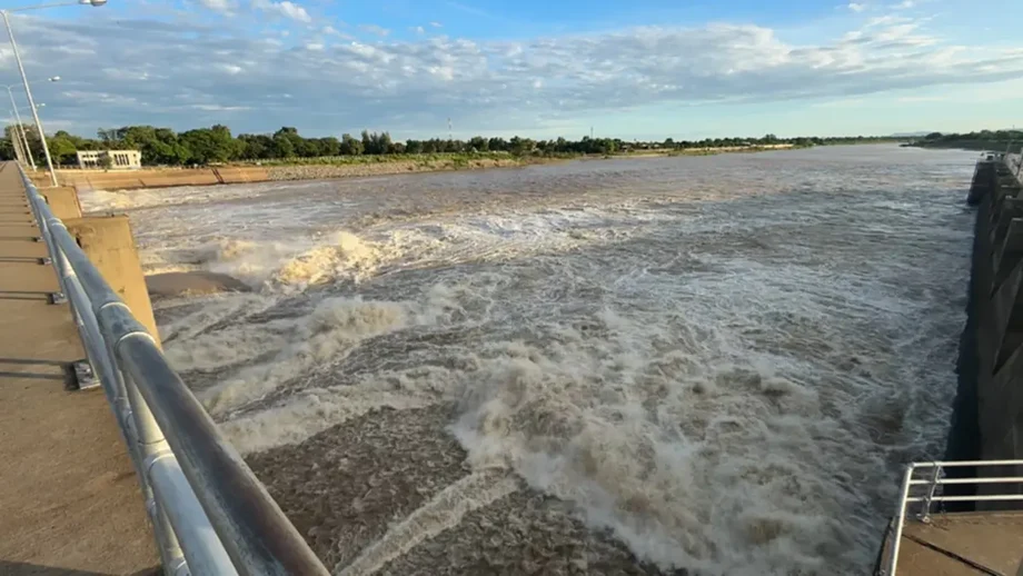
Conditions in the Chao Phraya basin were described as improving, with river levels falling by around 1–2 centimetres per hour at the time of the report. Officials said releases from the Chao Phraya Dam, then about 2,350 cubic metres per second, could be adjusted in stages depending on rainfall and water conditions. The situation remained more difficult in parts of the eastern basin, where the volume of water and its arrival from multiple channels could prolong drainage.
The scale of the wider emergency was reflected in a Department of Disaster Prevention and Mitigation report cited by the BMA, which said flooding in Bangkok had affected 329,000 households and caused four deaths. A separate October 8 update said more than 62,000 people had registered online for compensation, with the largest number of applications coming from Lat Krabang, followed by Bang Kapi and Sai Mai.
Forecasts point to another unsettled spell
The Thai Meteorological Department forecast increased rainfall from October 9–13 across the East, Central region, Bangkok and surrounding provinces, and the South. Its outlook linked the unsettled conditions to a high-pressure system extending from China over upper Thailand, a monsoon trough across the upper South, and the southwest monsoon continuing over the Andaman Sea, the South and the Gulf of Thailand. The combination was expected to bring thunderstorms, gusty winds, hail, lightning and isolated heavy to very heavy rain.
Forecast details published on October 8 pointed to shifting areas of risk through the period. On October 9, rain was expected in parts of the lower Northeast, East and South. Bangkok and the Central region were included in the areas forecast to receive rain on October 10 and 11. On October 12, heavier rainfall was expected in parts of the South, including Surat Thani, Nakhon Si Thammarat and Trang, with additional southern provinces at risk on October 13.
The Department of Disaster Prevention and Mitigation said it had coordinated preparations with 53 provinces and Bangkok. Its warning covered possible flash floods, runoff from hills, landslides, waterlogging and strong winds. Local agencies were asked to monitor rainfall and water levels, clear drainage routes, prepare pumps and response vehicles, and arrange shelters and essential supplies where needed. People affected by an emergency can contact the department through its 1784 hotline or its Line account, @1784DDPM.
The official forecast also warned of waves above two metres in thundershowers over the Andaman Sea and Gulf of Thailand. People in flood-prone areas were advised to watch for local warnings and avoid open areas, large trees and unstable billboards during storms. The marine warning called on vessels to proceed cautiously and keep clear of thunderstorms.
More local alerts are planned
Chadchart said the BMA intended to make flood alerts more closely tied to conditions in specific places. Under an event-based approach, rising water levels or reports of water backing up from drains could prompt advice for a particular community to raise belongings or prepare to move. The city is also developing and using models to identify flood-prone areas and improve location-specific warnings.
More precise alerts matter in a city where water can pool in one alley while nearby roads remain open. Existing warnings have often focused on areas near canals and waterways, while predicting flooding inside individual housing estates and communities can be harder. Officials have asked residents to report unusual water levels and drainage problems so teams can track conditions in places they cannot inspect continuously.
The BMA said it was shifting pumps and equipment from areas where water had receded to communities still affected, while also providing food, essential supplies and medical assistance, particularly in Nong Chok. Cleanup and recovery work continued in areas such as Kheha Rom Klao, where officials set a target of four to five days for restoration after floodwater receded. The volume of remaining water and natural drainage constraints could slow work.
Key Points
- Overnight rain on October 6 flooded roads in Bangkok and Nakhon Pathom, with deep water blocking a Suwinthawong Road U-turn.
- Bangkok reported rainfall averaging about 50 millimetres, with almost 100 millimetres in Sai Mai.
- Canal levels and incoming water continued to limit drainage capacity, especially in eastern Bangkok.
- Forecasters expected another unsettled period from October 9–13, with heavy rain possible in Bangkok and several regions.
- Authorities coordinated preparations across 53 provinces and Bangkok for flooding, strong winds and other storm hazards.