Ayutthaya lowlands face a possible rise of 30 to 40 centimetres
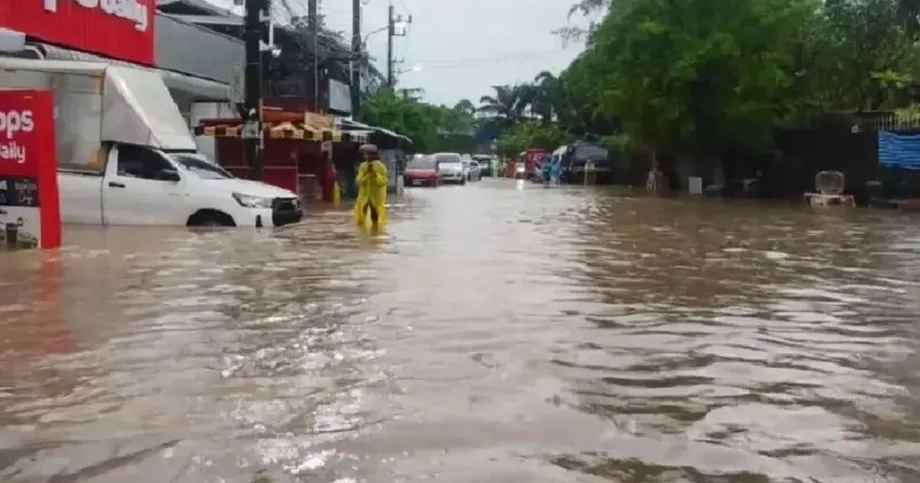
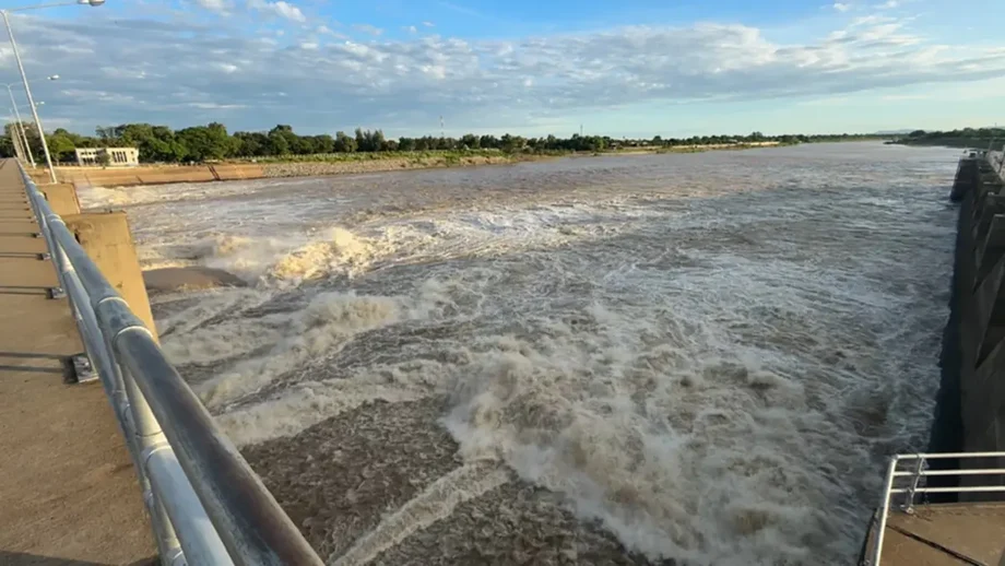
Thailand's Royal Irrigation Department (RID) began raising discharge through the Chao Phraya Dam from 800 to 900 cubic metres per second on November 10, 2026, after heavy rain across the lower North and Central Thailand. An urgent warning sent to 11 provinces said water in low areas outside flood embankments could rise by 30 to 40 centimetres, with six districts of Ayutthaya singled out for attention.
Contents
- Ayutthaya lowlands face a possible rise of 30 to 40 centimetres
- What the higher discharge means
- Heavy rain feeds three river basins
- What the upstream gauges show
- Eleven provinces receive an urgent warning
- Which parts of Ayutthaya are on the watch list?
- Canal diversions accompany the dam release
- The dates that matter
- Key Points
The increase at the dam in Sapphaya district, Chainat province, was scheduled to begin at 7am and finish by 2pm. The department planned to hold discharge at 900 cubic metres per second while monitoring incoming water around the clock and diverting some flow into irrigation systems on both sides of the river.
RID forecasts through November 19 put water levels below riverbanks at key monitoring stations in Pathum Thani, Nonthaburi and Bangkok. Homes and farmland on lower ground outside flood defences could nevertheless be affected as more water moves downstream.
The immediate concern is the arrival of runoff from rain that fell on November 5 to 7. RID director-general Wittaya Kaewmee said flows from Nakhon Sawan and the Sakae Krang River were expected to increase during November 10 to 13 before gradually declining.
What the higher discharge means
The move from 800 to 900 cubic metres per second represents a 12.5% increase in water passing through the dam. A cubic metre equals 1,000 litres, so the adjustment adds 100,000 litres every second to the release through the structure.
RID's operating schedule called for increases of approximately 15 cubic metres per second each hour until the target was reached. The earlier warning described a possible discharge range of about 700 to 1,000 cubic metres per second; the November 10 operating target of 900 falls within that range.
River height depends on more than the amount released at the dam. Water arriving from tributaries and the shape and elevation of the land downstream also affect where rising water reaches homes or fields. RID warned that low areas outside embankments could experience a rise of 0.30 to 0.40 metres under the planned discharge range.
Heavy rain feeds three river basins
Lan Sak district in Uthai Thani recorded 172.5 millimetres of rain during November 6 to 7, the highest of the three highlighted measurements. Nakhon Thai district in Phitsanulok recorded 130.0 millimetres, while Kosamphi Nakhon district in Kamphaeng Phet recorded 125.4 millimetres.
Lan Sak's total was 47.1 millimetres greater than the measurement at Kosamphi Nakhon. Rainfall measured in millimetres describes the depth of water that would collect on a flat surface if none drained away, soaked into the ground or evaporated.
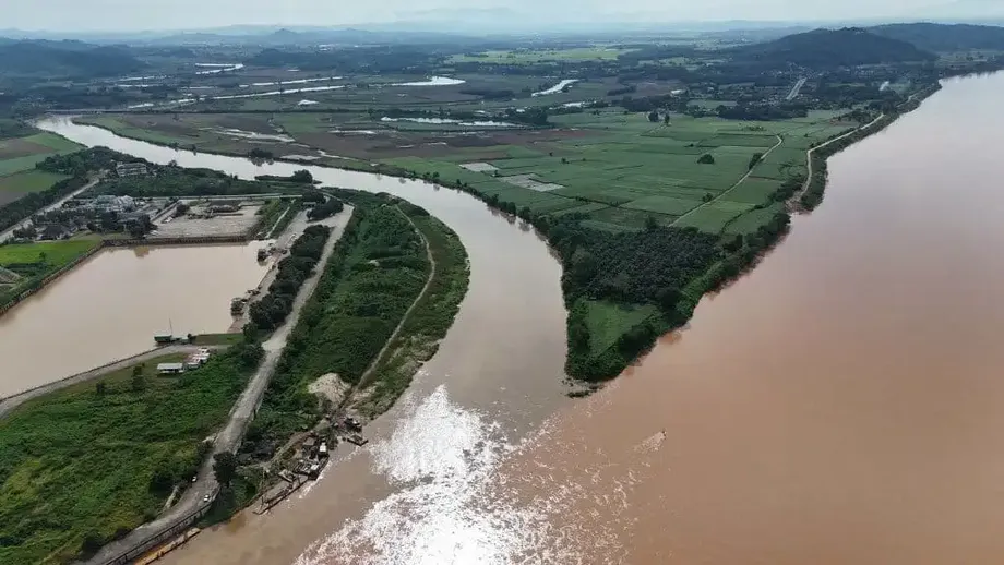
The rain increased runoff into the Ping, Nan and Sakae Krang river basins. Runoff is water that travels across the land and into streams and rivers. As those flows move into the Chao Phraya system, they increase the volume that water managers must handle upstream of the dam.
The Thai Meteorological Department had issued advance warnings before the heavy to very heavy rain on November 5 to 7. RID's response now centres on managing the water moving through the river system after those storms.
What the upstream gauges show
At 6am on November 10, RID recorded flow of 1,173 cubic metres per second at station C.2 in Mueang district, Nakhon Sawan, with an increasing trend. Discharge at station C.13 at the Chao Phraya Dam was still 800 cubic metres per second before the scheduled adjustment.
For November 12, the department forecast flow at C.2 of 1,000 to 1,125 cubic metres per second, with another 180 to 200 cubic metres per second expected from tributaries. Taken together, those forecast components amount to approximately 1,180 to 1,325 cubic metres per second feeding the upstream system.
The C.13 readings accompanying the warning placed the upstream water level at 16.96 metres and the downstream level at 10.22 metres, measured against a standard elevation reference. These figures describe water surface elevation rather than the depth of the river. The downstream level was described as approximately 6.12 metres below the local riverbank.
RID is using incoming flow measurements, accumulated rainfall and forecasts to adjust its operations. The main river release and the diversions into canals are separate parts of that management plan.
Eleven provinces receive an urgent warning
RID's urgent warning No. 8, dated November 9, went to the governors of Uthai Thani, Chainat, Sing Buri, Ang Thong, Ayutthaya, Suphan Buri, Lop Buri, Pathum Thani, Nonthaburi, Samut Prakan and Bangkok.
Deputy director-general Worapoj Phetnorachat issued the warning while acting for the director-general. It asked provincial authorities to alert people along rivers, in low areas and outside flood embankments, allowing them time to move belongings to higher ground.
Residents along both the Chao Phraya and Noi rivers were asked to watch conditions closely. The warning's assessment anticipated no effect on community areas under the projected conditions, while the subsequent operating update warned that exposed homes and farmland outside flood defences could be affected.
Local elevation and the position of an embankment therefore matter to individual households. A river can remain below the bank at a monitoring station while water reaches lower land elsewhere along its course.
Which parts of Ayutthaya are on the watch list?
Ayutthaya's six named districts are Sena, Phak Hai, Bang Ban, Phra Nakhon Si Ayutthaya, Bang Pa-in and Bang Sai. The detailed notice identified subdistricts within each district so that residents could check their own locality.
The concern centres on low ground outside flood embankments. The following locations were listed for attention as discharge increased:
- Sena: Ban Krathum, Hua Wiang, Ban Pho, Rang Chorakhe, Ban Phaen, Lat Nga, Bang Nom Kho, Sam Ko and Sena.
- Phak Hai: Tha Din Daeng, Kudi, Lat Chit, Ban Yai, Ta Lan, Ammarit, Phak Hai and Na Khok.
- Bang Ban: Ban Khlang, Nam Tao, Wat Taku, Bang Hak, Bang Luang, Thang Chang, Kop Chao, Ban Kum, Bang Luang Dot and Bang Chani.
- Phra Nakhon Si Ayutthaya: Khlong Takhian, Phu Khao Thong and Ban Run.
- Bang Pa-in: Bang Krasan, Wat Yom and Ban Paeng.
- Bang Sai: Ban Klueng, Krachaeng, Chang Noi, Ban Paeng, Sanam Chai, Khae Ok, Na Mai, Ban Ma, Khok Chang, Chiang Rak Noi, Pho Taeng, Ratchakhram, Mai Tra, Bang Sai, Bang Phli, Ban Ko, Ho Mok, Khae Tok, Chang Lek and Bang Yi Tho.
RID advised residents in vulnerable locations to move belongings to higher ground and follow official announcements closely. Provincial, district and local administrative authorities are coordinating the advance warnings.
Canal diversions accompany the dam release
RID is directing water into irrigation systems east and west of the Chao Phraya River. Irrigation and drainage canals provide other routes for part of the incoming water, reducing the volume that continues along the main river toward communities below the dam.
Wittaya Kaewmee, the RID director-general, said the department had prepared its operations around the needs of people on both sides of the dam:
"The Royal Irrigation Department has prepared a water management plan for the Chao Phraya Dam in advance, placing the highest priority on the impact on people living both upstream and downstream of the dam," Wittaya said.
The department plans to maintain the 900 cubic metres per second target while reviewing upstream conditions throughout the day and night. It has not given an end date for that operating rate. The warning said residents would receive a further notice if incoming water required discharge above 1,000 cubic metres per second.
Wittaya said rainfall totals, arriving flows and forecasts would guide changes as conditions developed. The response follows instructions from Agriculture and Cooperatives Minister Suriya Juangroongruangkit for agencies under the ministry to prepare fully for natural disasters and adjust water management to limit harm to lives and property.
The dates that matter
The sequence runs from several days of heavy rain to a warning, a gradual increase in releases and continued monitoring downstream. November 12 is the specific date attached to the C.2 flow forecast, while November 19 is the end of the stated forecast period for key lower river stations.
- November 5 to 7: Heavy to very heavy rain falls in parts of the lower North and Central Thailand.
- November 6 to 7: Rainfall measurements reach 172.5 millimetres in Lan Sak, 130.0 millimetres in Nakhon Thai and 125.4 millimetres in Kosamphi Nakhon.
- November 9: RID issues urgent warning No. 8 to 11 provinces.
- November 10: The dam's discharge increase from 800 to 900 cubic metres per second is scheduled between 7am and 2pm.
- November 10 to 13: Flows from Nakhon Sawan and the Sakae Krang River are expected to increase before gradually declining.
- November 12: Forecast flow at C.2 is 1,000 to 1,125 cubic metres per second, with additional tributary flows expected.
- Through November 19: RID forecasts water below riverbanks at key stations in Pathum Thani, Nonthaburi and Bangkok.
Residents can obtain water conditions, warnings and management updates through the RID website or its hotline, 1460, which operates 24 hours a day. Households outside embankments have been asked to keep following those updates while the increased flows pass downstream.
Key Points
- RID began gradually raising Chao Phraya Dam discharge to 900 cubic metres per second on November 10, a 12.5% increase.
- An urgent warning covers 11 provinces, with low areas outside embankments facing a possible water rise of 30 to 40 centimetres.
- Six Ayutthaya districts and their named subdistricts are on the watch list.
- Key stations in Pathum Thani, Nonthaburi and Bangkok are forecast to remain below riverbank levels through November 19.
- Water is also being diverted into irrigation systems on both sides of the river.
- Residents in vulnerable areas should move belongings higher and follow official updates. RID's 24-hour hotline is 1460.