Why a popular short hike keeps stranding visitors
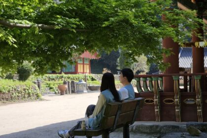
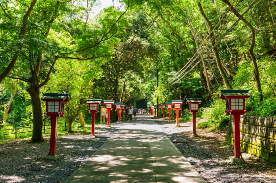
On clear autumn weekends, Mt. Takao’s trails fill with families, students, and travelers. The mountain sits on Tokyo’s western edge, roughly 599 meters above sea level, and it is less than an hour by train from Shinjuku. The ease of access, the paved main path, the cable car, and the chair lift make it feel like a simple nature walk. It is also a sacred site, home to Yakuoin temple and statues of the tengu mountain deities. The appeal is obvious. That sense of casual comfort is part of the risk.
- Why a popular short hike keeps stranding visitors
- What the data shows on Mt. Takao
- Why a modest peak can still be a tough climb
- Choosing the right trail on Mt. Takao
- Seasonal hazards to keep in mind
- Plan, gear, and habits that prevent rescues
- If you are lost or injured on Mt. Takao
- How to enjoy Mt. Takao safely
- What to Know
Data tell a sharper story. The National Police Agency (NPA) recorded 131 people stranded in the Mount Takaosan area last year. That figure is about 50 percent higher than the five year average of 86. Across Japan, mountain accidents remained high, with 2,946 incidents involving 3,357 people, the third highest since records began. Three hundred people were dead or missing and 1,390 were injured. People in their 50s, 60s, and 70s made up the majority of victims, and 135 of those involved nationwide were visitors from abroad. Rescue trends reflect a single pattern on Mt. Takao as well, a busy low mountain that many underestimate.
On recent days, visitors find booths near trailheads renting emergency transmitters and radios, and shops offering boots and warm layers. Staff who outfit hikers caution that the route is steeper than it looks. Wildlife alerts add to the caution this year. Bears have been seen repeatedly in the Tokyo mountains, and many walkers now attach bells to their packs to make noise.
What the data shows on Mt. Takao
Mt. Takao draws up to four million visitors in a typical year. The NPA says more people were stranded there in 2024 than on Mount Fuji, with 131 in the Takao range compared with 83 on Fuji and 66 in the Hotaka range. Getting lost remains the leading trigger of emergencies countrywide. On Takao, falls and fatigue are rising as causes, and many rescues involve middle aged and older climbers. Most incidents happen on or near Trail 1, the broad paved route to the summit that almost everyone walks at least in part. It runs beside the funicular, which has a maximum grade of 31 degrees, the steepest in Japan. That grade taxes legs and lungs, and exhaustion can set in faster than expected. Quite a few people give up below the cable car upper station, or lose balance on the way down and fall. Others get caught after sunset when visibility drops or follow a junction onto a quieter ridge that leads away from the main paths.
Misjudgment also plays a role. A paved path can encourage light footwear and a quick start late in the day, yet the elevation gain is real and the slopes are long and winding. The crowd itself can mask how hard the walk is. When the rush eases, the main trail still feels civilized, but the side routes are narrower and less busy. If you run short of time, the last cable car or chair lift might already be closed. When that happens, an easy afternoon can turn into a night search.
Why a modest peak can still be a tough climb
Mt. Takao sits low compared with alpine giants, yet three factors consistently catch people off guard. The first is heat and humidity in warm months. Summer peaks near Tokyo can feel stifling. Hikers who start at midday often arrive at the steeper sections flushed, dizzy, and short on water. The second is trail choice. There are eight main routes to the summit, along with ridges that continue toward other peaks. Some signs away from the main path are in Japanese only. An outdated guidebook or a phone with no signal can turn a detour into hours of extra walking. The third is timing. In autumn and winter, daylight fades early. Both the cable car and the chair lift stop service in the early evening on most days. A late start adds pressure and raises the chance of a rushed descent.
Local workers who see hikers every day try to reset expectations. A staff member at a small hotel near the base said the slope demands respect even if the mountain is low and advised wearing good boots and pacing yourself. Regulars also adapt to wildlife reports. A woman in her 60s who visited this month carried a small bell on her pack after reports of bears across Japan and noticed many others doing the same.
Choosing the right trail on Mt. Takao
Picking a route that matches your time, fitness, and experience is the fastest way to avoid trouble. The main options are well known, but their character varies. Here is a quick guide for first timers and those returning after a long break.
- Trail 1: Broad, mostly paved, and packed with cultural stops, tea houses, and viewpoints. It is suitable for strollers on dry days, yet the grade is constant and the descent can be hard on knees. It passes the main sites and reaches the summit in about 90 minutes from the base for average walkers.
- Trail 2: A short loop near the cable car top station that shows the contrast between the mountain’s sunny and shaded sides. Good for a gentle walk.
- Trail 3: A quieter forest path through katsura groves. Fewer crowds and less pavement, so shoes with grip help.
- Trail 4: A pleasant route that includes the Miyama suspension bridge. Paths have been improved in recent years but can still feel narrow in places.
- Trail 5: A loop near the summit that offers short diversions and access to viewpoints, including stands of Egawa cedars.
- Trail 6, also called the Water Course: A favorite for nature lovers that follows a stream and passes the Biwa-taki waterfall. Expect stepping stones, damp rocks, and a steep final climb to the summit. It is more technical than the main path and can be slippery after rain. During peak foliage it sometimes operates as a one way ascent.
- Inariyama Course: A southern ridgeline with long stair sections and broader views of Tokyo on clear days. It feels like a true hike and is less crowded than Trail 1.
- Takao to Jinba traverse: A long ridge walk of roughly 15 kilometers that links several summits, including Shiroyama and Kagenobuyama, and reaches Mt. Jinba with its white horse statue. Views of Mt. Fuji are outstanding on a dry, crisp day. This is best for intermediate to experienced hikers with a very early start, a headlamp, and a plan for transport from the far trailhead.
Facilities thin out away from the main path. Beyond the summit, signs may be less frequent and some are in Japanese only. Check current trail notices, since maintenance or safety rules can create temporary changes to direction of travel on popular routes.
Seasonal hazards to keep in mind
Conditions on a 599 meter hill can change quickly. The season shapes the risks, so match your plan to the weather and daylight.
Heat and humidity
Summer days on Takao are taxing. Temperatures in the mid 30s Celsius with high humidity are common. Hikers who began at noon during recent hot spells reported signs of heat exhaustion such as headache, nausea, and confusion. Start early, rest often, carry plenty of water with electrolytes, and use a towel to manage sweat as many locals do. Pick shaded paths like Trail 6 for the ascent, and turn back at the first signs of heat stress.
Rain and slippery paths
After rain, the water course and stone steps become slick. Trail 6 includes stream crossings that require careful footing. The Inariyama ridgeline turns muddy. Avoid umbrellas on narrow paths and carry a lightweight rain jacket. Typhoon forecasts in autumn can make even the paved sections hazardous because wet leaves create a thin, slippery layer underfoot.
Short winter days and ice
In late autumn and winter, the sun sets early and shady north facing slopes stay cold. Black ice can form on paved inclines, especially near the cable car station. Pack a small headlamp and consider light traction if temperatures dip near freezing. Confirm last cable car and chair lift times, since these often close before dinner on weekdays.
Bears in Tokyo mountains
Bear sightings have been reported across the Tokyo highlands this year, including the Takao area. Make noise by talking with your group or using a small bell, keep food sealed, and never approach wildlife. If you see a bear at close range, back away slowly while facing the animal and give it space. Report sightings to local authorities when safe to do so.
Plan, gear, and habits that prevent rescues
Treat Mt. Takao like a mountain, not a city park. File a simple climbing plan with authorities if you can, or at least tell someone your route and return time. Check weather, sunset, and the final departures for the cable car and chair lift before you go. Build a time buffer so a temple visit or a long photo stop does not force a rushed descent.
- Water and food: Carry at least one liter of water per person in cool weather and more in heat, plus salty snacks or a light meal. Vendors exist, but lines can be long and kiosks may close early.
- Light and battery: Pack a headlamp and spare batteries. Preserve phone power with airplane mode and offline maps in case signals drop under tree cover.
- Clothing: Wear sturdy shoes with grip and bring a light rain jacket and a warm layer, even on sunny days in spring and autumn.
- Navigation: Carry a paper map from the visitor center or a reliable offline map. Check trail junctions carefully, especially beyond the summit.
- Emergency basics: A whistle, small first aid supplies, and a light emergency blanket weigh little and matter a lot if plans go wrong.
- Cash and transit card: Useful for the cable car, chair lift, snacks, and the onsen at the base after your hike.
Families should keep children close in crowded sections and avoid peak hours when possible. Strollers work only on the broad paved areas. The chair lift requires children to sit still for the ride, and staff directions are strict for safety.
Many visitors aim for Beer Mount, the seasonal beer garden near the cable car top station. On very hot days the climb is tiring. If you plan to drink, the safest choice is to descend by cable car rather than walking down steep slopes after alcohol.
If you are lost or injured on Mt. Takao
Stop, take stock, and avoid panic. If you still have a signal, call for help and explain your last known location, such as a trail number, a landmark like Yakuoin temple or Biwa-taki waterfall, or a nearby cable car or chair lift station. Share a map pin from your phone if possible and conserve battery by dimming the screen and closing background apps.
- Dial 110 for the police or 119 for fire and ambulance in Japan. Describe any injuries and the condition of the trail around you.
- Stay on the trail. Do not try to cut straight down a slope or scramble along a cliff. Many rescues occur when tired hikers choose a steep shortcut and slip.
- Make yourself visible. Use a whistle, bright clothing, or a light after dark to signal rescuers.
- If you cannot move safely, wait in place, stay warm and dry, and keep your group together. A simple emergency blanket can prevent a chill while you wait.
Transmitter and locator rentals near the trailhead can speed up searches. Submitting a climb plan and carrying a headlamp are two of the simplest steps that dramatically reduce risk on this mountain.
How to enjoy Mt. Takao safely
For a first visit, start early on a weekday in peak foliage season to skip the biggest crowds. Take Trail 6 up through the forest, pause at the summit for a snack and views of Mt. Fuji on a clear day, then return by Trail 1 to pass through Yakuoin temple. If legs are tired, take the chair lift or cable car down. At the base, a soak at the onsen and a stop at the free nature museum round out the day.
For a longer adventure, consider the ridge walk to Mt. Jinba on a cool, dry day with a dawn start. This route is beautiful and much quieter, yet it is a real mountain day. Carry a headlamp, extra water and food, and know the bus connections at the far end. If weather or time turn against you, turn around and return to Takao’s summit while there is still plenty of light.
What to Know
- Rescues on Mt. Takao rose to 131 last year, up about 50 percent from the five year average according to the NPA.
- Most incidents involve getting lost, falls, or fatigue, often on or near Trail 1 and near the cable car station.
- The funicular beside Trail 1 reaches a 31 degree grade, which makes the paved route steeper than many expect.
- Older hikers make up a large share of victims nationwide, and tourists are among those rescued each year.
- Choose a trail that matches your fitness, carry a headlamp and rainwear, and file a simple climb plan.
- Heat, rain, early nightfall, and occasional bear sightings are the main seasonal hazards.
- Dial 110 or 119 in an emergency and stay on marked trails while you wait for help.
- Early starts, extra water, and realistic turn around times keep a day out on Takao safe and memorable.