A farmland freeze with lives and food supplies at stake
Bali is moving to stop new permits that turn productive rice fields into hotels, villas, restaurants and other commercial facilities, as deadly September floods bring the island's rapid development under closer scrutiny. The provincial policy begins in 2025, while Indonesia's land ministry is pressing Bali to restore protected agricultural land to national standards or face legal consequences.
Contents
- A farmland freeze with lives and food supplies at stake
- What the two protection categories mean
- Why the land ministry is warning of legal consequences
- How lost paddies can make floods worse
- Ministers and the governor call for a change
- Where tourism development can continue
- Rice supplies depend on keeping the subak connected
- Where Bali has lost the most farmland
- The practical work behind 6,000 hectares
- Enforcement starts with local permits
- What residents and builders can do now
- Key Points
Agrarian Affairs and Spatial Planning Minister Nusron Wahid, who also heads the National Land Agency, has endorsed the moratorium and instructed local authorities to add approximately 6,000 hectares of rice fields. About 4,000 hectares would replace fields already lost to development. Another 2,000 hectares would help meet minimum protection requirements.
The pressure comes from two shortfalls. Bali protects about 62 percent of its rice field area as Sustainable Agricultural Land, known as LP2B, against a national benchmark of at least 87 percent. Its Sustainable Food Agriculture Zones, or KP2B, stand at about 83 percent, below the 90 percent benchmark.
September's floods and landslides killed more than a dozen people and damaged homes and public facilities. Environmental officials have linked the disaster to heavy rain, poor waste management and unregulated construction on former paddies and hillsides. The response now connects farmland protection with public safety, water management, food supplies and the landscapes that help sustain tourism.
Governor I Wayan Koster has instructed regents and mayors to stop allowing productive agricultural land to become commercial property. Projects that already have valid approvals can continue, according to provincial leaders. A joint technical review of spatial plans is underway to bring development maps into line with the moratorium and update the environmental baseline used in planning.
What the two protection categories mean
LP2B is land set aside for permanent agriculture. Its purpose is to keep a dependable base of rice fields in production, even when developers are willing to pay for land to build accommodation, shops or other facilities.
KP2B covers a wider agricultural area. Alongside farmland, it includes reserves and supporting infrastructure such as irrigation canals, reservoirs, storage facilities and farm roads. A rice field needs these connections to remain useful: protecting a plot while losing its water supply or access road can leave farmers unable to work it.
National rules expect provinces to protect at least 87 percent of rice field area as LP2B and 90 percent as KP2B, then maintain those shares in their spatial plans. These plans identify which places are intended for farming, housing, commerce and other uses.
Bali's LP2B share is about 25 percentage points below its benchmark, using the figures of 62 percent and 87 percent. Its KP2B share is about seven percentage points below the benchmark, comparing 83 percent with 90 percent. Both gaps are driving the ministry's demand for additional rice fields.
The ministry says the 6,000 hectare program would bring Bali back into compliance, help legalize past conversions that failed to meet the rules and restore agricultural functions that reduce flood risk. The task involves both replacing lost fields and protecting the wider network that keeps farming possible.
Why the land ministry is warning of legal consequences
Indonesia's 2009 Sustainable Agricultural Land Law allows prison sentences of up to five years for illegal conversion of protected farmland. The ministry's warning puts local authorities and landowners under pressure to respect protected zones when approving or carrying out construction.
Nusron's intervention combines support for the provincial freeze with a demand to repair the agricultural shortfall. Restoring land protection is intended to reduce the risk of penalties for illegal conversion while rebuilding the island's farming base.
Officials are also urging residents and developers to choose nonproductive land for housing and consider vertical housing where appropriate. Housing that uses several floors in an already urbanized area can accommodate more residents without spreading as far into rice fields and other green space.
The legal framework gives prosecutors tools to act against illegal conversion. Prevention, however, depends on whether local planning and permit decisions keep protected land in agriculture before construction begins.
How lost paddies can make floods worse
Rice fields, forests and wetlands slow the movement of rainwater. Soil and roots help some water soak into the ground, while terraces spread and hold water rather than allowing all of it to rush downhill at once.
Concrete, asphalt and roofs change that process. When paddies become villas, roads or parking areas, more rain flows across the surface. This runoff can reach streets, drains and rivers quickly, increasing the amount of water they must carry during a downpour.
Hillside development creates another danger. Clearing trees or reshaping terraces without proper drainage can make slopes vulnerable to landslides. Waste adds to the problem when trash blocks canals and drains, leaving floodwater to spill into homes and streets.
Government figures indicate that Bali has lost several hundred hectares of forest over the past decade. That loss reduces the island's ability to absorb water during extreme rain. Environmental officials say green cover is now too thin in some places to provide an adequate buffer.
The Environment and Forestry Ministry has pointed to critical river basins, including the Ayung, where forest cover has fallen far below the minimum 30 percent recommended by watershed experts to stabilize water flows. A watershed is the area from which rain drains into a river and its tributaries, so land changes upstream can affect communities farther downstream.
Uncontrolled building on former paddies has also reduced the space available to absorb runoff. During storms, trash washed into rivers can block watercourses and multiply the danger created by heavy rain and rapid surface flow.
Scientists expect intense rain events to become stronger as the climate warms. Warmer air can hold more moisture, allowing storms to release more water in a short period. Where buildings have replaced forests and fields, floodwaters can rise faster and reach greater heights. Bali's policy response therefore links food protection with reducing disaster risk.
Ministers and the governor call for a change
Environment and Forestry Minister Hanif Faisol Nurofiq urged Bali to halt further land conversion after the floods. During meetings with provincial leaders, he argued that environmental safeguards must become a core part of tourism policy because the island could not withstand repeated disasters while development continued consuming green space.
Hanif expressed the urgency of stopping conversion:
I really hope he will immediately stop the land conversions in Bali. This is extremely important.
Koster has presented the permit freeze as a lasting commitment aligned with Bali's century plan. He said district and municipal leaders had already received instructions and would meet again after flood response work to ensure productive land remained protected.
The governor set out the scope and starting year of the policy:
Starting this year, there is already an instruction to all heads of districts and mayors across Bali. After handling the floods, we will meet again to ensure no more permits are issued for hotels, restaurants or other facilities on productive land, especially rice fields. Starting this year, the land conversion ban will align with Bali's 100 year plan. From 2025 onward, no productive land can be converted into commercial facilities.
The sequence places the new restrictions alongside an assessment of earlier losses and the recent disaster:
- 2019 to 2024: Bali lost more than 6,500 hectares of rice fields to other uses, according to data compiled by the National Land Office.
- September 2025: Floods and landslides killed more than a dozen people and damaged homes and public facilities.
- 2025 onward: Koster's instruction calls for no new permits converting productive land into commercial facilities.
Where tourism development can continue
Bali's policy changes where new tourism facilities can be built rather than ending tourism development. Provincial leaders say projects with valid approvals may proceed, while new hotels, restaurants, villas and other commercial facilities should be kept off productive agricultural land.
Developers are being directed toward sites that are already developed, vacant urban parcels and nonproductive land where projects will not disrupt irrigation networks. The technical review of spatial plans is intended to give that separation between agricultural and built areas a clearer place in permit decisions.
Tourism operators also have a stake in protecting the rice landscapes that attract visitors and support Balinese cultural activities. For residents, the policy is intended to slow construction in corridors vulnerable to flooding and on steep hillsides.
Provincial leaders describe protection of paddies and forests as an investment in the scenery, water and cultural assets that keep visitors returning. Tourism remains a pillar of Bali's economy, but its growth is being tied more closely to environmental limits within river catchments.
Rice supplies depend on keeping the subak connected
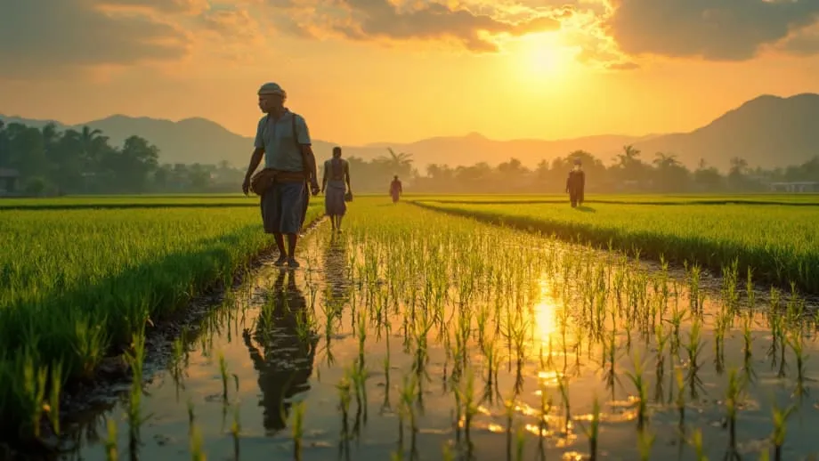
Bali's rice fields are part of the subak, the community managed irrigation system recognized by UNESCO. It coordinates water sharing and planting cycles across watersheds through canals, terraced paddies and shared rules.
Subak councils decide planting schedules, share water during the dry season and maintain the channels that make terraced farming possible. The system depends on connected fields and cooperation between communities upstream and downstream.
Buildings can interrupt that network when paddies are divided into separate development plots. Walls, roads and restaurants built across channels can sever irrigation routes. Water that once moved slowly through terraces may instead be sent into pipes, culverts or parking areas unable to absorb a sudden cloudburst.
Protecting rice production therefore requires more than preserving individual plots. Canals, reservoirs, access routes and the relationships used to manage water must remain functional. The land ministry's broader agricultural protection targets reflect the need to keep those supporting structures intact.
Indonesia has prioritized food self sufficiency to protect households from global price swings and supply shocks. Bali produces less rice than Java or Sumatra, but its paddies serve local markets, help stabilize prices in surrounding regencies and support farming livelihoods.
When fields become villas, the island loses both food production and agricultural income, increasing its dependence on shipments from elsewhere. Keeping connected irrigated land in use helps protect those local supplies while preserving a central part of Balinese cultural life.
Large infrastructure proposals present related risks. Roads can create economic value, but routes across rice terraces may disrupt dozens of subak nodes at once. Authorities say the new farmland rules will require closer review of road alignments and measures to limit damage where projects affect agricultural land or irrigation structures.
Where Bali has lost the most farmland
Data compiled by the National Land Office show that Bali lost more than 6,500 hectares of rice fields between 2019 and 2024, a decline of roughly 1.5 percent a year. The losses help explain why stopping new conversions is only one part of the response: authorities also want to rebuild agricultural area.
Denpasar recorded the steepest decline, losing nearly four in ten of its rice fields over six years. Gianyar ranked second by the share lost. Tabanan, which retains a large agricultural base, experienced smaller declines during the same period.
The pattern makes restoration especially difficult in dense urban areas, where former fields may already be occupied by buildings and roads. Recovery may be more feasible where farmland still exists in large, connected blocks and irrigation infrastructure remains usable.
Officials are likely to look first at places with reliable water, intact irrigation and opportunities to bring land together into connected terraces. Tabanan's strong farming base makes it a possible focus, alongside buffer areas around existing paddies in Badung and Gianyar.
Mapping must also consider erosion risk and whether catchments can cope with heavier rain. A plot's size alone is insufficient: new fields need suitable land, water and connections to the surrounding agricultural network.
The practical work behind 6,000 hectares
Creating new rice fields requires water supplies, soil preparation, roads for farm machinery and links to existing irrigation. Authorities need to identify connected areas that can be serviced without breaking up habitats and avoid slopes vulnerable to flooding.
Some restoration could involve bringing fallow plots back into use, reshaping terraces and reopening irrigation lines closed during past conversions. These measures would recover farming functions where enough of the original land and water network remains.
Land swaps offer another possible route. Suitable nonproductive land could be reclassified for agriculture while new housing is directed toward places already urbanized. The goal is to create workable farming areas rather than isolated patches surrounded by development.
The recovery effort also needs to preserve the centuries old canals supporting communal water management. Replacing the surface area of lost paddies without restoring their connections would leave farmers facing the same practical problems over access and irrigation.
No completion date has been given for the 6,000 hectare target. The program's success will depend on finding suitable land and rebuilding the infrastructure needed to keep it productive.
Enforcement starts with local permits
Bali's moratorium depends on consistent enforcement by district governments. The province plans to tighten permits, publish clearer zoning maps and bring regents, mayors and subak councils into the same process so protected farmland boundaries are respected in each approval.
Local coordination matters because a building decision can affect more than the property itself. Construction near a canal can change water access for neighboring fields, while development in a catchment can increase runoff reaching communities below it.
Officials are encouraging construction on nonproductive land and vertical housing in urban areas to meet demand without further spreading into green space. Where construction proceeds near waterways, stormwater standards such as retention ponds and infiltration wells will be required to slow runoff and reduce flooding.
A retention pond holds rainwater temporarily instead of sending it immediately into drains. An infiltration well helps water enter the ground. Both address the faster runoff created when buildings and paved surfaces replace absorbent land.
What residents and builders can do now
Residents and developers can take practical steps while the province completes its rules and planning updates. Checking land status before buying or building can reveal whether a site falls within LP2B or KP2B or supports subak channels and reservoirs.
Project choices also affect local safety. Protecting irrigation routes, keeping waste out of drains and allowing space for rainwater can reduce pressure on neighborhoods during heavy downpours and improve the prospects of securing approval.
- Check zoning and agricultural protection status before purchasing land or seeking a building permit.
- Choose nonproductive land and avoid riverbanks and slopes vulnerable to erosion and flash floods.
- Include retention ponds, vegetated swales and infiltration wells so more rainfall can be stored or absorbed on site.
- Work with subak councils near canals to protect channels and, where necessary, reroute them without disrupting water flow.
- Keep construction debris and household trash out of waterways and drains.
- Consider vertical housing in urban areas rather than extending development into green space.
- Plan drainage for more intense rain events.
Key Points
- Bali is moving to halt new permits converting productive rice fields into commercial facilities from 2025. Projects with valid approvals can continue.
- Nusron Wahid has instructed local authorities to add about 6,000 hectares of rice fields, including 4,000 hectares to replace losses and 2,000 hectares to meet protection requirements.
- Bali's LP2B share is about 62 percent against an 87 percent benchmark. Its KP2B share is about 83 percent against 90 percent.
- Illegal conversion of protected farmland can bring up to five years in prison under the 2009 Sustainable Agricultural Land Law.
- September floods and landslides killed more than a dozen people. Officials linked the disaster to heavy rain, waste problems and unregulated construction.
- Bali lost more than 6,500 hectares of rice fields from 2019 to 2024. Denpasar lost nearly four in ten of its fields over six years.
- Protecting connected paddies and subak irrigation supports food production, water management, tourism landscapes and Balinese culture.
- Authorities are reviewing spatial plans, tightening permits and encouraging development on nonproductive land and vertical housing in urban areas.