Storm-lashed northeast sees rail shutdowns
Heavy rain sweeping across northeastern Japan on Monday led to widespread rail disruption, urgent safety alerts, and heightened flood and landslide risks. East Japan Railway, better known as JR East, suspended Akita Shinkansen service between Omagari and Akita in the early afternoon, then extended the suspension north to Morioka in Iwate as conditions worsened. The Japan Meteorological Agency said rainfall would likely continue through Tuesday, and urged residents across broad areas to be alert for landslides, sudden river rises, lightning, gusts, and hail.
- Storm-lashed northeast sees rail shutdowns
- Where and why services were halted
- How much rain is falling and what risks are rising
- Evacuations and local impact across Akita and Iwate
- Passengers face long waits and limited alternatives
- How railways manage safety in extreme rain
- Are severe weather disruptions becoming more common
- Travel advice and live updates
- What happens next
- At a Glance
Local authorities moved quickly. The city of Akita issued the highest level emergency alert for more than 4,500 residents after the Shinjo River overflowed, instructing people in the most threatened areas to secure their safety at once. Officials in Gojome and Senboku announced the same top-tier alert in parts of their municipalities. Forecasters said precipitation in some locations could exceed the typical monthly total for September within a short time frame, a warning sign for both slope failures and urban flooding.
Disrupted rail service in Tohoku rippled onto other lines. JR East reported delays on some Tohoku Shinkansen trains, while it warned of further cancellations on the Akita route as saturated ground and rising waterways made inspections more complex. Substitute transportation was not offered on the high speed corridor, making contingency planning essential for travelers.
Where and why services were halted
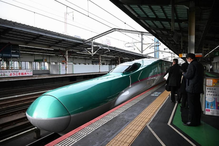
JR East first halted Komachi services on the Akita Shinkansen between Omagari and Akita, a low-lying stretch where tracks run near rivers and soft soils, then expanded the suspension to Morioka as rain bands intensified across the interior. The company’s train status portal, updated throughout the day, listed a mix of delays and cancellations on Akita services and noted knock-on delays for certain Tohoku Shinkansen Hayabusa trains between Morioka and Tokyo. That pattern reflects how the Akita mini-shinkansen, which shares track segments and operating windows with the main north-south corridor, can impact the wider high speed network when rain forces speed restrictions or closures.
Japan’s weather agency linked the deluge to low pressure systems spinning over the Sea of Okhotsk and the Sea of Japan. As those systems slide northeast toward the Kuril Islands and across northern Honshu, they pull in moist air that rises along a stationary front. When warm, humid air lifts over cooler layers, towering rain clouds can form and stall, unleashing intense bursts that overwhelm drainage and destabilize slopes. These set-ups can persist for a day or more, which raises the chance that safeguard thresholds along railways will be met repeatedly.
On high speed lines, operators use a network of rain gauges, river sensors, wind anemometers, and ground stability indices to decide when to slow trains, impose shorter formations, or halt service. If sensor readings cross predefined safety limits or if crews observe water near track systems, trains are stopped until inspections confirm conditions have improved. That conservative approach is why trains sometimes resume in stages even when the rain backs off briefly.
How much rain is falling and what risks are rising
Forecasters warned that some areas of Akita and neighboring prefectures could see rain totals surpass the September average within roughly a day. The overflow of the Shinjo River in Akita underscored how quickly conditions can escalate. When rainfall saturates soil layers, the risk of shallow landslides, often triggered by short, intense bursts, rises sharply. Persistent downpours also increase the chance of larger slope failures, particularly where earthquake fractures or older scarps weaken hillsides.
JMA advisories covered more than rain alone. Lightning, strong gusts, and hail can accompany the same convective cells that produce extreme precipitation. For rail operators, lightning carries risks for signaling and power equipment. For residents, gust fronts can uproot trees and send debris onto roads and tracks. Authorities urged people near rivers to monitor level changes and to be prepared to move quickly if local orders escalate.
In recent years, some of Japan’s most intense rain episodes have featured hourly rain rates topping 100 millimeters in narrow bands. Events in Tokyo and northern Kanto this summer reached that pace in some districts, briefly forcing halts on multiple shinkansen lines. The pattern this week in Tohoku is part of that broader trend of short, severe bursts embedded in longer rain spells.
Evacuations and local impact across Akita and Iwate
Municipal leaders in Akita City activated the highest emergency step for several thousand residents as river levels rose and rainwater pooled in low areas. The instruction, known as an emergency safety assurance, asks people already in danger to take immediate action to protect their lives. In practical terms, that can mean moving to the second floor, seeking a sturdy building nearby if going outside is still safe, or relocating to a designated center when officials confirm the route is passable.
Partial alerts in Gojome and Senboku reflected localized hazards, including swollen tributaries and slopes with known instability. In rural stretches of Iwate, officials cautioned that flooded rice paddies can hide fast currents. Fire and disaster teams pre-positioned pumps, sandbags, and high axle vehicles where access roads often flood. Utility crews prepared for brief outages as trees and debris threaten lines.
Emergency managers also reminded residents that evacuations at night can be more dangerous. People were encouraged to charge phones, keep flashlights ready, and place essential medication and documents in waterproof bags in case an evacuation order became unavoidable.
Passengers face long waits and limited alternatives
Rail disruptions hit during busy travel periods can strand thousands. While JR East’s updates help riders replan, high speed routes in rural Tohoku have limited redundancy when buses cannot safely operate and local lines face the same weather. Operators typically prioritize inspections as soon as rain intensity drops, then restart with reduced speeds before returning to full timetables.
Travelers caught in prior rain events described long, uncertain waits. During a recent heavy rain suspension reported by Kyodo News, commuters shared their frustration as services repeatedly paused to keep trains out of flood prone segments.
One traveler, Kazuhiro Yamane, 52, told Kyodo he had been trying to get home to Yamaguchi from Nagoya when a burst of rainfall shut service:
It seems like everything stops whenever there’s rain lately.
Another passenger, a 47 year old woman traveling with her daughter, said she waited over an hour at Tokyo Station as conditions swung between caution and closure:
I didn’t expect it will stop due to rain.
Such scenes have become more familiar across regions and seasons. When rain gauges or ground saturation indices cross safety limits, operators halt trains to avoid stranding them between stations or inside tunnels. That policy lowers risk, yet it also lengthens delays since inspectors must clear each section one by one.
How railways manage safety in extreme rain
Japan’s high speed railways use layered defenses designed to keep passengers safe even when weather changes quickly. The approach begins well before a storm arrives, with teams monitoring radar, river data, and soil moisture models. If forecasters predict extreme rain, railways announce the possibility of planned suspensions so that travelers can adjust trips and avoid congested stations.
From rain gauges to soil water index
On the Tokaido Shinkansen, Central Japan Railway updated its guidelines in recent years to rely less on rain gauge totals alone and more on a soil water index that tracks how much moisture hillsides are holding. The index helps predict when slopes might fail after long rain periods. A shift to that model followed repeated multi day rain events in central Japan that caused extended suspensions. The logic applies nationwide: the longer rain persists, the more unstable slopes can become, even if a given hour does not look extreme.
Inspections and staged restarts
When gauges or indices cross thresholds, trains are stopped and track patrols often deploy by road to check culverts, ballast, and embankments. Drone and camera systems assist where access is limited. If crews find no damage and rain eases, service returns in stages with temporary speed limits. If inspectors see erosion, debris on tracks, or rising water near sensitive equipment, closures continue until repairs and thorough checks are complete.
JR East’s current notices for the Akita Shinkansen flagged delays and cancellations for Komachi services and warned that substitute transportation is not provided on the high speed route. That is typical for shinkansen operations, which run on dedicated track and require lengthy processes to arrange safe alternatives during severe weather.
Are severe weather disruptions becoming more common
Past seasons show how widespread and frequent these disruptions have become. In late summer last year, Typhoon Shanshan drenched parts of central and western Japan, leading to suspensions of shinkansen services in and around Nagoya and along the corridor between Tokyo and Osaka. Around the same period, Typhoon Ampil approached eastern Japan, forcing airlines to cancel hundreds of flights and prompting major rail operators to halt trains around Tokyo for safety checks.
Western Japan has seen similar patterns. Heavy rain events in 2024 and 2025 temporarily halted segments of the Sanyo and Tokaido shinkansen, sometimes affecting more than one hundred thousand travelers over a single weekend. In July this year, downpours around Tokyo briefly shut stretches of the Tokaido and Tohoku lines after hourly rain totals topped 100 millimeters in several locations. In Kyushu this summer, intense rain triggered floods and landslides, suspended the Kyushu Shinkansen, and led to evacuation advisories across multiple prefectures.
Scientists point to a warming climate as a factor that increases the intensity of heavy rainfall. Warmer air holds more moisture, which can lead to higher hourly rain rates when storms form. For rail systems that depend on thresholds tied to both hourly and multi day totals, that shift can push gauges and soil indices over safety limits more often. Operators have responded with earlier warnings, larger maintenance programs for slopes and culverts, and more conservative restart criteria after heavy rain peaks.
Travel advice and live updates
With conditions still changing, travelers in Akita, Iwate, and neighboring prefectures should plan for longer trips and possible detours. Advance planning, flexible tickets, and verified updates from official channels make a difference when services stop and restart without much notice.
- Check the JR East train status page for the latest on shinkansen and limited express operations. The English status site is available at JR East Shinkansen Train Information.
- Build extra time into itineraries. When service resumes, speed limits often remain in place for a while.
- Expect limited or no substitute transportation on shinkansen routes. Consider local lines or highway buses only if operators confirm routes are safe.
- If an evacuation order is issued for your area, follow local instructions first and adjust travel later. Keep phones charged and pack medication, water, and a lightweight rain cover.
- Monitor weather alerts from the Japan Meteorological Agency and municipal channels. River level maps and landslide hazard maps update frequently during heavy rain.
- If you must travel during intense rain, choose daytime windows when visibility is higher and inspection crews can work faster.
English language notices from JR companies tend to prioritize line status and safety steps. Detailed route by route updates and station announcements are usually fastest in Japanese, so travelers should also consult station displays and staff.
What happens next
Forecasters expect rain bands to shift gradually northeast into Tuesday, with local bursts that can still trigger fresh warnings. Even after peak rainfall passes, saturated hillsides remain fragile for a day or two. Rail operators will rely on inspections to clear each segment, and any new bursts can reset the clock. Municipalities along rivers will watch for delayed runoff as upland areas drain.
For now, the crucial steps are patience and caution. Travelers should verify departures close to boarding time, keep backup plans ready, and look for announcements about partial resumptions. Residents in alert zones should stay aware of local instructions regarding evacuation routes and centers. As the weather system drifts away, both rail and road conditions will improve, but intermittent delays are likely until inspections confirm stability along all vulnerable sections.
At a Glance
- Akita Shinkansen suspended between Omagari and Akita, later extended to Morioka, after intense rain.
- Akita City issued the highest emergency alert for more than 4,500 residents as the Shinjo River overflowed.
- Gojome and Senboku announced top-tier alerts in parts of their municipalities.
- JMA said rainfall would continue into Tuesday and warned of landslides, flooding, lightning, gusts, and hail.
- JR East reported delays and cancellations on Akita services and ripple delays on some Tohoku Shinkansen trains.
- No substitute transportation is provided on the high speed corridor during this suspension.
- Precipitation in some areas may exceed the average monthly total for September within a short period.
- Inspections and staged restarts will determine when full service returns, with potential for additional short notice halts.