The Lost Highway of the Gobi
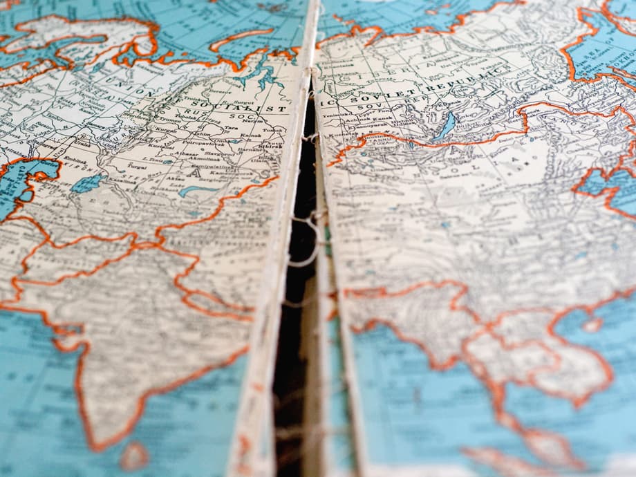
For centuries, the Great Mongolian Road served as a crucial artery of commerce across Inner Asia, enabling camel caravans to traverse the unforgiving expanse of the Gobi Desert. Yet despite its historical importance as a central link in the Silk Road network, the precise route had faded into obscurity, existing only as scattered references in the journals of early twentieth century explorers. Now, a remarkable discovery has brought this forgotten corridor back to light. A team of researchers has unlocked the secrets of the Great Mongolian Road through an unlikely source: a collection of classified Japanese military maps created during the imperial expansion period between 1873 and 1945.
These documents, known as gaihōzu, or “maps of outer lands,” have revealed the complete infrastructure of a 1200 kilometer east to west trade route with startling precision. Published in the Journal of Historical Geography, the study documents how these century-old cartographic records capture not merely geographic coordinates, but the intricate survival systems that enabled human movement across one of Earths harshest environments. Field verification across southern Mongolia has confirmed that water sources, settlements, and cultural landmarks appear exactly where the maps positioned them decades ago, transforming military intelligence into an irreplaceable archive of human geographic knowledge.
Secret Archives and Imperial Ambitions
The gaihōzu represent one of the most comprehensive cartographic undertakings of the modern era. Between 1873 and 1945, the Japanese Imperial Army produced tens of thousands of map sheets documenting territories stretching from Korea and Manchuria through Southeast Asia, Mongolia, and into Central Asia. Originally conceived for military planning and strategic expansion, these maps recorded landscapes far beyond Japan’s direct control with meticulous attention to infrastructure, terrain, and resources.
During World War II, the gaihōzu were classified as secret documents, hidden away from public view. As the war drew to a close, official orders mandated the destruction of these sensitive materials. However, recognizing their potential value for scholarship, Japanese researchers secretly transferred thousands of sheets to university collections and libraries, saving them from the flames. This clandestine preservation effort ensured that the maps survived to become what researchers now describe as geographical time capsules, preserving landscapes that have since been transformed by modernization, industrial development, and environmental change.
The specific maps that revealed the Great Mongolian Road belong to the Tōa Yochizu series, or “Maps of East Asia,” compiled between 1901 and 1922 at a scale of 1:1,000,000. Rather than representing original Japanese surveys conducted in the Mongolian desert, these sheets represent a sophisticated synthesis of existing cartographic knowledge. The mapmakers compiled information from Russian surveys conducted in 1884 and Chinese imperial records from 1890, combining these sources into a unified format that displayed remarkable consistency across different panels and time periods.
Mapping the Unforgiving Desert
The research team from the Journal of Historical Geography study analyzed four specific map panels from the Tōa Yochizu series, covering a continuous corridor from Mongolia’s eastern border with China westward toward the frontier with Xinjiang. The maps identify the route through a series of numbered nodes, each representing critical infrastructure points that made desert travel possible. During the summer of 2024, researchers conducted extensive field verification across 1200 kilometers of southern Mongolia to test the accuracy of these century-old documents.
The results were unequivocal. Of the ten key sites analyzed in detail, eight water sources remain active today, all four documented cultural sites remain in their original locations, and many place names are still recognized by local herders. The study confirmed at least 50 key points along the route, including wells, springs, monasteries, and orientation landmarks, all positioned with striking accuracy. This field verification demonstrates that the gaihōzu captured the environmental realities of the desert with a precision that rivals modern cartography, despite being compiled from existing sources without the benefit of aerial photography or satellite imagery.
Among the verified locations are specific nodes such as Khetsüü Uul, Ökhöntkhel, and Khudag Khovor, each representing essential waypoints where caravans could access water and shelter. The maps document the eastern section near Sair Us, the central region around Tsagaan Tolgoi, and the western terminus approaching Hami, creating a complete picture of the route’s trajectory across the desert. This cartographic accuracy reveals the accumulated geographical knowledge of generations of travelers, compiled by Japanese cartographers into a format that has survived for over a century.
A Network of Survival
What distinguishes the gaihōzu from simple route maps is their documentation of complete support systems necessary for survival in arid environments. The Great Mongolian Road was not merely a line drawn across sand, but a carefully calibrated response to environmental constraints. Analysis of the verified route reveals that water sources were spaced at approximately 24 kilometer intervals, a distance that corresponds precisely to the daily travel capacity of camel caravans as described in historical literature. This regular spacing was not accidental, but represented generations of practical knowledge about the limits of pack animals and human endurance in desert conditions.
The maps reveal a sophisticated infrastructure that included not only water wells and springs, but also Buddhist monasteries that offered shelter, ritual stone mounds that served as orientation markers, and alternative pathways that allowed travelers to adapt to seasonal conditions. At several points, the cartography shows bifurcations in the route, offering multiple paths based on water availability, security concerns, or seasonal weather patterns. This flexibility demonstrates that the Silk Road functioned not as a rigid highway, but as a dynamic network that shifted according to the needs of merchants and the realities of the desert environment.
Local herders confirmed oral traditions of sites serving as historical stopping points along the caravan route. At Khalkhiin Ulaan Davaa, residents pointed out depressions in the earth attributed to centuries of camel traffic, physical evidence that corroborates the mapped locations. Throughout the fieldwork, locals helped confirm historical place names that matched those recorded on the gaihōzu, bridging the gap between written cartography and living memory. This convergence of mapped data and oral history reinforces the route’s significance as a continuous thread of human movement across generations.
Echoes of Ancient Commerce
The Great Mongolian Road formed a central link in the broader Eurasian trade network, functioning as a northern alternative to the more commonly discussed Silk Road corridors that passed through the Taklamakan Desert. While the route extended beyond Mongolia into China toward Kucheng in Dzungaria and connected to paths leading south to Kashgar, its specific infrastructure had remained undocumented until the gaihōzu analysis. The route was likely part of the historic Tea Road, facilitating the movement of tea from China westward in exchange for steppe products such as wool, hides, and livestock moving eastward.
The twentieth century explorer and geographer Owen Lattimore, who traveled extensively through Inner Asia during the early 1900s, provided some of the only written accounts of this route before its rediscovery. Lattimore described heavy caravans taking up to 120 days to complete the full journey, with express caravans carrying premium merchandise under guaranteed time limits completing the trip in 90 days. His observations about the route’s infrastructure and spacing of water sources have now been confirmed by the cartographic evidence, validating his role as one of the most astute observers of Inner Asian trade networks.
One of the most evocative discoveries occurred at Khurdent Cave, near one of the first nodes on the mapped route. Researchers found inscriptions made approximately 300 years ago by merchants crossing the region. A text written in Chinese characters starkly expresses the economic logic that drove these dangerous journeys.
Only in pursuit of triple profits in business do we keep walking through mountainous provinces; the road is long.
These words offer a rare direct window into the mindset of historical caravaneers, who accepted extreme conditions and prolonged absences from home in exchange for the economic opportunities presented by long-distance trade across Eurasia.
Beyond Military Intelligence
Although the gaihōzu were created to serve imperial military ambitions, they have transcended their original purpose to become essential tools for historical geography and cultural heritage preservation. The study authors emphasize that these maps provide valuable baseline data for assessing environmental change across Asian landscapes. By comparing the historical cartography with modern conditions, researchers can track desertification, water source depletion, and landscape transformation over the past century.
Dr. Chris McCarthy, the lead researcher on the project, explained the broader significance of these documents.
The gaihōzu capture not merely routes but complete support systems, including water sources, terrain features, and settlements vital for navigation and survival in these harsh arid environments. By mapping this historical corridor, these once-secret military documents provide valuable baseline data for historical geography, cultural heritage preservation, and environmental change assessment across the landscapes of Asia.
This perspective highlights how documents created for warfare can be repurposed to understand the everyday lives of past civilizations and their practical adaptations to extreme environments.
The maps also serve as crucial evidence for preserving cultural heritage sites that might otherwise be overlooked. Monasteries such as Amarbuyant, documented on the western sections of the mapped route, appear precisely where the century-old cartography indicated, demonstrating the persistence of cultural landmarks despite decades of political and environmental change. These sites offer physical connections to the Buddhist traditions and commercial practices that sustained travelers along the Great Mongolian Road.
From Camel Caravans to Modern Expeditions
The rediscovery of the Great Mongolian Road arrives at a moment of renewed interest in Silk Road travel and tourism. While historical caravans relied on camels and carefully spaced water wells to survive the Gobi Desert, modern travelers can now traverse similar routes in considerably more comfort. Luxury tourism companies have begun offering expeditions that follow ancient trade corridors, though today they utilize cooled trains with private cabins and gourmet dining rather than pack animals.
Geographic Expeditions now offers a 22-day luxury train journey across five countries, covering 2400 miles from China to Uzbekistan aboard the Golden Eagle. Travelers can explore Beijing’s Forbidden City, view the Terracotta Warriors in Xian, ride camels in the Gobi Desert, and experience Islamic architecture in Kyrgyzstan and Uzbekistan, all while enjoying accommodations that include a bar lounge with a baby grand piano. These modern journeys, priced at over $50,000 per person, represent a stark contrast to the 300-year-old inscriptions at Khurdent Cave describing merchants seeking triple profits while enduring months of hardship.
This juxtaposition of ancient and modern travel highlights the enduring geographical significance of these routes. Whether traveled by camel caravan seeking water every 24 kilometers or by luxury train with temperature regulated cabins, the corridors of Inner Asia continue to fascinate those seeking to understand the connections between East and West. The gaihōzu maps have bridged these eras, providing the first detailed documentation of a route that connected civilizations for centuries before fading from memory.
Key Points
- Secret Japanese military maps called gaihōzu, created between 1873 and 1945, have revealed the complete 1200 kilometer route of the lost Great Mongolian Road across the Gobi Desert.
- Field verification confirmed that water sources, settlements, and monasteries appear exactly where the century-old maps positioned them, with 50 key points verified across 750 miles of the route.
- The maps show water sources spaced approximately 24 kilometers apart, matching the daily travel distance of camel caravans and demonstrating sophisticated environmental adaptation.
- Researchers found 300-year-old merchant inscriptions at Khurdent Cave describing the economic motivations for enduring the dangerous trade route.
- Although created for military intelligence during Japan’s imperial expansion, the gaihōzu now serve as geographical time capsules for heritage preservation and environmental change assessment.
- The Great Mongolian Road formed a crucial northern link in the Silk Road network, connecting northern China with Central Asia as part of the historic Tea Road.