A Bangkok rail stop with a Malaysian backstory
Kalantan Station on Bangkoks MRT Yellow Line carries a name that startles some visitors and feels familiar to many Malaysians. The station title points to a shared past that predates modern borders. It refers to an old canal dug in the nineteenth century by Malay workers with roots in Kelantan, part of the Patani network of communities that interacted with Siam. This link has turned a routine stop into a small lesson in regional history, woven into a fast growing urban rail system. The name reminds riders that infrastructure is not only steel and concrete. It is memory, identity, and the story of how this city came to be.
The term Kalantan traces back to Khlong Kalantan, known today by its shortened form Khlong Tan. This waterway connected Khlong Saen Saep to Khlong Phra Khanong during the reign of King Rama III. It helped move people and supplies during Siamese campaigns in Vietnam and Cambodia. The digging force included workers from the tributary Patani Kingdom, whose elite had ties to Kelantan. Over time, the canal shaped a neighborhood, and the name endured in local speech. The new station brings that history back into daily view.
Where is Kalantan Station and why the name matters
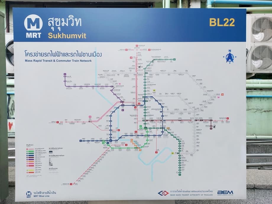
The station sits on Srinagarindra Road in Bangkoks Suan Luang District, directly in front of Thanya Park shopping mall. It is part of the MRT Yellow Line, a monorail that follows the busy Srinagarindra corridor. Kalantan opened to riders on 3 June 2023 during trial operations on the section between Samrong and Hua Mak. The stop has four entrances, side platforms, and a concourse level with ticket machines and gates. It serves commuters, shoppers, and families visiting nearby retail areas, slotting into a rail network that also includes the BTS and the MRT Blue Line on other corridors.
During the planning period in 2022, the chosen name stirred online debate. Some users questioned why a Bangkok station seemed to carry the name of Kelantan, a Malaysian state just across the border from southern Thailand. Transport officials and local historians pointed to long standing usage tied to the canal. The formal spelling kept the historic reference, connecting a modern rail stop to a nineteenth century waterway and the people who dug it.
The canal that shaped a neighborhood
Bangkok grew from a river town into a canal city. During the reign of Rama III, the court pushed new waterways to move rice, timber, people, and troops. Khlong Saen Saep stretched east from the Chao Phraya basin to the countryside near Chachoengsao, supporting supply lines for Siamese campaigns in the east. Khlong Kalantan, a feeder to Saen Saep, linked the inland route to Khlong Phra Khanong, closer to the Gulf. Boats could bypass slow bends of the main river and reach front lines and markets with fewer delays. The digging crews included Malay workers from territories aligned with Siam, many of them from the Patani region with dynastic connections to Kelantan. Their labor changed the landscape, and their name marked the canal.
As decades passed, the spoken form of the canal shortened. Kalantan became Tan in everyday usage, a shift heard in place names across the area. Khlong Tan is familiar to Bangkok residents, from intersections and neighborhoods to schools. The older form survives in certain institutions, such as Khlong Kalantan School, and in the rail stations name. These toponyms are more than labels. They are clues to a layered city where waterways guided growth long before trains and expressways.
Why canals shaped the capital
Before paved roads spread across Bangkok, canals served as highways, markets, and defense lines. They carried produce from farms to floating shops, soldiers to frontier posts, and families to new settlements. Canal digging often drew on conscripts and resettled communities from around the kingdom. Malay Muslims from the south, Lao speakers from the northeast, and Chinese settlers from across the sea all contributed labor and skills. Many of those communities stayed, married, and built houses near the water. Even where canals were later straightened, covered, or diverted into drainage systems, their names endured. That is why a modern rider can scan a system map and still read the citys watery past.
Thai Malay connections across centuries
Long before passports and checkpoints, the Malay Peninsula and southern Siam saw constant movement of people. Patani, a Malay sultanate, acknowledged Siamese authority at various times and kept close ties to Kelantan and other northern Malay courts. Traders, clerics, soldiers, and craftsmen moved along rivers and coastal routes. Families with roots on both sides of todays border are common in the deep south. When Bangkok mobilized for campaigns in Cambodia and Vietnam in the 1830s, the state drew labor and manpower from these networks. The work on Saen Saep and its connectors reflects that moment in time.
Traces of this shared past still live in Bangkok. Several mosques serve long time Muslim communities near the Saen Saep corridor and in districts close to Phra Khanong and eastern Bangkok. Food, language, and family names hint at journeys made over generations. The Kalantan name folds a fragment of that story into public space where millions move every year. It shows how history can be both local and regional at once.
For many Malaysians, especially those from Kelantan, seeing Kalantan on a station sign in Bangkok sparks curiosity and pride. For Thai riders, it can be a prompt to ask how a name traveled from a canal to a concourse and what that says about the city they call home.
From historic waterway to modern rail line
The MRT Yellow Line is designed as a busy east side connector, threading through residential zones and shopping districts that grew around old canals and new roads. Monorail technology allows a slimmer guideway above the median, which limits land taking and keeps stations close to the street. The line aims to offer a faster option than road traffic along Srinagarindra, easing commutes and linking families to work, schools, and clinics. Local businesses benefit from steady foot traffic, while riders gain easier access to large malls and neighborhood markets.
Kalantan Station itself follows a simple layout that is familiar to Bangkok commuters. Trains use side platforms with doors opening on the left. A mezzanine holds ticket machines, fare gates, and concourse services. Four exits distribute foot traffic toward bus stops, shops, and parking areas. Signage is in Thai and English, which helps visitors navigate between the mall and the platforms. The setup keeps movement intuitive even during peak hours.
At the corridor level, riders can step from the station directly into Thanya Park. The area around Srinagarindra bustles through the day with retail, food, and neighborhood services. Feeder buses and motorcycle taxis connect the station to streets deeper inside Suan Luang. At the line level, the Yellow route links to other rail services at its terminals, giving passengers more options to cross the metropolis without relying on traffic clogged roads.
A name that invites conversation
Names in public space carry meaning. They help people orient in the city, and they also shape stories that communities tell about themselves. The Kalantan label has proved that point. Some see it and think of Kelantan across the border. Others recall a Bangkok canal that supported a royal project in crisis years. Both views are valid, and both point to a history of exchange across the upper Malay Peninsula.
Keeping the historic spelling preserves a thread that links waterway laborers of the 1800s to rail riders of today. It invites travelers to look beyond the platform edge and ask how a canal became a district name, a school name, and now a station name. That conversation can deepen appreciation for the citys diversity without erasing local identity. The canal and the station sit in Bangkok, yet they reflect ties that reach far beyond the capital.
What travelers can see nearby
Most visitors will know Kalantan for its convenience. The station rises above Srinagarindra Road beside Thanya Park, a family friendly retail complex with cafes, casual dining, and green touches that offer a break from the heat. The surrounding blocks mix housing with small offices and local shops. It is a spot where daily life, weekend errands, and a bit of history all meet on a single platform.
Those with an interest in place names can look for signs that still use Kalantan in the area, such as the nearby school that preserves the older canal name. Respect local communities when exploring and be mindful that many residents are commuting or working nearby. A visit during daylight hours makes it easier to take photos of the station exterior and the surrounding streets. Short walks on side roads bring visitors to food stalls and small markets that show a quieter side of eastern Bangkok.
Key Points
- Kalantan Station is on the MRT Yellow Line in Bangkoks Suan Luang District, in front of Thanya Park on Srinagarindra Road.
- The station opened to riders on 3 June 2023 during trial operations between Samrong and Hua Mak.
- Its name comes from Khlong Kalantan, a canal dug during the reign of King Rama III to link Khlong Saen Saep and Khlong Phra Khanong.
- Workers from the tributary Patani Kingdom, with dynastic ties to Kelantan, were part of the digging crews, which is why the canal carried the Kalantan name.
- The canal name later shortened to Khlong Tan, and the older form survives in local institutions and in the stations title.
- Online debate in 2022 questioned the name, but it was retained for historical reasons tied to the canal and the areas heritage.
- Kalantan Station has side platforms, four entrances, and direct access to Thanya Park, with signage in Thai and English.
- The stop highlights centuries of Thai and Malay connections that continue to shape communities in Bangkok today.