When the Roof of the World Loses Its Water
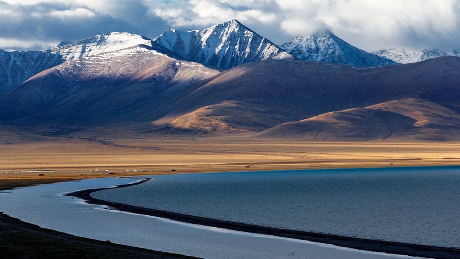
Approximately 115,000 years ago, the high plateau of southern Tibet contained vast inland seas that stretched for more than 125 miles (200 kilometers). These massive bodies of water, including ancestors of modern lakes like Nam Co (also known as Namtso or Lake Nam), have since shrunk dramatically. Today, Nam Co measures just 45 miles (75 kilometers) long. While scientists have long tracked the environmental consequences of this desiccation, new research reveals a far more dramatic impact. The vanishing lakes appear to have triggered earthquakes by awakening long-dormant faults deep within the crust of Earth.
- When the Roof of the World Loses Its Water
- The Weight of Water and the Rise of Rock
- Quantifying the Shifts: Fifteen Meters of Movement
- Reading the Geological Record in Lake Sediments
- Expert Perspectives on Surface-Deep Earth Coupling
- Glacial Lessons from the Last Ice Age
- When the Earth Shakes the Lakes
- Global Echoes of Coupled Systems
- The Bottom Line
A team of geologists led by Chunrui Li from the Chinese Academy of Geological Sciences in Beijing has uncovered evidence that the loss of water weight from these ancient lakes caused the crust to rise, reactivating nearby fault lines. Published in the journal Geophysical Research Letters, the study strengthens the understanding of how surface climate changes can influence deep geological processes. The findings suggest that as Tibet loses its water, the land itself rises in response, much like a ship rising in the water as cargo is removed, creating stress that can rupture ancient cracks in the rock. This discovery challenges previous assumptions that only deep tectonic forces could generate significant seismic activity in the region.
The implications extend beyond academic interest. As climate change accelerates water loss in high-altitude regions worldwide, understanding how shrinking lakes affect geological stability becomes critical for hazard assessment. The Tibetan Plateau, often called the Roof of the World, serves as a sentinel for these processes, showing how surface environmental changes can penetrate deep into the planetary interior.
The Weight of Water and the Rise of Rock
The mechanism behind this phenomenon involves the principle of isostasy, which describes how the crust of Earth floats on the denser mantle beneath. Large lakes weigh down the crust significantly. When they begin to dry up, that weight disappears and the crust slowly rebounds upward. This process, known as isostatic rebound, occurs slowly over thousands of years but can accumulate significant stress on geological structures. In southern Tibet, this process occurs in a region already under immense tectonic pressure from the ongoing collision between the Indian and Eurasian plates, a collision that began approximately 50 million years ago and created the Himalayan mountain range and the Tibetan Plateau.
Over millions of years, this continental collision has built up tremendous strain within the crust beneath southern Tibet. Ancient faults, or cracks in the rock, lie dormant but ready to rupture under the right conditions. Li and his colleagues reasoned that the slow rise of the crust caused by shrinking lakes might provide the trigger needed to release this stored strain. Using computer models to predict crustal response to water loss, they found that the unloading of weight from vanished lakes could indeed reactivate these sleeping faults. The research highlights the unexpected sensitivity of deep Earth structures to changes occurring at the surface.
The geological setting of southern Tibet makes it particularly susceptible to these effects. The region sits at the boundary between two massive continental plates, where the crust is thick, fractured, and under constant strain. Unlike coastal regions where tectonic plates meet beneath oceans, this continental collision zone creates complex fault networks that can remain dormant for millennia until triggered by unusual stresses. The ancient lake systems that once covered the region added significant mass to specific areas, suppressing the natural tendency of the crust to rise and shift. As that mass disappeared, the suppressed energy found release through fault movement.
Quantifying the Shifts: Fifteen Meters of Movement
To test their hypothesis, the researchers mapped ancient lake shorelines to calculate exactly how much water the lakes lost over millennia. Their analysis focused on the period between 115,000 and 30,000 years ago, when significant desiccation occurred. The results reveal striking numbers. Water loss from Nam Co Lake alone appears to have caused approximately 50 feet (15 meters) of total movement on a nearby fault. Lakes situated 60 miles (100 kilometers) to the south lost even more volume, potentially triggering 230 feet (70 meters) of movement on local faults.
These calculations translate to fault movement rates between 0.008 and 0.06 inches (0.2 and 1.6 millimeters) per year. While this appears modest compared to the San Andreas Fault in California, which moves about 0.8 inches (20 millimeters) annually, the source of the movement differs critically. The San Andreas moves primarily because of deep tectonic processes at plate boundaries. The Tibetan faults moved because of surface changes thousands of years ago, demonstrating that aboveground processes can substantially affect deep Earth structures. The study provides concrete evidence that climate-driven hydrological changes can generate measurable geological responses.
The distinction between tectonically driven fault movement and surface-triggered movement matters for how scientists classify and predict seismic hazards. Traditionally, geologists focused almost exclusively on plate boundary dynamics when assessing earthquake risks. The Tibetan data suggest that intraplate earthquakes, those occurring far from plate boundaries, might sometimes result from accumulated surface changes rather than deep mantle processes. This reclassification could affect how hazard maps are drawn for continental interiors where ancient lakes once existed.
Reading the Geological Record in Lake Sediments
The relationship between lakes and seismic activity works in both directions. Just as vanishing lakes can trigger earthquakes, strong earthquakes can dramatically alter lake systems. Research on Qionghai Lake, located at the southeastern edge of the Tibetan Plateau, demonstrates how lake sediments serve as archives of past seismic events. Scientists analyzing six sediment cores from different parts of the lake identified distinct layers created by earthquakes in 1850 and 1952, using CT scans, grain size analysis, and geochemical markers like manganese content.
These studies reveal that earthquake-induced deposits appear as homogeneous layers with poor sorting and specific chemical signatures. The 1850 earthquake, which measured magnitude 7.5 on the Zemu River Fault, and the 1952 magnitude 6.75 event on the Anning River Fault both left permanent records in the mud. This research confirms that lakes both influence and record tectonic activity, creating a complex feedback loop between surface hydrology and deep Earth processes. The sediment layers provide a timeline of disasters, showing how the landscape responds to major seismic events over centuries.
The methodology employed at Qionghai Lake offers a template for investigating historical earthquakes elsewhere. Researchers used multibeam echosounders to map the lake bottom, then extracted cores from multiple locations to correlate events across the basin. CT scanning revealed internal structures without destroying samples, while X-ray fluorescence scanning identified elemental changes at millimeter resolution. Grain size analysis distinguished between flood deposits, which show gradual fining upward, and earthquake deposits, which appear as chaotic, poorly sorted layers. These techniques allow scientists to read the geological history of a region like reading pages in a book, identifying specific years when the Earth shook and changed the water bodies above.
Expert Perspectives on Surface-Deep Earth Coupling
Independent geologists emphasize the significance of these findings for understanding how landscapes evolve. Matthew Fox, an associate professor of geology at University College London who was not involved in the study, explained the wider significance of the research.
Surface processes can exert a surprisingly strong influence on the solid Earth. Geologists are increasingly aware that to fully understand the evolution of a landscape or tectonic region, we need to consider this coupling between surface and deep Earth processes.
However, experts caution against assuming that every drying lake will cause earthquakes. Sean Gallen, an associate professor of geology at Colorado State University who was not involved in the research, clarified that tectonic strain must already exist for surface unloading to trigger seismic events.
Tectonics is always the driver. Changes in water load just alter how the built-up tectonic strain is released over time.
Philippe Steer, an assistant professor of geosciences at the University of Rennes in France, noted that other surface processes can similarly trigger strain release. Severe storms that cause rapid erosion, or large quarries that remove massive amounts of rock, can create similar unloading effects that allow the crust to rise and potentially trigger fault movement. These processes demonstrate that the surface of Earth is not a passive player in geological dynamics but an active participant that can initiate deep-seated changes. The recognition of this coupling represents a paradigm shift in how geologists view the interaction between climate and tectonics.
The research community now faces the challenge of incorporating these surface effects into existing hazard models. Most current earthquake prediction models focus on deep stress accumulation and plate movements. Adding surface unloading factors requires monitoring water levels, ice sheets, and erosion rates alongside traditional seismic measurements. While this adds complexity, it also offers new ways to assess risks in regions with ancient faults and changing surface loads.
Glacial Lessons from the Last Ice Age
The most significant example of crustal unloading involves the last glacial maximum, approximately 20,000 years ago, when massive ice sheets several miles thick covered much of North America and Eurasia. These ice sheets largely melted by 10,000 years ago, but the crust beneath them continues to rebound today. This ongoing glacial isostatic adjustment may explain some of the most puzzling earthquakes in history.
In 1811 and 1812, three powerful earthquakes of magnitude 7 or 8 struck the Mississippi River valley in the central United States, thousands of miles from any tectonic plate boundary. Geologists believe that strain accumulated on ancient faults in the Mississippi Valley due to tectonic activity at the distant edges of the North American plate. When the ice sheets melted and the crust began to rise, that stored strain released in the form of the New Madrid earthquakes. As Fox observed, climate change does not cause tectonics, but it can modulate the stress conditions in the crust, a factor that hazard assessments must consider.
Similar processes occur in Scandinavia and Canada, where the land still rises following the removal of ice age glaciers. In Sweden, the crust rises at rates of up to 10 millimeters per year in some areas, causing adjustments in local fault systems. While these regions experience fewer major earthquakes than Tibet, the continuous monitoring of post-glacial rebound provides valuable data on how quickly the crust responds to unloading. The Tibetan lakes offer a different timescale and magnitude of unloading, but the physical principles remain identical. Understanding both fast and slow unloading events helps build comprehensive models of crustal behavior.
When the Earth Shakes the Lakes
The bidirectional relationship between water and earthquakes extends to modern events on the Qinghai-Tibet Plateau. The 2021 Maduo earthquake, which registered magnitude 7.4, caused dramatic changes to alpine wetlands in the region. Research published following this event documented how the earthquake fractured underlying geological structures, causing surface water to infiltrate deep into the ground. This infiltration lowered lake levels and degraded wetlands, leading to the die-off of aquatic plants and snails while reducing water bird populations.
These findings suggest that dried and degraded wetlands could become sources of desertification, creating ecological shifts that last for generations. The research provided specific recommendations for restoration efforts following seismic events, including filling earthquake fissures and supplementing surface water to protect biodiversity. Such studies illustrate that the connection between lakes and earthquakes is not merely historical but continues to shape the ecology and geology of the Tibetan Plateau today. The interaction creates a cycle where water loss can trigger quakes, and quakes can accelerate water loss.
The ecological consequences of this cycle are severe for the unique high-altitude wetlands of the plateau. These wetlands serve as critical breeding grounds for migratory birds and support endemic species adapted to extreme conditions. When earthquakes fracture the underlying permafrost or bedrock, the hydraulic connectivity of the landscape changes permanently. Water that once pooled on the surface drains away, leaving meadows to dry and soils to become saline. Researchers warn that these degraded areas could expand into desertified regions, altering local climate patterns and reducing the capacity of the plateau to store carbon and water.
Global Echoes of Coupled Systems
Similar interactions between surface and deep Earth processes occur worldwide, confirming the global relevance of the Tibetan findings. In July 2024, an 8.8 magnitude earthquake struck the Kamchatka Peninsula in Russia, followed by eruptions from six volcanoes including Klyuchevskoy, the tallest active volcano in Asia and Europe. While the volcano showed signs of unrest before the quake, experts believe the seismic event intensified the eruption. The earthquake changed stress conditions in the crust, potentially making it easier for magma to reach the surface.
Other examples include the 2025 AI-assisted discovery of a hidden ring fault at the Campi Flegrei volcano in Italy, which has produced over 54,000 earthquakes between 2022 and 2025, and the 2024 fissure eruption in Iceland following intense earthquake swarms on the Reykjanes Peninsula. These events demonstrate that whether through ice melt, lake desiccation, or quarry operations, surface unloading can trigger deep responses, while deep tectonic shifts can reshape surface landscapes. The planet operates as an integrated system where changes at one level inevitably affect the other.
The Kamchatka events particularly illustrate the sensitivity of volcanic systems to seismic shaking. Following the 8.8 magnitude event, Klyuchevskoy, Shiveluch, Bezymianny, Karymsky, Avachinsky, and Krasheninnikov all showed increased activity. Krasheninnikov had not erupted in approximately 500 years, suggesting that the earthquake waves may have destabilized magma chambers that had remained dormant for centuries. This parallels the Tibetan situation where long-dormant faults awakened in response to surface changes. Together, these cases build a compelling picture of a dynamic Earth where surface and interior constantly interact.
The Bottom Line
- Research indicates that vanishing lakes in Tibet triggered earthquakes between 115,000 and 30,000 years ago by causing crustal rebound that reactivated dormant faults.
- Water loss from Nam Co Lake led to approximately 15 meters of fault movement, while lakes to the south may have caused up to 70 meters of movement.
- The India-Eurasia collision created the tectonic strain necessary for these surface-triggered events; climate change modulates but does not create the underlying tectonic forces.
- Lake sediments in the region record historical earthquakes, providing evidence of the bidirectional relationship between hydrological and seismic events.
- Similar processes occur globally, from glacial rebound triggering the 1811-1812 New Madrid earthquakes to modern earthquake-volcano interactions in Kamchatka and Iceland.
- Experts recommend incorporating surface unloading effects into future seismic hazard assessments.