A new look at Taiwan from orbit
China’s commercial Jilin-1 satellite constellation released a new set of high resolution images of Taiwan during commemorations for the 80th anniversary of what Beijing calls Taiwan’s restoration. The pictures, taken from space by a fast growing private constellation operated by Chang Guang Satellite Technology, capture landmarks and urban grids in striking clarity. The timing and presentation are intended to showcase Chinese space technology, while also signaling that activities on and around the island are visible to sensors overhead. The release highlights the fusion of business, science and politics now common in modern Earth observation.
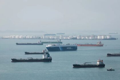
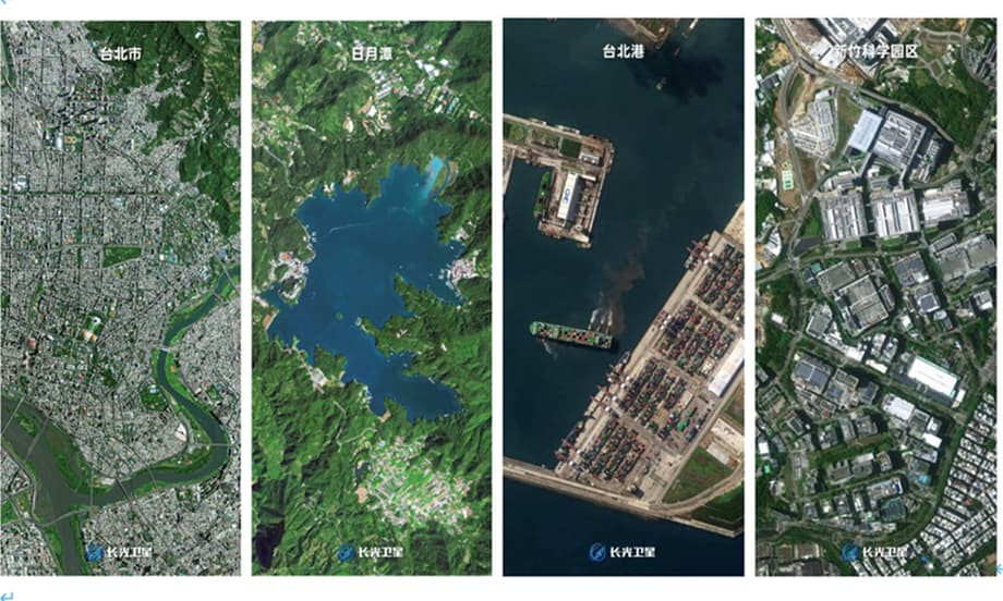
The new collection includes sweeping views of Taipei City and the Keelung River, as well as Alishan Mountain, Sun Moon Lake and the Eluanbi Peninsula. Industrial and transport sites appear too, including Hsinchu Science Park and the Port of Taipei, a logistics hub that faces Fuzhou across the Taiwan Strait. Several Taiwan media outlets remarked that individual streets and neighborhood blocks could be picked out, a testament to the level of detail now available from commercial optics. The constellation’s own social media presentation emphasized vitality on the island from a space perspective.
The images arrive amid a tense political backdrop. Beijing claims Taiwan as part of China, and marks late October as the anniversary of Taiwan’s return after Japan’s surrender in 1945. Taiwan is self governed and its authorities reject Beijing’s sovereignty claim, stating that the island’s future is determined by its people. In this context, any highly publicized imaging of Taiwan, even when focused on scenic spots, carries a strategic message about visibility, reach and attention.
How powerful is Jilin-1
Jilin-1 is a commercial optical remote sensing network. It began with a handful of satellites in 2015 and has expanded rapidly. By late 2025, the operator reported more than 140 satellites in orbit, giving the system the ability to revisit worldwide areas many times per day. Company specifications say the constellation can revisit global targets up to 40 times per day, enabling near real time monitoring in many regions. Frequent revisit is the key advantage of a large constellation. It allows operators to catch short weather windows and watch change over hours rather than only days or weeks.
Product resolution for publicly sold imagery in China is normally limited to about 50 centimeters by regulation. At the same time, Chinese firms continue to test sharper sensors. In 2024, a small technology demonstrator labeled Gaofen 05B was described as capable of 20 centimeter resolution, a level that rivals the sharpest commercial images available globally. The company behind Jilin-1 has cast these experiments as steps toward a denser, more responsive network with quicker data delivery and more flexible tasking.
Xuan Ming, chairman and general manager of Chang Guang Satellite Technology, summarized the aim at an industry forum in Zhuhai.
“The satellite can capture remote sensing images with a resolution of up to 20 centimeters, outpacing the 30 centimeter commercial standard.”
That level of detail means individual vehicles, road markings and small rooftop features can be distinguished, although it does not reveal faces or read license plates. In practice, image value depends on atmospheric conditions, sun angle, and how often a target can be revisited. The advantage goes to operators who can combine sharp sensors with fast scheduling and frequent passes.
Why the timing matters
The image release coincided with ceremonies and messaging around the 80th anniversary of Taiwan’s retrocession, a date that Beijing emphasizes in state narratives. Sharing polished scenes of Sun Moon Lake and Alishan leans into national imagery, while frames of the Port of Taipei underline trade links across the Strait. The package also carried a deterrent note. Analysts aligned with Beijing said the clarity signals that separatist activities are observable and that technology can hold targets at risk if needed. Whether viewed as celebration, soft power outreach or strategic signaling, the choice of timing was deliberate.
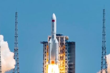
The military backdrop was not subtle. In recent days, the People’s Liberation Army Eastern Theater Command Air Force conducted training near Taiwan that tested reconnaissance, early warning, air blockade and strike tasks. Space based data often supports these drills by cueing airborne patrols, flagging maritime traffic and mapping lines of communication. The combination of new images, a fresh launch of the Gaofen 14 02 stereo mapping satellite, and exercises along Taiwan’s perimeter pointed to a full spectrum demonstration of observation, planning and force readiness.
Signaling inside and outside the island
For mainland audiences, the images present a confident story about high tech progress and national cohesion. For audiences in Taiwan, reactions vary. Some appreciate the artistry and engineering, others see an information operation delivered through glossy photography. Taiwan’s government maintains that it is a sovereign democracy. It regularly criticizes displays of military force and political claims framed as historical inevitabilities. In this environment, satellite pictures can do double duty as postcards and as reminders that space based eyes are always open.
Civil uses and military value
Earth observation is a dual use field. The same image that helps plan tourist facilities around Sun Moon Lake can support flood mapping or track illegal sand dredging. Agricultural planners use satellite time series to estimate crop health. Port operators study queue lengths and yard utilization. Insurance adjusters assess storm damage. Environmental monitors map algal blooms and deforestation. The value of remote sensing comes from repeated, consistent, georeferenced views of the same place over time.
Security agencies also prize these data. High resolution images support target recognition, route analysis and mission rehearsal. Frequent revisit compresses the timeline from detection to action. Commercial constellations like Jilin-1 offer governments additional vantage points even when military systems are busy or clouded out. The line between civil and military applications is thin, and the direction of travel in all major space powers has been toward more sharing and faster tasking between communities.
Stereo imagery and mapping
China recently launched Gaofen 14 02, a satellite that collects stereo imagery, which is used to build three dimensional maps. Stereo pairs are two or more images taken from slightly different angles. With geometry and calibration, software turns those pairs into digital elevation models. Urban planners use them to site infrastructure, highway engineers use them to model cuts and fills, and disaster responders use them to estimate landslide volumes or measure changes after earthquakes. In a defense setting, high precision elevation data aids line of sight analysis, terrain masking assessments and ballistic modeling.
Optical and radar complement each other
Jilin-1 is primarily an optical system, which means it captures reflected sunlight. Clouds and heavy haze can block the view or wash out contrast. Synthetic aperture radar, used on other Chinese spacecraft, sends its own radio pulses and can see through clouds and at night. The most capable observation networks blend optical and radar data, plus signals intelligence and ground reports, into common maps and alerts. China has invested across that spectrum, building civil series like Gaofen and Huanjing, commercial fleets like Jilin-1 and Beijing satellites, and classified assets under military programs.
The company behind the cameras
Founded in 2014 and spun out of a provincial academy, Chang Guang Satellite Technology launched its first Jilin-1 units in 2015. A decade later, it operates one of the largest commercial optical fleets on Earth. The company advertises frequent global coverage, rapid tasking windows and a growing archive that supports industries from land survey and urban planning to energy, insurance and disaster response. It has provided imagery to international partners during fires and floods and promotes its role in the Belt and Road markets.
Plans call for hundreds of additional satellites over the next few years. Company materials describe a follow on network with 20 centimeter class sensors and a revisit cadence measured in minutes when combined with existing platforms. That pace would bring persistent coverage of key corridors and mega cities, at least during daylight and in clear weather. On the data side, Chinese firms are investing in faster downlinks, onboard compression and edge computing to shorten the time from shutter click to user download.
International scrutiny and compliance
Chang Guang and other Chinese space firms face increasing scrutiny abroad. U.S. officials have accused Chinese commercial providers of supplying imagery that aided adversaries on distant battlefields, and they warn that companies with state ties can shift between civil and military support. Chang Guang promotes its commercial services and global user base, while export controls and privacy rules vary by customer and jurisdiction. The debate reflects a worldwide reality. Commercial satellites are now powerful enough to matter in conflict and policy, and their operators are pulled by both market demand and national strategy.
Reactions in Taiwan and on the mainland
Media in Taiwan paid attention to the sharpness of the new pictures, with some coverage noting that every street seemed visible from orbit. Locations like Hsinchu Science Park, the heart of Taiwan’s chip industry, and the Chiang Kai Shek Memorial Hall in central Taipei drew special interest because of their symbolism and industrial weight. The scenic frames, including Alishan ridgelines and Sun Moon Lake’s circular bays, traveled widely on social platforms.
Reaction split along familiar political lines. Some pro unification figures on the island praised the release and described it as a point of pride for ethnic Chinese. Others dismissed the fanfare as propaganda. Mainland commentators accused Taiwan’s ruling party of creating an information cocoon that obscures developments across the Strait. Taiwan based analysts countered that the island is a technology leader in its own right and that public debate remains open. The pictures themselves, while striking, do not change the policy choices that define cross Strait relations. They do, however, raise the visibility of space technology in daily news and in public conversation.
How high resolution satellite imaging works
Resolution refers to the smallest object that can be distinguished in an image. At 50 centimeters, a single pixel represents a square about half a meter on a side. This is sharp enough to distinguish cars from trucks, identify lane counts on a highway and spot new buildings or trench lines. It is not sharp enough to identify a person. Constellation imaging relies on orbital mechanics. Satellites in low Earth orbit circle the planet roughly every 90 minutes. With enough satellites arranged in different orbital planes, tasking software can bring a sensor over a target several times each day.
Revisit frequency is the key to monitoring change. A single satellite might pass over a city once every few days at a useful angle. A large fleet can narrow that gap to a few hours or less. For optical sensors, weather is the enemy. Clouds block the view, and even thin haze can flatten contrast. Operators plan multiple attempts and make heavy use of short notice tasking to exploit sudden clearings. When clouds persist, radar images can fill the gap, and fusing optical and radar data provides a richer picture than either alone.
A more transparent orbit
Space is growing more crowded and, in a sense, more transparent. In September, a Jilin-1 unit used a favorable geometry to image an American WorldView Legion satellite from a distance of a few dozen kilometers. Earlier in the year, U.S. commercial operators had released detailed pictures of a Chinese satellite near China’s space station. These exchanges show how commercial cameras are now capable of satellite on satellite observation, a capability once associated mostly with governments.
Susanne Hake, a senior executive at Maxar Intelligence who oversees work with the U.S. government, described the moment when sub meter lenses began capturing such scenes.
“The clarity of the imagery signalled a new era in orbital observation.”
That era features more eyes, faster delivery and longer archives. For governments, it means less chance of moving in secret. For businesses and communities, it means richer data for mapping, planning and disaster response. For contested regions like the Taiwan Strait, it means that the line between a photo essay and a strategic message is often measured in centimeters and minutes.
Key Points
- China’s Jilin-1 commercial constellation released sharp new images of Taiwan during the 80th anniversary of Beijing’s Taiwan restoration commemoration.
- The set includes Taipei City, Hsinchu Science Park, Alishan, Sun Moon Lake, Eluanbi Peninsula and the Port of Taipei.
- Jilin-1 has more than 140 satellites in orbit and can revisit targets up to 40 times per day, enabling near real time monitoring.
- Chinese regulations limit public sale of optical imagery to about 50 centimeters, but a recent tech demonstrator was described as capable of 20 centimeters.
- Gaofen 14 02, launched recently, collects stereo imagery for three dimensional mapping that supports both civil planning and defense tasks.
- PLA Eastern Theater Command ran training near Taiwan that tested reconnaissance, early warning, air blockade and strike functions.
- Reactions in Taiwan ranged from praise for engineering to criticism of political messaging, reflecting the island’s divided views.
- Commercial satellite data is increasingly dual use, and Chinese providers face scrutiny abroad over potential military applications.
- Satellite on satellite imaging by commercial firms shows a more transparent orbit, where strategic signaling and technology marketing often overlap.