A festival sky rewritten by software
Liuyang in Hunan Province is famous for fireworks, yet its latest celebration looked more like a digital symphony than a pyrotechnic blast. A total of 15,947 illuminated quadcopters climbed into the evening sky and moved as one, forming vast shapes that morphed in perfect unison. The team behind the show titled the performance A Firework Belonging to Me, a nod to the way software can now craft the kind of shared wonder once reserved for gunpowder and flame.
- A festival sky rewritten by software
- What exactly did Liuyang set a record for
- How the choreography works at drone scale
- The firework twist and how engineers kept it in sync
- A fast moving record book in China and beyond
- Safety, failures, and how risk is managed
- Why cities are swapping fireworks for pixels of light
- Where this tech could go next
- Highlights
The flyover unfurled a sequence of kinetic images, including a towering Sky Tree, a double helix, a seed that seemed to sprout and bloom, and a cascade of petals and butterflies. The formations held their geometry as if drawn on the night itself, then shifted on cue to the next scene. Viewers watched a living storyboard animated by light, with the city’s riverbanks and festival grounds acting as a gigantic amphitheater.
By the end of the program, the spectacle had done more than dazzle. It set two Guinness World Records titles: one for the most drones simultaneously launched and controlled by a single computer and another for the most fireworks carried by a drone formation in flight, with 7,496 pyrotechnic units attached and fired during the show. The feat underscored how far mass flight coordination has come, and how Liuyang’s culture of pyrotechnic craft is now augmented by precision code.
What exactly did Liuyang set a record for
Guinness World Records recognizes multiple categories for aerial formations because there are different ways to measure ambition in the sky. Liuyang’s team targeted two of the most demanding. The first focuses on control, asking a single ground system to manage every craft at once. The adjudication counts the airborne units that meet strict standards for position, duration, and reliability. The second category focuses on the combination of aviation and pyrotechnics, counting the number of individual fireworks carried and successfully fired by a drone formation during flight.
In Liuyang, both thresholds were pushed far beyond the scale seen even a year ago. The ground control station took responsibility for all 15,947 aircraft, and the integrated fireworks segment reached 7,496 shots, synchronized to musical cues and light choreography. These are not the same as the record for largest aerial image formed by drones, where organizers typically seek validation for a specific single picture in the sky. Instead, Liuyang emphasized two capabilities that are difficult to deliver together at massive scale: unified command and safe integration of airborne pyrotechnics.
The show’s acclaim spread quickly online as clips raced across social platforms. The reaction was amplified by shares from high profile accounts, which added to the global audience for a festival staged by a city with centuries of fireworks tradition. For organizers, the numbers are more than bragging rights. They are proof that software coordination, positioning accuracy, and radio reliability can now manage a sky full of aircraft with little visible drift or lag.
How the choreography works at drone scale
A show with tens of thousands of aircraft rises or falls on timing and geometry. Each craft must know exactly where it is, where it needs to go next, and how fast to move without colliding with neighbors. That demands a positioning system that beats everyday GPS accuracy by a wide margin, a communication network that reaches every node, and a ground control system that can compute and stream thousands of trajectories while catching errors in real time.
RTK positioning and timing
The Liuyang formation used real time kinematic positioning (RTK), a technique that improves satellite navigation accuracy by referencing a local base station. RTK sends correction data that compensates for small satellite timing errors, atmospheric delay, and geometry issues, delivering centimeter class precision when links are clean. In practice, the fleet receives a steady stream of corrections to keep positions crisp as images evolve. A centralized clock keeps timing consistent, so turns, rises, and descents happen on beat instead of collapsing into a blur.
For a ground team, RTK is not simply about knowing where drones are. It is also about guaranteeing where they will be a fraction of a second from now. That forecast matters when a hundred neighboring aircraft are about to execute a rotation while another layer punches upward to form a tree canopy or spiral into a helix. Without accurate predictions based on precise measurements, these moves would degrade into drift and gaps.
Mesh networking and control integrity
A separate layer keeps the data flowing. Large fleets often rely on mesh networking, where drones act as repeaters for each other. Messages can hop across the formation, which reduces the chance that any single dead zone will cut a craft off from control. The ground system monitors link health and can reroute packets, throttle updates for stable regions, and concentrate bandwidth where a transitional move demands more frequent updates.
Even with a robust mesh, spectrum management is a constant concern. Shows run in crowded radio environments and urban cores reflect signals unpredictably. Organizers typically scope out local interference, segment channels, and plan antenna placement carefully. They also run offline rehearsals in simulation to spot bottlenecks before the first rotor spins in public. These practices do not remove uncertainty, yet they lower the odds that packet loss will ripple through a critical moment on stage.
The firework twist and how engineers kept it in sync
Liuyang’s performance blended classic pyrotechnics with aerial robotics at a level that few cities have attempted. Drones carried pyrotechnic payloads that ignited on cue, interlacing sparks with the LED constellations. The timing margin for such effects is slim. Pyro ejection burns on a predictable curve, but the choreography must absorb tiny delays and the craft’s micro movements. The control system mapped these delays into the script, which allowed the chemical light to marry the graphical light without drifting out of phase.
Safety design shaped every choice. Payload weights were matched to motor and battery margins so the extra mass did not compromise maneuvering authority. Fire resistant materials separated ignition lines from flight critical components. Pilots preplanned safety corridors and no go volumes beneath high risk segments, and the landing sequence was programmed so craft with spent pyro did not cross paths with active units. Keeping pyrotechnics in sync with drone motion does not just serve beauty. It steadies risk by limiting unpredictable interactions between hot particles and nearby aircraft.
A fast moving record book in China and beyond
Only a few years ago, a thousand drones in the air counted as a technical milestone. In 2017, a show in Guangzhou featured 1,000 synchronized craft and set a new bar at the time. Then the ceiling climbed quickly. Teams in China pushed the count past 3,000, then into five figures. In 2024, a Shenzhen display controlled over ten thousand aircraft from a single computer during National Day celebrations. Months later, a performance in Ho Chi Minh City reached 10,518, and in June 2025 a major show over Chongqing documented 11,787 synchronized craft for the largest aerial image category.
Those numbers illustrate an arms race in logistics, software, and radio design. Each step up in scale forces refinements in staging, battery charging, antenna planning, crew roles, and emergency procedures. Large cities have embraced the format as a way to promote culture, tourism, and a growing low altitude economy, where aerial services and entertainment blend with urban life. Liuyang now sits at the top of this list for the control and pyrotechnic integration categories, and it does so in a city whose name is synonymous with fireworks manufacturing.
Safety, failures, and how risk is managed
Swarms at this size are fragile ecosystems. A single software bug can ripple across a fleet. A few lost positioning fixes can chew holes in an image. A sudden gust can induce a cascade if neighbors cannot recover separation. Organizers in Liuyang know the stakes. Previous events in the city have suffered malfunctions where units caught fire and fell toward the crowd, a reminder that public displays demand humility as much as virtuosity.
Weather and interference
Wind shear, rain, and turbulent layers complicate every move. Urban canyons bounce radio waves and confuse satellite receivers, especially when reflections mimic true signals. Ionospheric conditions can degrade accuracy for a while. Teams plan for these cases by setting go and no go thresholds for wind and precipitation, by placing base stations to minimize multipath errors, and by designing formations that tolerate small position errors without obvious visual damage.
Radio interference is an equal threat. Public Wi Fi, private networks, and mobile devices create busy airwaves. Spectrum scans ahead of time reveal where trouble is likely. During a show, supervisors watch signal quality dashboards for signs of congestion and can adjust transmission power, switch channels, or temporarily slow update rates if needed. Layering these techniques reduces the chance that a patch of the sky will go silent at the worst moment.
Failsafes and landing zones
The fleet’s operating system must know how to fail gracefully. Common safeguards include geofencing, altitude and corridor limits, and a staged response to link loss that can include pause, climb, return, and land decisions based on distance from crowds. Battery monitors alert controllers if margins are closing too fast, and those aircraft peel off to predefined landing pads instead of risking a brownout over the display area. Before the public ever arrives, crews rehearse emergency paths and clear fallback routes so an orderly landing is possible even if a section of the fleet needs to stand down.
Risk cannot be erased in a public performance, especially when pyrotechnics are involved. Yet transparency about abort criteria, layered redundancy, and conservative staging have improved safety outcomes as counts have climbed. When spectators see a fleet hold steady in a gust and then return to form, they are seeing the sum of every test flight that was scrubbed when the math did not pencil out.
Why cities are swapping fireworks for pixels of light
Drone shows promise a cleaner canvas. Traditional fireworks leave smoke, paper, and spent casings. Large shells can stress pets and wildlife and occasionally spark fires. By comparison, multirotor light shows produce little debris and can adjust brightness to fit sensitive locations near hospitals or habitats. The downside is that drone rotors still make noise and, at large scale, battery charging and transport carry their own footprints. Organizers weigh these tradeoffs against the ability to paint stories in the sky with a fidelity fireworks cannot match.
Another reason cities are testing aerial choreography is creative control. A drone formation can draw crisp logos, portraits, and landscapes in a planned sequence and hold them for as long as batteries allow. Animations can blend seamlessly with music and ground projection. For civic events, that means the skyline can tell a narrative about a city’s history, its industries, or a holiday theme without relying on a specific pyrotechnic color or shell count.
Where this tech could go next
Skills developed for entertainment are already flowing into other fields. The same formation control, positioning accuracy, and radio networking used in Liuyang are relevant to mapping at scale, temporary communication relays, and distributed sensing. Public safety agencies experiment with coordinated search grids. Surveyors stitch drone data into high resolution models of terrain and structures. Researchers build swarms that can maintain formations around obstacles or share tasks without overloading the network.
Defense planners study the same playbook. A fleet that can hold a stable formation while the network adapts to interference has clear value for training and testbeds. Nations investing in the low altitude economy also see a path to export services, equipment, and software stacks that make these formations possible. The commercial side will benefit from better automation, safer batteries, and onboard algorithms that can spot and correct drift before humans notice. Every gain in reliability lowers costs and opens venues where local rules have been cautious.
Highlights
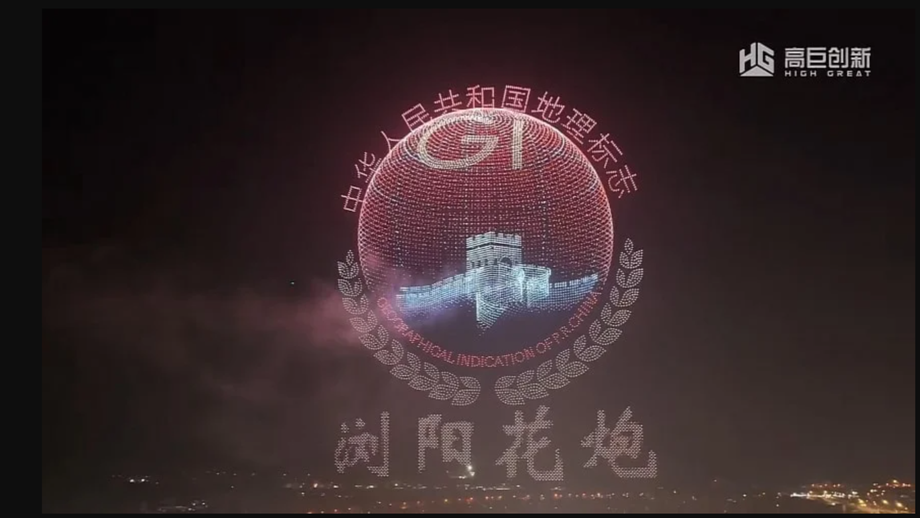
- Liuyang, Hunan staged a 15,947 drone performance titled A Firework Belonging to Me
- Two Guinness World Records were achieved, including most drones controlled by a single computer and most fireworks carried by a drone formation at 7,496
- The show blended drone LEDs with pyrotechnics, syncing effects to music with millisecond level timing
- RTK positioning and mesh networking kept formations stable and communications resilient
- China’s drone show records climbed rapidly from 1,000 in 2017 to over 11,000 in 2025, with Liuyang now setting new marks in control and pyro integration
- Organizers emphasize safety through weather thresholds, spectrum planning, geofencing, and staged emergency landings
- Cities favor drone shows for cleaner skies, narrative control, and reduced debris compared to fireworks
- Formation control techniques are relevant to mapping, communications, and defense research as the low altitude economy expands