What is driving Indonesia peatland floods
Across Indonesia, floods that swamp towns and farmland are increasingly traced to land management, not only to extreme storms. A new analysis by Indonesian NGO Pantau Gambut links rising flood risk to a vast network of canals that companies dug to drain peatlands for plantations. By the group’s count, 281,253 kilometers of industrial canals now slice through peat ecosystems in Sumatra, Kalimantan and Papua. Built to dry soils for oil palm and pulpwood, these channels lower water tables and compromise peat’s natural sponge function. The result is hydrological collapse. In many districts the same landscapes burn in the dry months and flood in the wet months.
- What is driving Indonesia peatland floods
- How canals break a living sponge
- A vast network carved into peat
- Fire in dry months, floods in wet months
- The climate math behind canal drainage
- Law and enforcement gaps
- Communities living with the consequences
- What can reduce flood risk now
- Global demand and due diligence
- Key Points
Peatlands are Indonesia’s quiet workhorses for both water regulation and climate. They store immense amounts of carbon that accumulated over centuries under waterlogged, low oxygen conditions. When peat is drained, it dries and oxidizes. Ground subsides. Rivers rise more quickly after rain, while a lattice of ditches routes runoff straight toward settlements. Pantau Gambut’s report ties the intensifying flood pattern to corporate footprints. Most canals sit inside concessions: nearly 4 million hectares of oil palm on peat and about 2.5 million hectares in industrial plantation forests. From 2015 to 2022, more than 500,000 hectares of peatlands were converted to monoculture, increasing flood and fire risk.
Fire scars tell a similar story. Of the 3 million hectares of peatlands that burned from 2015 to 2024, more than 1.2 million hectares were inside concessions. Separate assessments find that 43% of Indonesia’s roughly 24 million hectares of peat are at risk of flooding, with 6 million hectares highly exposed. Provinces like Riau in Sumatra and parts of Kalimantan have seen floodwaters linger longer and arrive more often. Communities describe floods no longer confined to peak monsoon months.
This shift is not just the story of heavier rains in a warming climate. It is the story of water tables lowered by design, soils that collapse once dried, and a canal grid that delivers rainfall faster than rivers can carry it away. The numbers show scale. The fixes require a different approach to land, water and accountability.
How canals break a living sponge
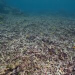
Peat forms when plant material builds up in waterlogged conditions that keep oxygen low. In intact swamps, water moves slowly. The ground rises and falls like a sponge as it absorbs and releases rainfall. When companies cut canals to drain peat for plantations, the water table drops. Oxygen enters deep layers. Peat starts to decompose, releasing carbon dioxide. The surface compacts and sinks, a process known as subsidence. Once peat is lost to oxidation and fire, it does not return within any meaningful planning horizon.
From slow release to flash floods
A living peat swamp spreads and slows stormwater, then meters it out to downstream areas over days or weeks. A drained peat landscape does the opposite. Canals become fast lanes that pass rain directly to rivers and settlements. Sunk ground removes the shallow platform that once stored water. In coastal peat, subsidence lowers land relative to the sea, which invites tidal flooding and saltwater intrusion. Both inland and coastal communities end up with higher peaks and longer durations of flood.
A vast network carved into peat
The scale of the canal grid is staggering. Pantau Gambut calculates 281,253 kilometers of canals cut across peat ecosystems. Scientific mapping backs up how extensive drainage is. A regional analysis that used high resolution satellite images and machine learning found drainage in at least 65% of Southeast Asian peatlands across all land uses. Areas with dense canal networks had subsidence rates around 3.2 times higher than non drained areas. Including canal data improved subsidence prediction far more than using land use labels alone. In short, drainage density drives the physics of flood risk and land collapse.
The business footprint is clear. Canals concentrate inside commercial concessions for oil palm and pulpwood. Pantau Gambut points to 10 firms whose operations on peat raise flood risk well beyond their boundaries. Their output feeds global supply chains for palm oil, paper and tissue. Policy gaps compound the problem. Even import rules that aim to curb deforestation do not consistently treat peat drainage as deforestation, which leaves buyers with blind spots.
Fire in dry months, floods in wet months
Drained peat is tinder. Once canals lower water tables and loggers open forest canopy, the dried surface can ignite with sparks from land clearing or nearby fires. Fires race through peat below ground, hard to stop and hard to detect until smoke thickens. During the wet season, the same drained catchments turn into supercharged runoff systems. The result is a punishing cycle: smoke and haze that send people to clinics when rains are scarce, then repeated floods that inundate homes, roads and crops when rains return.
The numbers from recent years match that cycle. Millions of hectares of peat burned since 2015. More than a third of burned peat fell inside concessions. Flood alerts are now common in peat districts. South Kalimantan has seen widespread inundation since 2021, while low lying parts of Riau endure water that returns faster than before. Residents describe a new normal that leaves less time to recover between disasters.
The climate math behind canal drainage
Degraded peatlands are a major part of the climate problem, responsible for about 5% of annual human greenhouse gas emissions worldwide. Emissions from dried soils are only part of the story. New measurements from Indonesia show canals themselves are hidden emitters. Laboratory experiments using water from peatland canals in West Kalimantan measured carbon dioxide produced by microbes and by sunlight breaking down dissolved organic carbon. The team estimated that each square meter of canal surface releases about 70 milligrams of carbon dioxide per day. Around 35% of the carbon that dissolves into canals is re released to the atmosphere before it reaches rivers or the sea.
Jennifer Bowen, a lead author of the study and a postdoctoral scholar with Scripps Institution of Oceanography and Stanford University, said the canal effect adds a sizeable climate cost on top of soil emissions.
These canal systems are likely a significant source of carbon dioxide emissions on top of the emissions from dried peat soils, and we are probably underestimating the climate impacts of degrading these systems.
Those emissions also mean less peat carbon makes it to the ocean, where some fraction might otherwise be stored. If inventories only count smoke from fires and miss both soil oxidation and canal emissions, they will understate the true climate impact of peat drainage.
Law and enforcement gaps
Indonesia has rules to protect peat, but legal architecture leaves space for circumvention. Much of the protection sits at the level of government regulation instead of statutory law. Higher level laws can override those protections. A 2017 ministerial regulation allows companies to avoid restoration duties if fires occur inside their concessions, shifting responsibility to the government. Damage is often recognized only when peat burns. Draining peat is not consistently treated as damage that triggers sanctions.
Pantau Gambut urges authorities to treat drainage, deforestation and flood outcomes as key indicators of harm on par with fire. Enforcement actions that stop canals and require water table recovery would prevent larger disasters. Civil cases tied to haze have been thrown out in several instances, leaving victims without remedy. Without clear penalties for lowering water tables, the financial incentives tilt toward drainage.
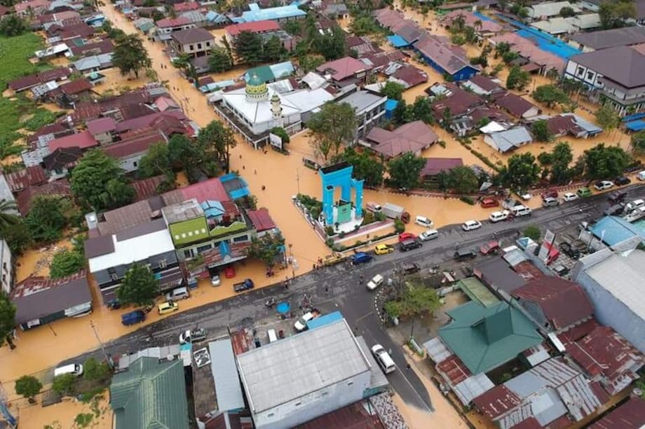
Communities living with the consequences
Villages on peat margins carry the burden. Farmers in South Sumatra describe how upstream canal cutting shifted seasonal water in ways that ruined rice paddies and reduced fish catches. In low lying settlements along the Musi River and across Riau, people report water that rises higher with each storm and takes longer to recede. Many cannot abandon their homes. Work and family networks anchor them to places where daily life now demands pumps, repairs and frequent evacuation.
Health and income suffer when smoke from peat fires blankets towns and floodwater disrupts markets and schools. Small scale repairs that once kept floodwater at bay no longer match deeper hydrological change. When land sinks and canals route rain faster, informal dikes and drains provide little relief.
What can reduce flood risk now
Rewetting works when it is done carefully and at landscape scale. A seven and a half year restoration trial in Sumatra raised groundwater in a former plantation by installing 257 compacted peat dams over 4,800 hectares. Subsidence rates fell by about half and emissions dropped. In the wettest areas, 57 native peat swamp tree species regenerated without planting, a sign that hydrology was returning to a healthier range. The study recommends stepwise rewetting that avoids prolonged deep inundation and lets native forest recover on its own where possible.
Blocking canals is only one part of the solution. Concessions that remain in production can set water table targets supported by automatic monitors and public reporting. No new canals should be allowed on peat. Emergency fire prevention needs to include permanent solutions that raise water tables, not just seasonal patrols. Government agencies and companies can coordinate dam placement across concession boundaries because hydrology follows the peat dome, not property lines.
Sustainable livelihood options help communities stay engaged with restoration. Paludiculture, or wet cultivation, replaces dryland crops with species that tolerate high water tables. Farmers in South Sumatra use jelutung for latex, ramin and balangeran for timber and native fruits for household income. Projects that mix agriculture, forestry and fishery have to balance water needs. Closed loop fish canals can support incomes, yet they can also lower water tables if connected to open drainage in nearby plantations. Careful design and community oversight keep restoration goals intact.
Global demand and due diligence
Palm oil, paper and other peat linked products reach supermarkets and storerooms around the world. Buyers and lenders can reduce flood and fire risk by requiring suppliers to stop draining peat and to restore water tables. Contractual zero drainage commitments, field verification and traceable supply chains are achievable with current technologies. Certification schemes can be strengthened to include hydrology, not only forest cover.
Import rules can help if they close gaps. Peat drainage should be treated as a deforestation equivalent because it destroys an ecosystem and its services even when some trees remain. Greenhouse gas reporting by companies and governments needs to include emissions from soil oxidation and canal waters. Banks and insurers can assess drainage risk across portfolios. Communities should have free, prior and informed consent before any project touches peat.
Key Points
- Pantau Gambut links rising floods to a canal network of 281,253 kilometers that drains peatlands in Sumatra, Kalimantan and Papua.
- Most canals lie inside concessions, with nearly 4 million hectares of oil palm on peat and about 2.5 million hectares in industrial plantation forests.
- From 2015 to 2022, more than 500,000 hectares of peatlands were converted to monoculture, heightening flood and fire risk.
- Of the 3 million hectares of peat that burned between 2015 and 2024, over 1.2 million hectares were inside concessions.
- Analyses indicate 43% of Indonesia’s peat area faces flood risk, with 6 million hectares highly exposed.
- Regional mapping shows drainage in at least 65% of peatlands and subsidence rates about 3.2 times higher in heavily drained areas.
- Canal waters themselves emit carbon: about 70 mg CO2 per square meter per day, with around 35% of dissolved peat carbon degassed to the atmosphere.
- Legal gaps persist. A 2017 regulation shifts restoration duties to government after fires, and drainage is not consistently sanctioned as damage.
- Restoration at scale can work. Canal blocks and rewetting halved subsidence in a large Sumatra trial and supported spontaneous regrowth of native trees.
- Buyers and regulators can require zero drainage, include peat in deforestation rules, and expand climate reporting to cover soil and canal emissions.