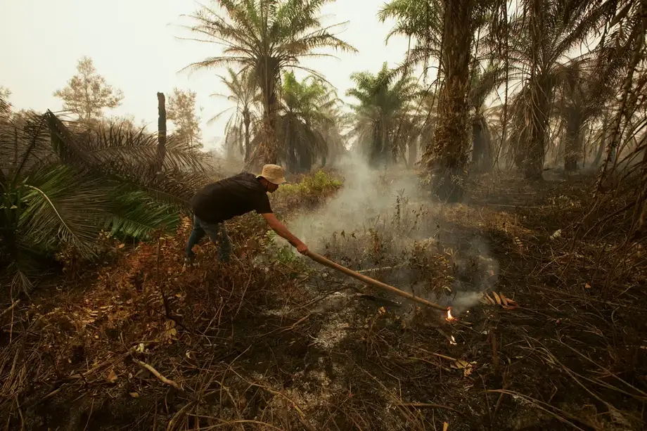
Satellite estimate overtakes the monitor's 2019 total
Fires burned an estimated 2.88 million hectares across Indonesia through the end of October 2026, according to satellite analysis by Nusantara Atlas, exceeding the monitor's total for all of 2019. The findings, disclosed on November 11, show an increase of nearly one million hectares since its September update.
Contents
- Satellite estimate overtakes the monitor's 2019 total
- What the government figures show
- How the emergency developed
- Why drought and damaged peat are a dangerous combination
- Firefighters face smoke, limited visibility and persistent heat
- Health costs spread far beyond the fire zones
- Eastern provinces join the most affected areas
- Carbon losses put climate targets under pressure
- Domestic penalties and regional legal limits
- Key Points
The burned area, equivalent to 7.1 million acres, reflects a crisis stretching from peatlands in Sumatra and Kalimantan to eastern Indonesia. Strong El Niño conditions have intensified drought, while drained peat and land cleared for plantations have left large areas vulnerable to fire. Smoke has damaged public health, disrupted schools and transport, and spread into neighbouring countries.
David Gaveau, founder of Nusantara Atlas, described the severity of the season:
"Basically, it's a really bad year," he said.
Gaveau considers the estimate conservative because smoke has hidden some burned ground from satellites. Rain has brought some of the worst blazes under control, and hotspot counts are beginning to flatten or decline. The measured area can still grow as fires continue and clearer images reveal previously obscured damage.
Indonesia's last published government total covers January through July, leaving a substantial gap between the latest satellite assessment and the official reporting period. The expanding emergency now connects several problems: extinguishing fires, treating smoke exposure, identifying responsibility and measuring damage to forests that Indonesia relies on to absorb carbon.
What the government figures show
The Forestry Ministry's SIPONGI fire dataset records 202,004.30 hectares burned from January through July 2026. SIPONGI KEMENHUT says its calculation combines Landsat 8 OLI/TIRS satellite imagery with hotspot distribution, field checks and suppression reports from the Manggala Agni firefighting service.
The dataset lists that total as 47% above its 2019 comparison figure, 80% above 2023 and 69% above 2025. Those comparisons concern the government dataset; Nusantara Atlas separately says its October estimate exceeds its own full year total for 2019.
Forestry Ministry spokesman Ristianto Pribadi said the government was still preparing updated estimates. He explained the work required before publication:
"Updating the data on the size of land and forest fire-affected areas requires in-depth confirmation and verification," said Ristianto.
No announcement date was given. Indonesia's devastating 2015 fires provide another historical reference, with research estimating 2.6 million hectares burned. Gaveau cautions that changes in satellite imagery make a direct comparison between 2015 and the current Nusantara Atlas series difficult.
How the emergency developed
Indonesia entered the dry season with fires already consuming land and personnel being mobilised across several islands. The subsequent sequence shows how the emergency grew, even as individual daily hotspot counts sometimes fell.
- January through July: SIPONGI KEMENHUT recorded 202,004.30 hectares burned.
- August 30: the Forestry Ministry counted 946 hotspots with high detection confidence and reported 60 fire locations still undergoing suppression.
- September 7: the Global Fire Emissions Database estimated that fires had released 76 million tonnes of carbon.
- September: Nusantara Atlas estimated that more than 1.9 million hectares had burned.
- October 15: the government planned a trial dispersing 1.5 tons of dry ice over Palembang to address haze.
- End of October: Nusantara Atlas's cumulative burned area reached 2.88 million hectares, announced on November 11.
A hotspot is a satellite signal indicating unusually high heat. Field teams check those signals to locate fires, while satellite images of burn scars help calculate the area damaged. Several heat signals can come from a single fire, so hotspot totals and hectares measure different aspects of the emergency.
The ministry's August operations update recorded 455 hotspots in West Kalimantan and 308 in Central Kalimantan. Together, those provinces accounted for 763 of the national total of 946, about 81%. The national count had fallen by 629 from the previous day, while crews were still handling fires across 12 provinces.
Why drought and damaged peat are a dangerous combination
El Niño is a recurring warming of the tropical Pacific Ocean that changes weather patterns. In Indonesia, it can bring hotter, drier conditions that help fires ignite and spread. The 2026 event began in June and was expected to continue into 2027.
Dr Nisa Novita, strategic lead for peatland at Yayasan Konservasi Alam Nusantara, described El Niño as a "major amplifier by creating hotter and drier conditions, making fires easier to ignite, spread faster and much harder to control". Land clearance and drainage supply another part of the explanation by making the landscape more flammable.
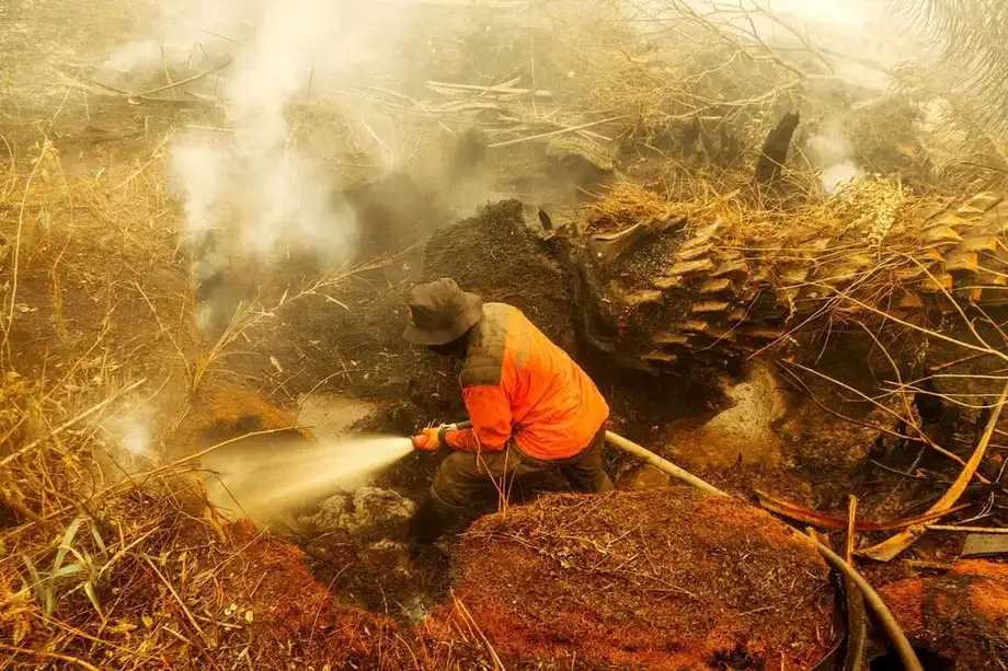
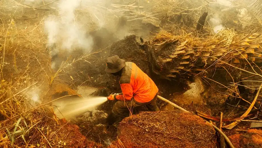
Peat consists of partly decomposed vegetation accumulated in wet ground. Canals built for agriculture can lower the water table, drying material that previously stored water and carbon. Once ignited, peat can smoulder underground for weeks, feeding smoke into the air after visible flames disappear.
That danger was evident during underground fires near Palembang, where crews repeatedly cooled dry peat near homes in October. Residents faced smoke, breathing difficulties and the risk that concealed heat would produce new flames.
In Bangka Belitung province, nearly 300 homes were destroyed and almost 1,000 residents fled a settlement in South Bangka. Regency head Riza Herdavid said residents had tried to extinguish the approaching fire with portable pumps before it returned from beneath the peat.
Riza explained how the fire reached the homes:
They thought it was taken care of. But it's peatland, and there was still a fire smouldering underneath. So, when they assumed it was over, the wind shifted and quickly drove the fire toward the settlement.
Riza said the settlement had been developed the previous year on protected peatland. The destruction shows the practical stakes of land use decisions: people can lose homes even after a surface fire appears to have been extinguished.
Firefighters face smoke, limited visibility and persistent heat
Indonesia's response has combined ground crews, water bombing, aerial patrols and attempts to modify weather. The August ministry update recorded 4,801 response operations covering 38,829.46 hectares, supported by 30 helicopters in Kalimantan and 22 in Sumatra.
Deployment later rose to more than 60,000 personnel, according to cabinet secretary Teddy Indra Wijaya. That followed the mobilisation of nearly 50,000 personnel reported in August. President Prabowo Subianto ordered maximum efforts to extinguish the fires and action against suspected perpetrators.
Smoke has also obstructed the response. Thick haze grounded aircraft used for water bombing in a province of Borneo. Official observations on August 31 recorded visibility of just 1.3 kilometres at Supadio airport in Pontianak and 1.5 kilometres at Tjilik Riwut airport in Palangka Raya.
The government also planned a trial dispersing 1.5 tons of dry ice, solid carbon dioxide, over Palembang on October 15. Coordinating security minister Dudung Abdurachman said the president had ordered the experiment, with possible expansion depending on the results.
Rick McRae, an adjunct professor with the University of New South Wales bushfire research group, said dry ice might provide temporary local relief. Moving weather systems could bring replacement smoke into an area that had been cleared. His assessment points to the continuing task for firefighters: stopping the source of the smoke while protecting communities exposed to it.
Health costs spread far beyond the fire zones
Hundreds of thousands of people have been sickened during the emergency. In Central Kalimantan, the ISPU air pollution index exceeded 1,200 during an October episode, more than four times the hazardous threshold of 300.
Indonesia had already recorded 50,891 acute respiratory infection cases associated with fires during July and August, including more than 12,000 children under five. The September school and health crisis also included more than 1.4 million students moving to remote learning and about 12,800 schools remaining closed.
Haze blanketed Malaysia and Singapore for more than a month, closing schools and increasing respiratory complaints. Singapore introduced subsidies for treatment of illnesses associated with haze and distributed N95 masks to eligible residents. Pollution also reached the Philippines and Timor-Leste, which announced a nationwide school closure lasting three days.
The Centre for Research on Energy and Clean Air estimated that smoke pollution caused 3,560 deaths in September and exposed 58 million people to unhealthy or hazardous air that month. These are modelled estimates of the health burden, alongside the cases recorded by health services.
Researchers Nailul Huda and Bhima Yudhistira Adhinegara at the Center of Economic and Law Studies, or CELIOS, estimated health costs of Rp19.20 trillion for diagnosed acute respiratory infections. Their broader calculation, including people with symptoms outside official records, reached Rp224.65 trillion. The costs include medical care and lost productivity for patients and those caring for them.
Eastern provinces join the most affected areas
South Papua recorded the largest burned area in the CELIOS assessment, at 319,119.68 hectares. West Kalimantan followed with 277,127.29 hectares, ahead of East Nusa Tenggara at 223,192.97, Central Kalimantan at 220,329.68 and South Sumatra at 170,775.03.
CELIOS used a cumulative estimate of 1.92 million hectares through October 20. Nusantara Atlas's later assessment reached 2.88 million hectares through the end of October. The CELIOS study places about 86% of its burned area in the ten most affected provinces.
The prominence of South Papua and East Nusa Tenggara broadens the picture beyond the peatland regions of Sumatra and Kalimantan. Dr Guido van der Werf of Wageningen University described Papua and neighbouring Papua New Guinea as emerging fire frontiers. Grasslands and other dry landscapes also feature in this year's damage.
CELIOS projected combined economic and health costs of Rp359.58 trillion to Rp565.03 trillion. Its economic component alone was Rp340.38 trillion, including Rp262.33 trillion attributed to forestry and logging. That calculation covers lost assets and productive activity, with restoration costs contributing to the forestry estimate.
Wildlife has suffered too. The West Kalimantan Natural Resources Conservation Agency reported at least 46 orangutans rescued since August. The International Union for Conservation of Nature said fires had affected habitats containing 52% of Borneo's orangutan population. Surviving animals face reduced habitat, food and water as drought and burned vegetation alter their surroundings.
Carbon losses put climate targets under pressure
The Global Fire Emissions Database estimated that Indonesia's fires had emitted 76 million tonnes of carbon by September 7. The 2015 fires generated an estimated 333 million tonnes across the full season. Van der Werf said the 2026 season was "more or less on track" to reach the earlier emissions level, depending on how long severe conditions persisted.
Peat makes the carbon consequences especially large because fire consumes material stored beneath the surface as well as trees and vegetation. Carbon stored over long periods can be released as the ground burns.
Syaiful Anwar, a senior policy analyst at the Environment Ministry and Environmental Control Agency, said the fires could make Indonesia's FOLU Net Sink 2030 target harder to reach. That target requires forestry and other land uses to absorb more greenhouse gases than they release by 2030.
Syaiful said emissions from the 2026 fires were expected to be calculated in 2027 for an initial report in 2028. That process involves gathering data, calculating emissions and checking quality before international reporting. Franky Zamzani, the ministry's director of climate adaptation, said the fires could affect Indonesia's climate performance and its position at COP31 negotiations.
Restoration is therefore part of both fire prevention and climate policy. Indonesia's previous peatland restoration agency, whose mandate expanded to mangroves in 2021, was dissolved in 2025. Satyawan Pudyatmoko, identified as head of the National Peatland and Mangrove Management Agency, said the government hoped to use wetter conditions forecast for the next two years to accelerate peat recovery.
Domestic penalties and regional legal limits
Indonesian authorities identified fires across 33,514.01 hectares of concessions belonging to 57 businesses in eight provinces. Dudung said authorities had recorded 241 notices of the start of investigations involving individuals and 93 involving corporations.
The Forestry Ministry imposed administrative sanctions on 32 legal subjects: five permit revocations, 19 permit suspensions and eight written warnings or restoration measures. Authorities also named PT MAP in West Kalimantan and PT GAP in Central Kalimantan as suspects in alleged fire offences. A class action lawsuit separately accused the government of gross negligence in handling the emergency.
Malaysia and Singapore face a more complicated route when seeking redress across borders. Professor Mohd Hazmi Mohd Rusli of Universiti Sains Islam Malaysia explained the central obstacle to bringing a dispute before the International Court of Justice:
"The main issue is jurisdiction, as the ICJ generally requires the consent of both states," he said.
The 2002 ASEAN Agreement on Transboundary Haze Pollution is legally binding but provides no mechanism for one member to take another to that court. Indonesia, Malaysia and Singapore are also outside the 1979 Convention on Long-range Transboundary Air Pollution. ASEAN's framework instead centres on national action and regional cooperation.
ClientEarth legal expert Azam Hawari said people pursuing companies in Indonesian courts would need evidence connecting company activities to the haze and their losses. Singapore's Transboundary Haze Pollution Act, enacted in 2014, allows action against companies contributing to unhealthy haze in Singapore, but investigations into four Indonesian companies over the 2015 episode remain open.
National University of Singapore environmental law professor Alan Tan said Singapore would probably wait for Indonesia to identify companies before acting under its own law. Effective enforcement depends on access to land maps, evidence from fire locations and cooperation across borders, alongside the immediate work of keeping peat wet and preventing further burning.
Key Points
- Nusantara Atlas estimates that 2.88 million hectares burned through October 2026, exceeding its full year total for 2019.
- The official SIPONGI KEMENHUT figure is 202,004.30 hectares for January through July; an updated government total has no announced publication date.
- Rain has reduced some fire activity, while continued burning and newly visible burn scars may increase the measured damage.
- Drained peat, land clearance and drought associated with El Niño have made fires harder to control.
- Smoke has disrupted health, schools and transport in Indonesia and neighbouring countries.
- Authorities have imposed permit sanctions and opened investigations, while the fires put additional pressure on Indonesia's 2030 land sector climate target.