A fire that survives after the flames disappear
In Talang Jambi, near homes in Palembang, South Sumatra, a fire covering about two hectares has required days of rotating firefighting crews. During an October 4, 2026 inspection, Brigadier General Khabib Mahfud described dry peat that retained heat underground, allowing smoke and flames to return after visible fires had been extinguished. A resident, Neni, 56, said the burning had continued for about a week, leaving neighbours with breathing difficulties, irritated eyes and fear that flames would reach their houses at night.
Contents
- A fire that survives after the flames disappear
- Why dry peat is so difficult to extinguish
- Drought meets decades of drainage
- How much land has burned?
- Why hotspot counts can mislead
- Volunteers confront smoke and scarce water
- A pollution burden beyond ordinary forest smoke
- How smoke reaches neighbouring countries
- Investigations and a new peatland agency
- Rain may bring relief, but water management decides resilience
- Key Points
That small fire illustrates the central problem in Indonesia's much larger emergency: the ground itself can become fuel. Peat, made from partly decomposed vegetation accumulated over centuries or millennia, can smoulder below the surface for weeks. Putting out visible flames does not necessarily extinguish the burning material beneath them.
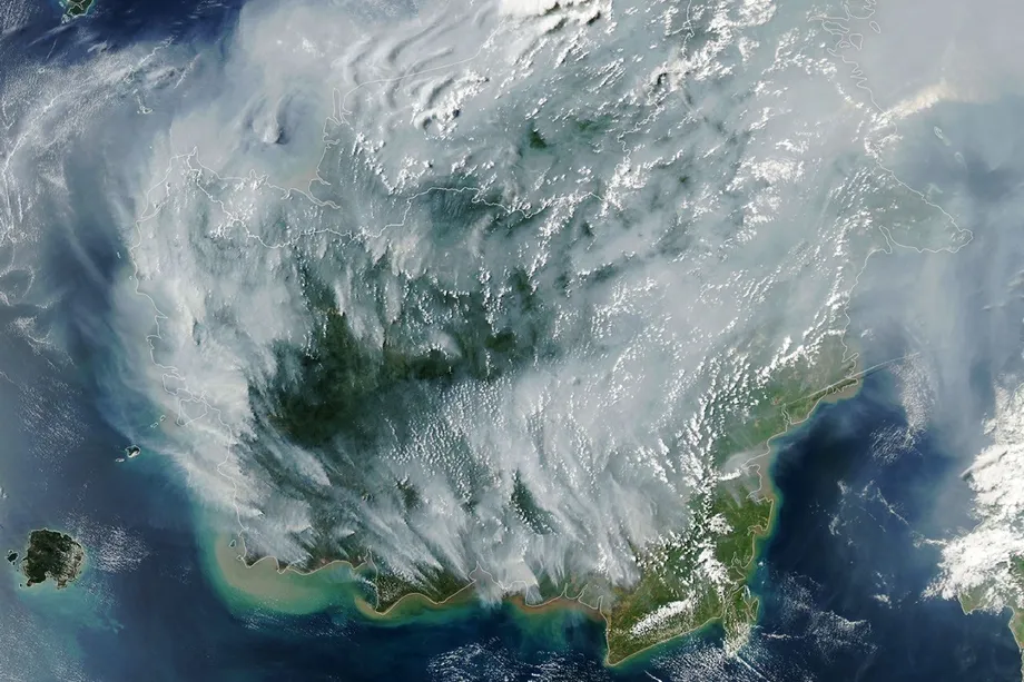
NASA's Peatland Fires Darken Skies in Indonesia explains why these fires are unusually persistent and polluting. Indonesia contains about 36 percent of the world's tropical peatlands. During drought, normally waterlogged deposits in Kalimantan, Sumatra and Papua can dry sufficiently for fire to spread underground, producing smoke that travels into neighbouring countries.
The response therefore involves more than extinguishing forest vegetation. Firefighters must find concealed heat, bring water to difficult locations and keep combustible soil wet. Meanwhile, officials face a second challenge: measuring an emergency in which satellites can miss fires, estimates of burned land differ, and health statistics cover different populations and reporting periods.
Why dry peat is so difficult to extinguish
In an intact peat swamp, water slows the decomposition of dead plants, allowing organic material and carbon to build up. Drainage changes those conditions. As the water table falls, formerly saturated layers become exposed to air and can dry into a deep reserve of combustible material.
Dr Nisa Novita, a peatland researcher at the Indonesian conservation organisation Yayasan Konservasi Alam Nusantara, explains how the same ecosystem can shift from carbon storage to a source of emissions:
Peatlands are incredibly effective carbon stores because their waterlogged conditions slow decomposition, allowing carbon to accumulate underground for thousands of years.
Novita says peat deposits in Kalimantan can exceed 20 metres in depth. Deposits that deep may contain more than 6,000 tonnes of carbon per hectare. That is a measure of stored carbon, not a claim that every fire burns through the entire deposit or releases all of it.
Peat fires smoulder at relatively low temperatures and may advance without a conspicuous flame front. Water applied at the surface must reach the burning layers, and apparently quiet ground may still contain enough heat to reignite. In Palembang, combined military, police, municipal firefighting and disaster agency teams were cooling the ground and watching for renewed burning near housing.
Robert Field, a Columbia University researcher who developed the Global Fire Weather Database, described the persistence of underground fires in NASA's account:
Surface fires are less of a concern, but when fires get underground, they just won't stop.
Field expected sustained seasonal rains in October or November to be necessary to end that burning. His forecast describes the difficulty of suppression during drought, rather than suggesting that surface fires are harmless.
Drought meets decades of drainage
NASA says about 90 percent of Indonesia received little or no rainfall in early August 2026, citing the country's meteorological agency. El Nino, a Pacific climate pattern that often reduces Indonesian rainfall, was present and strengthening. A positive Indian Ocean Dipole, another ocean temperature pattern associated with reduced rainfall in the region, was also present.
Dry weather makes ignition and spread more likely, but does not itself explain who starts a fire. Indonesia's Meteorology, Climatology and Geophysical Agency says an ignition source, including human activity, is still needed.
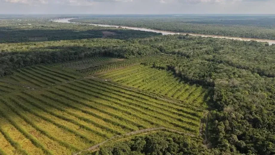
The landscape has also been altered over decades. Mark Cochrane, an ecologist at the University of Maryland Center for Environmental Science, attributes some of today's flammability to canals built during the 1990s to drain peat swamps for large rice farming projects. Oil palm and plantation forestry have also expanded across peat landscapes.
Kalimantan lost almost 160,000 hectares of forest in 2025, more than one third of Indonesia's national forest loss. Forest loss and burned area are different measurements, but the clearing helps explain how land use and drought can combine to increase exposure to fire.
Susan Page, a University of Leicester professor who has studied Asian peatlands for three decades, says drained peat releases carbon dioxide even when it is not burning. Fire is the most visible episode of a longer process of carbon loss.
The connection between drainage and water management extends beyond the dry season. A previous assessment described how industrial canals increased both flood exposure and fire risk across Indonesian peatlands. Keeping peat wet is therefore part of protecting its carbon stores and its capacity to regulate water.
How much land has burned?
The SIPONGI KEMENHUT provincial burned area compilation gives a national total of 202,004.30 hectares for January through July 2026. It says the area was 82,791.04 hectares, or about 69 percent, greater than its 2025 comparison figure.
SIPONGI calculates burned area using Landsat 8 imagery combined with hotspot distributions, field verification and suppression reports from Manggala Agni, the forestry ministry's fire control service. This is an estimate of affected land, not simply a count of satellite detections.
Reports differ on the timing and size of the total. One account assigns more than 202,000 hectares to January through June and nearly 95,000 additional hectares to July, including over 73,300 hectares in Sumatra and Kalimantan. That does not match the official compilation's January through July total and cannot be combined with it as though the periods were consistent.
A later satellite estimate puts burned land near 896,000 hectares by the end of August. Separately, about 200,000 hectares of forest and farmland were reported affected in Indonesian Borneo from early July. These figures use different geographic boundaries, periods or methods. None establishes how much of the national total burned specifically on peat in 2026.
The sequence of dated observations shows how the emergency developed:
- Early August: about 90 percent of Indonesia received little or no rainfall, according to meteorological data cited by NASA.
- August 27: the Health Ministry recorded 10,674,201 people affected across seven provinces.
- August 31: SiPongi recorded 946 hotspots.
- September 2: NASA reported emissions equivalent to roughly one tenth of the 2015 fire season total.
- September 24: President Prabowo Subianto ordered the creation of a new peatland and mangrove agency.
- October 4: crews in Talang Jambi continued cooling a peat fire near homes.
- October 6: environmental groups reported satellite findings linking likely smoke sources to agricultural concessions.
Why hotspot counts can mislead
The Ministry of Forestry's forest and land fire control information page cautions that satellite hotspots are preliminary indicators requiring field verification. A hotspot does not always mean a fire has occurred.
The reverse problem also matters. NASA explains that MODIS and VIIRS satellite instruments can struggle to detect fires beneath forest cover, underground, or through thick smoke and clouds. A single fire may generate multiple detections, while a concealed fire may generate none.
Cochrane describes the resulting observation problem:
The worst smoke events, paradoxically, can be the hardest to observe from space with MODIS and VIIRS.
A declining hotspot count therefore cannot, by itself, demonstrate that fires are coming under control. Thickening smoke may be obstructing detection. Officials need satellite observations alongside field checks, burned area mapping and suppression reports.
Shi Jun Wee, a University of Maryland graduate student, is working with NASA and MapBiomas on methods using shortwave infrared observations from Landsat and Sentinel 2 to detect more fires beneath forest cover. Those efforts address an observation gap, but do not eliminate the need to verify conditions on the ground.
Volunteers confront smoke and scarce water
Indonesia's National Disaster Management Agency, BNPB, reported more than 39,000 people deployed in joint firefighting operations involving military personnel, police, forestry and local government staff, and volunteers. Ground operations have been supplemented by water bombing and weather modification efforts.
BNPB official Berton Panjaitan identified difficult access, distant water sources, extensive burning, wind and smoke as major obstacles. Volunteers have dug ponds and borewells, driven pipes into the soil and used portable pumps to get water into burning peat.
Many volunteers are Indigenous Dayak or Banjar people. Dwi Sujatmoko, a 35 year old volunteer firefighter who had worked in the haze for more than a month, described what the smoke felt like:
It hits your nose straight away, your eyes burn – that's more or less what it's like.
Accounts from Central Kalimantan reported that two volunteers died after their health deteriorated while fighting fires. The reports do not establish a medical cause of death. They nevertheless underline the danger facing people who spend long periods close to burning peat.
By September, volunteers were already working through the night and pumping water into underground peat fires. The continuing operation in Palembang shows why repeated cooling and surveillance are needed even at a comparatively small site.
A pollution burden beyond ordinary forest smoke
NASA cites an estimate that peat fires produce three times as much fine particulate matter, five times as much sulphur dioxide, three times as much organic carbon, and twice as much methane and carbon monoxide as other tropical forest fires.
Fine particles known as PM2.5 measure no more than 2.5 micrometres across. Their small size allows them to penetrate deep into the lungs. Page says very fine particles can pass into the bloodstream and contribute to health problems elsewhere in the body, including the heart. Carbon monoxide is also toxic.
The Health Ministry's forest and land fire health policy article, written by policy analyst Bambang Setiaji, cites a situation report dated August 27. It records 4,082 acute respiratory infection cases that day and 13,449 cumulative cases across 63 districts and cities in seven provinces.
Other reported totals are higher but cover different periods or populations: more than 50,000 infections linked to fires during July and August; more than 170,000 in affected areas from August to mid September; and nearly 175,000 from August 18 to September 21, including more than 40,000 among children under five. These totals should not be added together. Nor does every infection recorded in an affected area necessarily establish an individual causal link to smoke.
As of August 27, the ministry reported 848 health workers mobilised, with 1,691 community health centres, 360 referral hospitals and 87 public health laboratories ready to respond. The policy article calls for warnings combining hotspots, weather, wind, air quality, exposed populations and disease surveillance, so protection begins before hospital visits rise.
How smoke reaches neighbouring countries
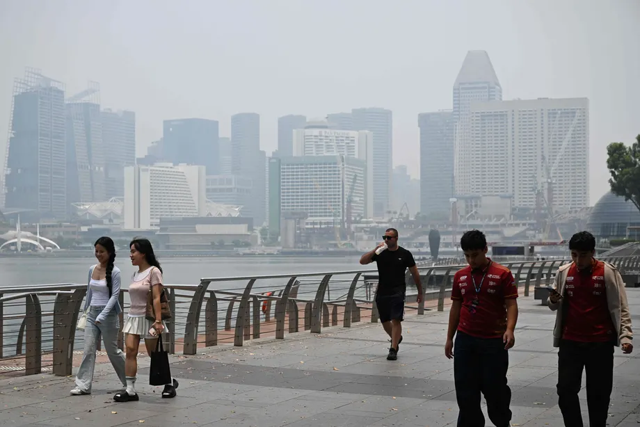
The ASEAN Specialised Meteorological Centre activated its highest regional haze alert, Level 3, for southern Southeast Asia. Smoke affected Malaysia, Singapore, Brunei and the Philippines, while more than 1.4 million Indonesian students reportedly shifted to remote learning and hundreds of Malaysian schools closed. Nine Indonesian national parks closed, and flights were delayed.
Malaysia's Health Ministry reported a 259 percent rise in asthma cases in the last week of August. An air quality study by the ASMPH Center for Research and Innovation and Breathe Metro Manila found pollution in Manila above four times World Health Organization guideline levels between August 30 and September 2.
Other accounts describe readings approaching 75 times recommended levels in some places, but without consistent information about the pollutant, averaging period and location. That figure should not be treated as directly comparable with the Manila finding.
Ardhi Adhary Arbain, a researcher at Indonesia's National Research and Innovation Agency, used WRF Chem, a model combining weather and atmospheric chemistry, to simulate smoke movement. In August, prevailing winds moved from the southeast and turned northeast after crossing the equator, potentially carrying pollution towards Malaysia, Singapore, Brunei, the Philippines and Thailand.
The simulations produced PM2.5 concentrations above 7,500 micrograms per cubic metre near some fire sources, with a late August maximum above 12,000. These are modelled concentrations, not confirmed readings from monitoring stations. The simulated spread was more localised than in August 2015, showing that pollution intensity and geographic reach are separate aspects of severity.
Investigations and a new peatland agency
Authorities have investigated alleged burning connected to oil palm development and road construction. Police reported arresting 72 people suspected of starting forest fires and tracing financial records to determine whether companies financed or ordered clearing. Dayak Kanayatn representative Tono, meanwhile, disputes the tendency to blame Indigenous farming communities, saying traditional controlled burning involves planning and customary safeguards.
By September 29, the environment ministry had suspended 57 companies linked to 34,636 hectares of burned land. Forestry sanctions covered 26 entities and nearly 11,000 hectares. The figures may overlap and should not be combined into a single total.
Greenpeace and Pantau Gambut identified 6,811 likely smoke source points between August 1 and October 1 across five Indonesian regions. They associated concession locations with more than 20 palm, pulp and sugar companies, naming First Resources and Kuala Lumpur Kepong among them. Neither company immediately responded to requests for comment. Satellite evidence of smoke within concessions does not, on its own, establish who ignited a fire or prove deliberate burning.
The enforcement record also includes an appeals court order requiring PT Banyu Kahuripan Indonesia to pay around 14 million euros for environmental damage from fires covering more than 3,300 hectares. Separately, reported penalties for violations causing fires can reach 15 years in prison and 10 billion rupiah in fines, depending on the offence and liability established.
On September 24, Prabowo ordered the establishment of the National Peatland and Mangrove Management Agency, BPGMN, reporting directly to the president. Its detailed structure, budget and powers had not been announced. Potential authority over permits and land suitability remained a proposal, not a confirmed mandate.
Its predecessor, BRGM, ceased operating in December 2024 and reported restoring around 1.6 million hectares. Researchers dispute whether all counted interventions produced lasting recovery. Former BRGM member Nyoman Suryadiputra says the agency could not intervene in oil palm or forestry concessions sharing the same peat ecosystems as its restoration sites.
Rain may bring relief, but water management decides resilience
Managed peatlands are required to maintain groundwater no more than 40 centimetres below the surface. Nyoman says he encountered levels as low as 1.5 metres below ground. Such a gap shows why formal rules and actual moisture conditions can produce very different fire risks.
The 2015 disaster burned roughly 2.6 million hectares and caused an estimated $16 billion in Indonesian economic losses, according to the World Bank. NASA puts that season's emissions at 1.75 billion tonnes of greenhouse gas equivalents. Its September 2 estimate for 2026 was roughly one tenth of that amount, about 175 million tonnes, but was an early season figure rather than a final total.
Regional mechanisms include the ASEAN Agreement on Transboundary Haze Pollution, the second Haze Free Roadmap for 2023 to 2030, and a coordinating centre whose Jakarta secretariat opened in April. Their effectiveness depends on national implementation and practical cooperation.
The regional meteorological outlook anticipated increasing rain towards the end of October, while Indonesia expected a later than usual rainy season. The full economic cost, final burned area and effectiveness of the proposed agency were still unknown. Rain can help extinguish current fires; preventing the next episode requires keeping peat wet, controlling ignition and enforcing land management rules across connected landscapes.
Key Points
- Dry peat can burn underground for weeks and reignite after surface flames disappear.
- SIPONGI KEMENHUT records 202,004.30 hectares burned from January through July 2026; other estimates differ in period and method.
- Thick smoke, forest cover and underground burning can prevent satellites from detecting active fires.
- Peat smoke produces unusually high pollution, affecting health and disrupting schools across borders.
- Indonesia has ordered a new peatland agency, but its detailed powers and budget were not announced.
- Seasonal rain was expected to bring relief from late October, while lasting prevention depends on water management and ignition control.