
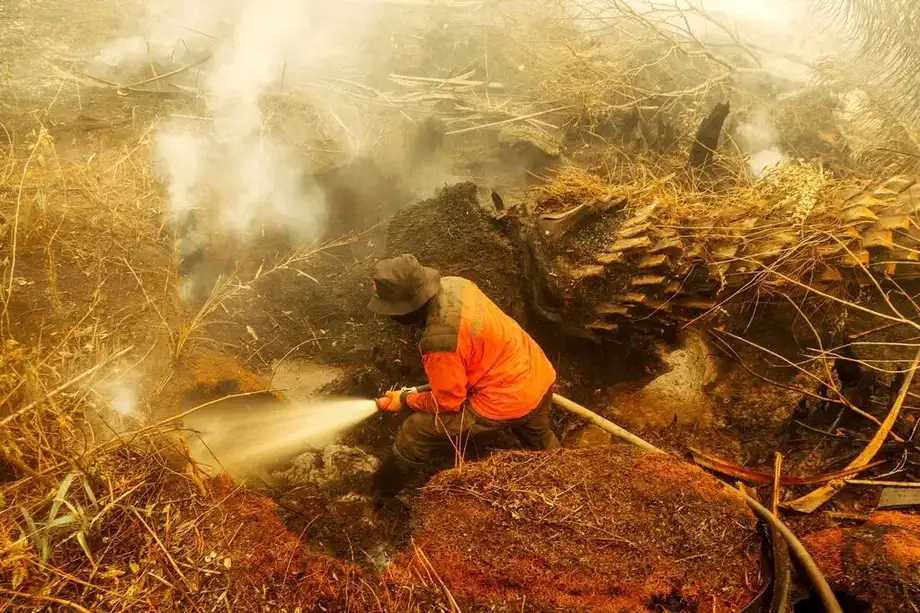
A rice project leaves a lasting fire threat
Indonesia is preparing to rewet 10,378 hectares of degraded peatland in Central Kalimantan as it confronts the lasting damage from the Mega Rice Project, an attempt to turn about 1 million hectares of peat swamp forest into rice fields. The project began in 1995 and ended in 1998, but its drainage canals continue to shape the province's vulnerability to fire.
Contents
- A rice project leaves a lasting fire threat
- How the Mega Rice Project changed the land
- Where the first restoration work will happen
- Why keeping peat wet is difficult
- Farming must fit the wet landscape
- What Indonesia's fire figures measure
- Smoke carries the damage beyond the peatlands
- The decisions that follow the restoration pledge
- Key Points
The initial work will target Talawang Raya, Sabaru and the area stretching from Tanjung Taruna to Tumbang Nusa. Plans described by Deputy Coordinating Food Minister Hanif Faisol Nurofiq include boreholes and a system drawing water from the Kahayan River to keep damaged peat wet.
Hanif outlined the infrastructure proposals on November 3, 2026. Three days later, after a wildfire coordination meeting in Jakarta, he described peat around Palangkaraya as so badly degraded that it repels water instead of absorbing it. He said uninterrupted wetting was needed because drying would turn the peat back into material that burns easily.
The government is also reviewing whether crops grown in the province suit its peatland conditions. Its broader restoration approach combines water management, vegetation suited to wet ground and paludiculture, which means growing crops on wet peat without draining it.
For Central Kalimantan, the practical change is a shift from repeatedly bringing water to fires toward keeping water in the landscape before fires start. The challenge is to repair a water system disrupted decades ago while supporting farming that can work with wet soil.
How the Mega Rice Project changed the land
President Soeharto authorized the Mega Rice Project through Presidential Decree No. 82 of 1995. The scheme sought to support national rice self sufficiency amid concerns about the loss of agricultural land on Java. Its planned conversion area was about 1 million hectares of peat swamp forest in Central Kalimantan.
Peat is soil made largely from plant material that accumulates in wet conditions. Water helps preserve that material by slowing its breakdown. When canals drain a peat swamp, the ground loses moisture and the dried organic material becomes fuel.
The project's extensive canals disrupted this natural water system. Hanif said drainage became uncontrolled, leaving peat dry and some areas permanently damaged. Although the rice project was terminated in 1998, ending the scheme did not restore the water that its canals had carried away.
Central Kalimantan's peat can reach a thickness of 3 metres, according to Hanif. That depth helps explain why restoring the landscape involves more than wetting the surface. Fire can smolder within dry peat below ground, making it difficult to extinguish and allowing smoke to persist.
Walhi executive director Boy Jerry Even Sembiring has linked Indonesia's recurring fire crisis to decades of permits allowing forest clearance and peatland drainage. His assessment places the failed rice project within a wider problem of land management decisions that leave peat exposed to drying.
Where the first restoration work will happen
The announced rewetting target covers three priority areas. The largest is the corridor from Tanjung Taruna to Tumbang Nusa, where more than 9,600 hectares are identified for attention. Talawang Raya accounts for 362 hectares and Sabaru for 320 hectares.
The 10,378 hectares proposed for rewetting amount to about 1% of the roughly 1 million hectares targeted by the original rice scheme. The comparison shows the scale of the initial intervention against the ambition of the earlier conversion project.
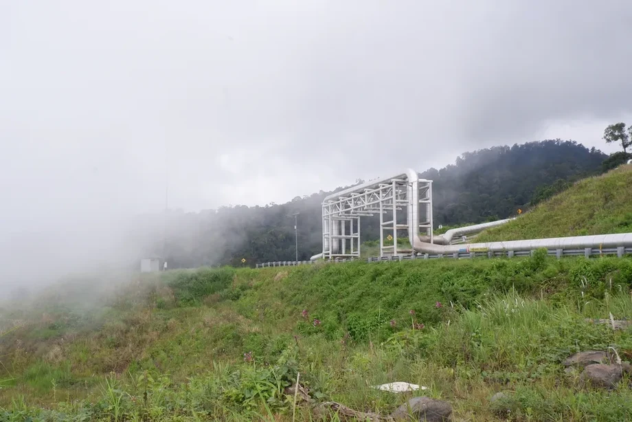
Hanif said the government would build boreholes and develop an inundation system using water from the Kahayan River. Boreholes provide access to water at particular locations, while a wider water management system is intended to keep moisture across the peat landscape.
The government also plans to work with the national peatland and mangrove management agency on a detailed restoration plan. No completion date or total restoration budget was given. Hanif said formal funding and participation by businesses and communities would be needed to sustain prevention.
Why keeping peat wet is difficult
Hanif used the term hydrophobic to describe damaged peat around Palangkaraya. In simple terms, it means the material resists taking in water. He contrasted that condition with the peat's earlier ability to absorb and hold moisture.
A landscape that sheds or struggles to absorb water requires more sustained management than occasional watering. Hanif warned that even short interruptions in wetting could allow the peat to dry again, increasing its vulnerability when temperatures rise.
Authorities plan to maintain firefighting boreholes and canals after the fire season and consider reinforcing them with cement. That proposal sits alongside the wider effort to repair water management. Infrastructure must support the intended movement and retention of water across damaged areas.
Central Kalimantan's immediate weather outlook adds pressure. In the November 3 account, forecasts from Indonesia's meteorological agency, BMKG, and a meteorological team indicated light rain during that week, followed by three weeks dominated by hot weather. Brief rainfall would therefore offer only a limited window before renewed drying pressure.
Farming must fit the wet landscape
The government is reviewing crop suitability because restoring peat changes the conditions under which farming takes place. A crop that depends on draining the soil creates a direct conflict with the goal of keeping peat wet.
Paludiculture offers a different approach: cultivate plants that tolerate wet peat while leaving the water in place. The restoration proposal also includes replanting vegetation suited to waterlogged conditions, bringing planting decisions and fire prevention into the same plan.
For farmers, the practical issue is what they can grow successfully under those conditions. The government's review has not identified a final crop list. Its stated direction is to match cultivation to the landscape's need for water, rather than repeat the drainage approach used for the rice scheme.
Hanif's warning that some peat has suffered permanent damage also affects the purpose of restoration. The immediate priorities are to hold moisture, reduce the supply of dry material that can burn and establish vegetation suited to the damaged areas.
What Indonesia's fire figures measure
The Forestry Ministry's SIPONGI fire area dataset, credited as SIPONGI KEMENHUT, lists 202,004.30 hectares of forest and land fires nationwide for January through July 2026. Its methodology combines Landsat 8 OLI/TIRS satellite imagery with hotspot information, checks on the ground and firefighting reports from Manggala Agni, Indonesia's forest fire control teams.
Nusantara Atlas put the national burned area at more than 1.9 million hectares from January through the end of September in the fire crisis account. That is a much larger figure than the ministry's total. The figures cover different reporting windows and come from different monitoring systems, so a useful national picture requires the dates and measurement method to accompany each number.
A separate dispute concerned President Prabowo Subianto's use of a figure of 639 hectares across six provinces. On October 12, he cited the number while describing a sharp reduction in the area affected by fire. On October 14, the National Disaster Mitigation Agency, BNPB, and the Forestry Ministry clarified that 639 hectares referred to locations where firefighters were working.
Three measurements therefore matter to readers: land burned over a period, places actively burning and places receiving firefighting operations. Each answers a different practical question. The area receiving crews tells the public about the response, while the cumulative burned area shows how much land has already been affected.
Sapta Ananda Proklamasi, a senior researcher and geographic information system specialist at Greenpeace Indonesia, called for the government to report the spread and duration of haze and the number of people affected alongside fire figures. He described the continuing exposure this way:
People are not exposed to smoke for just one minute and then it ends. They are exposed every minute, every hour, and every day, for months,
Smoke carries the damage beyond the peatlands
Greenpeace estimated that about 40 million people across Indonesian Borneo and Sumatra had been exposed to smoke haze during the preceding two months in its October assessment. Ministry of Health figures recorded 283,270 cases of acute respiratory illness across seven affected provinces as of October 13.
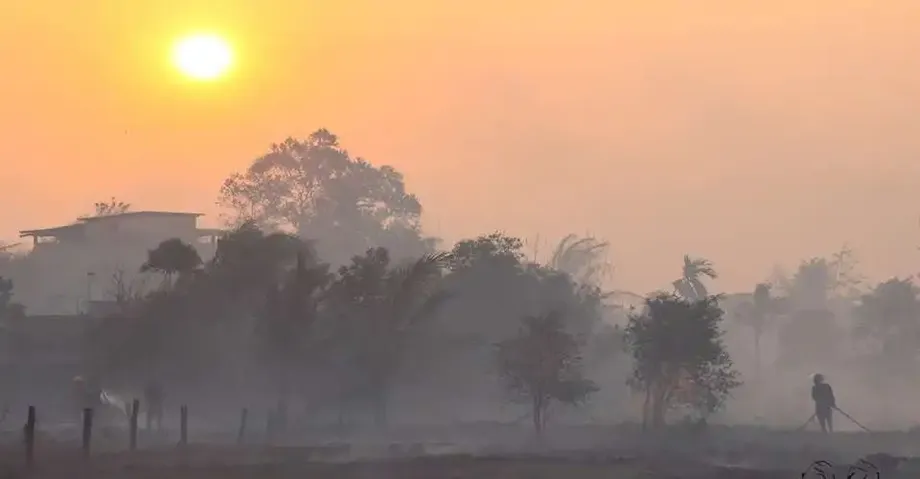
Smoke contains tiny particles that can reach deep into the lungs. Peat fires are particularly difficult to manage because burning can continue underground, sustaining the smoke even when surface flames are less visible. Preventing the peat from drying therefore has a direct connection to the air people breathe.
Wildlife was also affected. International Animal Rescue reported rescuing 46 orangutans in West Kalimantan by October 9, while 47 orangutans at a rehabilitation center in Palangkaraya were reported ill. Those figures describe separate groups affected during the crisis.
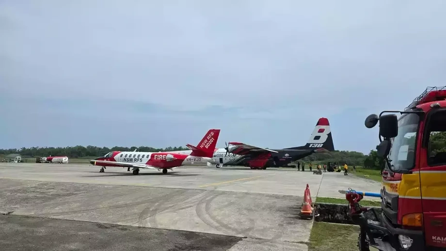
Haze spread into Malaysia and Singapore, turning Indonesia's fire response into a regional concern. Malaysia offered one firefighting aircraft, three helicopters and 52 personnel. As of October 16, Indonesia had not formally responded to that offer. Singapore also offered assistance.
The decisions that follow the restoration pledge
Central Kalimantan Governor Agustiar Sabran instructed regents and mayors to hold technical meetings within one or two days of the November 3 account. Those meetings were intended to work through improvements to peat water management in their respective districts and cities.
Agustiar also called for a wider review of fire prevention, land monitoring, permits and enforcement. He said violations should be handled under the law and sought participation from the military, police, central government, businesses and communities. His instructions connect the proposed engineering work with oversight of activities that can damage or dry the land.
The main milestones show how a short period of rice development created a much longer restoration task:
- 1995: Presidential Decree No. 82 authorized the Mega Rice Project, targeting about 1 million hectares of peat swamp forest.
- 1998: The rice project ended, leaving drainage damage that continued to affect the peat's water system.
- November 3, 2026: Hanif described plans to rewet 10,378 hectares using boreholes and water from the Kahayan River.
- November 6, 2026: Hanif warned that badly degraded peat required continuous wetting to reduce its vulnerability to fire.
- After the fire season: Authorities plan to maintain firefighting water infrastructure while developing the detailed restoration program.
The work ahead involves more than constructing water points. Local authorities must coordinate water management across the targeted areas, the crop review must identify cultivation suited to wet peat, and maintenance must continue after the immediate emergency. Those are the concrete tasks behind the government's promise to replace repeated firefighting with sustained prevention.
Key Points
- Indonesia plans to rewet 10,378 hectares of degraded peatland in Central Kalimantan.
- The priority areas are Talawang Raya, Sabaru and the corridor from Tanjung Taruna to Tumbang Nusa.
- The Mega Rice Project began in 1995 and ended in 1998, leaving extensive drainage damage.
- Proposals include boreholes, water from the Kahayan River, wetland vegetation and crops suited to wet peat.
- SIPONGI KEMENHUT records 202,004.30 hectares of fires nationwide for January through July 2026; Nusantara Atlas gives more than 1.9 million hectares through September.
- Officials are reviewing local water management, crop suitability, permits and enforcement as part of prevention.