A measured show of strength in thin air
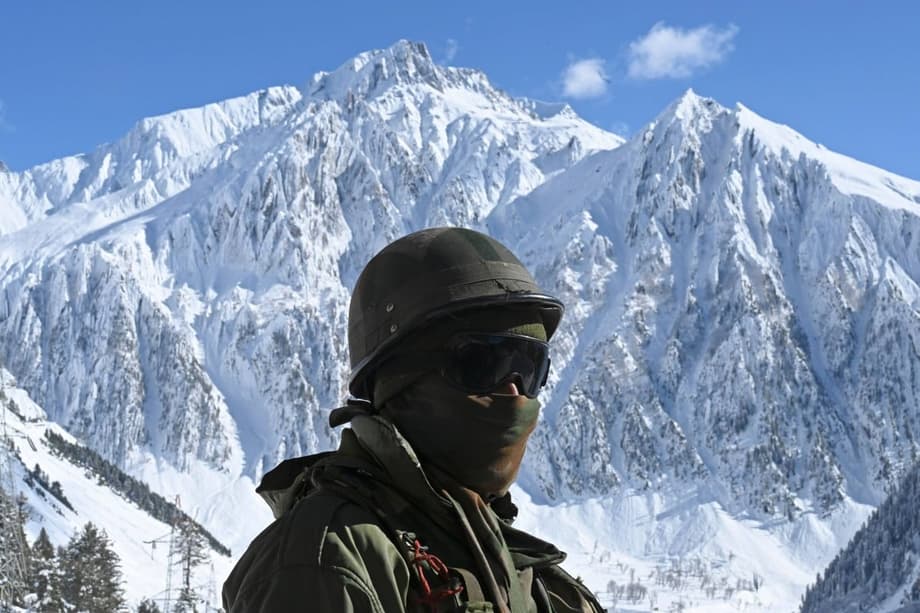
India has put a new airbase on the map at the top of the world. The Indian Air Force inaugurated the Mudh Nyoma Air Force Station in eastern Ladakh with a public landing by a C-130J Super Hercules. The field sits around 13,700 feet above sea level and roughly 30 kilometers from the Line of Actual Control, the long disputed boundary with China. The timing and location drew instant attention, yet regional analysts see the site mainly as an infrastructure step in a wider program that aims to shorten response times, strengthen logistics, and reduce reliance on fragile mountain roads.
- A measured show of strength in thin air
- Where Nyoma sits and why it matters
- What the airbase adds to Indian capability
- China is expanding too
- Why many analysts see an upgrade, not a provocation
- Operations in thin air, the physics and the limits
- Mobility, permits and the civilian edge
- Diplomacy and deterrence move in parallel
- What to Know
New concrete at Nyoma is part of a broader push after the 2020 border crisis, when a deadly clash in the Galwan Valley exposed gaps in fast mobility at extreme altitude. Since a 2024 confidence building pact, India and China have restored some military communications and resumed visits. Both sides continue to improve roads, airfields, and support hubs on their own territory. Nyoma fits that pattern. It gives India a forward location that can host transport aircraft and helicopters today, and is being prepared for fighter operations, while China still holds a head start in the density of airports, heliports, and highways across Tibet and Xinjiang.
Where Nyoma sits and why it matters
Nyoma lies in a sparse, high plateau south of Pangong Tso and east of the Chushul Valley, areas that have seen tense standoffs in recent years. The base is within a short flight of several sensitive approaches in eastern Ladakh, including the Depsang Plains and Demchok. Its proximity to the LAC reduces flight times for patrols and resupply, which is crucial in winter when mountain passes close and the Darbuk Shyok Daulat Beg Oldie road can be cut by avalanches. Engineers rebuilt what once was a basic strip into a paved field with a runway of about 2.7 kilometers, hardened parking areas, and new control and support buildings designed for round the clock operations in sub zero temperatures.
The geography and the altitude
Operating at 13,700 feet poses unusual limits. Air is thin, engines make less thrust, and wings generate less lift. Aircraft need longer runways and must carry lighter loads to take off safely. Planners must factor density altitude on hot days and the effect of wind and turbulence spilling over ridgelines. Nyoma’s altitude is lower than Daulat Beg Oldie, the world’s highest landing ground in the same region, yet far higher than most bases in India’s plains. As a result, Nyoma enables heavier aircraft than DBO but still demands strict payload calculations and specialized crew training for short notice missions in the mountains.
The base and its immediate neighborhood
Nyoma complements a local network that includes Leh, Kargil, and Thoise airfields, plus advanced landing grounds at Daulat Beg Oldie and Fukche. That cluster covers different sectors and gives the Air Force options to stage aircraft, rotate units, and maintain airlift even if weather closes one valley or a runway needs repair. Nyoma’s position near the Pangong and Chushul sectors tightens response times for troops along the ridge lines and lake shores that have repeatedly seen face offs since 2020. The site also sits closer to several forward posts than Leh, reducing time and fuel burn for helicopters shuttling personnel and supplies.
What the airbase adds to Indian capability
The inauguration landing by the C-130J confirmed that Nyoma can accept heavy transport planes, which is vital for moving troops, vehicles, radar, drones, fuel, and medical teams. Officials say fighter operations are planned as the next phase once support systems and procedures mature. Even without routine fighter sorties, the field already improves air patrols, surveillance coverage, and quick reaction lift in a corridor that has strained logistics ever since road traffic swelled after the 2020 crisis.
Aircraft it can host and missions it enables
At altitude, transport aircraft, helicopters, and light fixed wing platforms often do the hardest work. From Nyoma, the Air Force can stage C-130J or An-32 flights with careful payload planning, while deploying helicopters to outposts that sit on narrow ledges or near contested streams. Unmanned aircraft can launch closer to areas of interest, increasing time on station for surveillance. The base gives commanders a forward location for disaster response as well, shortening the chain for casualty evacuation and medical resupply if snowstorms or landslides isolate villages or posts.
A new link in Ladakh’s air grid
Nyoma became the fourth major Air Force operating location in Ladakh alongside Leh, Kargil, and Thoise. The network is growing more robust as Daulat Beg Oldie sees upgrades and other strips such as Fukche or Chushul receive maintenance and support improvements. In parallel, road projects continue on the spine of the region. A second road link to Daulat Beg Oldie is planned by 2026, which would reduce risk from single route closures in the far north. Air and ground advances together reduce the time and uncertainty that historically constrained operations across high passes and narrow valleys.
China is expanding too
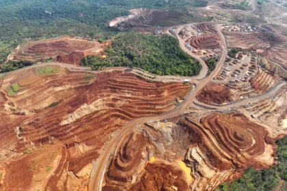
China has poured resources into airports, heliports, roads, and rail lines to bolster mobility along its western frontier. Since 2017, dozens of air facilities in Tibet and Xinjiang have been built or upgraded, with many close to the Indian border. Key airfields such as Hotan, Shigatse, and Nyingchi have received longer runways, new hangars, and improved defenses. Satellite images in recent years showed new sites and expansions at locations including Tingri, Lhunze, Yutian, Yarkant, and Burang, forming clusters that improve resilience by spreading aircraft and support assets across a wider network.
New airports and heliports on the plateau
New heliports across the plateau enhance China’s ability to lift troops and supplies to high valleys and passes that would take many hours by road. The move to base fighters, reconnaissance aircraft, and drones near the frontier aims to cut response times. Chinese planners are also working to offset the payload penalty of high altitude by relying on stronger engines, tankers, airborne early warning, and unmanned systems that are less affected by thin air. India has responded with its own upgrades in both the western and eastern sectors, including reinforcements at bases in Assam such as Chabua that support operations along the eastern stretch of the LAC.
Why many analysts see an upgrade, not a provocation
Despite Nyoma’s location, regional experts say the new airfield fits a longer build out rather than a bid to raise tensions. India has cast the project as a way to improve border management and deter incursions without changing the basic posture along the LAC. Since late 2024, contacts between the two sides grew more regular, with efforts to keep the border stable even as each side continues to build on its own side. Analysts also note that China still enjoys a numerical edge in nearby airfields and road mileage, a gap that a single airbase will not erase.
Operations in thin air, the physics and the limits
Aviation at altitude is a technical challenge. Air density falls with height and temperature, which increases the distance an aircraft needs to take off and land. Pilots calculate density altitude, a blend of pressure altitude and temperature, to set speeds and throttle. On warm days at a field like Nyoma, the thin air can make the aircraft perform as if it were trying to depart from an even higher elevation. Crews often trade payload for safety margin, loading fewer troops or lighter cargo to ensure sufficient climb performance in the first minutes after takeoff.
Density altitude and payload
Every kilogram matters in the rare air of Ladakh. Transport crews balance fuel, cargo, and runway length to meet performance charts. Helicopters feel the strain even more because rotor systems lose lift as air thins. That drives careful planning for sling loads, search and rescue, and casualty evacuation missions. At Nyoma, the runway length helps larger transports operate with useful payloads, but commanders will still prioritize lighter, frequent sorties over risky heavy lifts when temperatures spike or winds shift unpredictably.
Winter operations and maintenance
Winter brings extreme cold, which helps engine performance yet creates its own problems. Hydraulic fluids thicken and batteries lose charge. Crews face icing on surfaces and need heated shelters to service aircraft. Snow removal at altitude requires specialized equipment and trained teams to avoid damage to the runway surface. The new base includes reinforced hard standings and updated air traffic control that allow around the clock operations during long winter nights when weather permits. The aim is more predictable air access to forward posts, even when mountain passes are closed for weeks.
Mobility, permits and the civilian edge
Nyoma is a military base first, but infrastructure at this altitude can serve more than one mission. The field can help move disaster relief teams after landslides and floods, which are common during summer rains in the Himalayas. Upgraded logistics could also enable limited charter flights under strict permits for scientific research or construction crews working on road and telecom projects. Faster air links make it feasible to rotate personnel without long delays caused by weather interruptions on mountain roads.
Travel rules that still apply
Ladakh near the LAC remains a sensitive area. Foreign visitors need Inner Line Permits, and companies sending staff or equipment to forward areas must secure clearances from the Ministry of Home Affairs. Satellite phones and some sensors require explicit approvals. The new airbase could shorten notice for movement restrictions if a crisis flares. Security advisors recommend active traveler tracking for personnel in the region and contingency plans for evacuation via military lift if commercial flights to Leh face disruption.
Disaster relief and science access
High altitude fields are lifelines when landslides or avalanches cut roads for days. A forward base like Nyoma brings rescue aircraft closer to remote villages and army posts, reducing transit time in the critical first hours after an accident. Scientists who study glaciers, permafrost, and mountain ecology could reach temporary field sites more quickly under controlled access. The same runway that supports troop rotations can also land medical teams and supplies when snowstorms isolate communities.
Diplomacy and deterrence move in parallel
Even as both sides add concrete, steel, and sensors along the frontier, officials in New Delhi and Beijing continue to signal interest in a stable border. Recent meetings through military and diplomatic channels have focused on managing differences and improving communication. The inauguration of Nyoma is framed by India as a step to make the frontier safer to manage, not a step to alter the status quo.
India’s Ministry of External Affairs has stressed sovereignty over Arunachal Pradesh and continuity in engagement with China. After a series of renaming moves by Beijing earlier this year, the ministry’s spokesperson restated New Delhi’s position in strong terms.
India’s foreign ministry spokesperson Randhir Jaiswal said the following on the subject of Arunachal Pradesh’s status:
Creative naming will not alter the undeniable reality that Arunachal Pradesh was, is, and will always remain an integral and inalienable part of India.
Beijing emphasizes that the boundary issue is complex and needs time while urging both sides to keep talking. China’s foreign ministry points to established mechanisms to manage border affairs and reduce risks through dialogue.
China’s Foreign Ministry spokesperson Mao Ning said during a regular briefing:
The boundary question is complicated, and it takes time to settle it. The two countries have already established mechanisms at various levels for communication. We hope that India will work with China in the same direction, continue to stay in communication on relevant issue and jointly keep the border areas peaceful and tranquil.
Infrastructure building will continue on both sides of the LAC even as officials seek to lower the risk of miscalculation. Construction teams push forward each summer season in short weather windows. In late 2025, the head of India’s Border Roads Organisation underlined the pace of work and the focus on linking remote posts.
Lieutenant General Raghu Srinivasan, who leads the Border Roads Organisation, described the long term plan this way:
We’re now building roads to connect those posts.
That simple aim, better access to the frontier, is where Nyoma fits best. It is a practical step inside a larger, methodical effort to move people and supplies faster in mountains where time, weather, and distance have always been the hardest enemies.
What to Know
- India inaugurated the Nyoma airbase in eastern Ladakh with a C-130J landing at about 13,700 feet, roughly 30 km from the LAC.
- The runway is around 2.7 km, with new control and support facilities designed for year round operations in extreme cold.
- Analysts view the base as an infrastructure upgrade that boosts patrols and logistics, not as a trigger for escalation.
- Nyoma complements Leh, Kargil, Thoise, and the Daulat Beg Oldie landing ground, tightening air links to forward posts.
- Fighter operations are expected after support systems and procedures mature, with payload limits inherent to high altitude.
- China has expanded multiple airports and heliports across Tibet and Xinjiang, fielding clusters near the frontier.
- Officials in New Delhi and Beijing say talks will continue through established channels to keep the border stable.
- Permits and security clearances remain mandatory for foreign workers and equipment in Ladakh’s sensitive districts.
- Nyoma can support disaster relief, medical evacuation, and limited charter flights for research or infrastructure crews under strict controls.
- Road projects, including a second route to Daulat Beg Oldie by 2026, aim to reduce reliance on single corridors.