
One hour overwhelmed the city
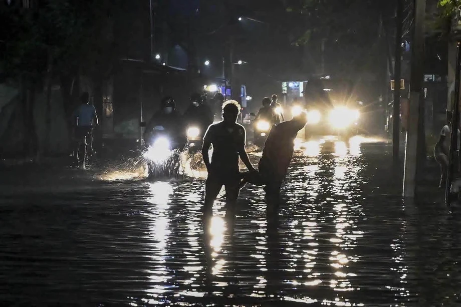
More than 129 millimeters of rain fell on Colombo on Nov. 6, flooding streets within minutes, stranding commuters and leaving vehicles partly underwater. For Siva Sivasagunthan, a driver for a local ride hailing app, a journey that normally takes 30 minutes stretched to about two hours after water partly submerged his vehicle.
Contents
The speed of the downpour mattered as much as its total volume. Sri Lanka Department of Meteorology Director Ajith Wijemanna said readings exceeded 120 millimeters in an hour, while a gauge elsewhere in Colombo recorded more than 135 millimeters in that period. A separate city total was 129 millimeters. Rain gauges record conditions at specific places, so amounts can vary across a city and by measurement period.
Wijemanna said the brief burst was the main reason the water rose so quickly.
We believe that the main cause of flooding was the high intensity during a short period of time, such as an hour, which was similar to a gushing downpour.
The event came despite Colombo's status as a Ramsar accredited wetland city. Wetlands can soak up rain, hold it for a time and release it gradually. Their ability to do so has been reduced by urban development, waste and invasive plants, while the city's drainage network is built to handle far less rain per hour than fell during the storm.
Why did the water have nowhere to go?
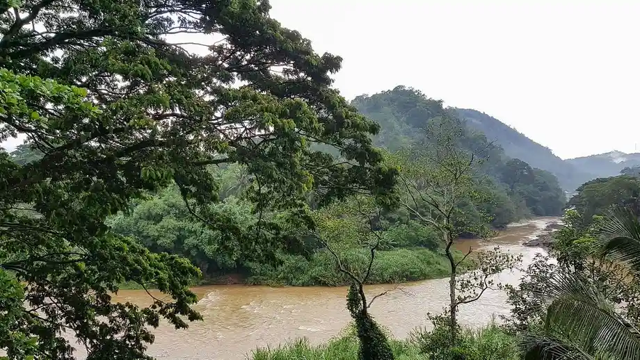
Colombo lies at low elevation in the lower Kelani River basin, where floods are a natural risk. The city's canals, wetlands and drains work together: wetlands temporarily store water, while canals and storm water drains carry it away. If one part is blocked or overwhelmed, water can spill into streets and buildings.
Colombo Municipal Council deputy director of engineering for drainage design Deepika Wijethilake said the sewer and storm water networks are about a century old and were designed to operate separately. The storm water system was built for rainfall of about 30 millimeters per hour. On Nov. 6, rain fell at more than 100 millimeters per hour, according to her account.
Wijethilake explained that the rainfall put the system under pressure and that paved surfaces make the problem harder by giving rain less ground to soak into.
But on Nov. 6, there was a rainfall exceeding 100 mm [3.9 in] per hour. Since it rained heavily, there was extensive pressure on the system and it took some time for the water to recede.
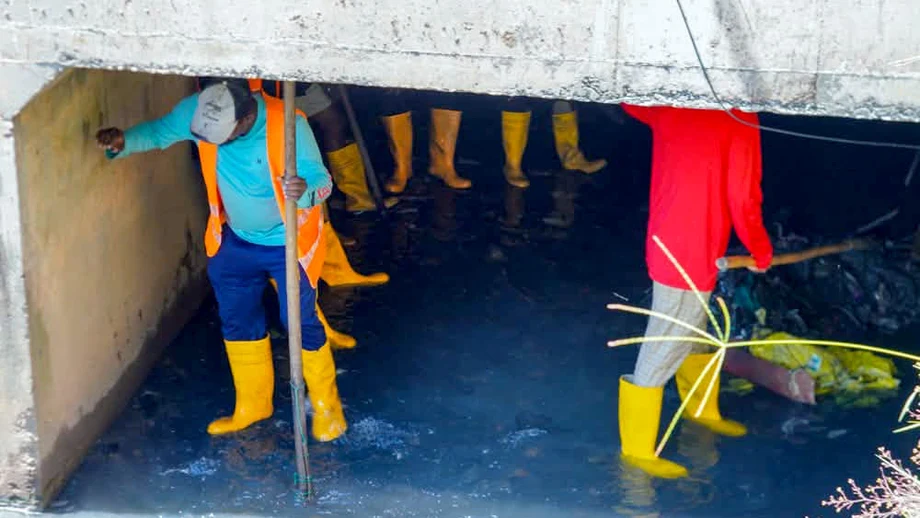
City officials identified 60 locations where blocked drains and waterways were obstructing the flow of floodwater. After the flooding, workers were sent to clear canals and drains, removing overgrowth, silt and garbage. Clearing blockages can help water move, but the rainfall figures show the size of the longer term capacity gap: the peak rate was more than three times the system's original design level.
Wetlands are part of the city's flood defenses
Environmental scientist Chethika Gunasiri said the Colombo Wetland Complex retains about 37% of the rainwater that enters Colombo. Around 20 square kilometers of wetlands remain in the complex, which extends beyond the municipal council's boundaries. Wetland areas hold rain temporarily, allow some water to seep into the soil and help replenish groundwater.
Gunasiri said many wetlands have become isolated patches, and their ability to retain water has fallen. Pond apple, an invasive tree, has spread through some wetlands, changing marshy areas into drier land. She said restoring wetlands and connecting them to the city's flood plan would help preserve their role in managing rainwater.
Real estate development is also reshaping wetland areas. A 2025 study by Colombo based nonprofit Centre for a Smart Future examined development pressure around the Thalangama environment protection area. It found that wetlands, rice fields and other landscapes around Kaduwela, Malabe and Thalawathugoda were being marketed as exclusive housing and green living areas. Property prices in those locations had risen by about 30% to 40% a year, the study said.
Centre for a Smart Future co founder and director Anushka Wijesinha said some developers use the appeal of wetlands to attract buyers without ensuring that projects protect the natural environment. He has argued that the economic value of wetlands should be counted alongside the prices charged for nearby homes. A 2003 study of the Muthurajawela wetland near Colombo, which he cited, examined benefits such as flood control. Replacing those services with built infrastructure could cost the country billions, he said.
Research traces a longer pattern of land loss
A 2021 Kolonnawa study examined flooding in the Kolonnawa Divisional Secretariat area of the lower Kelani basin, rather than the Nov. 6 event. Using population data, mapping and satellite analysis, it found marshy land declined by 42% between 2005 and 2017. It also traced the conversion of rice fields and wetlands into home gardens from 1972 to 2018 as the suburbs expanded.
The researchers identified settlement growth, changes in land use, waste dumping, blocked water flows and poor drainage maintenance as factors that can worsen flooding. Their historical review recorded a Kelani River basin flood in 1837 and found that minor floods became more frequent after 1947. The findings help explain why one intense storm can cause trouble in a landscape that has gradually lost places to store water.
A separate Greater Colombo flood model used HEC RAS 2D, a computer system that simulates how water moves across land and through canals. Researchers calibrated it against the May 2016 flood and checked it against the May 2017 flood. Its water level estimates had a correlation of 0.98 and a root mean square error of 0.12 meters; its match for flooded areas had a goodness of fit score of 81%.
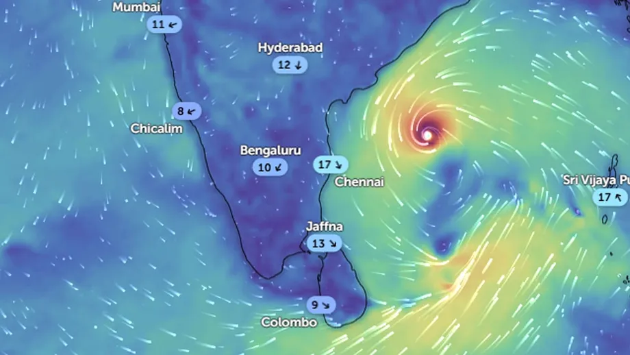
The model offers a tool for studying where water may spread under different conditions. Forecasting the timing and intensity of rain is a separate challenge. Wijemanna said Sri Lanka does not have an operational Doppler weather radar system, which would help meteorologists track rain and improve the accuracy and lead time of forecasts.
What are officials doing about drains and forecasts?
Before the flooding, Prime Minister Harini Amarasuriya had instructed local authorities, the Department of Irrigation and divisional secretariats to clean Colombo's canals and drainage systems. The 60 locations found to have blockages point to the importance of regular maintenance as well as the need to increase the capacity of infrastructure that is already about a century old.
Wijethilake said Colombo Municipal Council plans to design new drainage systems able to handle more than 100 millimeters of rain per hour. In the meantime, the council is clearing drains and canals. No completion date or budget for the planned designs was given.
Economist Anushka Wijesinha has proposed an adaptation and resilience fund to help local authorities pay for improved drainage, roads built to withstand changing weather and wetland management. He suggested combining government funds with grants from other countries, money from development banks, charitable contributions and a set share of local taxes or fees paid by property developers. The proposal addresses a practical constraint: local councils need money available when costly infrastructure work is required.
More than 45% of Sri Lanka's gross domestic product is generated in the Western Province, of which Colombo is a major part. The city also supports freight movement and international connections. Flooded roads and disrupted waterways can therefore affect residents' daily travel as well as businesses moving goods through the region.
Parliament seeks details on spending and preparedness
Opposition Leader Sajith Premadasa asked Parliament for records on money allocated, released and spent by local authorities in 2025 and 2026 for drainage, canals and solid waste management. He also sought a breakdown of projects that had started, finished or remained incomplete, including their budgets and progress.
Premadasa asked whether the government's Punharudaya Purawara program included drainage or waste management projects, and what steps and funds had been set aside to address flood risks and drainage weaknesses identified after Cyclone Ditwah in 2025. He also requested information on canal cleaning before the monsoon and measures under the Clean Sri Lanka program to prevent rubbish from blocking drains and waterways.
A special operations task force under Colombo Municipal Council was established on Nov. 7 on the instructions of the President's secretary. Premadasa asked Parliament for details of its membership, authority, responsibilities, budget and method for reporting progress. The requested records would help show how much work has been funded and what remains unfinished.
The city's wider effort to address drainage problems and unauthorised buildings was also described in plans to clear unauthorised buildings. That account noted that proposed action would need to be matched with completed drainage works, waste management and arrangements for people living beside canals.
What remains unknown?
The Nov. 6 storm exposed both an immediate maintenance problem and a larger mismatch between rainfall and drainage capacity. Officials have identified blocked locations and proposed new drains, while scientists have pointed to shrinking wetlands and development pressure. The exact budget, timetable and completed work for the new drainage plans were not provided.
Sri Lanka's weather agency also has not given a date for when a Doppler radar system will become operational. Until that system is in place, Colombo's ability to receive more precise rainfall forecasts with greater warning time remains limited. The next practical test will be whether drain cleaning, wetland restoration, stronger infrastructure and public funding plans move from proposals into completed work.
Key Points
- More than 129 millimeters of rain flooded parts of Colombo on Nov. 6, with hourly readings above 120 millimeters.
- The storm water system was designed for about 30 millimeters of rain per hour.
- The Colombo Wetland Complex retains about 37% of rainwater entering the city, but development and invasive plants threaten its capacity.
- A study found marshy land in Kolonnawa declined by 42% between 2005 and 2017.
- Colombo plans new drains designed for more than 100 millimeters of rain per hour, while crews clear existing canals and drains.
- Parliament has been asked for details on local government flood prevention spending, project progress and a new municipal task force.