
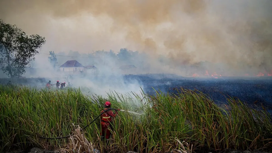
A growing bill for fires across Indonesia
Indonesia's 2026 forest and land fires could cost as much as 565.03 trillion rupiah, or about $30.9 billion, in economic and health losses, according to an October estimate by the Center of Economic and Law Studies, known as CELIOS. Fires had burned an estimated 2.88 million hectares, or 7.1 million acres, between January and October, according to Nusantara Atlas. That is an area about 18 times the size of London.
Contents
The losses reach beyond trees and buildings. Fires have disrupted work and business, filled towns with smoke, sent people for medical care and damaged peatlands that may take centuries to regain much of their lost carbon. Smoke has also crossed into Malaysia and Singapore, while people in Indonesia face closed schools, poor air and fewer chances to work outdoors.
The figures describe different parts of the crisis, and they come from estimates made at different times. In its October assessment, CELIOS put damage to physical assets and interrupted economic activity at 340.38 trillion rupiah, equal to 2.69% of Indonesia's gross domestic product (GDP). It placed total economic and health losses between 359.58 trillion and 565.03 trillion rupiah, depending on how health effects were counted.
An earlier CELIOS report covered January through August and gave a smaller range, 39.29 trillion to 123.1 trillion rupiah. The report also said its upper estimate did not include a scenario in which fires continued to spread through the end of 2026. The later October estimate used cumulative fire data and a wider calculation of economic effects, including health costs that vary according to whether the count includes people with symptoms as well as diagnosed patients.
For readers, the central point is that the $30.9 billion figure is the high end of a range, not a single final bill. The fires were still burning during the year, and the estimate could rise if damage continued.
How do fires become an economy wide loss?
CELIOS estimated that physical damage and interrupted economic activity alone cost 340.38 trillion rupiah. Its researchers used an Inter Regional Input Output method, which traces how a disruption in one place or industry can affect others. If a fire closes a road, for example, the effect can spread from farms and factories to transport, shops and workers who depend on deliveries.
CELIOS researcher Galau D. Muhammad said the estimate used cumulative fire data accessed as of October 20. He said losses in some palm oil and mining regions far exceeded the revenue sharing funds they received from the central government. In West Kalimantan, he put fire losses at about 200 times the province's revenue sharing funds. CELIOS also estimated that fires could reduce local tax revenue by as much as 4.06 trillion rupiah.
The wood and forestry sector accounted for an estimated 262.33 trillion rupiah, or about 77% of the economic losses, according to CELIOS. Trade, mining, manufacturing and transport can also be affected when workers are ill, goods cannot move normally or smoky conditions limit daily activity.
The size of the bill matters for local governments that must help residents and restore damaged areas. Galau said four national ministries and agencies involved in disaster work had combined budgets of about 6.3 trillion rupiah, with only part available for direct response. The October estimate's upper end is almost 90 times that combined budget, although the figures cover different purposes and periods.
Why are the estimates so different?
CELIOS's health calculations account for much of the wide range. Its October estimate put health costs at 19.20 trillion rupiah for diagnosed cases of acute respiratory infection. When people experiencing symptoms were also counted, potential health costs rose to 224.65 trillion rupiah. The upper figure includes indirect costs as well as treatment, such as work and income lost when people are sick or must stay indoors.
A separate CELIOS assessment for January through August estimated health costs of 9.75 trillion rupiah for diagnosed cases, rising to 93.56 trillion when people with symptoms were included. The different totals reflect the later cutoff date and different cumulative estimates, rather than a contradiction that can be settled by choosing one number. CELIOS's October range is the more recent estimate in the figures available for this story.
CELIOS put the number of people at risk of or experiencing acute respiratory infection symptoms at 17.4 million across 12 provinces. Indonesia's Health Ministry recorded more than 50,000 fire linked respiratory infections in July and August, including more than 12,000 cases among children under five. These counts use different time periods and measures: one is an estimate of people at risk or reporting symptoms, while the ministry figure records cases.
The Centre for Research on Energy and Clean Air estimated that fire smoke had contributed to more than 5,250 deaths and about 400,000 respiratory infections in Indonesia. Such estimates describe population wide health effects, including harm that may not appear as a visit to a clinic. Fine particles known as PM2.5 are especially concerning because they are small enough to travel deep into the lungs.
How much land has burned?
Nusantara Atlas estimated 2.88 million hectares burned between January and October. A separate Copernicus Atmosphere Monitoring Service estimate, based on its own approach, said nearly 8.9 million hectares could be affected by fire during 2026. The larger figure is an estimate of potentially affected land, not the same measure as the monitor's reported burned area, so the two should not be read as matching totals.
Indonesia's Forestry Ministry recorded 202,004 hectares of forest and land burned from January through July. That government figure covers a shorter period than the Nusantara Atlas estimate. For late September, Nusantara Atlas had put the burned area at about 1.9 million hectares, before its October total rose to 2.88 million hectares.
Copernicus estimated that fires had produced nearly 200 million metric tonnes of carbon emissions by November 15, the third highest annual total in its record dating to 2003. That amount is equivalent to more than one fifth of Indonesia's estimated 2025 emissions from energy and industry, about 960 million tonnes of carbon dioxide. The comparison shows how fires can add a large burst of pollution to a country's yearly emissions.
The carbon figures also use different measures. A study of the fires estimated about 100 million tonnes of carbon, equivalent to roughly 370 million tonnes of carbon dioxide, by late September. Copernicus later reported almost 200 million tonnes of carbon emissions by November 15. These estimates come from different monitoring methods and dates. The Copernicus figure remained below the record set in 2015, when fire emissions approached 400 million tonnes.
The crisis has hit several parts of the archipelago. West Kalimantan recorded its highest cumulative fire emissions for the matching period since Copernicus began tracking them in 2003. Central Kalimantan and Papua approached earlier peaks. A separate analysis by Pantau Gambut estimated that 263,558 hectares of protected peatland burned from January to September. About half of the burned area in peat hydrological units was in areas designated for peat ecosystem protection.
What made the fires so severe?
Strong El Niño conditions brought a severe lack of rain. A World Weather Attribution analysis of parts of Sumatra, Kalimantan and Java found that El Niño reduced rainfall from July to October by about 50%. The researchers also found that human driven global warming raised August to October temperatures by about 1.6 degrees Celsius. El Niño added about 0.3 degrees and made that heat roughly 11 times more likely.
The same analysis found that global warming made extremely hot, dry air conditions about three times more likely, while El Niño made them about five times more likely. Observed data suggested global warming reduced rainfall by about 15%, but climate models did not show that effect, so the researchers said its role in the rainfall shortage remained uncertain.
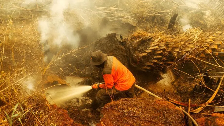
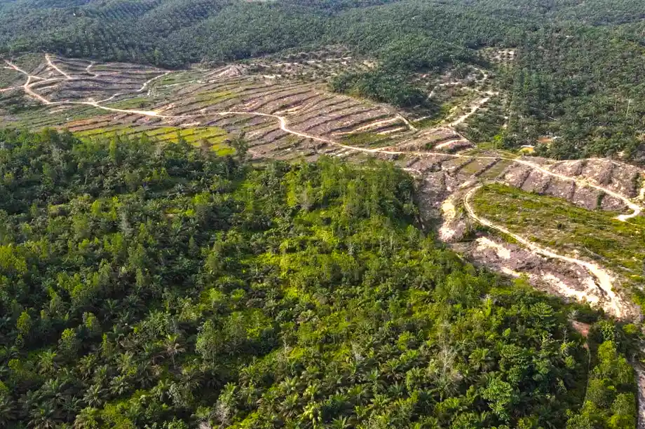
Weather helps explain why fires spread, but land use affects how easily they start and how hard they are to stop. Drained peatland, logging and land cleared for plantations or mining can leave vegetation and soil dry. When peat catches fire, it can smoulder below ground for weeks or months. The flames may be hidden, and the fire can return after crews have soaked the surface.
Indonesia has about 20.6 million hectares of tropical peatland, around 10.8% of its land area. The waterlogged soil stores large amounts of carbon. Drainage for farming or plantations makes it more likely to burn and releases some of that stored carbon into the air.
At a patrol in Ketapang, West Kalimantan, Irma, coordinator of a women's fire and conservation group called The Power of Mama, described how smoke affects her family and neighbours. She said the haze can close schools and airports and make people sick. Irma explained why she joined the patrols:
I thought I had to do something about it. Because we are housewives, we are the ones who feel its effects most.
The Power of Mama has 146 women across ten villages. During the dry season, volunteers patrol plantation edges and forest boundaries, record fire locations and send reports to Manggala Agni, the Forestry Ministry's fire brigade. During the rainy season, the group works with farmers on ways to manage land without burning.
Why can peat fires leave damage for centuries?
Peat is made from partly decayed plants built up over thousands of years. A fire can release carbon stored in that soil much faster than plants can replace it. In 2026, peatland made up about 20% of the area burned in one estimate, but produced about 80% of the carbon emissions.
Researchers estimated that peatland burned in 2026 could take about 400 years to recover under ideal conditions, including prompt rewetting, new vegetation and no further fires. Replacing 90% of the carbon lost could take around 350 years. Grassland may recover in a few rainy seasons, while damaged rainforest can need decades to restore carbon and much longer to regain its full mix of species.
The recovery task is not just a matter of planting trees. Water levels must rise again, fires must be prevented, and people need ways to earn a living without draining or burning peat. Indonesia's Peatland Restoration Agency said it had restored 1.6 million hectares before it was disbanded in 2025. Fires have since returned to some provinces that had been named priority areas for restoration.
A 2021 study estimated that Indonesia's 2015 fires caused $28 billion in losses. It found that restoring peatland could have saved $8.4 billion across six major fire events between 2004 and 2015, including $4 billion in 2015. The study estimated that 40% of the 2015 losses came from the assessed damage of carbon dioxide emissions and 26% from long term health costs.
That historical estimate helps put the present crisis in context, while measuring a different year and using a different method from CELIOS's 2026 calculations. A World Bank report on the 2015 fires said the Indonesian government recorded 2.6 million hectares burned between June and October that year. The report connected fire intensity with peat drainage and conversion, much of it linked to palm oil production.
What is at stake for forests and wildlife?
Fire damage is more than the number of hectares left black. A comparison of two one hectare plots in Kalampangan peat swamp forest found 2,851 trees across 114 species in the natural plot. A plot that had burned in 2015 held 926 trees across 80 species. The burned plot also had much less above ground tree biomass, 53.2 tonnes per hectare compared with 341 tonnes in the natural plot.
The comparison describes two plots at one location, not a count of species lost across Indonesia. It shows how a fire can leave a forest with fewer kinds of trees and less living material, changing the habitat and relationships that support animals and other plants. Ramin, a peat swamp tree listed as Critically Endangered, is among the species facing fire risk.
Fires inside conservation areas have also drawn attention. By late August, Indonesia's Forestry Ministry had recorded 8,638 hotspots in Kalimantan, including 3,705 in West Kalimantan. Fires have affected national parks and other protected places, with smoke and burning peat making some operations difficult to finish. Fires in national parks have also prompted demands for investigations and accountability.
What action is being urged?
CELIOS has called for the government to declare the 2026 fires a national disaster, provide safe evacuation and medical support, review permits for plantations and mining in affected areas, and create a task force for ecosystem recovery. A national disaster declaration would place the crisis under a coordinated national response with resources shared across government.
Rules already require businesses to restore peat ecosystem functions within 30 days after a fire, under government regulations issued in 2014 and amended in 2016. The rules also prohibit burning peatland and drainage that dries it out. The challenge is enforcing those duties across a large area and checking whether damaged sites are actually restored.
Indonesia has taken action against companies over fire related land rights. A November announcement covered eight companies facing withdrawal or denial of land rights over more than 42,000 hectares, while three more companies were under inspection. The decision shows that enforcement is part of the response, alongside fire suppression and medical care.
For communities, the immediate needs are clean air, health services, safe shelter and protection from flames. For the country, the cost also includes lost work, damaged forests, reduced public revenue and carbon that may remain in the atmosphere long after the fires stop. CELIOS's estimate reaches its highest level when those wider health costs are included.
Key Points
- CELIOS estimated total economic and health losses of 359.58 trillion to 565.03 trillion rupiah by October, with the upper figure equal to about $30.9 billion.
- Damage to assets and interrupted economic activity was estimated at 340.38 trillion rupiah, or 2.69% of national GDP.
- Nusantara Atlas estimated 2.88 million hectares burned from January through October. A separate Copernicus estimate said nearly 8.9 million hectares could be affected.
- Copernicus estimated nearly 200 million metric tonnes of fire related carbon emissions by November 15.
- Peatland made up about one fifth of the burned area in one estimate but produced about four fifths of fire emissions.
- Researchers say burned peatland could need centuries to recover much of its lost carbon.