
Construction is spreading into the paths of mountain floods
At least 108,500 people in Nepal's high mountain regions live in areas exposed to potential flooding, according to a study that found the number of buildings in simulated glacial lake flood paths increased by 78 percent between 2016 and 2023. More than 23,000 of those residents live less than 10 metres above riverbeds.
Contents
- Construction is spreading into the paths of mountain floods
- What the researchers measured
- Recent floods show how far danger can reach
- Roads and power projects draw settlements toward rivers
- Tourism faces disruption as well as physical danger
- Indigenous communities seek a place in development decisions
- Planning rules face a test on the ground
- Four lakes are targeted for water level reductions
- Remote construction and timely warnings must work together
- Key Points
The research, published in Scientific Reports, examined mountain areas spanning northern Nepal, southeastern Tibet and part of India's Uttarakhand state. Across that territory, about 300,000 people face potential flood exposure, while the area occupied by buildings within 50 vertical metres of rivers grew by 46 percent over seven years.
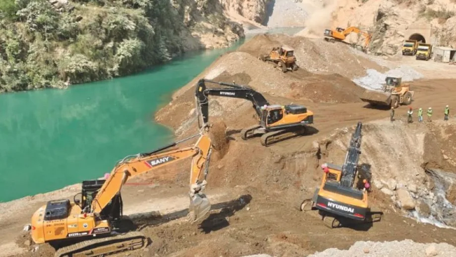
Nepal contains more than 80 percent of the structures identified as exposed across the study region. Hydropower construction, roads serving trade and border crossings, tourism accommodation and expanding towns are bringing more buildings and people into river corridors where floods can carry water, boulders and mud downstream.
The findings arrive as Nepal prepares a programme worth about $50 million to lower water levels in four glacial lakes between 2026 and 2033. That effort addresses danger upstream. The study points to a parallel challenge downstream: keeping new construction out of flood paths and protecting people who already live there.
What the researchers measured
Nine researchers from the United Kingdom, Nepal and India examined river corridors and about 1,360 glacial lakes, including areas extending as far as 50 kilometres downstream. They combined publicly accessible building information with population data, including Nepal's census, and simulations of floods caused by glacial lakes suddenly releasing water.
Mohan Bahadur Chand, a study researcher and assistant professor in Kathmandu University's Department of Environmental Science, described the team's two stages of analysis:
First we identified buildings and populations located within 50 meters above the existing river level.
Second, we simulated glacier lake outburst floods (GLOF) to understand how far the floodwaters could reach and which buildings would be affected.
The 50 metres describes height above the river, rather than distance along the ground from its bank. This matters in steep valleys, where a building can stand some distance from the channel while remaining within reach of a large flood.
The two construction figures also measure different changes. The 46 percent increase concerns the area covered by buildings within the elevation band. The 78 percent increase concerns the number of buildings in simulated glacial lake flood paths. Together, they show development spreading through exposed valleys and growing particularly quickly in places the modelling identifies as potential inundation zones.
Nepal's 108,500 exposed residents represent roughly 36 percent of the regional estimate of 300,000. More than one in five of those Nepal residents live within 10 vertical metres of riverbeds. Chand called for government field assessments to check local conditions and build on findings drawn from public datasets.
Recent floods show how far danger can reach
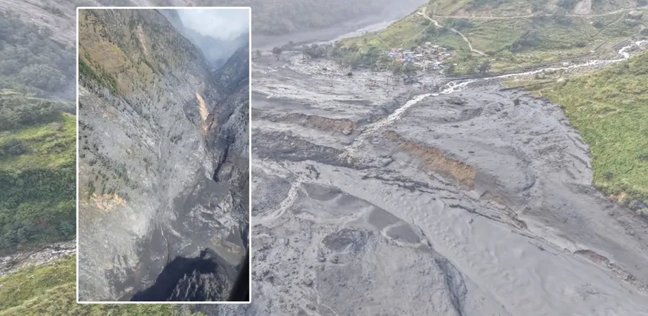
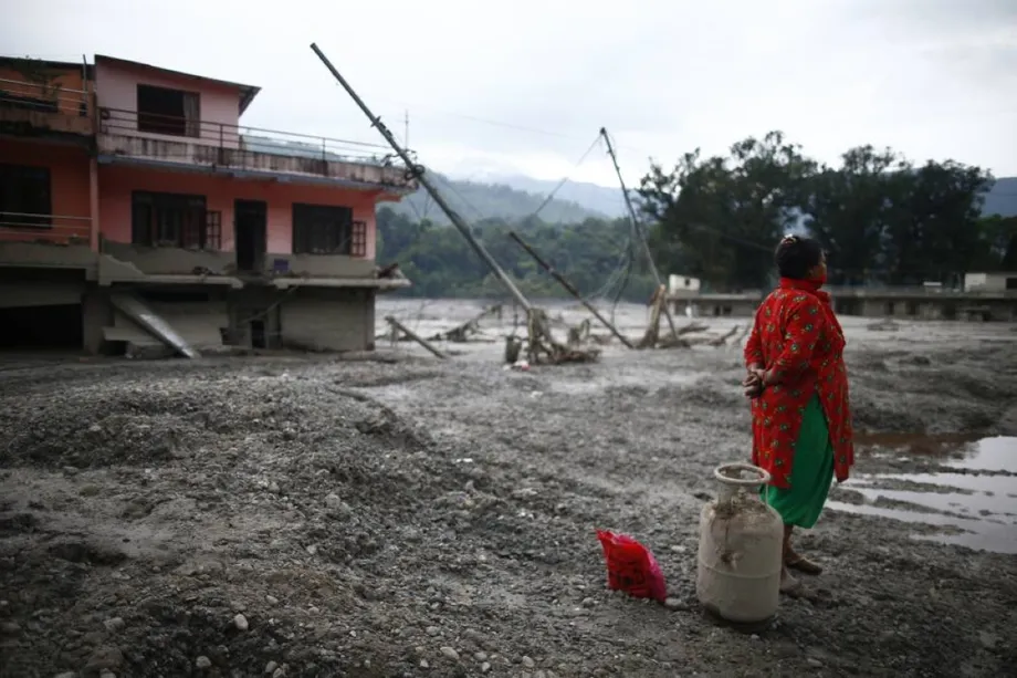
Rasuwa's recent flooding illustrates the difficulty of defining a safe height above a mountain river. The study discussion describes flood impacts reaching settlements 82 metres above river level; residents describing the 26 August flooding said the river rose by 70 metres at some locations. Both accounts place flood impacts above the study's 50 metre screening band.
Flooding along the Budhi Gandaki on 11 October damaged 200 houses, swept away five bridges and left five people missing. Destroyed bridges add another layer of disruption by cutting routes that communities use to reach markets, hospitals and emergency assistance.
A glacial lake outburst flood happens when water stored near a glacier suddenly escapes, often through failure of the natural barrier holding it back. The rush downstream can gather loose rock and soil. In a steep valley, several processes can combine, with slope collapse, debris and floodwater making an event more destructive.
Several dates show the sequence of development, disaster and proposed action:
- 2016 to 2023: Buildings in simulated glacial lake flood paths increased by 78 percent across the study region.
- 26 August: Residents in Rasuwa described floodwater rising by as much as 70 metres at some locations.
- 11 October: Budhi Gandaki flooding damaged 200 houses and swept away five bridges.
- 12 October: Uttarakhand approved new rules governing development on floodplains.
- 2026 to 2033: Nepal aims to carry out its programme targeting four glacial lakes and improving flood warnings.
Roads and power projects draw settlements toward rivers
Basanta Raj Adhikari, director of Tribhuvan University's Centre for Disaster Studies, links changing mountain settlement patterns to road expansion, new livelihoods and internal migration. River corridors offer routes through difficult terrain and access to construction materials, encouraging development to gather along them.
Adhikari described how public infrastructure can draw further settlement into exposed locations:
Most roads are built along river corridors where construction materials are readily available.
But we did not adequately assess flood risks. As we built bridges, hospitals, and other infrastructure, more people moved into hazard-prone areas, increasing their exposure to risks.
Hydropower development has expanded around the Bhotekoshi and Trishuli rivers. Roads, workplaces and services can make nearby land attractive to workers and businesses, creating settlements whose daily activities depend on remaining close to the river.
C Scott Watson, the study's lead author and a glaciologist at the University of Leeds, described the lasting consequences of these choices:
As river valleys become increasingly populated, development decisions being made today will shape disaster risk for decades to come.
Tourism faces disruption as well as physical danger
Pokhara Mayor Dhana Raj Acharya says many older buildings stand just five metres from riverbanks, despite newer rules requiring greater separation. The Seti Gandaki, which comes from the Annapurna mountains and passes through the city, presents a difficult problem for authorities responsible for existing neighbourhoods.
Acharya described the practical problem of relocation:
Where we move them, and how we do that, is the real challenge.
Businesses in the Annapurna trekking region are already describing lost income alongside fear of flooding. Homestay operator Phurpa Chhiring Lama said only five of his 20 rooms were occupied during a period when all would normally be full. That is one quarter of his usual occupancy during the peak trekking season.
Krishna Gauchan, whose hotel is close to the Modi river, described his concern about hazards upstream:
This river can flood if the glacier collapses or if the glacial lake bursts out and we are living in constant fear.
Laxman Subedi, president of the Hotel Association Pokhara, acknowledged that tourism businesses had expanded without proper planning. He said the association was trying to improve awareness among entrepreneurs and investors. For accommodation owners, the consequences extend from damage to buildings to cancelled visits and interrupted earnings.
Indigenous communities seek a place in development decisions
Advocate Shankar Limbu argues that assessing exposed buildings leaves out an essential part of the story: how people came to live or work beside dangerous rivers. He says hydropower development in Rasuwa displaced Tamang communities from safer settlements and weakened livelihoods based on livestock, herb collection and farming.
Limbu alleges that land acquisition left some residents with little choice but to take poorly paid work near the river. His account places land rights and access to livelihoods at the centre of decisions about relocation. A household needs somewhere to earn a living as well as somewhere to sleep safely.
Limbu also raised concerns about a hydropower project in Bhotkhola. He cited plans involving 192,000 tonnes of explosives and 188,000 detonators, said 26 glacial lakes lie upstream, and alleged that the project relied on an environmental impact assessment from Gorkha district. The project's response to those allegations and the technical assessment of his concerns were not given.
Limbu called for indigenous knowledge to receive equal consideration in climate planning and for investment that helps communities retain their established livelihoods. He urged people working at hydropower sites to keep their safer homes:
Community members who are working in hydropower plants must not abandon their safe settlements.
Planning rules face a test on the ground
Nepal's National Disaster Risk Reduction Policy, 2018 calls for land use planning based on local assessments of multiple hazards. In practice, Adhikari says local governments lack enough skilled personnel to apply those assessments, while federal authorities have been weak in enforcing requirements and holding institutions accountable.
Nepal's national disaster agency says settlements within 15 metres of the Rasuwa-Bhotekoshi riverbank will be banned, with similar measures planned for other river corridors. Chief executive Dharam Raj Uprety acknowledged the difficulty of moving people with strong attachments to their land and property. No commencement date for the proposed restriction was given.
A setback measured outward from a riverbank and a hazard assessment measured vertically above a river answer different planning questions. The first creates a strip where settlement is restricted. The second examines how high floodwater might reach. Authorities need local terrain and flood information to decide where buildings, roads and evacuation routes can be placed.
Uttarakhand's government approved new floodplain zoning rules on 12 October to regulate land use and development. Activist Anoop Nautiyal says previous restrictions have been bypassed and construction continues widely. Both sides of the border face the practical task of translating planning decisions into controls on actual building sites.
Four lakes are targeted for water level reductions
Nepal's planned programme targets Thulagi in Manang, Lower Barun in Sankhuwasabha, and Lumding Tsho and Hongu-2 in Solukhumbu. The proposal is to lower Hongu-2 by about one metre and the other three lakes by about three metres, with final amounts subject to detailed study.
The Green Climate Fund has approved a $36 million grant. Nepal's government and the United Nations Development Programme are expected to contribute about $14 million, bringing the total to roughly $50 million. The programme also includes better flood forecasting, stronger warning systems and ways to get alerts to exposed communities.
Sanjiv Baral, executive director of the Hydrology and Water Resources Research Centre, says surveys, design, approvals and procurement must come before construction. The water lowering work itself could take about two years. Teams must assess each lake's volume, natural dam and surrounding terrain before choosing a method.
Nepal has experience with this approach. Tsho Rolpa's water level was lowered by about three metres in 2000, and Imja's by about 3.4 metres in 2016. The new programme aims to use lessons from those projects.
Earlier research cited an inventory of 21 potentially dangerous glacial lakes across the Gandaki, Koshi and Karnali basins; current programme reporting refers to 23 across Nepal. The timing and coverage of the inventories need to be specified when authorities use them to set priorities.
Remote construction and timely warnings must work together
Rijan Bhakta Kayastha, a senior visiting professor at Kathmandu University, expects access to Lumding Tsho and Hongu-2 to be especially difficult. Limited routes, high altitude and steep terrain will complicate the delivery of equipment and materials. Thulagi has comparatively easier access, while trekking and mountaineering routes provide some access around Lower Barun.
Mountain weather also limits the working season. Snowfall, rapid weather changes and difficult transport require careful scheduling and arrangements to protect workers. The 2026 to 2033 programme therefore depends on completing technical and administrative preparations as well as securing funding.
Adhikari recommends using satellite observations to identify dangerous locations where physical monitoring is difficult, then installing sensors on the ground to support early warnings. He also proposes incentives for relocation and risk awareness campaigns for communities and political leaders.
Warnings need to reach people in time and connect to clear evacuation routes, safe destinations and emergency contacts. Assessments must account for stones, soil and other debris carried by mountain floods. Kayastha calls for continued lake monitoring and stronger warning systems alongside the engineering work.
Nepal's response has two connected tasks: reducing the amount of water that could escape from selected lakes and slowing the growth of settlements in exposed valleys. The first requires difficult construction in remote mountains. The second requires local planning capacity, enforcement and arrangements that protect livelihoods when people move.
Key Points
- At least 108,500 people in Nepal are exposed to potential mountain flooding, including more than 23,000 living less than 10 metres above riverbeds.
- Buildings in simulated glacial lake flood paths increased by 78 percent between 2016 and 2023 across the study region.
- Nepal contains more than 80 percent of the structures identified as exposed in the territory studied.
- Roads, hydropower projects, tourism and expanding settlements are bringing more development into river corridors.
- A programme worth about $50 million aims to lower four glacial lakes and improve warnings between 2026 and 2033.
- Local assessments, enforceable building rules, safer livelihoods and evacuation planning are central to protecting downstream communities.