A 42 second video puts Taiwan's landmarks in focus
China released detailed satellite images of Taiwan on Sunday, October 25, 2026, in a 42 second video showing Taipei's major landmarks, a commercial port, mountain ranges and coastal wetlands. The release marked 81 years since the end of Japanese colonial rule and one year since Beijing established an annual commemoration of Taiwan's restoration.
Contents
- A 42 second video puts Taiwan's landmarks in focus
- Why Beijing chose October 25
- What the pictures show
- How much can Jilin-1 see?
- Frequent visits require fast delivery
- Why a parking lot can matter to intelligence
- The message already reached Washington in 2025
- Taiwan wants control over its own satellite schedule
- Reading the pictures is another part of the job
- Key Points
The images came from Jilin-1, a commercial satellite constellation developed by Chang Guang Satellite Technology. The video moved from a view of the island to places including the National Palace Museum, Chiang Kai-shek Memorial Hall, Taipei Dome, Sun Moon Lake and Taipei Port.
Beijing paired the scenery with a claim of sovereignty over Taiwan, while the People's Liberation Army Eastern Theater Command issued a commemorative poster linking the anniversary to territorial unity. Taiwan governs itself, with its own elected government and military, and its authorities reject Beijing's claim.
The release brings together three developments: China's growing ability to photograph Taiwan from orbit, its use of those pictures to promote unification, and Taiwan's investment in satellites that can collect intelligence according to its own priorities.
Jilin-1's published specifications describe images with a resolution of about 0.5 meters. Taiwanese defense researchers say repeated observations could reveal changes in military activity, including something as ordinary as the number of cars parked at a base. The speed and continuity of that monitoring depend on the satellites, their sensors and the systems that deliver the pictures to people on the ground.
Why Beijing chose October 25
October 25 connects the release to the end of Japanese colonial rule in 1945. Beijing describes that event as Taiwan's restoration to China and uses the anniversary to support its present claim over the island. The People's Republic of China, founded in 1949, has never governed Taiwan.
China's National People's Congress Standing Committee established October 25 as a commemoration day in 2025. The 2026 video displayed the dates October 25, 1945, and October 25, 2026, placing the latest satellite views inside that historical narrative.
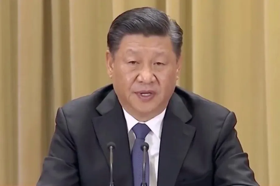
Chinese President Xi Jinping's earlier statements about Taiwan and unification were circulated again during the anniversary. The Eastern Theater Command's poster also presented the end of Japanese rule as a shared national memory and connected it with the defense of territorial unity.
The sequence shows how the imagery campaign has developed:
- 2015: The first Jilin-1 satellites were launched.
- September 2024: Chang Guang published a detailed global image mosaic assembled from satellite photographs.
- October 25, 2025: Beijing established its annual commemoration, and Jilin-1 images of Taiwan accompanied the 80th anniversary.
- November 1, 2025: China's embassy in Washington circulated Taiwan satellite images on X, prompting objections from Taiwanese and American officials.
- October 25, 2026: A new video marked the 81st anniversary with satellite views, music and messages supporting unification.
What the pictures show
Taipei's museums, memorials, bridges and sports facilities feature prominently in the video. Alongside the National Palace Museum and Taipei Dome, the sequence includes the National Sun Yat-sen Memorial Hall and Zhongzheng Bridge. The memorial hall is labeled using Sun Yat-sen's Chinese personal name rather than its current formal name in Taiwan.
The images also extend well beyond the capital. They show the Yushan mountain range, Sun Moon Lake, the Tamsui River, Qingshui Cliff in Hualien, Zhuangwei in Yilan, the fan shaped salt fields at Qingkunshen in Tainan, and wetlands in Chiayi.
Taipei Port adds a practical dimension to the scenic collection. Detailed images of a port can show the arrangement of docks, storage areas and transport connections. Images taken repeatedly can help observers track changes in how those facilities are used.
The soundtrack, the Chinese song commonly translated as Clouds of Home, repeatedly calls for a return home. Combined with the captions, it presents Taiwan's familiar landscapes as part of Beijing's argument for unification. The military poster released on the same day delivers that argument through the language of territorial defense.
How much can Jilin-1 see?
Chang Guang Satellite Technology developed Jilin-1 as a commercial remote sensing system. Remote sensing means gathering information about a place from a distance, in this case with instruments aboard satellites. A constellation is a group of satellites whose observations can be combined to cover more territory or revisit a location more often.
Technical descriptions accompanying the 2026 coverage put the fleet at 161 satellites, while another description of the anniversary release gives about 141. Chang Guang's figures cited during the 2025 release also put the constellation at 141 satellites. The fleet is described as producing imagery with a resolution of about 0.5 meters.
That resolution means an image element represents roughly half a meter on the ground. It helps explain why streets, buildings and larger objects can appear in considerable detail. The usefulness of any particular picture also depends on lighting, viewing angle, weather and image quality.
Chang Guang has described the constellation as capable of revisiting targets around the world up to 40 times a day. Its broader mapping claims include global coverage six times a year and coverage of mainland China about twice a month.
Those measures describe different jobs. Revisiting a target means another opportunity to observe a selected place. Completing a large map means collecting enough suitable images to cover a much wider area. A system can pass over a particular location frequently while taking much longer to assemble a complete regional or global picture.
Frequent visits require fast delivery
Joseph Wen, an affiliated researcher at Taiwan's Institute for National Defense and Security Research, identifies several factors behind continuous monitoring: satellite numbers, orbital arrangements, the mix of optical and radar sensors, and the speed of downloading, processing and distributing data.
Optical satellites use light to produce detailed views of the surface. Clouds can obstruct those views, and ordinary visible light cameras need daylight. Radar instruments use radio waves and can observe through cloud and darkness. The choice of sensor therefore affects when useful images can be collected.
Wen assesses that China is likely already capable of observing Taiwan with very little delay, or is moving toward that capability. His assessment connects the growing fleet with the entire delivery process, from taking a picture to getting it into the hands of someone who can act on it.
The capture dates of the individual images in the anniversary video were not given. The public release date tells viewers when the pictures were shown; operational monitoring also depends on when each picture was taken and how quickly it became available.
Chang Guang's September 2024 global mosaic illustrates the separate task of building a detailed map. The company said it selected 1.2 million images from a collection of 6.9 million to cover 99 percent of land outside Antarctica and Greenland. That is roughly one selected image for every six in the larger collection, showing the scale of the assembly work.
Why a parking lot can matter to intelligence
Wen points to military parking areas as an example of how ordinary details can become useful information. Changes in the number and colors of vehicles could help an observer estimate how many people are present at a base or identify a gathering associated with an important meeting.
Taiwanese military sites have installed steel canopies over many parking areas, originally to support solar panels. Wen says those structures can also conceal information from satellites. For personnel responsible for a base, the issue extends beyond hiding weapons to managing the small, repeated signs of activity around them.
Tu Cheng-yi, an assistant research fellow at the same institute, describes commercial space services as technology with both civilian and military uses. A business can sell mapping or environmental information while its images also support security operations.
Tu cited United States sanctions imposed on Chang Guang in May over the provision of satellite imagery used for targeting by Iran and the Houthi armed group. She also described earlier operational connections with China's military satellite control infrastructure and assessed that close cooperation could continue.
Wang Hsiu-wen, another assistant research fellow at the institute, has interpreted the public release of detailed Taiwan images as an effort to promote unification and create a sense of being watched. She also points to financial pressure on Chang Guang, including continuing losses and an unsuccessful application for a stock market listing, as a challenge to its commercial model.
The message already reached Washington in 2025
Beijing used a similar collection during the 80th anniversary in 2025. That release included Sun Moon Lake, Alishan and Taipei Port, while other images circulated during the campaign showed Hsinchu Science Park and Cape Eluanbi. The selection combined tourist destinations with industrial and transport infrastructure.
Chinese military affairs commentator Zhang Junshe described the pictures as a warning to supporters of Taiwan independence. Chi Chia-lin, honorary chairman of Taiwan's Reunification Alliance Party, welcomed them as a source of national pride. Their responses show the different audiences Beijing sought to reach with the same images.
China's embassy in Washington widened the campaign's international reach by posting the photographs on November 1, 2025. The embassy's image campaign drew objections from Taiwan's national security leadership and United States Senator Jim Risch.
Risch, chairman of the Senate Foreign Relations Committee, challenged the political claim attached to the images:
The People's Republic of China has never controlled the territory of Taiwan, and this post is a great example of the Chinese Communist Party's misrepresentation of history and blatant threats against a peaceful democracy.
Hsinchu Science Park gave that earlier collection particular economic weight because it houses major semiconductor companies, including Taiwan Semiconductor Manufacturing Company and United Microelectronics Corporation. Cape Eluanbi, at Taiwan's southern tip, overlooks the Bashi Channel between Taiwan and the Philippines. Those locations connect the imagery to manufacturing and maritime routes as well as the sovereignty dispute.
Taiwan wants control over its own satellite schedule
Taiwan's answer includes FORMOSAT-8, a planned constellation of six optical remote sensing satellites and two additional satellites designed for finer resolution. The program aims to complete the core group of six by 2031. Initial satellites have a stated resolution of one meter, with later spacecraft intended to produce more detailed images.
Wu Jong-shinn, director of the Taiwan Space Agency, has explained the national security value in practical terms: owning a satellite lets Taiwan decide which locations to photograph without competing with other customers for the same observation slot.
Satellite operators must schedule where their instruments point and what they record. A country buying commercial images may want a location photographed urgently while the operator has other commitments. Taiwan's own satellites give its authorities more control over those priorities.
The intended increase in observation frequency is substantial. FORMOSAT-5 passes Taiwan about once every two days, while the planned FORMOSAT-8 constellation is expected to provide about three passes a day. Using those figures, the opportunity to pass over Taiwan would rise about sixfold, from an average of half a pass daily to three.
Weather and daylight still affect optical photography, so successful image collection depends on conditions during each pass. More opportunities give operators a better chance of obtaining useful pictures and building a record of changes over time.
Reading the pictures is another part of the job
Lin Ying-yu, an associate professor at Tamkang University's Graduate Institute of International Affairs and Strategic Studies, describes repeated imagery as a way to study military exercises. Photographs of the same training area taken over time can help identify vehicles, formations and patterns of movement.
Wen has used public satellite imagery, military footage, terrain and vehicle details to map Chinese military facilities. Such work is known as open source intelligence: gathering and checking publicly accessible or commercially available information to answer a specific intelligence question.
Tseng Kuo-hsin, who heads the satellite receiving station at National Central University, describes a further step: combining images to follow activity over time. A series can show when a large vessel leaves a port, where it travels and when it returns, provided suitable observations are available.
National Central University's remote sensing center has monitored more than 200 islands and reefs in the South China Sea. Its image archive records changes such as land reclamation, construction and runway development. That experience illustrates why a long record can be more useful than a single striking photograph.
Lin argues that Taiwan's military and national security agencies need stronger skills in interpreting satellite images and closer cooperation with scientific institutions. The practical task is to turn pictures into a reliable account of what has changed, then combine that account with other intelligence.
China's anniversary video makes satellite visibility part of a public political message. Taiwan's constellation program addresses the same technology from the position of a government seeking its own observation schedule. For both, the value lies in the combination of detailed pictures, repeated visits and the ability to understand what the images show.
Key Points
- China released a 42 second Taiwan satellite video on October 25, 2026, marking the 81st anniversary of the end of Japanese colonial rule.
- The video showed Taipei landmarks, Taipei Port, Sun Moon Lake, mountains, salt fields and wetlands, alongside messages supporting unification.
- Jilin-1 specifications describe resolution of about 0.5 meters and frequent opportunities to revisit selected locations.
- Taiwanese researchers say effective monitoring depends on sensors, orbital coverage and the speed of delivering and interpreting images.
- A similar campaign in 2025 drew objections from Taiwanese and American officials after China's embassy in Washington circulated the pictures.
- Taiwan plans to complete FORMOSAT-8's core group of six satellites by 2031, increasing its control over intelligence collection.