A mapping decision reopens a sovereignty dispute
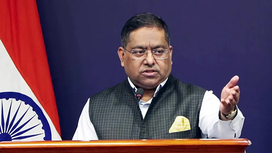
India reaffirmed its claim to Ladakh on October 13, 2026, after China challenged the standardisation of names for 28 places and geographical features on official Survey of India maps. The list includes Gogra and Hot Spring, associated with the military standoff that began in eastern Ladakh in 2020, as well as locations in Aksai Chin, which India claims and China administers.
Contents
- A mapping decision reopens a sovereignty dispute
- What India and China said
- What the 28 entries actually cover
- Why Gogra and Hot Spring matter
- Historical routes behind the Aksai Chin entries
- The list also reaches disputed areas involving Pakistan
- Arunachal Pradesh provides the closest comparison
- Names carry cultural meaning as well as territorial claims
- Diplomatic progress has not settled the boundary
- What remains unresolved
- Key Points
The Ministry of Home Affairs announced the exercise on October 2, saying it had consulted the Ladakh administration and local stakeholders. India presented the decision as a way to identify places accurately and improve public awareness. China described it as an assertion over territory it claims and repeated its rejection of Ladakh’s status as an Indian Union Territory.
The exchange exposes a limit to the improvement in relations since Prime Minister Narendra Modi and Chinese President Xi Jinping met in Kazan in October 2024. Military disengagement and renewed diplomatic contacts have reduced tensions, but neither government has abandoned its territorial position. Standardising a name on a national map does not itself change who controls the ground or settle a disputed boundary.
What India and China said
Chinese Foreign Ministry spokesperson Mao Ning opposed the announcement and linked it directly to Beijing’s rejection of the administrative arrangements India introduced in 2019. In her response to the naming decision, she said:
This move by India is illegal and void and does not change the fact that the western sector of the China-India boundary belongs to China.
Reports also render her description of the move as "illegal and invalid" and quote a narrower formulation referring to the "relevant areas" in the western sector. Both versions convey Beijing’s opposition, but its territorial assertion remains a contested claim, not an agreed description of the boundary.
India’s Ministry of External Affairs spokesperson, Randhir Jaiswal, rejected that position and reiterated New Delhi’s view of Ladakh:
It is reiterated that the UT of Ladakh is an integral and inalienable part of India. No amount of denial by the Chinese side can change this established fact.
Jaiswal described the Home Ministry announcement as self-explanatory. He said the names had been identified in consultation with the Union Territory and local stakeholders for inclusion on the official Survey of India map.
What the 28 entries actually cover
The detailed list describes 10 peaks, three mountains, seven land areas, two passes, two glaciers, one valley, one river, one lake and one other water body. Those categories add up to 28. Peaks and mountains account for 13 entries, while the seven land areas include several locations central to the territorial dispute.
The complete list, grouped by the feature types given in the detailed accounts, is:
- Peaks: Atisha Giri, Kanishka Peak, Martand Giri, Zorawar Peak, Rinchen Zangpo, Sakyasri Giri, Marpa Lotsava Ri, Milarepa Kangri, Shiva Ri and Maheshvara Ri.
- Mountains: Karun Pir, Drak Karpo and Jolmori.
- Land areas: Brangsa, Kuksel, Dehra Compass, Gogra, Kumarayana Point, Panglung and Shamal Lungpa.
- Passes: Chapchingal Pass and Shachmirk Pass.
- Glaciers: Parpik and Skamri Glacier.
- Other features: Shkorga Valley, Yangpa River, Guru Rinpoche lake and Hot Spring, classified as a water body.
Reports differ on spellings and classification. Some use Alisha Giri rather than Atisha Giri, Shachmirik rather than Shachmirk, and Maheshwara rather than Maheshvara. Another category breakdown gives 11 peaks, five mountains and six land areas alongside the remaining features, but those figures total 32 rather than 28. The detailed list above is internally consistent with the announced total.
There is also a date difference. Most accounts identify October 2 as the date of the Home Ministry press release, while another places the Survey of India announcement on October 3. These could refer to separate publication steps, but that distinction has not been established.
Why Gogra and Hot Spring matter
Gogra and Hot Spring are more than names on a map. They were among the points of friction during the eastern Ladakh standoff that followed clashes between Indian and Chinese forces in 2020. The deadly confrontation in Galwan Valley in June that year brought the boundary dispute into a much more dangerous phase.
The Line of Actual Control, or LAC, is the line separating areas under Indian and Chinese control. It is not a mutually agreed international boundary, and differences over its alignment can bring patrols into the same contested areas.
In September 2022, the two countries completed a disengagement process at Gogra-Hot Springs, associated with Patrolling Point 15. Disengagement means separating troops at a particular friction point. It does not amount to a final territorial settlement or necessarily resolve every disagreement over patrol access.
The Ministry of External Affairs subsequently said that the process was intended to ensure the LAC in that area was "strictly observed and respected". Placing Gogra and Hot Spring on the standardised list therefore connects the mapping exercise to locations where both countries had already negotiated military arrangements.
The broader standoff continued beyond that local disengagement. The October 2024 diplomatic breakthrough opened the way to restoring relations, illustrating why the 2022 agreement and the later improvement in ties should not be treated as the same event.
Historical routes behind the Aksai Chin entries
Dehra Compass and Shamal Lungpa bring another layer to the dispute. Both are associated with Aksai Chin, which India regards as part of Ladakh but which is under Chinese control. Aksai Chin also provides a connection between Xinjiang and Tibet, making it strategically important to Beijing.
The 1961 Report of the Officials of the Governments of India and China on the Boundary Question records historical routes through the Chang Chenmo valley, the Lingzi Tang plains and Aksai Chin. It describes a western Chang Chenmo route running from Pamzal through Shamal Lungpa and Samzung Ling toward Dehra Gompa and the upper Qara Qash valley.
The report also identifies Gogra as a stage on an eastern Chang Chenmo route and discusses the maintenance of routes, rest houses and storehouses by Kashmir State authorities for traders. It refers to Panglong as a valley with grassy ground. The current naming list uses Panglung, so the two spellings should not be treated as identical without checking their mapped positions.
Indian government correspondence from 1959 mentions Hot Spring and Shamal Lungpa in connection with patrols. These records explain why some entries carry historical weight beyond their physical descriptions. They document routes and activity used in presenting boundary claims, rather than a boundary settlement accepted by both countries.
The list also reaches disputed areas involving Pakistan
The naming exercise is not confined to the immediate India-China military frontier. Chapchingal Pass, Kuksel and Parpik Glacier appear, with some spelling differences, on a tourist map issued by the Gilgit-Baltistan Tourism Department. Those locations are in territory administered by Pakistan that India claims as part of the former princely state of Jammu and Kashmir.
Skamri Glacier adds a connection to the Shyok and Shaksgam valleys, where scientific literature places glaciers bearing that name. Shaksgam is the 5,180 square kilometre tract that Pakistan agreed to transfer to China under the 1963 China-Pakistan Boundary Agreement. India does not recognise that agreement.
The issue had already surfaced on September 16, when Pakistan and China operationalised their Boundary Joint Commission. Pakistan described the mechanism as supporting border management, joint surveys, trade and contact between people across the frontier.
India rejected the move. Jaiswal reiterated India’s claim to the entire Union Territories of Jammu and Kashmir and Ladakh and said Pakistan had no authority to enter arrangements concerning territory India considers to be under unlawful occupation. The inclusion of these features gives the Ladakh map a wider territorial dimension than a dispute over names near Patrolling Point 15 alone.
Arunachal Pradesh provides the closest comparison
India’s Ladakh announcement followed an August 2026 exercise assigning standard names to 27 places and features in Arunachal Pradesh. Taken together, the two announcements cover 55 entries, with the Ladakh list containing one more than the Arunachal list. They concern different sectors of the disputed boundary, but both place Indian names in formal mapping records.
China has issued several lists of standardised names for places in Arunachal Pradesh since 2017. Reports describe at least six such exercises over roughly a decade, although they differ on the precise sequence and number of announcements in 2026. India has consistently rejected China’s naming exercises as attempts to support claims over Indian territory.
Chinese Foreign Ministry spokesperson Guo Jiakun criticised India’s August Arunachal naming decision. His remarks concerned that exercise, not the later Ladakh announcement. Mao Ning’s October response is the relevant Chinese reaction to the 28 Ladakh entries.
Anushka Saxena, an Associate Fellow with the Takshashila Institution’s Geostrategy Programme, has described China’s renaming efforts as an attempt to reinforce its historical claims and introduce Chinese names into usage by other governments and countries. That analysis helps explain why the choice of map labels can attract diplomatic attention even without any accompanying change in military control.
The description of the October exchange as the first naming dispute in two years is also contested by reports identifying an earlier confrontation in August 2026. The distinction matters: the Ladakh announcement is a new dispute within an ongoing pattern, rather than necessarily the first such exchange since 2024.
Names carry cultural meaning as well as territorial claims
Several entries draw on Buddhist figures associated with the region’s religious and cultural history. Atisha, Rinchen Zangpo, Marpa Lotsava and Milarepa appear in the peak names. Guru Rinpoche, used for the lake, refers to the Buddhist master also known as Padmasambhava.
Shiva Ri and Maheshvara Ri draw on names associated with Shiva. Zorawar Peak refers to General Zorawar Singh and his campaigns in Ladakh. These choices give the list a cultural and historical vocabulary alongside its administrative purpose.
Standardisation is meant to give government agencies, mapping authorities and the public a consistent reference. That practical purpose is distinct from sovereignty: a name can become standard in one country’s records without being accepted by another government or changing the administration of the location.
Diplomatic progress has not settled the boundary
The latest dispute follows three rounds of talks between the countries’ Special Representatives since the Modi-Xi meeting in Kazan in 2024. The most recent round described in the reports took place in August and produced eight outcomes, including an intention to advance work on boundary delimitation and border management.
Boundary delimitation means agreeing where a boundary should run. Border management concerns how the two sides handle activity along the frontier while wider disagreements persist. Progress on managing tensions is therefore possible without a final territorial agreement.
The main sequence of events is:
- 2019: India created the Union Territory of Ladakh during its reorganisation of Jammu and Kashmir. China opposed the change.
- June 2020: The deadly Galwan confrontation deepened the military and diplomatic crisis.
- September 2022: India and China completed disengagement at Gogra-Hot Springs near Patrolling Point 15.
- October 2024: Modi and Xi met in Kazan as the countries began restoring relations.
- August 2026: India standardised 27 names in Arunachal Pradesh; the latest reported Special Representatives talks also took place in August.
- October 2, 2026: The Home Ministry announced the 28 Ladakh names.
- October 13, 2026: India rejected China’s objections and reaffirmed its position on Ladakh.
Reports differ on the timing of a subsequent Modi-Xi meeting at a BRICS summit in New Delhi. One places it on September 12, another in August, and another four days before the October 2 announcement. Without a verified common date, that meeting cannot reliably anchor the chronology of the naming dispute.
What remains unresolved
The diplomatic disagreement also sits alongside economic negotiations. China is seeking easier investment conditions for its companies in India. New Delhi is seeking reliable supplies of rare earth materials, certain fertilisers and other industrial inputs, together with greater transparency and fewer restrictions in visa issuance.
India has maintained that peace along the border is essential to the development of relations. The naming exchange shows how territorial differences can persist while both governments pursue practical cooperation. It does not, by itself, establish that military disengagement has been reversed or that economic discussions have stopped.
No date for a new boundary agreement, a further hearing or a specific decision responding to the Ladakh names has been announced in these accounts. The immediate outcome is a formal Indian mapping record and renewed statements of competing claims. Territorial control, the alignment of the boundary and acceptance of the names remain separate, unresolved matters.
Key Points
- India announced standard names for 28 Ladakh places and features on October 2, 2026.
- China objected to the names and repeated its rejection of Ladakh’s Union Territory status.
- India rejected China’s objections on October 13 and reaffirmed its territorial position.
- The list includes Gogra, Hot Spring, Aksai Chin locations and features in territory administered by Pakistan.
- The detailed classification totals 28 entries, although reports differ on some spellings, dates and category counts.
- The mapping exercise does not itself change territorial control or resolve the disputed boundary.