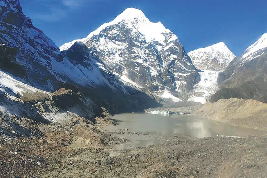
Four lakes, a 2033 deadline and a crucial design decision
Nepal is preparing a roughly $50 million project to lower four Himalayan glacial lakes, install flood warning systems and protect communities downstream, including along rivers that flow into India. The lakes sit between 4,050 and 5,483 metres above sea level, where unstable natural dams, avalanches and difficult working conditions make reducing the danger a demanding task.
Contents
- Four lakes, a 2033 deadline and a crucial design decision
- How a mountain lake becomes a flood threat
- Why the danger extends into India
- What workers will build, and when
- Why scientists disagree over three metres
- What earlier drainage projects taught Nepal
- Warning systems must reach people downstream
- Who pays, and who is expected to benefit
- Recent destruction gives the programme urgency
- Key Points
The United Nations Development Programme's official project record identifies Thulagi, Lower Barun, Lumding Tsho and Hongu 2 as the targets. It lists both the planned and actual project start as 11 March 2026, with completion planned for 11 March 2033. UNDP and Nepal's government are implementing the work with Green Climate Fund support.
The central engineering decision is still being studied: how far each lake should be lowered. Initial project descriptions proposed a reduction of one metre at Hongu 2 and three metres at the other lakes. National programme director Rajan Bhattarai has subsequently said the necessary studies and refined designs must come first, leaving the final reductions undecided.
The programme, known as the GLOF Sanjeevani Project, therefore involves more than digging drainage channels. Its success will depend on matching each intervention to the lake, maintaining safe outlets and giving people downstream enough warning to move before floodwater arrives.
How a mountain lake becomes a flood threat
Glacial lakes form as ice melts and water collects in mountain hollows. Some are held back by a moraine, a ridge of rock, sediment and sometimes buried ice left behind by a glacier. Unlike an engineered dam, that barrier can contain weak or unstable sections.
An avalanche or landslide can push water over the barrier. Erosion can then cut into it, releasing water rapidly into a valley. An earthquake, melting ice within the moraine or changes around the outlet can also destabilise the lake. This sudden release is called a glacial lake outburst flood, or GLOF.
Subash Tuladhar, an expert at Nepal's Centre for Hydrology and Water Resources Research, which is overseeing the project, described its purpose:
Our aim is to lower the risk of the lakes breaching their natural dams and reduce the risk of downstream floods.
Lowering the water creates more space below the top of the natural barrier and reduces the amount available for a sudden release. The protection depends on the lake's shape, depth, surrounding slopes and dam condition, which is why a reduction measured in metres can have different effects at different lakes.
Why the danger extends into India
Thulagi lies in Manang district, Lower Barun in Sankhuwasabha and Lumding Tsho in Solukhumbu. Together with Hongu 2, they form the project's focus in the Koshi and Gandaki basins. Floodwater travelling through these river systems can affect settlements, farms, roads and power infrastructure far below the lakes.
A 2020 assessment by the International Centre for Integrated Mountain Development and UNDP identified 47 potentially dangerous glacial lakes across Nepal, China and India. Of those, 21 were in Nepal, 25 in China and one in India.
The assessment placed 42 of the 47 lakes in the Koshi river system, including 24 in China and 18 in Nepal. That is about 89 percent of the identified total. Because the Koshi flows from Nepal into Bihar, the concentration gives the project importance beyond Nepal's mountain districts.
The figures also show the limits of a programme centred on four lakes within Nepal. Flood preparation along the Koshi must account for water arriving from a much wider basin, including lakes across the Chinese border. Local engineering and downstream warning arrangements address different parts of that shared danger.
What workers will build, and when
Engineers plan to construct channels and gated outlets that release water gradually into nearby rivers. The described approach avoids explosives and uses controlled drainage, with workers and technical methods chosen to reduce construction risks.
Bhattarai has said the water levels could be lowered within three years if work proceeds without interruption. Mountain weather, however, restricts construction to roughly five or six months annually. Workers must also contend with prolonged exposure to high altitude and the possibility of sudden flooding.
Sanjeeb Baral, executive director of the Centre for Hydrology and Water Resources Research, has given a longer working estimate: drainage through gated structures could take up to six years after detailed study. The 2033 completion target allows for a programme extending well beyond its initial administrative start.
The main dates distinguish earlier experience, project preparation and the eventual construction period:
- 2000: Nepal lowered Tsho Rolpa by three metres.
- 2016: Nepal lowered Imja by about 3.4 metres.
- 2020: The ICIMOD and UNDP assessment identified 47 potentially dangerous lakes across three countries.
- 11 March 2026: The official project record lists the programme's start.
- Fiscal year ending in mid-July 2027: Officials schedule design work and detailed studies.
- 11 March 2033: The official record lists the planned project end.
Bhattarai has said construction is not expected to begin in 2026 while consultants are appointed, environmental assessment is completed and designs are refined. Starting the programme and starting excavation are separate stages.
Why scientists disagree over three metres
Nepal's experience at Tsho Rolpa and Imja has made a reduction of roughly three metres a familiar reference point. Scientists disagree about how much protection that would provide at the four newly selected lakes.
Samjwal Ratna Bajracharya, a retired ICIMOD specialist in glaciers, glacial lakes and outburst floods, has said lowering the lakes by three metres would substantially reduce the threat. Other researchers argue that the required depth should come from detailed calculations for each lake rather than from previous construction targets.
Alton C Byers, a specialist in mountain environments and climate change who has studied Nepal's glacial lakes for decades, has questioned the earlier benchmark:
This idea of a three-metre reduction is based on Tsho Rolpa, and it is not sufficient.
Byers said the original plan at Tsho Rolpa envisaged lowering the lake by up to 20 metres, but funding constraints limited the work to three. Jeffrey S Kargel, an American scientist who has studied Imja, Lower Barun and Thulagi, said a reduction of at least 10 metres had been recommended at Imja. Binod Parajuli, chief of the Department of Hydrology and Meteorology's flood forecasting section, cited scientific advice for at least 20 metres there.
The disagreement concerns how much protection a particular investment buys. A suitable study would measure lake depth and volume, examine the natural barrier and model how different releases would travel through downstream valleys. Engineers could then compare lowering the water, strengthening the barrier and improving warning systems against the damage each option could prevent.
What earlier drainage projects taught Nepal
Imja illustrates why ambitious designs can become difficult to deliver. Parajuli said bulldozers and other equipment had to be flown in by helicopter. Three unsuccessful calls for tenders preceded the decision to give the work to the Nepali Army.
Parajuli described the contracting problem:
International contractors showed no interest at all.
He said some interested contractors quoted prices beyond the available budget. Transport, short working seasons and the difficulty of operating heavy equipment at altitude all contribute to the cost of removing each additional metre of water.
Parajuli nevertheless defended the value of the completed work, saying even modest lowering reduces the risk of a natural breach. Kargel also said stabilising Tsho Rolpa's outlet and lowering it by three metres had been effective.
Outlet management remains essential after excavation ends. Kargel explained that controlled outflow helps when incoming water increases or when buried ice melts and the outlet shifts downward. Imja has such a regulation arrangement. Maintaining these structures is part of managing a changing lake, rather than treating construction as a task that ends when the target level is reached.
Warning systems must reach people downstream
The official UNDP project description combines engineering with early warning systems and stronger institutional capacity. Officials also describe sensors, flood forecasting, community preparedness and measures to help downstream settlements withstand flooding.
Sensors can detect changes at a lake or along a river. Forecasting and warning systems turn those observations into alerts. Communities then need a practical response, including arrangements to communicate warnings and move people away from likely flood routes.
Parajuli has stressed that an avalanche entering a lake can remain dangerous even after its level has been lowered. Rijan Bhakta Kayastha, a Kathmandu University professor who specialises in glaciers and glacial lakes, made the broader point:
Lowering a lake is not the same as removing the risk.
Kargel has urged greater caution when locating roads, hydropower facilities and other expensive infrastructure near likely flood paths in Nepal and India. Choosing a less exposed location can prevent repeated destruction and rebuilding, while alerts address the danger to people already living or working downstream.
Nepal has more than 2,000 glacial lakes, and only two have so far been lowered. Kayastha said most have not been studied. The four selected for construction are therefore part of a much larger monitoring and preparedness challenge.
Who pays, and who is expected to benefit
The financing described for the project consists of a $36.16 million Green Climate Fund grant and another $13.8 million from Nepal's government and partner organisations. Together, those amounts total $49.96 million, explaining the rounded description of a $50 million programme.
The Green Climate Fund operates under the United Nations climate framework. Its grant represents about 72 percent of the stated total, with government and partner contributions covering the rest.
The Department of Hydrology and Meteorology has put the expected beneficiary population at roughly 2.3 million people living with mountain flood risk. Earlier project descriptions gave a larger estimate of more than 3.8 million. The department's figure provides the more recent planning estimate, while the difference leaves the exact scope of the beneficiary count unresolved.
The earlier project description also estimated that potential economic losses could be reduced by up to 2.12 billion rupees. The practical benefits would come from fewer damaged homes and farms, safer transport links and less disruption to power generation and local livelihoods.
Recent destruction gives the programme urgency
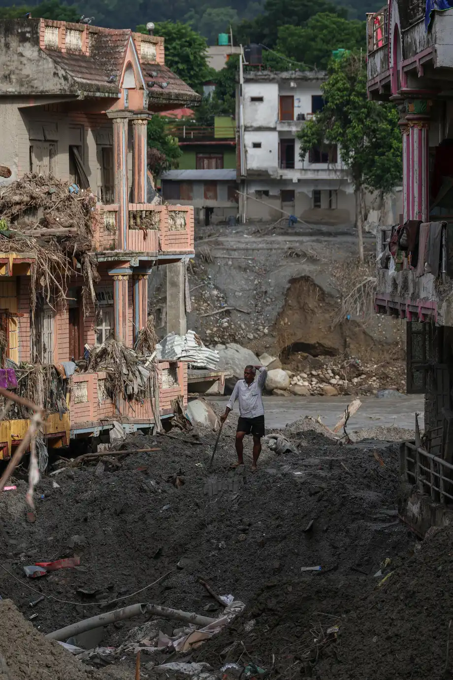
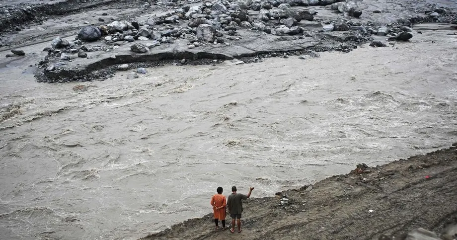
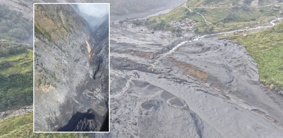
August flooding in the Bhotekoshi region renewed concern about disasters that can begin high in the mountains and gather destructive force as they move downstream. The October 2026 account of the disaster put deaths above 1,400 and the number missing above 5,000 after a glacier collapse, landslides and flash flooding near the Chinese border.
Officials said the floods damaged a dozen hydroelectric plants, along with roads, bridges, farms and settlements. They estimated that early recovery would require nearly $5 billion, about 100 times the planned cost of the four lake programme.
Nepal has recorded about 26 glacial lake outburst flood events over four decades. Extreme climate events of all kinds cause an average of more than 300 deaths annually in the country, a broader toll that includes hazards beyond glacial lakes.
The next concrete steps are the environmental assessment, detailed lake studies and refined engineering designs scheduled within the fiscal year ending in mid-July 2027. Those decisions will determine how much water is removed, how the outlets are built and how construction fits within the short mountain working season. For downstream communities, protection will also depend on warnings and preparedness operating alongside the drainage works.
Key Points
- Nepal plans to lower Thulagi, Lower Barun, Lumding Tsho and Hongu 2 under a programme scheduled to finish in March 2033.
- The roughly $50 million project combines controlled drainage, warning systems and community preparedness.
- Final lowering depths await detailed studies; initial proposals ranged from one to three metres.
- Scientists disagree over whether reductions of roughly three metres would provide enough protection.
- The 2020 regional assessment placed 42 of 47 potentially dangerous lakes in the Koshi system, which flows into Bihar.
- Design studies, safe outlet management and warnings downstream are central to reducing future losses.