
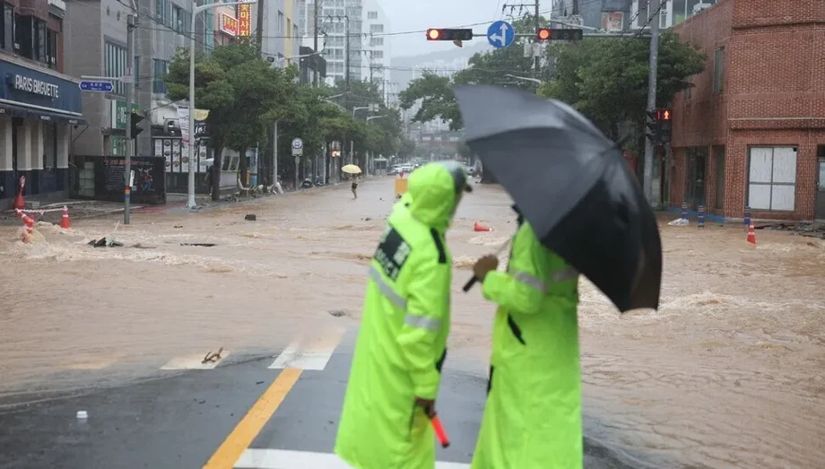
Dam safety rules move beyond past rainfall
South Korea will redesign its dam safety standards around extreme rainfall recorded through 2024 and climate projections extending to 2100, replacing a baseline that used rainfall records only through 2003. The change sits at the center of a national plan to prepare for floods and droughts striking different regions at the same time.
Contents
- Dam safety rules move beyond past rainfall
- What changes in the engineering standards?
- Research shows why the choice of climate models matters
- More room for floodwater, above and below ground
- New water routes for dry regions and chip factories
- Warnings will reach more rivers and road crossings
- More measurements will support decisions on dam releases
- Repairs target vulnerable rivers, pipes and dams
- The deadlines that will shape delivery
- Key Points
The Ministry of Climate, Environment and Energy presented its Water Management System Improvement in the Era of the Climate Crisis plan to the Cabinet on November 17. Its nine tasks cover three areas: expanding water infrastructure, improving forecasts and monitoring, and repairing vulnerable places and aging facilities.
The urgency is visible in sharply contrasting measurements. Nationwide summer rainfall totaled 558 millimeters, just 76.1% of the usual amount. Yet Geoje, in South Gyeongsang Province, recorded 124.5 millimeters in one hour, breaking its previous hourly record of 104 millimeters by nearly 20%.
Reservoirs showed the other side of the problem. On November 15, Seomjingang Dam was only 18.5% full and Unmun Dam was 28.4% full. Those levels were respectively 41.3% and 49.8% of their usual levels for the time of year, according to ministry figures.
For households, businesses and local authorities, the plan addresses two practical needs: keeping dangerous surges away from streets and buildings, while preserving enough usable water when rain is scarce. Its projects range from deep tunnels beneath Seoul to emergency connections between rivers and reservoirs, with major deadlines running through 2031.
Kim Han-seung, the ministry's first vice minister, described why the government wants to change the basis of its planning.
"The limits of a water management system built around past rainfall patterns are clear," Kim said.
What changes in the engineering standards?
Dam designers will have to look further back through recent extreme events and further forward through projected rainfall. Adding observations through 2024 brings another 21 years of records into the baseline. Looking ahead to 2100 brings expected changes in rainfall into decisions about structures intended to remain in service for decades.
The government has already changed standards for other flood defenses. In December 2025, it removed an upper ceiling on levee design standards, previously set at return periods of 100 to 200 years for national rivers and 50 to 100 years for local rivers.
In June 2026, design standards for sewer pipes and pumping stations rose from return periods of 10 to 30 years to 30 to 50 years. The revised rules also require an allowance for climate change.
A return period is a way of expressing probability. A rainfall event with a 50 year return period has a 2% chance of occurring in any given year under the conditions used in the calculation. Such events can happen close together. For drainage systems, moving to a longer return period means planning for a rarer and generally heavier storm.
The ministry has not specified the climate scenarios, calculation methods or implementation date for the revised dam standard. Those choices will determine how projections through 2100 translate into engineering requirements.
Research shows why the choice of climate models matters
A South Korean rainfall study published on August 10, 2024, in Water Resources Management offers a useful explanation of the technical work behind future rainfall estimates. The extreme precipitation study examined 60 stations across South Korea using global climate models from the sixth Coupled Model Intercomparison Project, known as CMIP6.
The researchers used shared socioeconomic pathways, or SSPs, which describe possible futures involving different social, economic and emissions conditions. They measured extreme rainfall with ten standard precipitation indicators, allowing them to examine several features of heavy rain rather than a single national average.
The study compared simply averaging the models with a method that gave different models different weights. The optimized combinations generally performed better in most regions. Among the tested evaluation methods, Kling-Gupta efficiency generally produced the strongest results.
In everyday terms, combining several weather and climate models requires judgment about how much confidence to place in each. The study provides a concrete reason for paying attention to model selection and testing as South Korea moves from designs based on historical rainfall toward designs that include future conditions.
A separate study, "A Critical Evaluation and Future Projection of Extreme Precipitation Over South Korea in Observation-Based Products and a High-Resolution Model Simulation," was published on July 29, 2024, in the Asia-Pacific Journal of Atmospheric Sciences, volume 60, pages 709–725. Its authors are Christian L. E. Franzke, Lichao Yang, Jun-Hyeok Son, June-Yi Lee, Kyung-Ja Ha and Sun-Seon Lee. Its DOI is 10.1007/s13143-024-00377-1.
That study compared South Korean station observations with APHRODITE and ERA5-Land gridded data and high-resolution Community Earth System Model, or CESM, simulations. The two observation-based gridded products underestimated the station data's 99th-percentile precipitation, while CESM reproduced extremes better. The station records showed an overall historical decrease in very large extremes, alongside statistically significant local increases in some areas. Simulations of a warmer climate showed increases in mean precipitation and precipitation extremes, underscoring the importance of distinguishing historical observations from future projections.
More room for floodwater, above and below ground
The ministry says it secured 1.04 billion tons of flood control capacity during 2026 and intends to identify more storage space in facilities that were built for other purposes. Agricultural reservoirs, dams used for electricity generation and estuary barriers are among the facilities it plans to use.
Operators will release water ahead of heavy rain when rainfall forecasts and river conditions allow, leaving room to catch the incoming surge. During dry periods, they will retain water for supply. South Korea's designated flood season runs from June 21 to September 20.
Seoul's biggest projects include deep stormwater tunnels near Gangnam Station and Gwanghwamun, along with an underground flood channel serving Dorimcheon. The government plans to finish them before the 2029 flood season. The tunnels are intended to carry large volumes of stormwater underground when surface drainage cannot cope.
Outside central Seoul, retention basins on Mokgamcheon and Wonjucheon are due by 2029. These are spaces where water can be held temporarily during heavy rain, slowing the amount entering a river at once. Bonghwa Dam, a small dam intended for flood control, is scheduled for completion in 2028.
The combination changes how floodwater is managed. Levees keep water within a river channel; basins, reservoirs and tunnels give some of that water somewhere else to go. Forecasts and operating decisions will be central to making the extra capacity useful before a storm arrives.
New water routes for dry regions and chip factories
An emergency channel carrying water from the Seomjingang River to Dongbok Dam is planned for completion by 2029. A proposed tunnel linking Namgang Dam and Hapcheon Dam will enter conceptual planning in 2027. Connecting supplies gives operators more options when one reservoir or catchment receives too little rain.
Reclaimed wastewater is another part of the supply plan. By 2030, the government aims to make 330,000 tons a day available in southern Gyeonggi Province and 200,000 tons a day for semiconductor industrial complexes in the Honam region. Together, the targets total 530,000 tons daily.
Reclaimed water is wastewater treated so it can be used again for an intended purpose. Providing it to industry adds a supply source alongside rivers and reservoirs, an important consideration for semiconductor complexes that need substantial and dependable water supplies.
For islands and mountain communities vulnerable to drought, the government plans to double the number of underground water retention dams from four to eight by 2030. These structures hold groundwater beneath the surface for later use.
Gunsan, Jecheon, Jeungpyeong and Cheonan, designated as water cycle promotion zones in June 2026, are due to receive comprehensive local plans by 2027. The different projects reflect a practical challenge: a large industrial region and an isolated community need different ways to secure water.
Warnings will reach more rivers and road crossings
River flood forecast locations will increase from 223 to 270 by 2030, an addition of 47, or about 21%. Urban inundation forecasts, tested in six Seoul districts during 2026, will expand to six metropolitan cities by the first half of 2030 and then to major urban river basins from 2031.
A more immediate change concerns recommendations to restrict entry to bridges and underpasses during intense rain. After a pilot covering 22 flood forecast locations in 2026, the recommendation system will expand to all 223 existing locations in 2027.
The expansion connects forecasts with a decision people can act on: whether to keep traffic away from a crossing or low road as water rises. Forecast coverage and access restrictions are separate tasks, so the plan seeks to connect the warning system more closely with responses on the ground.
The ministry says deaths caused by river overflow fell from eight in 2025 to zero in 2026, while related property damage declined from 232.4 billion won to 17.4 billion won. It credited advance storage preparations and the active use of artificial intelligence in flood forecasting with helping reduce losses.
The government is extending the system despite those improvements because rainfall shortages and intense local downpours are creating pressure in different places at once. A national rainfall total can be low while an individual city experiences a dangerous flood.
More measurements will support decisions on dam releases
Water level monitoring stations on local rivers are set to rise from 1,023 in 2026 to 1,191 by 2030. Facilities measuring streamflow will increase from 218 to 579 over the same period, more than doubling their number.
Water level and streamflow answer different questions. A level gauge shows how high the water is; streamflow measures how much water passes a point over time. Together, they help operators assess a river's behavior and the volume moving downstream.
An artificial intelligence model scheduled for deployment in 2027 will estimate streamflow in places without measurement records, using terrain and weather characteristics. The aim is to improve drought forecasting in areas where direct observations are sparse.
By 2028, another system is intended to support decisions on when dams should release water and how much to release. It will combine weather forecasts with current dam and river levels. A water resources satellite scheduled for launch in 2028 will add another layer of observation, alongside camera surveillance using artificial intelligence on national rivers.
These tools address the operational tension running through the plan: releasing water creates room for a flood, while storing it protects supplies during drought. Better observations give operators more information when choosing between those needs.
Repairs target vulnerable rivers, pipes and dams
The government will rank 1,073 rivers judged to be at highest risk among 3,760 local rivers vulnerable to flooding and provide the priorities to local authorities. That group represents about 29% of the vulnerable rivers, directing attention toward the places identified as most urgent.
Integrated flood prevention planning will also bring river and sewer management together. Gwangjucheon and Suyeonggang are the first two basins selected from 64 designated urban river basins, with plans to be prepared in sequence from 2027. Flood vulnerable river sections are to be formally defined under the River Act by 2027.
Aging infrastructure forms another large work program. About 4,000 kilometers of sewer pipes requiring repair or replacement are scheduled for overhaul by 2030. Work is also planned by that year on 40 aging levees still awaiting attention out of a group of 65.
Fourteen water supply dams are slated to receive emergency discharge facilities by 2030. Other safety work includes strengthening dam cores and spillways, and improving earthquake resistance in intake towers and bridges on top of dams.
The water supply network work sits alongside a program covering 330 projects across 142 local governments from 2017 to 2026, with a total budget of 9.9 trillion won and a renewal pace of roughly 600 kilometers a year. That amount belongs to the existing water infrastructure program; the newly presented measures bring together projects with several different schedules.
The deadlines that will shape delivery
The earliest operational changes are scheduled for 2027, while the largest construction and monitoring targets cluster around 2028 to 2030. Seoul's tunnels have a seasonal deadline, completion before the 2029 flood season, rather than simply by the end of that year.
The main milestones are:
- 2027: Expand bridge and underpass control recommendations to all 223 existing flood forecast locations, deploy the drought forecasting model, and begin conceptual planning for the Namgang and Hapcheon connection.
- 2028: Complete Bonghwa Dam, establish support for dam release decisions using artificial intelligence, and launch the planned water resources satellite.
- 2029: Complete the Seoul drainage projects before flood season, plus the Mokgamcheon and Wonjucheon retention basins and the Seomjingang to Dongbok emergency channel during the year.
- 2030: Reach 270 river flood forecast locations, expand monitoring networks, pursue reclaimed water supply targets and complete major pipe and dam safety work.
- 2031 onward: Extend urban inundation forecasts to major urban river basins.
For residents, the first changes may be wider warnings and traffic restrictions. The larger physical protections, including new underground routes for stormwater and additional links between water sources, depend on construction over the following years.
Key Points
- South Korea plans to use rainfall observations through 2024 and projections through 2100 in dam design standards.
- Summer rainfall was 76.1% of normal, while Geoje set an hourly rainfall record of 124.5 millimeters.
- Major Seoul stormwater tunnels and an underground flood channel are due before the 2029 flood season.
- River flood forecast locations will rise from 223 to 270 by 2030.
- New water connections and reclaimed wastewater supplies aim to reduce dependence on individual sources.
- Repairs include about 4,000 kilometers of sewer pipes and emergency discharge facilities at 14 water supply dams by 2030.