Seventeen lakes marked for closer assessment
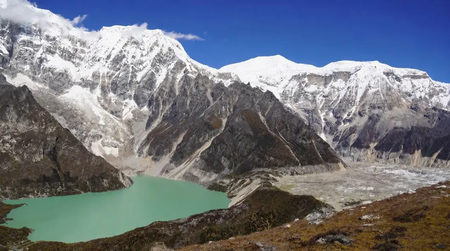
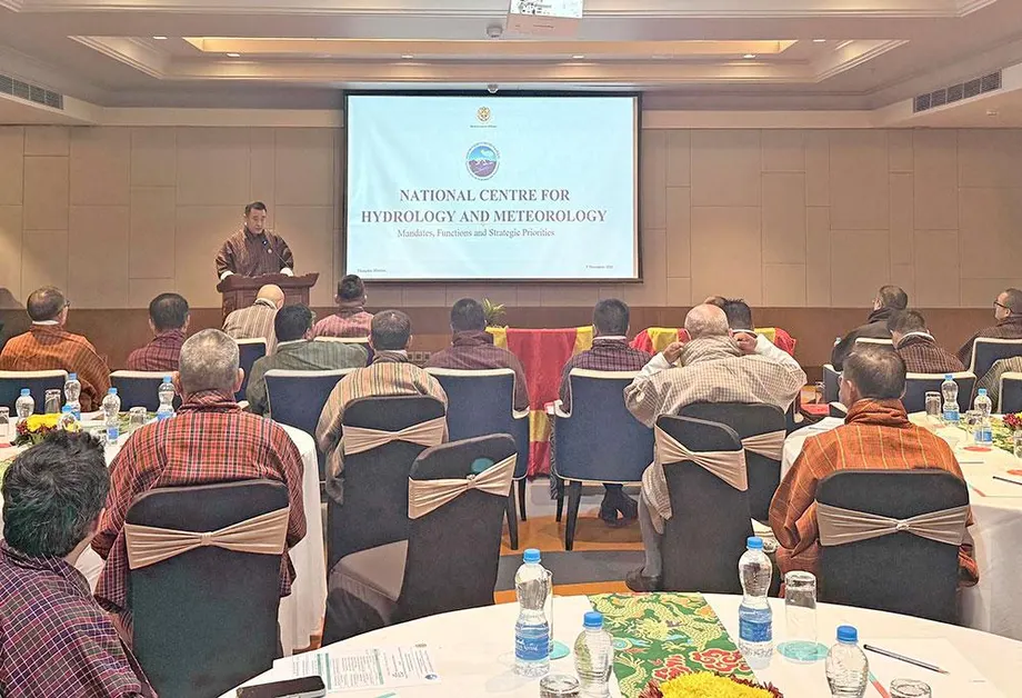
Bhutan has mapped 620 glacial lakes in its latest national inventory, up from 567 in 2021, while identifying 17 as potentially dangerous. The National Centre for Hydrology and Meteorology (NCHM) is also tracking a growing concern farther down the mountains: more people, roads, bridges and hydropower facilities are occupying river valleys that could carry an outburst flood.
Contents
- Seventeen lakes marked for closer assessment
- Less glacier ice, more lake water
- Why another study counted 2,574 lakes
- Flood maps change the priority list
- How the October 29 flood cascaded
- Satellites reveal sharply different lake changes
- Damage reached roads, livestock and hot springs
- Monitoring teams face limits in the mountains
- River development increases what is at stake
- Key Points
Nine of the 17 lakes are in the Pho Chhu sub-basin, three in the Chamkhar Chhu basin, two in the Mo Chhu basin and three elsewhere. The designation places them on a priority list for assessment and monitoring. NCHM says their immediate condition requires individual investigation rather than treating all 17 as facing an imminent outburst.
The latest inventory records 58.18 square kilometres of lake surface, compared with 55.04 square kilometres in 2021. Lake numbers rose by 9.4 percent, while their combined mapped area increased by 5.7 percent. Pho Chhu alone contains 187 lakes, about 30 percent of the national total, and nine of the 17 priority lakes.
Flood modelling adds a picture of what lies downstream. NCHM estimates that more than 11,000 people, 2,500 buildings, 250 kilometres of roads and 400 bridges could fall within potential flood inundation areas. A published academic assessment also identifies about 20 square kilometres of exposed farmland. These figures describe people and assets within simulated flood paths; actual damage would depend on the event, local conditions and preparedness.
The government lists the Bhutan Glacial Lake Inventory as an NCHM resource covering freshwater supplies, changes in lake numbers and risks to infrastructure and livelihoods. Its dataset listing was last modified on May 1, 2026.
Less glacier ice, more lake water
Bhutan's glacier inventory records 673 glaciers covering approximately 571.86 square kilometres, compared with 700 glaciers and 629.55 square kilometres in the 2018 inventory. The mapped area declined by 57.69 square kilometres, or 9.16 percent. The new assessment uses satellite imagery spanning 2016 to 2025.
Phuntsho Tshering, an official in NCHM's Cryosphere Service Division, described the changes during the inventory briefing:
Bhutan's glacierized Himalayan landscapes are undergoing rapid transformation due to climate change.
The fall of 27 in the glacier count is a net inventory change. Retreat, fragmentation and revised classification all affect that number. One feature previously counted as a glacier was reassessed as a seasonal snow patch. In the Mangde Chhu basin, larger glaciers breaking into smaller pieces increased the glacier count even as ice was being lost.
Most remaining glacier area lies between 5,000 and 5,700 metres above sea level. Some lakes in the high mountain basins have doubled in size. Lemthang Tsho, by contrast, disappeared from the records after its 2015 outburst flood.
NCHM used Sentinel-2 satellite imagery and deep learning models, computer systems trained to recognise patterns in images, to produce the inventories. It plans updates every five years. Glacier counts, ice area and lake area together give planners a fuller view of mountain change than any one measurement alone.
Why another study counted 2,574 lakes
A 2026 glacial flood risk study by Sonam Rinzin and five coauthors draws on a different inventory: 2,574 lakes mapped in 2020, covering about 156.63 square kilometres. That dataset includes lakes as small as 0.003 square kilometres within 10 kilometres of glacier termini, the lower ends of glaciers.
The research inventory also includes 85 lakes in Chinese and Indian territory whose drainage flows into Bhutan. The latest national inventory gives a total of 620. The datasets use different coverage and mapping criteria; the precise reconciliation between their totals has not been published in the information accompanying the national announcement.
For detailed flood simulations, the researchers selected 278 lakes measuring at least 0.05 square kilometres and lying within one kilometre of a glacier terminus. They then calculated where hypothetical floods might travel and what they might encounter. Their assessment connects conditions at individual lakes with the communities below them, rather than ranking lakes solely by their shape, growth or natural dams.
Flood maps change the priority list
The study classified Thorthormi Tsho as a very high hazard lake, five lakes as high hazard and another 22 as moderate hazard. Three of the high hazard lakes, Phudung Tsho, lake251 and Wonney Tsho, had not been recognised as high hazard in earlier studies.
Five downstream local government units were assigned very high risk and eight high risk. Five of those 13 units had not previously been documented as areas at risk from glacial lake outburst floods. The findings widen the geographic focus for preparedness beyond locations already familiar to disaster planners.
A glacial lake outburst flood, usually shortened to GLOF, happens when stored lake water escapes suddenly. Hazard describes the flood's potential force and reach. Exposure describes the people and assets in its path. Vulnerability describes how badly those people and assets could be affected. Combining these factors helps explain why a smaller flood reaching a settlement can demand greater attention than a larger flood in an unoccupied valley.
The researchers used HEC-RAS flood modelling software and terrain data represented on a grid of 30 metres. Their calculations combined simulated water depth and speed with buildings, roads, land use and population information, including Bhutan's 2017 population and housing census. They say the lake dataset, inundation maps and local government risk information are available through a public web portal.
Lake volumes were estimated from surface area where field measurements were unavailable. The model also assumed different proportions of drainage for different lake sizes. Those choices allow comparisons across hundreds of remote lakes, while detailed local investigations remain necessary for decisions about individual dams, settlements and infrastructure.
How the October 29 flood cascaded
The October 29 outburst in Gasa illustrates how one lake can set off failure in another. NCHM calls the event the Shitaphu GLOF; other accounts use Sintaphu or Sintaphu Tsho for the lake system near Wakila Mountain in Lungo, Laya, at the headwaters of the Mo Chhu. The satellite account dates the event to October 29, 2026.
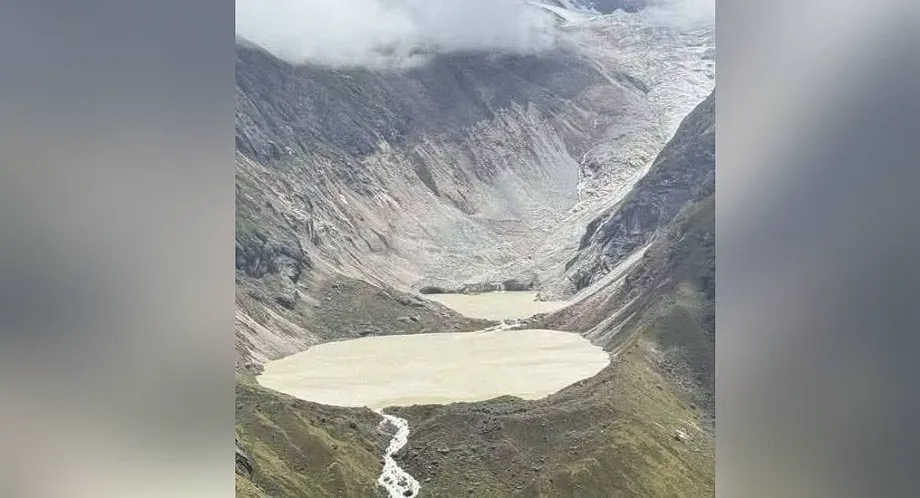
NCHM's assessment says ice broke away from the glacier and fell into the upper lake. The impact generated a wave that passed over and eroded its moraine dam, a natural barrier made of rock and sediment left by a glacier. Water then entered the lower lake, eroded its existing outlet channel and triggered failure of that lake's moraine dam.
Using satellite analysis and field assessments, NCHM estimated that the two lakes released about 6.1 million cubic metres of water, leaving approximately 2.5 million cubic metres. An earlier preliminary estimate put the release at 4.89 million cubic metres and remaining water at 3.19 million cubic metres; the International Centre for Integrated Mountain Development estimated the water stored before the outburst at 6 million to 7 million cubic metres.
The main dates show how the investigation developed:
- May to June 2023: Specialists examined the Sintaphu lakes, surrounding slopes, moraine barriers and feeding glacier.
- October 28, 2026: Satellite analysis recorded Sintaphu Tsho at 24.13 hectares, its largest mapped extent in that analysis.
- October 29: The outburst sent floodwater through the Mo Chhu system.
- October 30: Radar imagery captured changes in the affected lakes.
- October 31 and November 1: Further satellite images suggested that the upper lake was refilling.
- November 2: Gasa district administrator Jigme Namgyel said river flows were normal.
Satellites reveal sharply different lake changes
Suhora Technologies, a geospatial company based in Noida, used radar imagery with a resolution of one metre to assess the aftermath. Its analysis found that Sintaphu Tsho shrank from 24.13 hectares to 6.54 hectares, a reduction of about 73 percent. Radar observations can help monitor mountain terrain when clouds obstruct ordinary satellite photographs.
The company's analysis also found that an adjoining lake on the glacier shrank by 24.4 percent, from 16.50 hectares to 12.47 hectares. Such a lake is called supraglacial because it sits on the surface of glacier ice. It had grown from 5.74 hectares in 2016 to about 16.51 hectares before the outburst, an increase of nearly 188 percent.
Sintaphu Tsho itself had changed much less over that decade, from 23.33 hectares in 2016 to 24.13 hectares immediately before the flood. The nearby lake on the ice therefore showed much stronger growth than the larger lake that later lost most of its surface area.
A preliminary assessment of the upper and lower lake pair put the lower lake's area reduction at 73.03 percent and its volume reduction at 81.53 percent. It estimated a 9.55 percent area reduction and a 5.39 percent volume reduction for the upper lake. Suhora's 24.4 percent figure concerns the adjoining supraglacial lake; the accounts use different lake descriptions and mapped outlines for the surrounding water bodies.
Substantial water remained after the flood. Satellite indications of refilling, together with a new lake formed where debris blocked a channel near Taktse Makha, prompted calls for field checks. NCHM recommended continued monitoring, measurements of remaining water and dam stability, and further modelling of possible cascading failures.
Damage reached roads, livestock and hot springs
The flood destroyed facilities at Gasa Tshachu, the natural hot springs beside the Mo Chhu. Three major sections of the Laya Gewog Centre Road between Koina and Tongchudra were blocked or badly damaged, and the Tongchudra bridge was washed away. At some locations, floodwater removed the road foundation itself.
The Department of Livestock put preliminary losses at Nu 6.8 million. At least 128 yaks and 12 horses were killed, while about 10 yaks were still missing when the initial account was compiled. Around 12 acres of grazing land were affected, adding pressure on households that depend on livestock.
Farther downstream, debris covered Dzomlingthang recreational park in Punakha. A solar powered lift irrigation facility serving Dochhukha, Dzomlingthang and Ritsa was partially damaged, and a Bailey bridge linking Yebisa and Bhalue in Chhubu Gewog was swept away. Two sand collection boats were lost in Wangdue, where no deaths or damage to property, including hydropower projects, were reported.
Authorities also issued flood alerts in parts of West Bengal and Assam over a possible surge in the Sankosh River. Within Bhutan, the range of damage shows how the same flood can disrupt transport, farming, livestock and public facilities along successive stretches of a river.
Monitoring teams face limits in the mountains
NCHM uses satellite imagery to identify lake changes and decide where closer assessment is needed. Recent fieldwork included reassessing Trukjung Glacier Lake, above Lugge, and another lake opposite Ledi village in Lunana. Trukjung is among the 17 lakes listed as potentially dangerous.
Only two specialists are currently able to lead field research on glacial lakes, according to an NCHM specialist in the Cryosphere Services Division. Newer team members still need guidance. The number of lakes assessed therefore depends on staff availability and monitoring priorities.
The centre monitors three benchmark glaciers annually. Measurements from two had recently been collected, with analysis still underway to establish how glacier melt changed over the past year. No release date was given for those results.
Sintaphu had no instruments measuring lake water levels before the outburst, unlike monitored lakes in Lunana. NCHM received no advance indication of rising lake water, and its nearest monitoring station was at Tatshe Makha. Satellite coverage, field visits and continuous water level instruments each provide different pieces of information; the gap at Sintaphu left the centre without direct measurements from the lakes as the event developed.
River development increases what is at stake
Bhutan's expanding settlements, roads and hydropower facilities make downstream exposure a central planning issue. A lake can remain similar in size while more buildings and infrastructure appear along the route its floodwater could follow. The academic assessment captures that change by counting exposed assets and considering community vulnerability.
The study also points to a wider Himalayan pattern: the population living in areas exposed to glacial lake outburst floods increased from 7 million in 2000 to 9.2 million in 2020, about 31 percent. Bhutan's exposure estimates fit within that broader concern about development along rivers fed by glaciers.
NCHM's priorities include stronger early warning systems, preparation in downstream communities and assessments of infrastructure vulnerability. The new modelling gives planners a basis for looking beyond the 17 priority lakes to additional lakes and local government areas where simulated floods reach people, farmland or essential crossings.
For households and public agencies, the practical task is to connect mountain monitoring with decisions in the valleys: which communities need warning arrangements, which bridges and roads require closer assessment, and where detailed flood maps should inform new construction. The inventory measures a changing mountain landscape. The exposure assessment shows where those changes could reach daily life.
Key Points
- Bhutan's latest inventory maps 620 glacial lakes, up from 567 in 2021, covering 58.18 square kilometres.
- Seventeen lakes are prioritised as potentially dangerous, including nine in the Pho Chhu sub-basin.
- Mapped glacier area fell by 57.69 square kilometres, or 9.16 percent, compared with the 2018 inventory.
- Flood simulations identify potential exposure affecting more than 11,000 people, 2,500 buildings and about 20 square kilometres of farmland.
- NCHM estimates that the October 29 Gasa outburst released about 6.1 million cubic metres of water from two lakes.
- Monitoring priorities include remaining lake water, dam stability, warning systems and the vulnerability of downstream infrastructure.