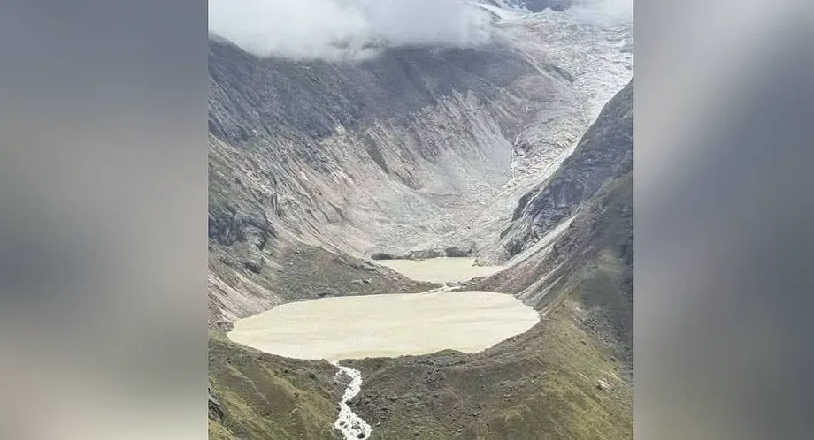
A mountain flood sends warnings across the border
A sudden flood from Sintaphu Lake in Bhutan's northern Gasa district on October 29, 2026, damaged the Gasa Tshachu hot springs complex, severed road access towards Laya and triggered evacuation measures affecting more than 10,000 people in neighbouring India. No deaths or injuries were reported in Bhutan, where the hot springs area had been evacuated before the water arrived.
Contents
- A mountain flood sends warnings across the border
- What happened near Laya and Gasa Tshachu?
- How much water was involved?
- How the flood reached India's river network
- Evacuations reached more than 10,000 people
- Why Bhutan kept watching a newly formed lake
- What makes a glacial lake burst?
- What regional assessments reveal
- What can reduce the danger?
- Key Points
Floodwater reached Taktsemakhang at about 8 p.m., then travelled through a river system connecting Bhutan's high mountains with the Sankosh River in India. West Bengal issued its highest warning level, a red alert, while Assam prepared for a possible rapid rise in river levels.
By October 30, the surge had passed through the Sankosh in West Bengal without major inundation. Residents who had spent the night in relief shelters began returning to their villages. Bhutan, however, continued monitoring a newly formed lake near the meeting point of two streams upstream.
The incident brought two immediate concerns into focus: damage to roads and public facilities in Bhutan, and the need to move people away from rivers far downstream before the size of the approaching flood was clear.
What happened near Laya and Gasa Tshachu?
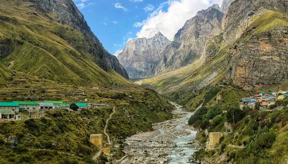
Sintaphu Lake, also spelled Shintaphu, lies below Wakila Mountain in Lungo, in Laya Gewog, an administrative area within Gasa district. Water escaping from the lake rushed into the Mo Chhu river system and damaged roads and bridges serving Laya, one of Bhutan's remote highland communities.
The Gasa Tshachu hot springs complex was washed away, and the Punakha-Gasa highway sustained damage. Sections of the road towards Laya were also swept away, leaving the route impassable and closed indefinitely. Losing that connection makes travel and the movement of supplies more difficult while repairs are arranged.
Two Bailey bridges may also have been washed away. These bridges are assembled from portable steel sections, allowing engineers to build crossings without constructing every component at the site. Their condition was initially uncertain because darkness and strong currents prevented a complete inspection.
Gasa Tshachu had suffered a damaging flood before. In 2021, the Mo Chhu changed course and swept through the hot springs area. The latest destruction adds to the repair burden at a destination already affected by the river's changing behaviour.
How much water was involved?
West Bengal's chief irrigation engineer said authorities had anticipated around 7.4 million cubic metres of water, using information from Bhutan's National Centre for Hydrology and Meteorology, or NCHM, passed through India's Central Water Commission. The International Centre for Integrated Mountain Development, known as ICIMOD, estimated that Sintaphu Lake held between 6 million and 7 million cubic metres before the outburst.
An early estimate also put the volume released at more than 7.4 million cubic metres. ICIMOD said the amount that actually escaped was still being assessed. The anticipated downstream volume, the lake's estimated contents and the measured release are different quantities, which explains why identifying what each number describes matters.
ICIMOD compared its estimate of the lake's contents with roughly 2,400 to 2,800 Olympic swimming pools. A cubic metre is 1,000 litres, so even the lower estimate represents about 6 billion litres of water stored high above inhabited valleys.
The immediate danger depends on how quickly that water escapes, the shape of the valley and the rocks and sediment it picks up. A concentrated surge can damage a bridge or road before spreading out farther downstream.
How the flood reached India's river network
Water from Sintaphu entered the Mo Chhu. At Punakha, that river joins the Pho Chhu to form the Punatsangchhu, which continues towards India and becomes the Sankosh. The connected rivers explain why an emergency beginning at a mountain lake required preparations across an international border.
Bhutan's NCHM monitored the Mo Chhu at Tashithang and informed India. The Indian Embassy in Bhutan also alerted Indian authorities, and the Central Water Commission issued an advisory on October 29 to the relevant authorities in West Bengal and Assam.
India's Ministry of Jal Shakti warned of a possible sudden rise in the Sankosh in West Bengal's Alipurduar district and Assam's Dhubri district. Authorities also monitored vulnerable areas in Assam's Kokrajhar district.
The main developments unfolded over two days:
- October 29, evening: Sintaphu Lake's outburst sent floodwater towards Taktsemakhang, where it arrived at about 8 p.m. and damaged transport links.
- October 29, night: Bhutan shared warnings with India, the Central Water Commission issued an advisory, and authorities began moving residents away from vulnerable riverbanks.
- October 30: No deaths or injuries were reported in Bhutan. Floodwater passed through West Bengal's Sankosh without major inundation, and some residents began returning from shelters.
- After the outburst: Bhutan's NCHM warned residents about a newly formed lake at Taktsemakhang and continued monitoring the river valleys.
Evacuations reached more than 10,000 people
West Bengal authorities ordered more than 10,000 people to move to safer ground in Alipurduar and Cooch Behar districts and vulnerable areas beside tributaries. More than 10,000 were also described as having been relocated in Alipurduar alone; a final district breakdown was not given.
Warnings covered settlements along the Sankosh in Kumargram, including Kumargram tea estate, Kumargram forest village, Pakriguri and Bholka. Residents in some riverbank villages left with their cattle, making the evacuation a matter of protecting livelihoods as well as lives.
Nisith Pramanik, identified as West Bengal's water resources investigation and development minister, urged people living beside the Sankosh and its tributaries to move away from the water:
Everyone living in the catchment areas of the Sankosh river and all its connected tributaries has been asked to move to a safe distance immediately to protect their lives.
India's National Disaster Response Force deployed personnel to vulnerable locations for assistance and rescue operations around the clock. Assam instructed Dhubri district officials to prepare for a rapid rise in river levels, while the chief minister's office said it was closely monitoring the situation.
Why Bhutan kept watching a newly formed lake
Bhutan's NCHM subsequently identified a newly formed lake at Taktsemakhang, close to the confluence of Sintaphu Chhu and Lungu Chhu, also called Gangchen Tag Chhu. Its advisory described the water body as an artificial lake.
The agency advised people along the Mo Chhu and Punatsangchhu valleys to remain vigilant and avoid riverbanks and areas prone to flooding. That warning continued after the first surge had moved downstream because conditions around the new lake still required observation.
Authorities had not announced its size, stability or likely drainage behaviour. The practical instruction for nearby communities was therefore straightforward: keep clear of exposed river margins while monitoring continued.
West Bengal's improving conditions and Bhutan's continuing vigilance reflected conditions at different points along the same river system. Residents returning from Indian shelters were responding to the passing surge, while Bhutanese authorities were also watching water newly stored upstream.
What makes a glacial lake burst?
A glacial lake outburst flood, usually shortened to GLOF, happens when water stored in a lake associated with a glacier suddenly escapes. Meltwater can gather in front of a glacier, on its surface or beneath it, depending on the terrain and the movement of the ice.
Some lakes are held back by ice. Others sit behind bedrock or a moraine, a natural accumulation of material left by a glacier. Moraines can contain sand, silt, gravel, pebbles and large boulders. Their strength and shape help determine how securely they retain water.
Heavy rain can increase the amount of water entering a lake. A landslide, rockfall or avalanche can plunge into it and push a wave over its barrier. Erosion or changes inside the barrier can also open a route for water to escape.
The escaping water may gather mud, stones and other debris as it descends. That mixture can strike roads, bridges, buildings and hydropower facilities with much greater force than a gradual rise in a river. The specific trigger of the Sintaphu outburst had not been identified.
What regional assessments reveal
ICIMOD's 2026 assessment found that glaciers across the Hindu Kush Himalaya lost around 12 per cent of their area and 9 per cent of their estimated ice reserves between 1990 and 2020. As glaciers retreat, meltwater can collect in newly exposed depressions or expand existing lakes.
A 2026 study in Natural Hazards and Earth System Sciences used an inventory of 2,574 glacial lakes in Bhutan, based on data from 2020. Researchers selected 278 for detailed flood modelling to examine potential exposure of buildings, roads and farmland downstream. That is about 11 per cent of the inventory, concentrating the modelling on a smaller group of lakes.
Sintaphu was identified as one of 17 potentially dangerous glacial lakes in Bhutan. Across the transboundary Koshi, Gandaki and Karnali basins, earlier ICIMOD and United Nations Development Programme assessments identified 47 major potentially dangerous lakes. Those numbers cover different geographical areas and assessment groups.
ICIMOD also cited 388 documented glacial lake outburst floods across the Hindu Kush Himalaya, including the Karakoram and the central and eastern Himalayas. India's Ministry of Home Affairs identified an outburst from South Lhonak Lake as the primary cause of the October 2023 Teesta surge, which caused substantial loss of life and damaged settlements, bridges and hydropower infrastructure.
What can reduce the danger?
India's National Disaster Management Authority recommends assessing potentially dangerous lakes by examining their size, natural barriers, surrounding glaciers and terrain. Satellite monitoring can track changes in water bodies and identify new lakes. Synthetic Aperture Radar, which uses radar signals to observe the ground, can support monitoring during the cloudy monsoon season.
For lakes assessed as particularly dangerous, possible engineering measures include controlled drainage, structures that regulate outlets, pumping, siphoning and drainage tunnels through natural barriers. The choice depends on the lake's physical conditions and the feasibility of carrying out work in difficult mountain terrain.
River gauges and warnings address the danger farther downstream. They help authorities decide when to close roads, prepare rescue teams and move people away from exposed settlements. The October 29 response depended on information moving from Bhutan's monitoring agencies to Indian authorities and then to communities.
Pema Gyamtsho, ICIMOD's director general, linked the response to the need for continuing observation and effective warnings:
The timely warnings issued by Bhutan's authorities illustrate the importance of sustained monitoring and effective early warning systems in reducing disaster risk,
Bhutan reported no deaths or injuries after evacuating the hot springs area, and West Bengal avoided major inundation as the surge passed. The remaining work included assessing damaged infrastructure, restoring the Laya route and monitoring the newly formed lake upstream.
Key Points
- Sintaphu Lake's October 29 outburst damaged Gasa Tshachu and roads in northern Bhutan.
- No deaths or injuries were reported in Bhutan; the hot springs area had been evacuated.
- Evacuation measures affected more than 10,000 people in West Bengal, while Assam prepared for rising rivers.
- The surge passed through West Bengal's Sankosh without major inundation by October 30.
- The Laya road remained closed indefinitely, and two Bailey bridges were feared washed away.
- Bhutan continued monitoring a newly formed lake at Taktsemakhang and advised residents to avoid vulnerable riverbanks.