
Sarawak and Sabah account for more than half of recorded landslides
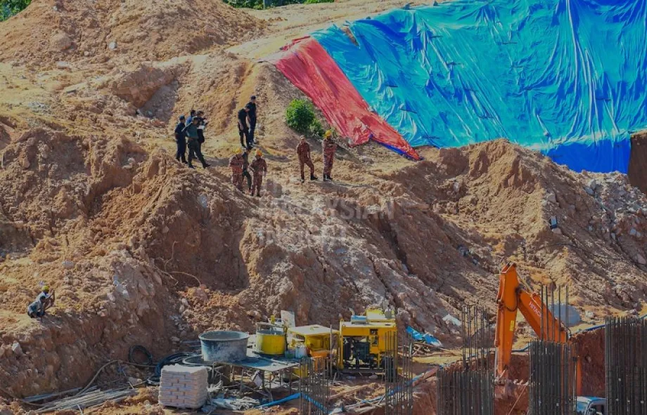
Malaysia has recorded 1,293 landslides since 2021 and identified 1,577 slopes in critical condition, according to Fire and Rescue Department director-general Datuk Seri Nor Hisham Mohammad. Prolonged rain during the Northeast Monsoon is increasing concern about slopes near homes, roads and essential infrastructure.
Contents
- Sarawak and Sabah account for more than half of recorded landslides
- What the annual figures show
- Which places face particular concern?
- How prolonged rain weakens a slope
- What the 34 warning systems do
- How mapping looks for danger before a collapse
- How agencies prepare for heavy rain
- Why damage can reach far beyond a hillside
- What residents should watch for
- Key Points
Sarawak recorded 508 incidents, followed by Sabah with 195 and Selangor with 176. Together, Sarawak and Sabah account for 703 incidents, or about 54.4 percent of the national total. Their concentration of cases places East Malaysia at the centre of the country's landslide preparedness efforts.
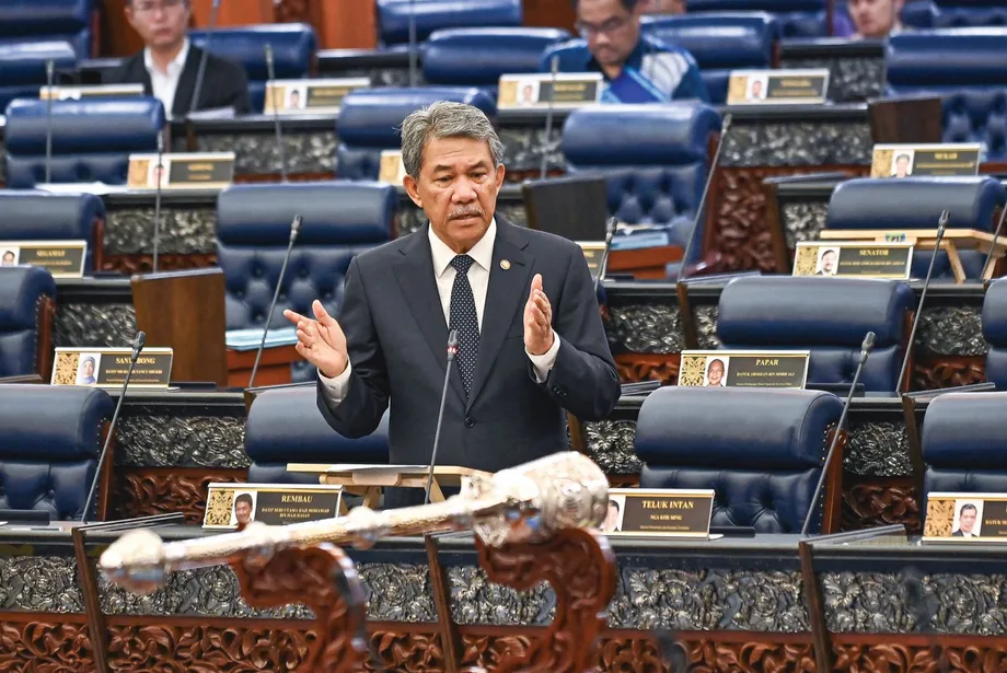
The warning comes alongside a wider government programme to identify unstable ground before it fails. Deputy Minister of Natural Resources and Environmental Sustainability Syed Ibrahim Syed Noh told the Dewan Rakyat on October 27 that the Minerals and Geoscience Department, known as JMG, had installed 34 early warning systems at slopes considered at high risk.
JMG's mapping of slope hazards and risks now covers nearly 3,000 square kilometres, including highland areas and Kundasang in Sabah. The work connects decisions about development and emergency preparations with information about terrain, rainfall and ground movement.
For residents, the immediate advice is practical: watch for new cracks, leaning trees or electricity poles, and changes in water flowing from hillsides. Leave promptly when authorities order an evacuation. For emergency agencies, the task is to turn maps and monitoring data into decisions about where to position rescuers before heavy rain makes access difficult.
What the annual figures show
Nor Hisham gave a figure of 314 landslides for 2025, the highest annual count in the sequence he described. Sarawak accounted for 127 of those cases and Sabah for 75, together making up 202 incidents, or about 64.3 percent of that year's stated total.
The annual figures trace repeated damage to communities and transport routes:
- 2021: 242 incidents, with exceptional December floods damaging infrastructure in Hulu Langat, Selangor, and Bentong, Pahang.
- 2022: 234 incidents, including the December 16 landslide at a campsite in Batang Kali that killed 31 people.
- 2023: 188 incidents, the lowest annual figure listed, including slope damage at the Malaysian Anti-Corruption Academy and Bukit Tunku in Kuala Lumpur.
- 2024: 231 incidents, with failures along routes in Ranau, Genting Highlands and Paya Terubong causing road closures and deaths.
- 2025: 314 incidents, including 127 in Sarawak and 75 in Sabah.
The 2025 figure is 83 higher than the 231 incidents recorded in 2024, an increase of about 35.9 percent. It is also 126 higher than the 2023 low of 188.
The published breakdown needs clarification. The five annual figures add up to 1,209, which is 84 below the headline total of 1,293. A further figure of 84 incidents is given for January to September 2025, a period that overlaps the stated annual total for 2025. A reconciled breakdown explaining how those figures fit together has not been provided.
Which places face particular concern?
The Fire and Rescue Department has coordinated data with JMG to identify dozens of locations at high risk. They include Hulu Langat, Ampang and Batang Kali in the Klang Valley, routes to Cameron Highlands, Paya Terubong in Penang and Kundasang in Sabah.
Nor Hisham, who heads the national fire and rescue service, linked vulnerability in these locations to hillside development:
The rapid pace of development on hillsides in these locations makes them highly vulnerable to fast-moving rainwater runoff during the monsoon season,
Hillside development changes both the shape of the ground and the route water takes downhill. Roads and buildings add weight, while cut slopes and drainage channels can concentrate flowing water in particular places. During prolonged rain, those changes can put extra pressure on already vulnerable ground.
The locations identified span residential districts, highland destinations and roads connecting communities. A failure can therefore threaten people directly while also blocking the routes needed to reach them.
How prolonged rain weakens a slope
Nor Hisham said prolonged heavy rainfall allows groundwater to accumulate, increasing pore water pressure and weakening soil cohesion until slopes give way. Pore water pressure is the pressure of water inside the small spaces between soil particles.
Soil remains on a slope partly because its particles resist sliding past one another. As water pressure builds between them, that resistance can fall. Ground that previously supported its own weight, vegetation or structures may then begin to move.
Surface runoff creates another problem. Water moving quickly downhill can carry soil away, while drains that cannot handle the volume may overflow. Water can then reach areas where it erodes the surface or seeps into the slope.
Nor Hisham identified changes in land use, hillside deforestation, mining and inadequate drainage as factors that can accelerate erosion. Cutting into hillsides for roads and development can disturb their natural stability. The weight of infrastructure and vibrations from heavy vehicles can also accelerate the formation of hidden cracks in embankments.
These processes connect maintenance above and below a slope. A blocked drain near the top can redirect water onto ground farther down, while a road cut can change how that ground supports the hillside above it.
What the 34 warning systems do
Syed Ibrahim said JMG's 34 early warning systems include monitoring equipment, sirens and warning lights. The equipment observes conditions at selected slopes, while the sirens and lights provide a way to alert people nearby.
The deputy minister described the installations during a parliamentary answer to Datuk Verdon Bahanda, the independent MP for Kudat, who asked about stronger disaster mapping and the use of technology to improve forecasts and warnings.
The warning installations serve a different purpose from the wider mapping programme. Mapping identifies areas where terrain and other conditions create danger. Equipment installed at a particular location helps track conditions there and supports a local warning response.
For a household near an unstable slope, the connection between monitoring and evacuation is crucial. Information about changing ground conditions becomes useful when it reaches residents and emergency teams early enough for them to act.
How mapping looks for danger before a collapse
JMG uses geographic information systems, remote sensing, satellite radar measurements and laser surveying to improve its maps. Together, these tools help officials examine terrain across large areas and study places where closer monitoring may be needed.
A geographic information system, or GIS, brings different layers of information onto a map. Terrain, geology and other data can then be considered together rather than kept in separate records.
Interferometric Synthetic Aperture Radar, known as InSAR, compares radar observations to detect changes in ground position. Light Detection and Ranging, or LiDAR, uses laser measurements to produce detailed information about the shape of the land. Both can help reveal features that are difficult to assess from an ordinary map.
Syed Ibrahim said information is shared through the Malaysia Minerals and Geoscience Geospatial Information System, known as MyGEMS, and the National Terrain and Slope Information System, or NaSIS. Those platforms support the exchange of information needed for disaster risk assessments.
JMG has also developed GeoSlide, an analytics system that uses rainfall and geological data to support landslide risk assessment. Bringing those inputs together helps authorities consider both the condition of the ground and the rain affecting it.
How agencies prepare for heavy rain
The Fire and Rescue Department is working with the National Disaster Management Agency, known as NADMA, and technical agencies to strengthen preparations in vulnerable areas. Hazard maps guide the positioning of rescue resources near areas marked as red zones before heavy rain warnings are issued.
Those resources include K9 search units and the Special Malaysia Disaster Assistance and Rescue Team, known as SMART. Positioning teams and equipment closer to vulnerable locations can reduce the distance they must travel when a collapse blocks roads or damages access routes.
Nor Hisham described how the agencies divide their monitoring responsibilities:
MetMalaysia provides continuous weather warnings, JMG supplies geological and ground-movement data, while JKR monitors the technical integrity of road structures and slopes.
All this integrated data acts as a compass for rescue teams in planning safer and faster search and rescue (SAR) operations,
MetMalaysia is also strengthening its forecasting through weather radar, satellites and observation stations. Syed Ibrahim said its capabilities include high performance computing, artificial intelligence and the Radar Integration Nowcasting System, which supports detailed forecasts of approaching rain.
Why damage can reach far beyond a hillside
Sabah's September 2025 emergency showed how a slope failure can disrupt communities far from the point of collapse. A landslide near Kampung Sarapung in Penampang brought down an electricity transmission tower on September 13, affecting about 230,000 consumer accounts at the peak of the outage.
The Sabah transmission tower collapse damaged Tower 5 on the 275 kV Kolopis to Segaliud corridor. The connection carries electricity from generating centres on the west coast to communities and businesses in the east.
Sandakan, Lahad Datu, Kinabatangan, Kunak, Semporna and Beluran experienced the main disruption. Heavy rain, blocked roads and unstable ground complicated emergency work. The incident brought together several pressures at once: rescue operations, damaged electricity infrastructure and households waiting for essential services to recover.
That experience gives a concrete reason for monitoring roads, slopes and infrastructure together. A vulnerable hillside beside an important transmission route or access road can affect a much wider area when it fails.
What residents should watch for
Nor Hisham urged residents in vulnerable areas to watch for new cracks in floors or walls, trees and electricity poles beginning to lean, and sudden changes in the colour of water flowing from hillsides or drains. These are signs that ground conditions may be changing.
Water discolouration can reflect soil being carried into the flow. Leaning objects and new cracks can indicate movement in the ground supporting them. During prolonged rain, such changes deserve immediate attention because slopes may continue weakening as water accumulates.
Nor Hisham's advice to people near steep slopes was direct:
Most importantly, stay away from steep slopes during prolonged rainfall and comply immediately with evacuation orders from the authorities without waiting for the situation to worsen,
Residents facing an evacuation order should leave promptly. The same rain that weakens a hillside can also obstruct roads and make rescue access more difficult, reducing the time available to move safely.
Key Points
- Malaysia's fire and rescue chief reported 1,293 landslides since 2021 and 1,577 slopes in critical condition.
- Sarawak recorded 508 incidents, Sabah 195 and Selangor 176.
- The annual breakdown totals 1,209 incidents and needs reconciliation with the headline figure.
- JMG has installed 34 early warning systems and mapped slope hazards and risks across nearly 3,000 square kilometres.
- Authorities are combining weather, geological and infrastructure data to guide monitoring and rescue preparations.
- Residents should watch for ground movement, avoid steep slopes during prolonged rain and obey evacuation orders immediately.