A vanished sea sends dust toward distant mountains
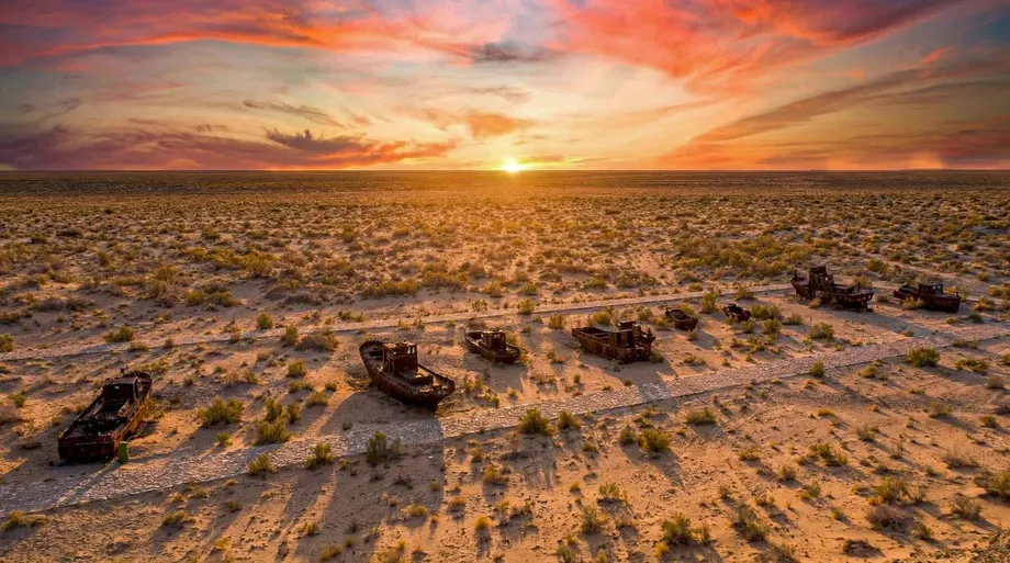
More than 100 million tonnes of dust and salt rise each year from the Aralkum Desert, the exposed bed of the shrinking Aral Sea, according to the Food and Agriculture Organization of the United Nations in The State of the World's Forests 2026. The desert covers more than 5.5 million hectares between Kazakhstan and Uzbekistan, creating an environmental problem that stretches far beyond the former shoreline.
Contents
- A vanished sea sends dust toward distant mountains
- How irrigation created a new desert
- What the dust figures tell us
- Why Tajikistan's glaciers are part of the story
- A planting campaign across the former seabed
- How the effort developed
- Nurseries, water and survival on salty ground
- Restoring land while managing the remaining water
- Key Points
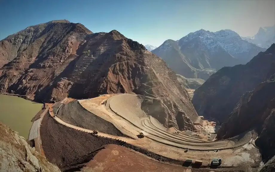
Winds can carry particles from the Aral region into Tajikistan's upper Zeravshan Valley and toward its glaciers. Scientist Abdulhamid Qayumov warned in November 2024 that airborne particles could travel as far as the Eastern Pamirs. Dust deposited on glacier surfaces contributes to faster melting, connecting the loss of a lowland sea with pressure on distant mountain ice.
The annual emissions estimate cited by FAO comes from the Regional Strategy for the Management of Sand and Dust Storms in Central Asia for 2021–2030, published in 2021. It describes an enormous continuing movement of material from land that was once underwater. Salt deposits on the former seabed also contain residues of pesticides, herbicides and fertilizers used in agriculture.
Kazakhstan is trying to hold part of that surface in place with vegetation. Figures attributed to its Ministry of Ecology and Natural Resources describe more than 56 million saxaul seedlings planted over six years, alongside extensive seed sowing. The effort has reached roughly 1.117 million hectares, although establishing vegetation that survives the desert's heat, salt and wind takes years.
How irrigation created a new desert
The Aral Sea once received water from the Amu Darya and Syr Darya rivers. Large diversions for irrigation, especially cotton cultivation, deprived it of much of that supply. FAO identifies excessive water withdrawal for irrigation as a major cause of degradation across the Aral Sea basin, with climate change worsening the damage.
The scale of the retreat is visible in figures attributed to France's space agency, CNES: the sea's surface fell from about 66,460 square kilometers in 1960 to about 7,300 square kilometers in the comparison presented. That is a loss of roughly 89%, commonly rounded to 90%, or about 59,000 square kilometers of water surface.
As water receded, sediments that had rested beneath the sea became exposed to the air. Those sediments contain salts, along with agricultural chemicals carried into the basin. Wind can lift loose particles from this surface and move them across national borders.
The resulting desert is not uniform. Salt flats, dunes, recently exposed ground and areas with different amounts of moisture make up a changing landscape. FAO's figure of more than 5.5 million hectares equals more than 55,000 square kilometers. Other published estimates put the Aralkum at about 27,000 square kilometers or nearly 60,000 square kilometers, depending on whether still moist exposed soils and the margins of the northern Aral are included.
What the dust figures tell us
FAO's estimate of more than 100 million tonnes annually provides the central measure of the problem. Other published calculations range from about 43 million tonnes to between 100 million and 150 million tonnes a year. Measuring material lifted from thousands of square kilometers is difficult, and estimates depend on how the emitting area and movement of particles are assessed.
The material is a mixture of dust and salts. Agricultural residues within seabed deposits add another concern because wind can move those substances along with the mineral particles. The total emissions figure measures the mass being carried away; the concentration of individual chemicals varies within that material.
For communities across Central Asia, the practical issue is that exposed land can remain a source of repeated storms. A large storm does not remove the entire supply of loose material. Until vegetation becomes established or surface conditions change, later winds can lift more dust from the same broad landscape.
The Aralkum also operates within a wider network of desert dust sources. The Karakum and Kyzylkum deserts are identified alongside the dried Aral seabed as sources of sand and dust storms threatening Tajikistan's environment.
Why Tajikistan's glaciers are part of the story
Tajikistan's upper Zeravshan Valley is one of the places that dust from the Aral region can reach. Qayumov's November 2024 comments extended the concern to the Eastern Pamirs, illustrating how particles released from the former sea can travel into high mountain environments.
Glaciers are large bodies of ice that accumulate snow and lose ice through melting and other processes. A clean, bright snow surface reflects much of the sunlight that reaches it. Dust can darken that surface, allowing it to absorb more solar energy and helping the snow or ice melt faster.
Qayumov described dust, including particles containing salt, settling on glaciers and accelerating melting. FAO places glacier conservation among the measures needed to address the consequences of the Aral Sea disaster. The mountain concern therefore sits alongside the more immediate task of stabilizing exposed land.
No figure is given for how much Aralkum material reaches Tajikistan's glaciers each year or how much glacier loss is attributable to it. The findings identify a route of environmental pressure, while the size of that contribution still needs measurement.
A planting campaign across the former seabed
Kazakhstan's response centers on saxaul, a desert shrub in the genus Haloxylon. It can tolerate arid conditions and saline soils, making it suitable for places where many other plants struggle. Its deep roots help bind loose sand, while vegetation reduces wind exposure at the ground surface.
In 2021, Kazakhstan's head of state directed officials to expand saxaul plantations on the dried seabed to between 1 million and 1.1 million hectares. Ministry figures now describe reclamation across approximately 1.117 million hectares, with more than 56 million seedlings planted over six years.
Workers have also sown more than 3,440 tonnes of saxaul and halophyte seeds. Halophytes are plants adapted to salty conditions. Using both seeds and seedlings gives the program different ways to establish vegetation across land where soil and moisture conditions vary.
The reported reclamation area is equivalent to roughly one fifth of the 5.5 million hectare desert figure cited by FAO. The comparison shows the scale of the work, although the planting program is in Kazakhstan and the wider Aralkum extends across Kazakhstan and Uzbekistan. Reclamation totals also describe land treated, while durable protection depends on plants surviving and growing.
How the effort developed
Kazakhstan's annual figures show an uneven pace of reclamation, with the largest area recorded in 2025. The broader chronology also includes an earlier effort to preserve water in the northern Aral and the later warning about dust reaching mountain ice.
- 2005: The Kok-Aral dam was built to help retain water in the northern Aral Sea.
- 2006: Fishing reportedly resumed in the northern Aral following the dam's construction.
- 2021: Kazakhstan directed the expansion of saxaul plantations, and reclamation covered 101,100 hectares. The regional dust storm strategy for 2021–2030 was also published that year.
- 2022: Reclamation covered 250,000 hectares.
- 2023: Reclamation covered 193,400 hectares.
- 2024: Reclamation covered 127,000 hectares. In November, Qayumov warned that airborne particles could reach the Eastern Pamirs.
- 2025: Reclamation reached 330,000 hectares, the largest annual area in the figures given.
- 2026: A further 116,000 hectares were recorded, while FAO's forest report drew attention to the desert's dust and salt emissions.
The 330,000 hectares treated in 2025 amounted to about three tenths of the six year total. Annual planting activity can therefore change substantially, making continued care and survival monitoring important alongside the area recorded each year.
Nurseries, water and survival on salty ground
FAO identifies several practical barriers to restoration: saline soils, shortages of seeds and seedlings, limited nursery capacity, too few specialists and inadequate monitoring resources. Planting across a large area requires a steady supply of suitable plants as well as knowledge of where they can survive.
Kazakhstan has constructed a nursery covering 33 hectares with capacity to grow up to 3 million seedlings annually. A second nursery is being developed directly on the dried seabed, where modular container units have been installed and a well has been drilled to a depth of 500 meters.
The well supplies warm, nearly fresh water at 9 liters per second. Growing seedlings under local Aral conditions is intended to produce plants better suited to the climate they will face after transplantation. Water supply is especially valuable in a place where low moisture limits plant establishment.
The Kazakh Research Institute of Forestry and Agroforestry has also established a local branch, with two researchers working at the dried seabed. Their presence provides scientific support for decisions about reclamation in a landscape exposed to high winds, intense summer heat and saline soil.
Saxaul takes years to develop into stable stands, even under favorable conditions. The central test is whether seedlings and germinating seeds become lasting vegetation. A planted area can begin the process, but roots, mature shrubs and continuing growth provide the protection against erosion.
Restoring land while managing the remaining water
The northern Aral offers an example of a different kind of intervention. The Kok-Aral dam, completed in 2005, helped retain water in the smaller northern basin, and fishing reportedly resumed in 2006. The southern sea remains in a much more difficult condition, with its eastern basin nearly dry.
Water retention and seabed planting address different parts of the disaster. Retaining water supports an aquatic environment in the north. Establishing shrubs on exposed ground aims to reduce erosion and the release of dust from land that has already dried.
FAO calls for cooperation among Central Asian countries through vegetation restoration, coordinated land and water management, and glacier conservation. The connection is concrete: irrigation withdrawals affect how much water reaches the basin, exposed sediments supply dust, and winds carry some of that material toward other countries.
Kazakhstan's nurseries and plantations tackle part of the problem at its source. Regional coordination is needed because the rivers, dust pathways and mountain environments cross national boundaries. The strategy cited by FAO runs through 2030, providing an existing period for joint work rather than a newly announced deadline.
The immediate priorities are closely connected: keep more exposed soil in place, build the capacity to grow plants that survive, monitor results and manage water across the basin. The northern sea's partial recovery and the planting campaign show different responses already in use, while the scale of the exposed seabed explains why sustained work is necessary.
Key Points
- FAO cites annual Aralkum emissions of more than 100 million tonnes of dust and salt, using an estimate from the regional strategy published in 2021.
- The desert covers more than 5.5 million hectares of former Aral Sea bed between Kazakhstan and Uzbekistan.
- Dust can reach Tajikistan's upper Zeravshan Valley and mountain environments, including the Eastern Pamirs.
- Kazakhstan reports more than 56 million saxaul seedlings planted and roughly 1.117 million hectares reclaimed over six years.
- Salty soil, limited moisture, nursery shortages and insufficient monitoring complicate restoration.
- FAO recommends coordinated vegetation restoration, land and water management, and glacier conservation across Central Asia.