Fishing Boats Would Help Map Taiwan's Coastal Defenses
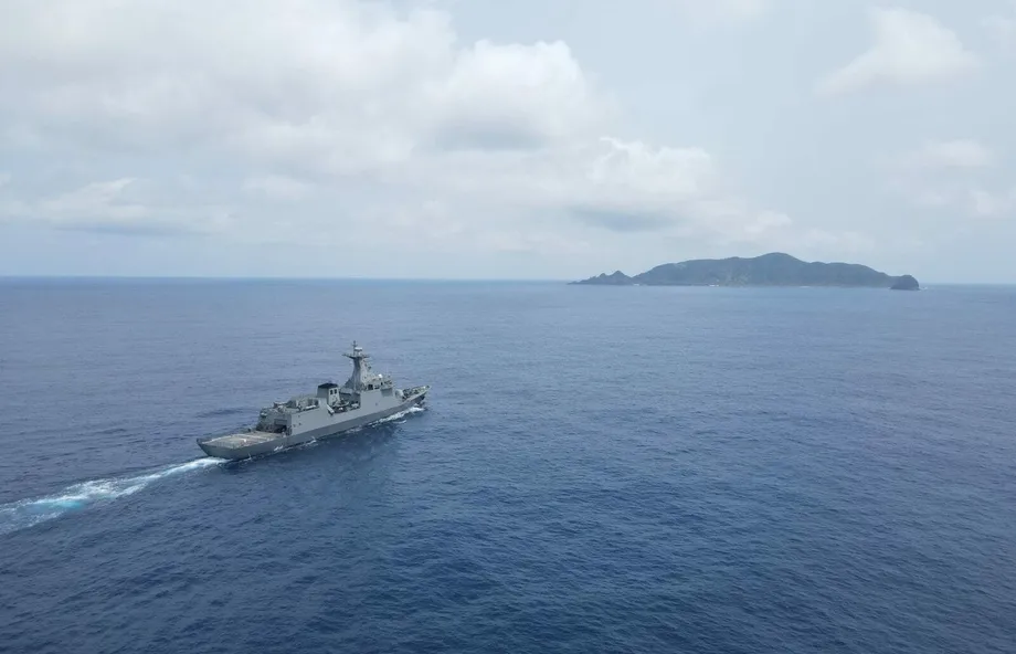
Taiwan's military plans to hire civilian fishing boats and aircraft to map potential Chinese invasion beaches, using commercial sensors to survey shallow water that larger naval vessels cannot reach. The proposed work would cover stretches of coast including Zhuwei in Taoyuan, Wazihwei in New Taipei City's Bali District and Sishu in Tainan.
Contents
- Fishing Boats Would Help Map Taiwan's Coastal Defenses
- Which Beaches Would Be Surveyed?
- Seasonal Changes Make Old Measurements Less Useful
- Sound Below the Water, Lasers Above It
- How the Maps Would Support Defensive Planning
- Military Units Would Keep the Sensitive Analysis
- A Larger Role for Commercial Technology
- Key Points
The Ministry of National Defense's Defense Innovation Division would manage the initiative. Private survey companies would gather measurements at sea and from the air, while military units would combine them into detailed three dimensional maps for planning defenses against amphibious landings, in which troops approach the shore from the sea.
The boats would concentrate on coastal water up to 3 meters deep. Aircraft would measure beach terrain and, where equipment and water conditions allow, features beneath the surface. Together, the surveys would help planners understand the transition from seabed to beach, an area that landing vessels and amphibious vehicles would have to cross.
A senior military official, speaking anonymously, described the approach as a first for the navy and said it could gather information about coastal operating conditions dozens of times faster than previous methods. The proposed division of work would leave civilian contractors responsible for collecting measurements and the military responsible for turning them into operational plans.
Which Beaches Would Be Surveyed?
Taiwanese defense planners use the term "red beaches" for coastal locations considered suitable for a Chinese amphibious assault. Assessments attributed to the defense ministry, US think tanks and Taiwan's Institute for National Defense and Security Research put the number of potential landing sites at roughly four to 20.
The range reflects different assessments of potential landing locations. Zhuwei and Wazihwei are among the northern sites named, while Sishu is in the southwestern city of Tainan. Their inclusion gives the proposed survey effort a geographic reach beyond a single stretch of coast.
Planners have also expanded the concept to include "composite red beaches," where port facilities sit alongside environments suitable for airborne operations. Such locations require an assessment of several connected features: access from the sea, usable shore terrain, port infrastructure and areas where forces might arrive by air.
The planned maps would bring those adjoining environments into a common geographic picture. For military planners, the practical task is to understand how an approach through shallow water connects with the ground immediately beyond the shoreline.
Seasonal Changes Make Old Measurements Less Useful
The navy's 192nd and 151st fleets previously gathered hydrographic information during training exercises. Hydrographic surveying measures water depth and underwater features, helping users understand the shape of the seabed and conditions affecting movement through the water.
Taiwan's nearshore environment changes with the seasons and with typhoons. Those changes can alter the shape of shallow seabeds, making the frequency of surveys important. A chart records conditions when measurements were taken; planners need refreshed measurements when the coast changes.
Traditional naval survey vessels have faced limits in flexibility, frequency and access to very shallow water. The proposed use of smaller civilian boats addresses the access problem, while private survey companies and commercial equipment would add capacity for collecting detailed measurements.
The change would also move some data collection beyond information gathered during fleet exercises. Dedicated survey work would give the military another way to update its picture of coastal terrain, with naval units retaining responsibility for interpreting the results.
Sound Below the Water, Lasers Above It
Fishing boats would carry multibeam echo sounders, instruments that send sound pulses into the water and measure their return from the seabed. By taking many measurements across a swath beneath the vessel, the equipment can build a detailed picture of underwater slopes, channels and other features.
The proposed survey area includes the surf zone, described as water from the shoreline to about 3 meters deep. Small boats would work in this shallow environment, where larger survey vessels cannot operate. The resulting bathymetric data, meaning measurements of underwater depth and shape, would contain closely spaced measurement points.
Chartered aircraft would carry light detection and ranging equipment, usually called LiDAR. These instruments send laser pulses toward the ground and calculate distances from the returning signals. Suitable systems can also measure shallow underwater terrain when water clarity and other conditions permit.
The two methods would provide complementary views. Boats would measure the seabed from the water, while aircraft would cover beach terrain and suitable shallow areas from above. Military staff would then join the measurements into models showing the land and adjoining seabed together.
That joining process matters because a landing route crosses both environments. A detailed underwater chart and a separate beach map become more useful for planning when their measurements line up accurately across the shoreline.
How the Maps Would Support Defensive Planning
Military planners would use the finished models to assess possible landing routes and identify locations for defensive mines and obstacles. The anonymous senior official described deep channels as potential locations for mines and reefs as places where obstacles could help block approaching forces.
The terrain measurements would help planners examine routes available to ships, amphibious vehicles and hovercraft. Each would approach the coast through a physical environment shaped by water depth, seabed features and the beach itself.
For a simple comparison, a road map shows how streets connect, while a terrain map also shows slopes and barriers. The proposed coastal models would serve a similar purpose at the water's edge, helping military units see where movement could be easier and where defenses could make it harder.
Surveying would provide the geographic foundation for those decisions. Choosing defensive positions would remain a military task, carried out after specialists had checked and combined the measurements. The collection of raw data and the planning of mine or obstacle locations would take place at different stages.
Military Units Would Keep the Sensitive Analysis
Civilian involvement would expand the number of companies, crews and data handlers participating in coastal surveys. The security arrangement described by the senior military official separates their collection work from the military's analysis and planning.
Contractors would gather raw physical measurements. Military units, including the Naval Meteorological and Oceanographic Office, would handle noise removal, data integration, tactical analysis and the planning of coordinates for defenses against landings.
Noise removal means identifying and reducing unwanted signals or measurement errors. Data integration means bringing different sets of measurements into one consistent model. Both steps are needed before planners can reliably connect survey results with decisions about where to place defenses.
The arrangement would keep the final operational interpretation inside military units. Civilian crews would supply measurements of the physical environment; military specialists would connect that information with defensive requirements and specific locations.
The security challenge extends across that workflow, from collection to transfer and processing. Keeping tactical planning within the military creates a defined division of responsibility, while the handling of survey files remains part of the project that requires protection.
A Larger Role for Commercial Technology
The initiative would use commercial off the shelf technology, often shortened to COTS. In plain language, that means equipment already available commercially rather than a new system developed exclusively for the armed forces. Multibeam echo sounders and airborne laser scanning would be applied to a military mapping requirement.
The senior military official linked the approach to the example of the US Defense Innovation Unit, which connects military needs with commercial technology. In Taiwan's proposed project, the immediate purpose is practical: use private surveying capacity and smaller platforms to collect coastal information more quickly.
The official's estimate of collection speeds dozens of times faster than before is the clearest stated performance expectation. No public budget, contract award, survey start date, completion deadline or fixed update schedule was specified in the descriptions of the plan.
For survey companies and participating crews, the proposed role would be measurement rather than military planning. For naval specialists, the additional data would create work in checking quality, combining surveys and updating the geographic information used in coastal defense decisions.
The central change would be how Taiwan obtains knowledge of its own shoreline. Instead of relying solely on naval vessels, the military would draw on civilian boats, aircraft and established sensors, then retain control of the analysis that turns those measurements into defense plans.
Key Points
- Taiwan plans to hire civilian survey companies, fishing boats and aircraft to map potential Chinese landing sites.
- Named locations include Zhuwei in Taoyuan, Wazihwei in New Taipei City and Sishu in Tainan.
- Boats would use multibeam echo sounders in water up to 3 meters deep, while aircraft would conduct complementary laser surveys.
- Military units would combine the measurements into maps supporting decisions about landing routes, defensive mines and obstacles.
- Civilian contractors would collect raw data, while military specialists would retain processing and tactical planning responsibilities.
- An anonymous senior military official projected much faster data collection, but no budget or implementation timetable was specified.