A rice surplus has not yet stopped forest clearing
Indonesia produced 34.71 million tonnes of rice in 2025 against demand of 31.19 million tonnes, a surplus of 3.52 million tonnes. That achievement now underpins a major policy announcement: the government says it no longer needs the 2 million hectares previously planned for food production. Yet officials have not confirmed whether clearing, plantation development and road construction already underway in South Papua and Kalimantan will stop.
Contents
- A rice surplus has not yet stopped forest clearing
- What the forestry map actually permits
- The national plan still reserves space for food and energy
- How the decisions unfolded
- Satellite records show what has already been lost
- A road can keep expansion moving
- Rice is only part of the plantation programme
- Forest status and degraded land need precise definitions
- Communities want decrees changed, not another speech
- Key Points
Speaking in Jakarta on October 6, 2026, Hashim Djojohadikusumo, the presidential special envoy for climate and energy, said Indonesia had reached rice self sufficiency three years before its 2029 target.
"The government sees no further need for expanding rice cultivation areas in the so-called forest areas and forest zones that were announced a few years ago," Hashim said.
Mari Pangestu, the presidential special envoy for multilateralism and international trade and deputy chair of the National Economic Council, said future food and biofuel production would instead use degraded land. She put the potential supply of that land at more than 12 million hectares.
The distinction between a policy announcement and a binding halt matters immediately. Satellite monitoring has documented tens of thousands of hectares cleared for rice and sugarcane in South Papua. Existing decrees still support forest use, changes to land status and infrastructure serving much larger plantation plans.
Forestry Ministry spokesperson Ristianto Pribadi said the Agriculture Ministry and other agencies must clarify the position on ongoing work in South Papua and Central Kalimantan.
"Therefore, we cannot yet say that all activities in the two regions will automatically stop, nor confirm when they will stop," he said.
The unresolved issue is therefore broader than whether Indonesia needs more rice fields. It is whether the new direction changes the legal permissions, budgets and construction decisions that continue to make forest conversion possible.
What the forestry map actually permits
Only 12 days before the announcement, the Forestry Ministry published a statement describing approximately 5.67 million hectares as potentially eligible for forest business permits under its 2026 Forest Utilization Direction Map, known as PAPH. The map was established through Forestry Ministerial Decree No. 7253 of 2026.
The ministry's forest utilization statement, dated September 24, describes uses extending beyond timber to food security, energy, other forest products and environmental services. Eligibility to apply for a permit is not the same as approval to clear the entire area.
The allocations include 387,641 hectares for aren, or sugar palm, as a bioenergy crop; 68,454 hectares for agroforestry involving rice, maize, soybeans, coffee and cocoa; and 902,298 hectares for forest and land rehabilitation. Agroforestry combines trees with crops or other agricultural activities rather than necessarily replacing trees with open fields.
Forestry official C. Hendro Widjanarko said aren should not be planted as a single crop plantation and can grow beneath approximately 50% forest cover. The ministry presents this approach as a way to produce energy while retaining forest.
It also says about 1.33 million hectares of protection forest and 1.37 million hectares of production forest within the moratorium area are restricted to activities that do not change the landscape. Together, those figures total about 2.70 million hectares, or approximately 48% of the 5.67 million hectares. That arithmetic does not match the statement's description of the allocation as nearly one quarter of the total.
These restrictions make it inaccurate to describe all 5.67 million hectares as designated for agricultural clearing. Nevertheless, the map keeps food and energy production within the forestry licensing framework. The government has not explained which allocations, if any, must change following Hashim's announcement.
The national plan still reserves space for food and energy
A wider policy framework also remains in place. Forestry Ministerial Regulation No. 8 of 2026, adopted on April 21, establishes the revised National Forestry Plan for 2011–2030. It guides forest management, indicative maps, business plans and coordination between sectors.
The plan anticipates growing demand for forest space from development and strategic programmes, including food and energy security. It identifies 20.62 million hectares for support to food and energy production, split between 16.35 million hectares under primary spatial allocations and 4.27 million hectares under a shared use approach.
These planning categories are not an instruction to clear 20.62 million hectares. They describe where different activities may be considered and under what management arrangements. The shared use approach allows activities to occupy the same space while, the regulation says, retaining the main forest function.
Still, the eligibility criteria extend beyond previously cleared farmland. They include low density secondary forest below 1,000 metres on land without peat, alongside scrub, swamp scrub, existing agricultural land and certain plantations. Secondary forest is forest that has regrown or been disturbed, not necessarily land without ecological value.
The plan estimates that 7.97 million hectares of the legally designated forest area could potentially be released by 2030 for several purposes, including national strategic projects, food estates, land reform and spatial planning changes. That is a planning estimate covering multiple sectors, not a forecast of agricultural deforestation alone.
There is also a route consistent with the new announcement. The regulation prioritizes improving existing irrigated rice fields as a relatively quick and inexpensive way to increase production. It discourages expanding food crops on deep peat because of environmental damage, high costs and poor expected returns.
The central policy test is whether the government now strengthens those priorities and narrows expansion provisions, or leaves both operating side by side.
How the decisions unfolded
The Papua programme began under former president Joko Widodo and expanded under President Prabowo Subianto. Its reach extends beyond Merauke into Boven Digoel, Mappi and Asmat. The following dates show how physical development and legal decisions preceded the latest announcement.
- 2024: Major clearing for the renewed Merauke food and energy programme accelerated. Infrastructure operations in Wanam and Wogikel began in August.
- May 2025: The government reported a successful rice harvest on a four hectare plot in Wanam and Wogikel.
- June 2025: Nusantara Atlas monitoring recorded 22,272 hectares of natural ecosystems cleared for the Merauke national strategic project since January 2024.
- 2025: Forestry Ministerial Decree No. 591 reclassified 486,939 hectares in Merauke, Boven Digoel and Mappi as land outside the Forest Estate.
- April 21, 2026: The revised National Forestry Plan was adopted.
- September 24, 2026: The Forestry Ministry announced the 5.67 million hectare PAPH permit eligibility map.
- October 6, 2026: Hashim and Mari announced that further food and biofuel production would shift away from forest expansion.
- October 8, 2026: Solidaritas Merauke called for binding measures to halt the South Papua projects.
No date has been announced for a decision on stopping existing operations. Preparation of PAPH 2027 is scheduled to begin in December 2026, providing a specific opportunity to bring the permit map into line with the new direction.
Satellite records show what has already been lost
David Gaveau's July 28, 2025 Nusantara Atlas analysis recorded 22,272 hectares of natural ecosystem conversion linked to the Merauke national strategic project from January 2024 through June 2025. Of that total, 9,835 hectares were forest. The remainder included Melaleuca swamp vegetation, wooded savanna and grassland.
This distinction is essential. A figure for all natural ecosystems cleared measures something different from a figure limited to primary forest loss. The analysis estimated Papua's primary forest loss at approximately 25,300 hectares in 2024, with the Merauke project accounting for 5,936 hectares, or about 24%.
More recent TheTreeMap monitoring puts clearing for rice in Wanam and Wogikel at about 11,500 hectares of wetlands and sugarcane clearing at about 40,000 hectares, mainly in primary forests and savannas near Papua New Guinea. Mighty Earth separately reports more than 50,000 hectares cleared for rice and sugarcane since 2024.
Solidaritas Merauke gives a total of 49,787 hectares cleared or deforested for the South Papua strategic projects since 2024. Walhi estimates that about 40,000 hectares of natural forest had been cleared by early July 2026, while Forest Watch Indonesia gives approximately 17,900 hectares of deforestation during 2024–2025.
Those estimates should not be added together. They cover overlapping territory, different periods and different categories of vegetation. The accounts do not establish a single reconciled total.
Project boundaries also differ. Greenpeace's analysis of government maps puts the broader project at about 2.7 million hectares. Walhi describes a 2.32 million hectare food and energy project, while the July 2025 Nusantara Atlas analysis describes targets of up to 1 million hectares for rice and 2 million hectares for sugarcane. A separate account puts the New Guinea scheme at roughly 7 million acres and a similar Borneo scheme at about 3 million acres. None should be treated as an exact substitute for another without matching the boundaries.
A road can keep expansion moving
The 135 kilometre Wanam–Muting access road is intended to support up to 1 million hectares of planned rice fields. Its importance extends beyond rice because improved access can also serve sugarcane, oil palm and settlement development.
Nusantara Atlas reported that 40 kilometres had been built by June 2025. Later satellite imagery described by Gaveau shows the full corridor opened, although it remains unpaved. At least one oil palm concession has constructed feeder roads connecting to it. These observations reflect different stages of development, rather than necessarily conflicting accounts.
The planned route ends about one kilometre from the Danau Bian protected area. The July 2025 analysis warned that roads through seasonally flooded wetlands can alter drainage and fire conditions while opening access to remote ecosystems. Connections with the existing MIFEE road and a possible connection to the Trans-Papua Highway could widen that access further.
Greenpeace estimated nearly 7,600 hectares of deforestation associated with road construction as of February. An investigation found that the Defense Ministry prepared the environmental impact assessment after construction was already approximately one third complete.
Indigenous communities challenged the project, alleging that clearing began without their consent and environmental approval. The Jayapura State Administrative Court rejected their lawsuit in September. The rejection does not resolve the separate policy question of whether construction should continue under the new government direction.
No public decision has been specified on paving, additional feeder roads or the future of land already cleared but not planted.
Rice is only part of the plantation programme
South Papua's food estate now includes sugarcane, oil palm and livestock alongside rice. Greenpeace identified 10 companies holding sugarcane concessions covering approximately 560,000 hectares in Merauke. The July 2025 Nusantara Atlas analysis described nine proposed strategic sugarcane concessions, two of which were then being developed. The counts differ and have not been reconciled.
The analysis recorded 11,751 hectares cleared by PT Global Papua Abadi between January 2024 and June 2025, including 4,404 hectares of primary evergreen forest and 7,347 hectares of wooded savanna. PT Murni Nusantara Mandiri cleared another 1,340 hectares during that period. These observations show that substantial development was already taking place for sugarcane, independently of rice cultivation.
Hashim said biofuels remain necessary to reduce imported fuel dependence. Indonesia also plans to increase the ethanol content of gasoline to 20% within five years. Sugarcane is a feedstock for ethanol, while palm oil supplies biodiesel.
An NGO coalition estimates that implementing the B50 biodiesel mandate, a blend containing 50% biodiesel, could require an additional 5.36 million hectares of oil palm plantations by 2039, with potential deforestation of 1.5 million hectares. Those are scenario estimates, not approved clearing totals.
Ending new rice expansion would therefore not automatically remove pressure for sugarcane or oil palm. The government has yet to explain whether existing concessions will be cancelled, restricted, moved or allowed to continue.
Forest status and degraded land need precise definitions
Two definitions could determine how much protection the announcement provides. The first is whether forest means the ecosystem on the ground or the legally designated Forest Estate, known as Kawasan Hutan.
Decree No. 591 of 2025 moved 486,939 hectares into APL, the category for land outside the Forest Estate. TheTreeMap estimates that nearly 300,000 hectares of primary forest remain within that area. Walhi gives a different estimate of 265,208 hectares of natural forest. The figures use different descriptions and have not been reconciled.
Changing legal status does not remove trees. APL land is no longer governed as Forest Estate under the Forestry Law, although environmental and land use requirements still apply. Unless the commitment protects actual ecosystems as well as legal forest areas, reclassified forest could remain exposed to conversion.
The second definition concerns degraded land. Merauke's TransFly landscape contains natural grasslands, wooded savannas and Melaleuca swamp forests. Low tree cover does not by itself mean an ecosystem has been damaged or abandoned.
WRI Indonesia identified 9.72 million hectares of degraded but productive land outside peat areas, yet found less than 10% suitable for large agricultural operations. That means less than 972,000 hectares met that suitability category. About 4.1 million hectares were better suited to farms smaller than 100 hectares. This assessment is not directly interchangeable with Mari's estimate of more than 12 million hectares.
Ristianto said sites must be checked for vegetation cover, legal status, spatial planning compliance, environmental conditions and community rights.
"Designating an area as degraded land does not by itself, or automatically, mean that the area can be converted," he said.
The National Forestry Plan's preference for improving existing irrigated fields offers a concrete alternative. Hashim credited higher state purchase prices for unhusked rice, from 4,000 to 6,500 rupiah per kilogram, and a 20% reduction in fertilizer costs for helping production. Those claims support an approach centred on existing farms, although they do not establish how much each measure contributed to the surplus.
Communities want decrees changed, not another speech
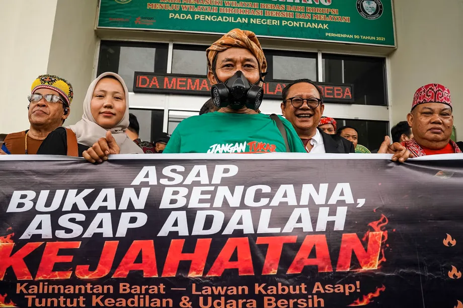
In its October 8 Solidaritas Merauke statement, the coalition said heavy machinery escorted by military personnel continued clearing and displacing natural ecosystems for rice, sugarcane, ethanol and palm oil projects. It also alleged violence and criminalization affecting Indigenous communities. These are allegations by the coalition, not findings established here by a court.
The coalition called for revising Coordinating Ministry for Economic Affairs Regulation No. 16 of 2025 to remove the projects from the national strategic list, or issuing a presidential decree to halt them. It also demanded a stop to the access road, revocation of Forestry Decree No. 591, cancellation of the HGU cultivation concession granted to PT Agrinas Pangan Nusantara, and withdrawal of military forces from Papua.
Its position is that restoration must include land rights, water systems, food sources, livelihoods and cultural relationships, rather than tree planting alone. Walhi says at least 24 Indigenous villages lie within the project area. Forest Watch Indonesia warns of threats to 159 customary territories and 11,000 hectares of peatland. Villages and customary territories are different units and should not be combined into one count.
The wider national data also differ. Auriga Nusantara estimates 433,751 hectares of forest loss in 2025, up 66% from 261,575 hectares in 2024 and the highest level in eight years. Walhi records 283,803 hectares for 2025. Auriga's preliminary assessment places about 58% of loss within licensed concessions or government projects, and more than 78,000 hectares were linked to food and energy programmes. No reconciled methodology explains the difference between the national totals.
Monitoring will depend partly on access to spatial data. The ministry says the PAPH map is publicly accessible through SIGAP, while separate reports describe restrictions on access to forest map data. A viewable map and downloadable data suitable for comparing concessions with satellite imagery are not necessarily equivalent.
Nadia Hadad, executive director of MADANI Berkelanjutan, described the practical test for the commitment:
"Climate commitments are ultimately not measured by how many statements are made, but by whether policies and state money move in the same direction," she said.
For now, no binding stop order or implementation deadline has been identified. The next scheduled planning milestone is the start of PAPH 2027 preparation in December 2026. Whether that process changes existing permissions, rather than only future applications, will be central to judging the announcement.
Key Points
- Indonesia's 2025 rice production exceeded demand by 3.52 million tonnes.
- Officials say the planned 2 million hectares for food production are no longer needed, but have not confirmed a halt to ongoing projects.
- The 5.67 million hectare forestry map permits applications for several uses, including rehabilitation and activities that retain forest.
- Satellite assessments document extensive clearing in South Papua, but totals differ by date, boundary and ecosystem category.
- Sugarcane, biofuel and oil palm plans remain separate sources of land demand.
- Protection depends on how the government defines forest and degraded land, including land already reclassified as APL.
- Indigenous and environmental groups are seeking changes to decrees, concessions and infrastructure decisions.
- Preparation of the next forestry utilization map is scheduled to begin in December 2026.