
A Trading World Built Around Cities
Chang'an had more than a million inhabitants at its height. Merv became a capital of the Great Seljuk Empire before Mongol forces destroyed it in 1221. In the mountains of southeastern Uzbekistan, archaeological surveys have revealed Tugunbulak, a medieval city covering nearly 300 acres at elevations reaching 7,200 feet. Together, these places show the extraordinary variety of cities that sustained the ancient Silk Road.
Contents
- A Trading World Built Around Cities
- Chang'an: A Capital With Two Great Markets
- Dunhuang: Commerce, Buddhism and a Printed Book
- Kashgar: Where Caravans Chose Their Route
- Samarkand: The Reach of Sogdian Merchants
- Balkh: A Meeting Place of Religious Traditions
- Merv: An Imperial Center Destroyed in 1221
- Tugunbulak and Tashbulak: Cities Above the Caravans
- Ctesiphon, Palmyra and Damascus: Three Western Roles
- Constantinople: A Gateway Between Seas and Continents
- Submerged Ruins and a Family's Trading Collection
- A Long History Still Being Reconstructed
- The Essentials
For over a millennium, the Silk Road formed the world's largest network of trade routes, connecting Han China in the east with the Roman Empire in the west. Its land routes stretched more than 6,000 kilometers across Central Asia, while maritime connections extended the movement of goods through ports and seas. Merchants used many paths, choosing routes according to geography, political conditions and their destinations.
Cities gave this network its strength. Travelers could rest, assemble caravans, find buyers and exchange information. Silk, spices, jewelry and medicines moved between markets, while religions, technologies and artistic traditions traveled with merchants, pilgrims and diplomatic missions. Some cities were imperial capitals; others were desert oases, mountain settlements or centers where imported materials were transformed into products for another market.
The great urban centers reached their peaks in different centuries. Their histories reveal how commerce survived changes of ruler, how wealth supported scholarship and architecture, and how conquest or natural disaster could bring an established trading center to an abrupt end. Archaeological discoveries continue to expand this picture, especially in places beyond the familiar caravan routes through deserts and valleys.
Chang'an: A Capital With Two Great Markets
Chang'an, modern Xi'an, stood among the world's largest cities during the Tang Dynasty, which lasted from 618 to 907 CE. Its population exceeded one million at its height. As China's imperial capital and the eastern terminus of the Silk Road, it brought together goods and people from across Asia and beyond.
Two markets reflected the city's different customers. The Eastern Market served the imperial household and aristocrats, supplying luxury goods and specialized products. The Western Market served the wider population and became especially associated with foreign imports.
Merchants from Persia, India and Central Asia sold jewelry, silk, tea, rare medicines and spices in the Western Market. Imported products helped shape local tastes and fashions. Foreign traders shared the city with religious pilgrims and diplomatic visitors, making Chang'an a place where commercial exchange and cultural contact happened together.
Chang'an's importance within that trading world can be expressed in these terms:
The sheer scale and diversity of Chang'an's markets made it the most important urban center in East Asia and a gateway between Chinese civilization and the wider world.
Dunhuang: Commerce, Buddhism and a Printed Book
Dunhuang occupied a strategic position at the western end of China's Hexi Corridor, a passage linking the Chinese interior with routes farther west. For more than a thousand years, it served commerce, military activity and cultural exchange despite its harsh desert surroundings.
Its strategic importance grew after Emperor Wu's forces defeated the Xiongnu in 121 BCE. Dunhuang later became one of the first major gateways through which Buddhism entered China from Central Asia, giving the city a role that reached far beyond the movement of merchandise.
The monk Lezun excavated the first Mogao Grotto, starting a tradition that eventually produced one of the world's most important complexes of Buddhist art. By the Tang Dynasty, Dunhuang was a thriving center for translating and studying Buddhist scriptures.
Archaeological discoveries there include the Diamond Sutra, dated to 868 CE and described as the earliest dated printed book ever discovered. Found in 1907, the Buddhist text connects Dunhuang's religious history with the history of printing. Its survival shows how a trading city could also become a storehouse of ideas and written knowledge.
Kashgar: Where Caravans Chose Their Route
Kashgar was a crucial meeting point between China and Central Asia. Often described as China's "Wild West," the oasis city provided an assembly point for caravans preparing to cross the region around the Taklamakan Desert. Merchants faced a practical choice between routes along its northern and southern edges.
Historical accounts connect the opening of routes beyond the desert frontier with Emperor Wu's search for the region's legendary "blood-sweating" heavenly horses for his armies. Military needs and commercial movement were closely connected: access to valued animals helped draw imperial attention toward the lands farther west.
Chinese control over Kashgar was intermittent across two millennia. The Uyghurs, a minority within China, maintained their position as the local majority. The city's role as a meeting place endured through changes in political authority.
During the late 19th and early 20th centuries, Kashgar became a center of the Great Game, the rivalry between the British and Russian empires for influence in Central Asia. Diplomats, intelligence agents, archaeologists and explorers joined the crowds in its bazaars. Traditional markets and caravan yards in Kashgar's Old City continue to preserve the atmosphere of that trading crossroads.
Samarkand: The Reach of Sogdian Merchants
Samarkand, near the western tip of the Alai Mountains in present day Uzbekistan, was founded around 2,750 years ago. Alexander the Great, Genghis Khan and Timur, also known as Tamerlane, conquered it at different times. Despite those upheavals, it retained a major commercial role.
Between the 6th and 8th centuries, Samarkand served as the capital of the Sogdians, who organized much of the trade in luxury goods that enriched Tang China. Their trading empire, described as Asia's largest during this period, connected China with the Mediterranean through extensive commercial networks.
Sogdian success depended on skills useful wherever goods crossed borders. Merchants spoke multiple languages and adapted to changing political conditions. Many were Zoroastrian, while remaining receptive to Buddhism, Christianity and Manichaeism. This religious openness helped them operate among communities with different beliefs.
Samarkand's architectural legacy is visible in Registan Square, framed by three madrassas, institutions associated with Islamic learning. The square remains one of the most striking examples of Islamic architecture, reflecting the city's lasting cultural importance alongside its commercial history.
Balkh: A Meeting Place of Religious Traditions
Balkh, known as the "Mother of Cities," was a major urban center of ancient Bactria. It lies approximately 22 kilometers west of modern Mazar-i-Sharif in Afghanistan. Trade and religious life gave the city importance across successive periods of its history.
Alexander the Great fought in the region and married Roxanne, a local princess, shortly after his conquest. In the early 7th century, the Chinese Buddhist monk Xuanzang documented numerous Buddhist communities in Balkh, recording its importance as a center of Buddhist scholarship.
Balkh also holds a place in traditions surrounding Zoroaster, the founder of Zoroastrianism. Some traditions identify it as his birthplace, while others place his death there. Centuries later, the city gained further prominence as the birthplace of the Sufi poet Rumi.
Genghis Khan's forces devastated Balkh in 1220 during their expansion westward, destroying much of the city. Its archaeological remains preserve layers of history from different civilizations, including evidence of the religious traditions and commercial connections that once made it a major crossroads.
Merv: An Imperial Center Destroyed in 1221
Merv lies east of Mary in Turkmenistan's Karakum Desert. It is one of Central Asia's most important historical sites and one of the largest medieval cities ever discovered. By the 12th century, under the Seljuk Turks, it rivaled Damascus, Baghdad and Cairo as a major Islamic center.
Successive empires, including the Parthians, Sassanids and Seljuks, left fortresses, palaces, religious buildings and residential areas. The El Kekara fortress, identified as Merv's oldest surviving structure, dates to the 6th century BCE. These remains show how urban life developed there across many centuries.
Merv reached its peak in the 12th century as the capital of the Great Seljuk Empire. Its political standing and cultural activity placed it among the great cities of the Islamic world.
The sequence leading to its destruction began with a Mongol demand for tribute in 1218. After a Mongol envoy was killed, Tolui led an army that destroyed Merv in 1221 and massacred its population, estimated at between 200,000 and 500,000. The attack ended its era as one of the world's great cities. Its ruins remain a major record of medieval Islamic urban life.
Tugunbulak and Tashbulak: Cities Above the Caravans
Drone surveys using lidar have revealed the remains of medieval cities in the rugged mountains of southeastern Uzbekistan. Lidar uses laser measurements to map the ground, allowing researchers to identify structures and patterns that are difficult to see from the surface.
Tugunbulak covered nearly 300 acres and stood at elevations reaching 7,200 feet, comparable to Machu Picchu. It flourished between the 6th and 11th centuries and was one of the largest regional settlements of its time. Nearby Tashbulak was smaller but densely built, with a similarly sophisticated layout.
The scans revealed five watchtowers connected by walls along ridgelines at Tugunbulak. A central fortress had thick stone and mud brick walls, and the settlement contained numerous residential and commercial structures. This investment in buildings and defenses expands the picture of urban life in remote mountain regions.
Michael Frachetti, a National Geographic Explorer and anthropologist at Washington University, described how the discoveries changed his understanding of the region:
This changes everything we thought we knew about Central Asian history. These weren't the barbarian horse-riding hordes that history has often painted them as. They were mountain populations, probably with nomadic political systems, but they were also investing in major urban infrastructure.
Researchers believe metalworking, especially iron and steel production, drove Tugunbulak's economy. Rich mineral deposits provided raw materials, while strong mountain winds could support the intense fires needed for smelting, the process of extracting metal from ore. The discoveries suggest that substantial cities were not uncommon at high elevations and that mountain communities participated actively in the region's economic development.
Ctesiphon, Palmyra and Damascus: Three Western Roles
Ctesiphon, southeast of modern Baghdad on the Tigris River, served as the capital of the Parthian Empire and later the Sassanid Dynasty. Rome held it at times during repeated conflicts. The Sassanian state retained it as a seat of power until Arab armies captured it in 637 CE and used it as a base for conquering eastern Persia.
Mud brick walls and palace remains survive, alongside the Taq Kasra, the vaulted hall of Khosrow I. Its unreinforced brick arch rises approximately 100 feet and is described as the world's tallest brick vault spanning a single opening. The structure reflects Persian engineering and imperial power. Ctesiphon's administrative functions and markets also supported the redistribution of goods moving between east and west.
Palmyra, modern Tadmur, occupied an oasis at the edge of the Syrian Desert. From the 1st century CE, it grew wealthy by connecting the Persian Gulf and Asia with the Mediterranean and Europe. Merchants brought Chinese silk, pottery and herbs through Syria, exchanging them for glass, dyes and pearls.
Known as Syria's "Pearl of the Desert," Palmyra expanded rapidly under Roman rule and reached its peak in the 2nd century CE. Queen Zenobia, whose life is dated approximately 240 to 274 CE, later broke from Roman control and established the brief Palmyrene Empire. Rome destroyed Palmyra in 273 CE, ending its independence.
Colonnaded avenues, towering tombs and temples cover approximately 2.3 square miles. Archaeological discoveries include catacombs linked to Queen Zenobia, found during oil pipeline construction in 1957. These remains record the scale and sophistication of the desert trading city.
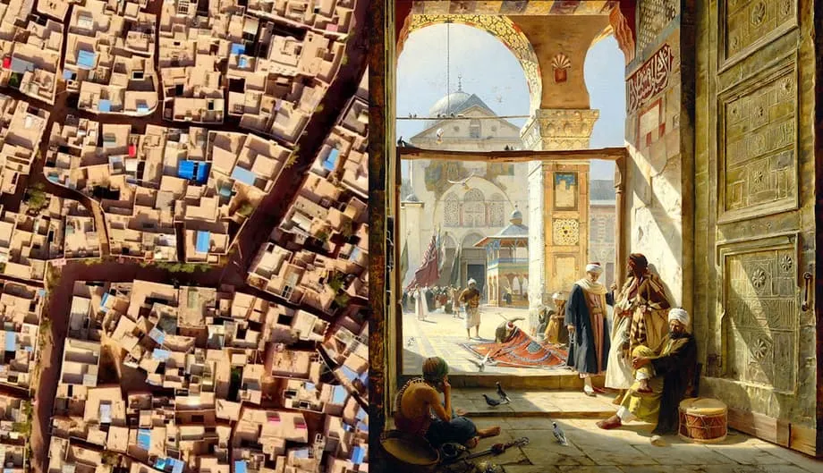
Damascus developed a different specialty. At the foot of Mount Qasioun, tributaries of the Barada River supplied gardens and workshops that sustained urban life for millennia. By 115 CE, Chinese silk was being finished and dyed there for Roman consumers, then shipped to Rome or sold locally.
Caravanserais near the Old City's souqs preserve evidence of this commercial activity. These lodging and trading buildings commonly had animal stables below, merchants' rooms above and open courtyards where business took place. The arrangement was familiar across the Silk Road. Damascus's association with fine textiles also survives in the English word "damask," which entered the language as a synonym for fine silk.
Constantinople: A Gateway Between Seas and Continents
Constantinople, now Istanbul, stood at the meeting point of Asia and Europe. It served as the capital of the Roman, Byzantine and Ottoman empires, and briefly as the capital of modern Turkey. Emperor Constantine renamed it Constantinople in 330 CE when he established it as the "New Rome."
The city became Istanbul following the Ottoman conquest in 1453. The Turkish Republic moved its capital to Ankara in 1923, while Istanbul remained the country's largest city.
Its geographical position made it a commercial hub and an essential passage for merchant ships from Black Sea ports. Often considered the terminus of the Asian overland Silk Road, Constantinople controlled trade between the Black Sea and Mediterranean and collected taxes on goods passing through its markets.
Harbors along the Golden Horn provided a final stop for many caravans before their goods were distributed through Europe. Markets, customs houses and administrative buildings reflected the city's role in managing and profiting from the movement of merchandise.
Submerged Ruins and a Family's Trading Collection
Lake Issyk-Kul in eastern Kyrgyzstan holds another chapter of Silk Road urban history. Researchers from the Russian Academy of Sciences and the National Academy of Sciences of the Kyrgyz Republic have uncovered an urban complex with buildings of fired brick, a possible religious structure and a necropolis containing burials in the Islamic tradition.
The ruins at Toru-Aygyr lie only 3 to 13 feet, or 1 to 4 meters, below the lake surface. Researchers believe the settlement was a significant commercial and cultural node and that a catastrophic earthquake altered the landscape and submerged it. The shallow depth suggests relatively recent submergence in geological terms, although no date for the disaster is given.
In the Kargil region, described as being in Pakistan, Muzzamil Hussain's family found wooden crates in an old property containing an extraordinary range of trading goods. They included silks from China, silver cookware from Afghanistan, Persian rugs, Tibetan turquoise, Mongolian saddles and luxury goods from London, New York and Munich.
The objects are preserved in the Munshi Aziz Bhat Museum and are described as among the finest collections held privately in India. They connect visitors with the last known traders along one of the final sections of the Silk Road to close, following the partition of India and Pakistan in 1948.
A Long History Still Being Reconstructed
The cities' histories span ancient empires, medieval commerce and modern archaeological work. A short timeline connects several of the major developments:
- 121 BCE: Emperor Wu's victory over the Xiongnu increased Dunhuang's strategic importance.
- 330 CE: Constantine established Constantinople as the New Rome.
- 618 to 907 CE: Chang'an flourished during the Tang Dynasty.
- 868 CE: The Diamond Sutra found at Dunhuang was printed.
- 1220 to 1221: Mongol forces devastated Balkh and destroyed Merv.
- 1453: The Ottoman conquest transformed Constantinople's imperial role.
- 1907: The Diamond Sutra was discovered.
- 1923: Ankara replaced Istanbul as Turkey's capital.
- 1957: Pipeline construction revealed catacombs linked to Queen Zenobia at Palmyra.
China has revived Silk Road imagery through the Belt and Road Initiative, developing land and maritime connections across more than 60 countries. Cities undergoing major transformation include New Lanzhou, Wuwei and Khorgas in China; Aktau in Kazakhstan; Gwadar in Pakistan; Anaklia in Georgia; and Rotterdam in the Netherlands.
UNESCO's Silk Roads Programme provides an inventory of major cities and their roles in cultural exchange. World Heritage recognition includes Samarkand, Bukhara and Khiva in Uzbekistan, supporting the preservation of architectural and cultural achievements associated with the routes.
Historian Peter Frankopan's argument in "The Silk Road is once more the centre of the world" places these connections at the center of history rather than viewing events mainly through Western civilization. Judaism, Christianity, Islam, Buddhism and Hinduism all emerged along or near the Silk Road, making the network a setting for religious and philosophical development as well as commerce.
Lidar surveys in Uzbekistan, underwater archaeology at Issyk-Kul and renewed examination of historical accounts continue to reconstruct this urban world. The resulting picture includes mountains, oases, rivers and seas, with communities sustaining different forms of settlement and trade across a vast connected region.
The Essentials
- Chang'an exceeded one million inhabitants at its height and maintained separate markets serving imperial elites and the wider population.
- Dunhuang connected trade with Buddhist scholarship and preserved the Diamond Sutra dated to 868 CE.
- Kashgar organized caravans traveling around the Taklamakan Desert, while Samarkand anchored extensive Sogdian merchant networks.
- Balkh supported several religious traditions; Merv became a major Islamic capital before its destruction in 1221.
- Tugunbulak covered nearly 300 acres in Uzbekistan's mountains, where researchers believe metalworking supported its economy.
- Ctesiphon, Palmyra, Damascus and Constantinople linked imperial authority, manufacturing and distribution with western trade.
- Submerged ruins at Issyk-Kul and preserved trading goods in the Munshi Aziz Bhat Museum add further chapters to Silk Road history.