A growing contest beneath Taiwan's surrounding seas
China operates more than 120 research vessels, according to Taiwan's coast guard. Taiwan has five ships actively conducting maritime research, with two more launched in August to expand its capacity. The gap is becoming increasingly consequential as Chinese vessels map waters south and east of Taiwan, including routes that American naval forces would need to cross during a conflict.
Contents
- A growing contest beneath Taiwan's surrounding seas
- Why the waters east of Taiwan matter
- How a seabed survey becomes useful underwater
- What the vessel tracking research measured
- Two ships show the geographic reach
- Why cable security reaches beyond Taiwan
- Taiwan's response goes beyond adding ships
- A timeline of surveys and responses
- Key Points
Ship tracking data show Chinese research vessels repeatedly sailing parallel lines across these waters, a pattern commonly used to survey the seabed. Taiwan's coast guard describes the activity as preparation of the maritime battlefield. Detailed information about underwater terrain and water conditions can help submarines and underwater drones navigate, remain concealed and search for opposing forces.
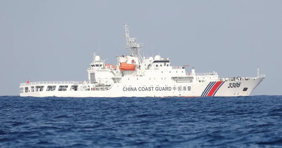
Taiwan also identified six Chinese survey vessels, six Chinese coast guard ships and four fishing boats suspected of belonging to China's maritime militia in mid-October. Lii Wen, deputy secretary-general of Taiwan's National Security Council, described the vessels as evidence of cooperation among Chinese agencies.
The activity brings together two security concerns: Beijing's ability to operate underwater around Taiwan and the vulnerability of the cables that carry the island's communications abroad. Research into vessel movements across the Pacific adds detail to both, while Taiwan is trying to expand its own understanding of the seas surrounding it.
Beijing claims Taiwan as its territory and threatens to use force if necessary to take control. Its Taiwan Affairs Office did not respond to questions about the research activity. Ocean surveys can support scientific work, mineral exploration and military operations, making their equipment, location and collected information central to the security debate.
Why the waters east of Taiwan matter
Chinese research ships have been especially active east of Taiwan, where American forces approaching from the Pacific could travel if Washington intervened in a conflict. Bryan Clark, a senior fellow and director of the Hudson Institute's Center for Defense Concepts and Technology, said detailed seabed information could support Chinese submarines and underwater drones used in a blockade or in efforts to prevent American intervention.
A submarine crew needs more than a surface map. Underwater ridges, trenches and changes in depth affect where a vessel can travel. Water temperature, salinity and currents also influence underwater operations and the performance of sonar, which uses sound to find objects beneath the surface.
Chinese surveying around Taiwan increased after Japan and the Philippines announced in May that they would discuss overlapping maritime boundaries east of the island. Beijing called the talks illegal and conducted coast guard exercises to press its claims.
Allen Zhang, a research assistant at the Heritage Foundation who has studied Chinese research ships, described Beijing's response as part of a wider pressure campaign. He said the boundary discussions provided a pretext for activity China already wanted to pursue.
Research vessels fit into what security specialists call gray zone tactics: pressure applied below the level of open warfare. Around Taiwan, survey ships operate alongside a larger Chinese maritime presence that includes coast guard vessels and fishing boats suspected of performing state directed missions.
How a seabed survey becomes useful underwater
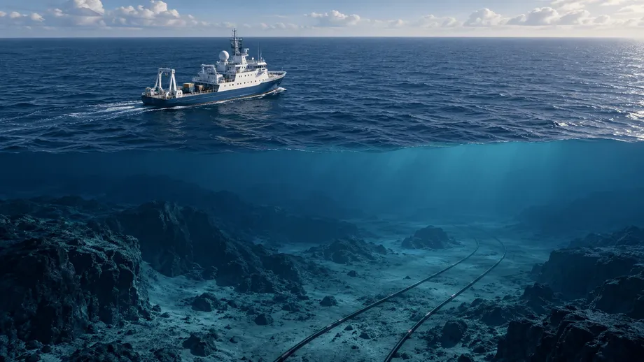
Research ships use multibeam sonar to send hundreds of sound beams outward in a fan. By measuring their return, the equipment builds a picture of depth and seabed shape across a broad strip of ocean. Repeated parallel passes allow a ship to cover a larger area systematically.
Other instruments measure currents or image geological layers beneath the seabed. Remotely operated vehicles and autonomous underwater vehicles can collect more detailed information at depth. Survey data can be processed aboard the ship, transmitted by satellite to laboratories or examined after the vessel returns to port.
Clark said precise seabed maps are particularly useful for autonomous vehicles. An underwater drone can compare the terrain it senses with a stored map to help determine its position. Satellite navigation signals are unavailable underwater, so a vehicle that can navigate without surfacing can stay concealed for longer.
Taiwan is investing in maritime drones as part of its defenses. Its mapping effort therefore has a practical purpose alongside academic research: understanding the environment in which those systems would operate.
What the vessel tracking research measured
A Center for Strategic and International Studies analysis published on October 8, 2026, compared 223 research vessels from 48 countries. Its tracking period ran from January 1, 2020, to December 9, 2025. Researchers used Automatic Identification System data, the location messages ships broadcast, to estimate how much observed time vessels spent near seabed infrastructure on the high seas.
The study defined proximity as being within one kilometer of a mapped submarine telecommunications cable or gas pipeline. Researchers verified vessel types and identifying numbers before selecting the sample. Some vessels had gaps in their tracking records.
Chinese vessels spent a greater share of their observed time near this infrastructure than vessels from the comparison group. In 2024, seven Chinese research ships ranked above the sample's 80th percentile, placing them among roughly the highest fifth for that measure.
Most vessels spent less than 1% of their annual tracked time near the infrastructure. American research vessels also ranked near the top in some years. The statistical model explained about 1.3% of the variation in the data, leaving most differences among vessel movements unexplained.
The study measured shares of observed time, so a vessel's ranking depended on both its time near infrastructure and its total recorded activity. Its 1,177 statistical observations represented records for individual vessels in individual years, drawn from the 223 ships.
Two ships show the geographic reach
The research examined Xiang Yang Hong 06 and Ke Xue in detail. Their routes connect the concerns around Taiwan with a much wider stretch of the Pacific and, in Ke Xue's case, the Bering Sea.
Xiang Yang Hong 06 made three deployments to international waters off Guam between February and May 2024. Its repeated parallel tracks ran near mapped routes of the Apricot and AAG telecommunications cables. Early survey areas lay outside zones identified as promising for certain seabed minerals.
By July, the vessel's survey area included routes associated with ACC-1, AAG and SEA-US. ACC-1 was still planned, making it a prospective cable route rather than an operating connection. From August to October, surveying expanded into areas considered promising for minerals, and the researchers suggested that mineral exploration had become a stronger explanation for the activity.
Ke Xue repeatedly operated west of Okinotorishima between March and May 2024, near or across mapped routes of TGN-IA, Apricot and JUPITER. From mid-July, it traveled through the Sea of Japan and Tsugaru Strait toward the Bering Sea, leaving survey patterns near international cables, including Russia's Polar Express system.
Ke Xue was also observed near cables northeast and southwest of Taiwan during the summer described in the account of increased Chinese activity. The mission orders, instruments deployed and information collected during the individual voyages remain unknown.
Why cable security reaches beyond Taiwan
Undersea telecommunications cables carry international internet traffic. Damage can force data onto alternative routes, increasing the distance it travels and the time it takes to arrive. Multiple disruptions can place much greater pressure on the connections that remain available.
A September assessment prepared by the China Strategic Risks Institute for the U.S.-China Economic and Security Review Commission ranked Pacific cable systems by exposure to potential disruption. Its Trans-Pacific Cable Gray Zone Vulnerability Index considered water depth, shipping traffic, ownership, proximity to Chinese maritime claims and connections to Taiwan.
Trans-Pacific Express ranked first. E2A, partly owned by Verizon, ranked second; Google's TPU ranked third; and Meta's ORCA ranked fifth. E2A, TPU and ORCA were still under development. Taiwan, Japan and the Philippines were identified as especially exposed because of their geography, contested waters and busy shipping routes.
The assessment's modeling indicated that losing a major connection could send traffic between the United States and East Asia along longer routes. Simultaneous failures could exceed available capacity, affecting cloud services, financial transactions and other applications that depend on rapid communication.
Clark, a former American Navy submariner, said China was seeking knowledge of underwater infrastructure that could support a coercive campaign. He explained the possible objective in these terms:
They're trying to see what the undersea infrastructure looks like, because they probably want the ability to cut off Taiwan from outside communications if they can as part of a coercion campaign.
Chinese vessels have been implicated in several cable damage incidents around Taiwan in recent years. Worldwide, fishing equipment, anchors and natural events account for most submarine cable damage. The congressional assessment recommended more allied maritime surveillance, alternative cable connections, coordinated incident response and greater repair capacity. Aging and limited repair fleets could slow restoration after major disruptions.
Taiwan's response goes beyond adding ships
Taiwan's five active research ships are divided among several operators: three are managed by universities, one by the government supported Taiwan Ocean Research Institute and one by the navy. The two ships launched in August are intended for another institution under the Ocean Affairs Council.
President Lai Ching-te linked the expansion directly to security at the launch:
Only by gaining a more complete understanding of our own maritime environment can we safeguard national security.
The National Academy of Marine Research in Kaohsiung plans to launch a large research ship in 2029. Its president, Chen Chung-ling, described an effort to combine scattered information into a marine database:
We want to take these fragmented pieces, gradually gather the data, add our own input, and build a marine database.
Taiwan retains an advantage in surveying waters close to its coast, where Chinese research vessels are excluded. Farther offshore, China's fleet of more than 120 research vessels gives it much greater capacity to collect information repeatedly over broad areas.
Liao Te-yu, director general of the Taiwan Ocean Research Institute, said Taiwan's research fleet primarily serves academic interests that do not always match defense requirements. More ships will increase the capacity to gather data, while decisions about where to survey and how to combine the results will shape its usefulness for defense.
A timeline of surveys and responses
The developments span several periods. The detailed ship case studies concern 2024, while the broader statistical study follows vessel movements through December 2025.
- February to May 2024: Xiang Yang Hong 06 makes three deployments off Guam near mapped cable routes.
- March to May 2024: Ke Xue repeatedly operates west of Okinotorishima near several telecommunications cable routes.
- From July 2024: Ke Xue travels through the Sea of Japan and Tsugaru Strait toward the Bering Sea.
- August to October 2024: Xiang Yang Hong 06 expands surveying into areas considered promising for minerals.
- October 8, 2026: The comparative analysis of 223 research vessels is published.
- 2029: Taiwan's National Academy of Marine Research plans to launch a large research ship.
Taiwan's immediate task is to improve its own maritime knowledge while monitoring Chinese activity. Cable resilience adds another practical priority: keeping alternative connections and repair resources available if a major route fails.
Key Points
- Chinese research vessels are mapping waters south and east of Taiwan that could matter in a blockade or military intervention.
- Taiwan's coast guard puts China's research fleet at more than 120 vessels, compared with five ships actively conducting Taiwanese maritime research.
- A study of 223 vessels found Chinese ships spent a greater share of observed time near mapped seabed infrastructure than the comparison group.
- Detailed cases trace Xiang Yang Hong 06 and Ke Xue near cable routes around Guam, across the western Pacific and into the Bering Sea.
- Taiwan launched two additional research ships in August, and a larger vessel is planned for 2029.
- Recommended cable protections include alternative connections, maritime monitoring, coordinated responses and more repair capacity.