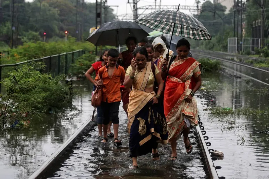
Heavy Rain Meets Cities With Nowhere for Water to Go
From Mumbai's flooded transport infrastructure to Delhi's submerged roads and Bengaluru's waterlogged neighbourhoods, India's monsoon repeatedly exposes a problem that reaches beyond heavy rain. Cities have expanded across the lakes, wetlands, riverbanks and drainage channels that once gave water somewhere to go, while the systems built to carry it away have struggled to keep pace.
Contents
- Heavy Rain Meets Cities With Nowhere for Water to Go
- Urban Growth Has Removed Natural Flood Buffers
- Older Drains Face Demands They Were Never Built to Handle
- Environmental Damage Adds to the Risk
- A More Erratic Monsoon Increases the Pressure
- Mumbai Faces Pressure From Both Rain and Sea
- Delhi and Bengaluru Show Different Routes to the Same Disruption
- Smaller Cities and the Northeast Face Wider Losses
- Why Emergency Measures Need Lasting Planning
- Key Points
In 2024, torrential rain brought Mumbai, Delhi, Bengaluru and several other urban centres to a standstill. Streets became rivers, vehicles stalled during commutes and entire neighbourhoods were submerged within hours. By June 9, 2025, the recurring disruption had again brought attention to how cities are built, how their drainage is maintained and how authorities prepare for the rainy season.
Even new infrastructure has proved vulnerable. Viral images showed muddy water flooding platforms at Mumbai's underground metro stations just days after inauguration. Such scenes put a practical concern at the centre of the debate: whether the infrastructure people depend on can keep operating when the monsoon arrives.
The causes overlap. Construction removes places where rainwater could collect or soak into the ground. Older drains must then handle water from a much larger developed area. Environmental damage reduces natural protection, while increasingly erratic rainfall can deliver more water than those systems can carry.
For residents, the consequences arrive together: flooded homes, damaged property, stranded vehicles and journeys that cannot be completed. Understanding why this happens means looking at both the rain falling on a city and the routes that water can still take through it.
Urban Growth Has Removed Natural Flood Buffers
Bengaluru was once known for its interconnected lakes. Many water bodies have since been replaced by apartment complexes and business hubs, removing spaces that could hold excess rainwater before it spread into surrounding areas.
Ram Prasad, a lake conservation activist, explains how that conversion changes the movement of water:
When you convert lakes—which traditionally act as flood buffers—into built-up areas, the water has nowhere to go,
Lakes, wetlands and natural channels perform different parts of the same task. They hold water, absorb some of it and provide routes for the rest to move onward. When development occupies those spaces, the rain still falls, but the room available to accommodate it shrinks.
The pattern extends beyond Bengaluru. Chennai has lost tanks, while Hyderabad's lakes have been shrinking. Across expanding cities, encroachment and paving have weakened the natural drainage networks that previously helped manage seasonal downpours.
Older Drains Face Demands They Were Never Built to Handle
Many Indian cities still depend on drainage systems designed decades ago. Those systems were never intended to serve today's population density or cope with the volumes of rainfall now being experienced.
Dikshu Kukreja, an architect and urban planner, describes the gap between construction and the services needed to support it:
The pace of urban expansion has far exceeded the evolution of supporting infrastructure, particularly in water and drainage systems.
More development places greater demands on drains at the same time that natural water storage is being lost. Water that once had space to spread out must instead pass through a limited drainage network. When that network cannot carry it away quickly enough, drains overflow and water collects on streets.
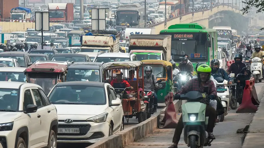
The effects spread through the city. Roads collapse, traffic grinds to a halt and access to homes and workplaces becomes difficult. Even the first heavy rain can expose the mismatch between the scale of urban growth and the infrastructure beneath it.
Environmental Damage Adds to the Risk
Mumbai's mangroves act as natural flood barriers, yet development has led to their destruction. Their loss forms part of a wider change in the city's relationship with water, alongside land reclamation and the narrowing of rivers.
Delhi faces a related problem on the Yamuna's floodplains. These are areas intended to accommodate water when a river overflows. Construction there, including major infrastructure projects, has reduced the land available to absorb excess water and increased the risk of flooding.
Environmental neglect and planning failures therefore affect more than individual building sites. A development that occupies a drainage channel, wetland or floodplain changes the space through which water can move, with consequences for surrounding neighbourhoods.
Policy responses often concentrate on immediate measures, such as pumps that remove standing water. Those interventions can provide relief, but the broader problem includes decisions about where construction is allowed and which natural features are protected.
A More Erratic Monsoon Increases the Pressure
India receives about 80% of its annual rainfall during the monsoon, typically from June to September. That seasonal rain is vital for agriculture and millions of livelihoods, even as intense downpours disrupt urban life.
Climate change is making rainfall patterns more erratic. Unseasonal downpours, flash floods and droughts linked to extreme heat are becoming more common. For cities already struggling with inadequate drainage, greater uncertainty over the timing and intensity of rain makes preparation harder.
In 2025, the monsoon arrived a week early in parts of southern India, catching authorities off guard. Mahesh Palawat, vice-president of meteorology at Skymet, attributes the early movement to unusual depressions over the Arabian Sea that pulled the monsoon current northward ahead of schedule.
The northeast has also experienced extreme conditions. Record rainfall triggered devastating floods and landslides, with Guwahati and Silchar experiencing their highest rainfall in more than a century. Scientists warn that rising sea surface temperatures and shifting atmospheric patterns are likely to make such extreme events more frequent.
Rainfall and urban development act on the same drainage system. More intense rain increases the water arriving, while the loss of lakes, channels and wetlands reduces the space available to manage it.
Mumbai Faces Pressure From Both Rain and Sea
Mumbai is naturally vulnerable because it is low lying and surrounded by the sea. Its ability to drain rainwater becomes especially strained when heavy downpours coincide with high tides.
Human changes have made that geographical challenge harder to manage. The narrowing of rivers such as the Mithi, unchecked land reclamation and the destruction of mangroves have all reduced the city's ability to drain water.
High tides and heavy rain can overwhelm the drainage system together. The city must cope with water arriving from above while conditions at the coast restrict its escape. Reduced river capacity and the loss of natural barriers leave less room to absorb that pressure.
The flooding of newly built underground metro infrastructure adds transport reliability to the concern. Stations and roads are part of the same urban environment, and their ability to function during rain depends on how water is managed around them as well as within them.
Delhi and Bengaluru Show Different Routes to the Same Disruption
Delhi's Minto Bridge has become a recurring symbol of monsoon disruption, with vehicles routinely stranded under water. In 2025, Delhi recorded its wettest May since 1901, alongside widespread property damage and several fatalities.
Construction on the Yamuna's floodplains has reduced the land's capacity to absorb excess rain. The capital's experience brings together local waterlogging on roads and the wider consequences of building in areas that accommodate river overflow.
Bengaluru's setting is different. The city sits atop a hill and was once organised around three major valleys and a network of lakes. That landscape provided routes and storage for water, but encroachment and illegal construction have disrupted them.
A city described as never meant to flood now experiences waterlogging associated with poor urban planning and violations of building norms. Its elevated position has not spared neighbourhoods where natural drainage has been obstructed or replaced by construction.
Mumbai, Delhi and Bengaluru therefore face different geographical conditions, yet share a practical problem: urban growth has reduced or interrupted the paths available to water.
Smaller Cities and the Northeast Face Wider Losses
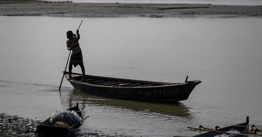
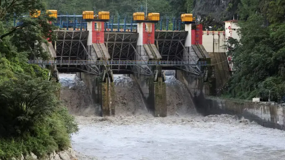
Flooding is not confined to India's largest metropolitan areas. In Assam and other northeastern states, extreme rainfall and sudden releases of water from dams have displaced hundreds of thousands of people, destroyed crops and caused dozens of deaths.
Inadequate drainage, encroachment on floodplains and poor coordination between dam operators and local authorities have contributed to the crisis. Communities must contend with both rainfall in their immediate surroundings and water moving through the wider river system.
Guwahati and Silchar's rainfall extremes show how severe weather can put urban areas under pressure far beyond the usual images of flooded streets in Mumbai or Delhi. Landslides add another danger in the northeast, while damaged crops extend the consequences into people's livelihoods.
Coordination matters because decisions about releasing water and preparing communities are connected. Local drainage work addresses only part of a situation shaped by rainfall, rivers, dams and the occupation of land where floodwater spreads.
Why Emergency Measures Need Lasting Planning
Authorities frequently respond by installing pumps, clearing drains or suspending officials after infrastructure failures. These actions may provide temporary relief, but they leave the underlying problems of lost drainage routes, inadequate capacity and unsuitable construction unresolved.
Alan Abraham, an urban planner, describes the consequence of leaving drainage problems in place:
If drainage issues remain unresolved, flooding will be a natural consequence.
Technology can help authorities prepare and respond. Sensors that provide information as conditions change, predictive models and maps of areas at high risk can support decisions about where flooding may occur and where action is needed.
Those tools depend on responsive governance and community involvement. Information becomes useful when authorities act on it and residents are included in preparations. The same approach requires coordination across the agencies responsible for development, drainage and water management.
Lasting resilience requires planning that accounts for water before construction proceeds, strict enforcement of building norms and restoration of natural water bodies and drainage channels. Pumps and drain cleaning remain part of the response, while protecting the space water needs addresses the conditions that make flooding recur.
For India's cities, the central task is concrete: preserve and restore routes for rainwater, bring drainage infrastructure into line with urban growth and prepare for a monsoon whose patterns are becoming harder to predict.
Key Points
- Unplanned urban growth, lost lakes and wetlands, ageing drainage and environmental damage are contributing to repeated flooding.
- India receives about 80% of its annual rainfall during the monsoon, typically from June to September.
- In 2025, the monsoon arrived a week early in parts of southern India, while Delhi recorded its wettest May since 1901.
- Mumbai faces combined pressure from heavy rain and high tides; Delhi and Bengaluru have lost space and routes that help manage water.
- Extreme rainfall and sudden dam releases have contributed to displacement, crop losses and deaths in Assam and other northeastern states.
- Lasting measures include restoring water bodies and channels, enforcing building rules, improving drainage and coordinating preparation and response.