
Bhutan Launches National Committee for Critical Glacial Lakes
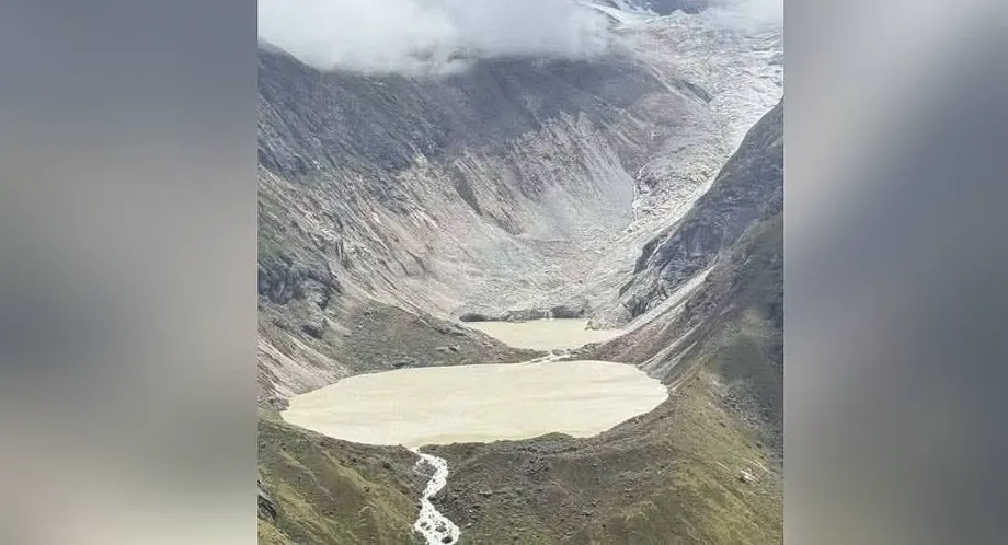
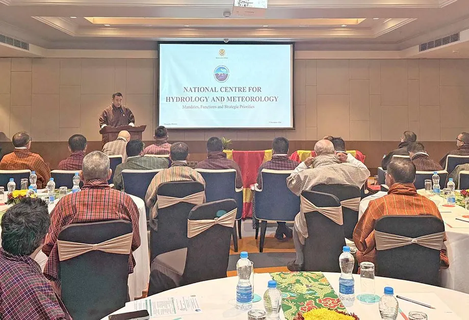
The Bhutan government announced the creation of a high-level steering committee on November 21, 2026, headed by Prime Minister Tshering Tobgay to oversee operations that will lower the water levels of 17 glacial lakes. Glacial lakes are bodies of water that form as glaciers melt and pool behind natural walls of rock and debris known as moraine dams. These 17 specific lakes have been identified as posing high risks for glacial lake outburst floods, which occur when a dam fails and sends a wall of water rushing downstream. Prime Minister Tobgay announced the panel at a news conference following an inspection of vulnerable high-altitude sites alongside King Jigme Khesar Namgyel Wangchuck and glaciologists from the National Centre for Hydrology and Meteorology. According to a social media post by Kuensel, the official newspaper of Bhutan, the newly formed National Committee for Critical Glacial Lakes includes military and police officers alongside officials from the Royal Office. The work to lower these water levels through controlled release mechanisms is scheduled to begin this winter, with the committee currently discussing budgetary requirements. This initiative follows an outburst flood from Shintaphu Lake in the Gasa district on October 29, which blocked a stream and formed an artificial lake at Takesemakhang.
Contents
Devastating Toll and Recovery Efforts After the Gasa Flood
The October 29 outburst from Shintaphu Lake caused severe damage across rural communities, destroying livestock, homes, and vital transportation routes. In the Gasa district alone, 128 yaks and cattle died, 86 went missing, 13 horses were presumed dead, and about 100 acres of pastureland known locally as tsamdro were washed away. Three animal sheds, major sections of the Laya road, and the Punakha-Gasa Highway were swept away, while the Tongchudra Bridge was completely destroyed, cutting off vehicle access. The Gasa Tshachu hot springs suffered extensive damage as its water source, soaking ponds, and hot stone bathhouse were destroyed. Facilities belonging to the Royal Bhutan Army at Tatshemakhang and the Laya crematorium ground also sustained heavy impacts. Downstream in Punakha, two bailey bridges were swept away, a suspension bridge was damaged, and paddy fields, farmland, and irrigation channels were affected, alongside the loss of seven cattle. Four sand-harvesting boats were washed away further down in Wangdue. Emergency responders have since restored temporary road access, delivered supplies to stranded workers, and re-established telecommunication links in Laya.
Early warning systems played a crucial role during the Gasa emergency by issuing alerts to five downstream dzongkhags, which are administrative and district headquarters, namely Gasa, Punakha, Wangdue, Tsirang, and Dagana. Sirens installed in Punakha and Wangdue enabled residents to evacuate in time, preventing any human injuries or fatalities. Officials noted that while early warnings successfully protected lives, warnings alone cannot remove the underlying danger, making it necessary to reduce water volumes directly at the source. Building on these protective measures, the country has mapped 620 glacial lakes in its national inventory, as detailed in Bhutan Maps 620 Glacial Lakes, which highlights growing risks to downstream communities and infrastructure.
Expanding Natural Siphon Technology at Thorthormi Lake
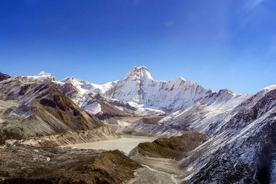
Engineers at the National Centre for Hydrology and Meteorology are exploring ways to scale up a pilot siphon system tested successfully in October at Thorthormi Lake, one of the 17 priority water bodies. A siphon is a bent pipe used to convey liquid from a higher level to a lower level by utilizing gravity and atmospheric pressure without needing pumps. Sangay Tenzin, a project engineer at the Hydrology and Water Resources Division of the National Centre for Hydrology and Meteorology, explained the technical mechanics of the natural siphon during operational evaluations. Sangay Tenzin said that the system features a rising lean of about 22 metres from the highest point to the water, a vertical height of around 4.5 or 4.7 metres, and a falling lean of approximately 275 metres from the apex to the outlet.
From the water level, around 12 metres goes down, and the vertical height is around 4.5 or 4.7 metres. Once the construction is complete, we prime the siphon, which means we fill it with water and seal it. Then we have a falling lean of around 275 metres from this point to the outlet.
The current pilot siphon system can drain roughly three million litres of water every day by releasing 33 to 35 litres of water every second. Engineers caution that because this setup is a small test version, it will not lower the overall lake level unless it is significantly expanded. Scaling up presents major logistical hurdles because the high-altitude site lacks heavy machinery, requiring all installation work to be performed manually. This siphoning method is intended to replace traditional manual excavation techniques used in the past. Karma Toeb, chief specialist at the Cryosphere Services Division of the National Centre for Hydrology and Meteorology, described the evolution of glacial mitigation methods by contrasting past labor-intensive projects with modern engineering. Karma Toeb noted that past mitigation projects on Rapstreng Lake from 1996 to 1998 and Thorthormi Lake from 2008 to 2012 required bringing in more than 300 people to dig outlet channels by hand.
In the traditional mitigation during that time, we brought in more than 300 people to the site and started digging up the outlet channel. Now, times have changed. I think it is high time to look forward and adopt new technologies. So a siphon came to mind. Why? Because this technology has been implemented in countries like Peru very successfully.
Thorthormi Lake continues to expand rapidly as glaciers melt and retreat across the Himalayan range. In 2019, a minor outburst at Subsidiary Lake-II lowered the main lake level by about 80 centimetres over four days and released 2.73 million cubic metres of water. Another partial breach occurred in October 2023, lowering the lake level by an additional 46 centimetres. Glaciologists warn that future icefalls or avalanches could generate massive waves that stress the weakened moraine dam separating Thorthormi from neighboring Rapstreng Lake.
Community Preparedness and Vulnerability Assessments in Paro
Local communities outside the immediate disaster zones are actively improving their emergency readiness through awareness programs and local coordination. In the Paro district, where floods damaged two bridges in August, local residents and administrative officials have identified 15 vulnerable sites and areas between Tsento and Chuzom. These locations include Jagarthang, Nemjo, Changnangka, downtown Paro, and Paro International Airport, alongside local hotels and public facilities. The National Centre for Hydrology and Meteorology maintains three automatic monitoring stations at Gunitsawa, Doteng, and Bondey that record river water levels every 15 minutes. Officials noted that a 15-minute sampling interval can occasionally miss rapid water level spikes during peak flood conditions, and the district currently lacks automated sirens to alert residents directly, relying instead on messaging applications.
To address these communication gaps, the Paro District Administration, the National Centre for Hydrology and Meteorology, and the Department of Local Governance and Disaster Management have organized weeklong community awareness programs. Residents living near riverbanks are learning evacuation routes, safe assembly zones, and techniques for assisting elderly neighbors during emergencies. Pem, a resident of Dopshari Gewog in Paro, shared the value of these community sessions. Pem stated that the most important thing learned from the training is where to go during a disaster, what supplies to bring, and how to guide elderly residents to safety. Tshering Dorji, a programme officer with the Department of Local Governance and Disaster Management in Paro, explained the participatory planning process. Tshering Dorji noted that officials first discuss safe evacuation areas with residents, identify the correct routes, assign support duties, and plan upcoming mock drills to put the discussions into practice.
Institutional Challenges and Financial Commitments
National disaster management agencies face operational obstacles, including staff retention difficulties and funding limitations. Karma Dupchu, director general of the National Centre for Hydrology and Meteorology, reported that the agency has lost more than 35 trained technical professionals over the past five years. Despite these staff shortages, the Royal Civil Service Commission has assisted in filling most vacant positions, and the agency is training young recruits through short courses and field attachments during glacier operations. Financial support for these disaster resilience initiatives is expanding through national budgets and international partnerships. Under Bhutan's 13th Plan, the government has allocated Nu 1.7 billion to upgrade national hydrological and meteorological services across seven priority areas. These funds will support the construction of a 24/7 National Weather and Flood Warning Center at Yusipang, the expansion of cryosphere research networks in the Bhutan Himalayas, and the reinforcement of aviation and glacial lake outburst flood early warning services. Additionally, the Ministry of Finance and the United Nations Environment Programme secured approval in August 2026 from the Green Climate Fund for a USD 22 million project concept note titled Enhancing Climate Information and Multi-Hazard Early Warning for Resilience in Bhutan.
Regional neighbors have expressed strong support for Bhutan's proactive mitigation strategy. Senior officials from the Central Water Commission in India and the Bengal irrigation department welcomed the initiative to lower hazardous lake levels through controlled discharges. An engineer from the West Bengal state irrigation department commented on the cross-border implications of the project.
Although the recent GLOF did not have any major impact downstream, there is always a concern as most of the lakes with potential risk open into rivers which flow to north Bengal and Assam. The plan to reduce the water levels through controlled discharge would surely reduce the risk of GLOF.
Forecasters are also monitoring broader meteorological patterns, warning officials to remain vigilant for the potential arrival of a Super El Niño event without causing unnecessary panic among mountain communities. The National Centre for Hydrology and Meteorology emphasizes that effective disaster risk reduction requires shifting from reactive emergency response to anticipatory risk management, supported by resilient infrastructure, reliable communication networks, and active local participation.
At a Glance
- Bhutan formed a high-level steering committee chaired by Prime Minister Tshering Tobgay to oversee the reduction of water levels in 17 dangerous glacial lakes.
- The October 29 outburst from Shintaphu Lake in Gasa caused the deaths of 128 yaks and cattle, left 86 animals missing, washed away 100 acres of pastureland, and destroyed multiple bridges.
- Early warning sirens in Punakha and Wangdue enabled successful evacuations, resulting in zero human casualties during the Gasa flood event.
- The National Centre for Hydrology and Meteorology tested a pilot natural siphon system at Thorthormi Lake that drains approximately three million litres of water daily.
- Paro district identified 15 flood-vulnerable zones and launched community awareness programs alongside upcoming evacuation drills.
- The Bhutanese government allocated Nu 1.7 billion under its 13th Plan to upgrade meteorological services and construct a 24/7 warning center at Yusipang.
- The Green Climate Fund approved a USD 22 million project concept note in August 2026 to enhance multi-hazard early warning systems across the country.