Soil tests bring the river pollution crisis onto farms
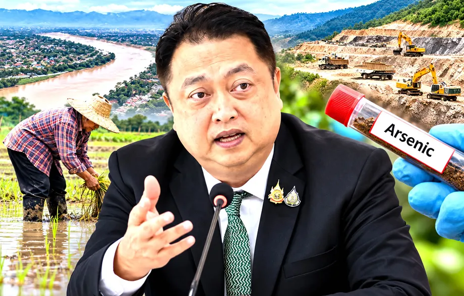
About 20% of agricultural areas tested in the Kok, Sai and Ruak river basins in Chiang Rai contained arsenic above the Department of Land Development's soil standard, while another 50% required monitoring, according to preliminary findings released on October 10. Only 30% fell into the department's lowest concentration category.
Contents
- Soil tests bring the river pollution crisis onto farms
- What the red, yellow and green categories mean
- Mae Sai farmers face a wider irrigation threat
- Flood sediment can carry contamination inland
- Crop restrictions need maps and income support
- Farmers want alternatives to polluted river water
- Upstream mining adds a regional dimension
- Health warnings and demands for action have accumulated
- Contaminated sediment presents another unresolved decision
- The Bottom Line
Parinyanon Thongkham, director of the Chiang Rai Land Development Station, confirmed that investigators collected more than 200 soil and water samples in an investigation funded by the Chiang Rai Irrigation Office. Soil was sampled at depths of 15 to 20 centimetres, at locations ranging from 100 metres to two kilometres from riverbanks.
The findings extend the immediate concern beyond polluted waterways to land used for agricultural production. Officials are advising farmers in areas with high contamination to avoid certain food crops, while researchers are calling for public contamination maps, treatment of affected soil and financial assistance for growers who cannot continue their usual planting.
The percentages describe the agricultural areas tested, not all farmland in Chiang Rai. The total of more than 200 also includes water samples, so it cannot be used to calculate an exact number of contaminated soil samples. These are preliminary results, rather than a completed assessment of every affected farm.
That distinction matters for consumers as well as farmers. Arsenic in soil identifies a potential route of exposure through agriculture, but does not establish the arsenic concentration in harvested rice, vegetables or other produce. Continued testing of agricultural products is among the measures researchers are requesting.
What the red, yellow and green categories mean
The department divides soil into three categories according to its arsenic concentration. Green soil contains less than 14 milligrams per kilogram. Yellow soil contains 14 to 25 milligrams per kilogram and requires monitoring. Red soil contains more than 25 milligrams per kilogram, exceeding the department's standard.
The preliminary distribution means that about 70% of tested agricultural areas were either above the standard or in the monitoring category, compared with 30% in green. Yellow areas accounted for two and a half times the share classified as red. This points to a monitoring task extending well beyond the most contaminated locations.
Officials plan to sample red areas every two to three months and yellow areas every six months. An earlier announcement described a broader programme of testing two to three times a year. The later schedule distinguishes monitoring frequency by contamination category, with more frequent checks for red areas.
These categories are soil management thresholds, not measurements of how much arsenic a person would consume. A milligram per kilogram measures the amount in a given mass of soil. River measurements, expressed in milligrams per litre, measure concentration in water and cannot be compared directly with the soil figures.
Mae Sai farmers face a wider irrigation threat
Concern is particularly acute in the Mae Sai irrigation system. Reports describe arsenic in the Sai River reaching 0.284 milligrams per litre, or 28.4 times the reference level used in that account. Lead reportedly reached five times its standard. Those measurements add urgency to decisions about using river water on farmland, although they do not describe conditions at every intake or on every sampling date.
More than 60,500 rai of farmland has been identified as threatened across five Mae Sai subdistricts: Mae Sai, Sri Mueang Chum, Pong Pha, Wiang Phang Kham and Koh Chang. Farmers rely on the RC1, RC2 and RC3 irrigation canals for seasonal rice and crops including potatoes, sweet corn, garlic, shallots, maize for animal feed, okra and soybeans.
The threatened area should not be confused with land confirmed to exceed the soil standard. Separately, a community petition sought soil monitoring across roughly 16,000 hectares of potentially contaminated farmland. These figures describe different geographic scopes and requests, rather than competing estimates of the acreage already proven contaminated.
Thongkham Inprom, chairman of the Ban Mueang Chum Water Users Group, described the concern among growers and customers:
Farmers are facing an immediate crisis with arsenic, lead, and cadmium. These poisons accumulate in the dirt and the food we grow. It is creating a massive wave of anxiety for both the farmers and the consumers who buy our produce.
Flood sediment can carry contamination inland
Distance from a river does not necessarily indicate lower contamination. Scientists examining soil within two kilometres of the rivers reported that some locations farther from the banks contained higher concentrations of toxic metals than locations beside the water. They attributed this pattern to floods carrying contaminated sediment into inland fields.
That observation helps explain why testing needs to cover farmland rather than stop at river channels. Water can recede while deposited mud remains. Repeated irrigation and flooding can also introduce more sediment, making soil management dependent on what continues to arrive from upstream.
Brian Eyler, director of the Stimson Center's Southeast Asia programme, called for testing of water, sediment and surrounding soil. He described the relative severity of the river contamination:
The Sai River actually has the worst levels of pollution of the rivers tested by Chiang Mai University, much worse than the Kok River, although the Kok River is still bad.
Parinyanon identified a practical gap in the response: agencies lack clear criteria for suspending irrigation intake when river water becomes heavily clouded by sediment. Visible cloudiness is not itself a precise arsenic measurement, but the concern about contaminated mud makes intake rules and timely testing central to protecting fields from further deposits.
Crop restrictions need maps and income support
The Chiang Rai Land Development Station is working with the Department of Agricultural Extension on alternative planting arrangements. Farmers in areas with high contamination are being advised to avoid food crops, particularly those grown for their leaves or fruits, and to consider alternatives such as energy crops that may be less likely to accumulate contaminants.
These alternatives are being considered, not presented as a verified solution for every field. Farmers need guidance identifying suitable species, cultivation methods and uses, alongside testing that establishes whether a proposed crop is appropriate for the contamination found locally.
Assistant Professor Sathian Chanta of Chiang Rai Rajabhat University's Faculty of Science and Technology called for detailed maps showing red, yellow and green agricultural zones. He said food crops should not be grown in red areas and urged treatment of contaminated soil to prevent further accumulation of metals.
Sathian also called for clear crop guidance in yellow areas and compensation for farmers restricted from growing their usual crops. No new compensation programme arising from the October findings has been confirmed. Reliance on rice and maize, limited agency budgets and uncertainty over irrigation supplies make an abrupt change in production difficult.
Publishing results at a useful geographic scale would connect the laboratory findings to those decisions. A basin percentage cannot tell an individual farmer which category applies to a field, whether irrigation should continue or which crop an agency recommends planting there.
Farmers want alternatives to polluted river water
On May 25, 2025, Thongkham submitted a complaint to Deputy Minister of Agriculture and Cooperatives Piyarat Tiyapairat during an inspection of the RC1 irrigation canal office. Farmers proposed solar powered groundwater wells on farms, faster construction of the Mae Kham Reservoir and international talks to stop upstream mining pollution and waste dumping.
The reservoir proposal faces a geographic complication: the planned reservoir, in Mae Fah Luang district, lies outside the service area of the five affected Mae Sai subdistricts. Thongkham has proposed a connecting pipeline to deliver water from the reservoir to RC1 and has been discussing the idea with upstream communities.
These remain proposals, rather than confirmed replacement supplies. Neither the wells nor the pipeline has a stated completion date. Any alternative intended to replace polluted river water would also need testing before it could be treated as suitable for agricultural use.
Piyarat ordered research into agricultural methods to block plant absorption of heavy metals. That work addresses exposure through crops, while new water sources would address continuing contamination from irrigation. Neither measure, by itself, establishes that metals already deposited in soil have been removed.
Upstream mining adds a regional dimension
A Stimson Center analysis published on September 22 identified 513 rare earth mining sites across Myanmar river basins feeding the Mekong, Salween and Irrawaddy systems. Forty sites were believed to have opened in 2025. Along the Ruak, Lwe and Kok rivers, 44 of 58 identified mines opened between 2022 and 2025, about 76% of that group.
The expansion supports concern about pollution originating upstream, including in parts of Shan state controlled by the United Wa State Army. The satellite inventory documents mining locations and growth. It does not, by itself, identify which operation produced the arsenic measured in a particular Chiang Rai field.
The mining process described in the analysis uses chemical solutions injected into hillsides to extract minerals, with liquid collected in pools below. Abandoned pools can retain contaminated wastewater that may overflow during heavy rain. Rain can therefore dilute pollution already in a river while also washing additional waste into streams.
China's demand for rare earth minerals, its controls on domestic mining and its dominant processing industry help explain the commercial pressure behind Myanmar's mining expansion. Thailand cannot directly regulate mines across the border, leaving negotiations and trade measures among the options being urged.
People's Party MP Phattarapong Leelaphat called for consideration of Section 104 of Thailand's Minerals Act of 2017 in relation to mineral import controls. A reported investigation identified more than 50 companies registered in Thailand importing critical minerals from Myanmar. That figure describes trade participation, not proof that every importer handled minerals from a polluting mine.
Health warnings and demands for action have accumulated
The response has developed over several months, moving from farmers seeking replacement irrigation water to wider requests for testing, health protection and regional negotiations. The principal dates are:
- May 25, 2025: Thongkham submitted the farmers' complaint and proposals for alternative water supplies to Piyarat.
- September 22: The Stimson Center published its analysis identifying 513 mining sites in Myanmar river basins.
- Early October: The Network for the Protection of Kok, Sai, Ruak, and Mekong Rivers submitted a petition to Thailand's new government.
- October 8: The Department of Disease Control warned residents in five Mae Sai subdistricts to avoid untreated Sai River water and aquatic animals caught in the river.
- October 10: The Chiang Rai Land Development Station released the preliminary agricultural soil findings.
The community network's petition sought monitoring across roughly 16,000 hectares, alternative water sources and provincial facilities for testing heavy metals. It also requested a halt to mineral imports from Myanmar until they could be shown to be free from pollution and negotiations involving Thailand, Myanmar and China.
Estimated losses across farming, fishing and tourism have been reported at 1.3 billion baht, approximately $40 million. That is a broader economic estimate, not a calculation of losses on the fields classified red in the October soil assessment, nor an announced compensation budget.
The health warning addresses untreated river water and river caught aquatic animals. It should not be read as a finding that all agricultural produce from Chiang Rai is unsafe. Establishing which products are affected requires the continuing agricultural testing researchers have requested.
Contaminated sediment presents another unresolved decision
A proposal involving the Pollution Control Department and Siam Cement Group would mix contaminated soil and sediment into cement products. Researchers have urged authorities to specify the intended uses and assess whether the resulting materials could pose risks in housing or the environment.
Dr Suebsakul Kitnukorn of Mae Fah Luang University called for transparency, participation by government agencies, academics, businesses and affected communities, and continued monitoring of environmental quality and agricultural products. Researchers also requested further study of sediment collected through dredging, sediment traps and water treatment.
Turning sediment into a construction material would not automatically establish that its contaminants are safely contained. The assessment needs to determine whether metals could be released during the material's intended use and what restrictions, if any, would be necessary. No completed safety assessment or final list of approved uses has been identified.
The immediate decisions remain agricultural as well as environmental: which fields require restrictions, which crops can be grown, how farmers will obtain suitable water and whether income support will follow. Red areas are scheduled for another sampling round within two to three months and yellow areas within six months, but no exact dates for those rounds, a compensation decision or completion of replacement water infrastructure have been announced.
The Bottom Line
- About 20% of tested agricultural areas exceeded the department's arsenic soil standard; 50% required monitoring and 30% were classified green.
- The investigation collected more than 200 soil and water samples. Its percentages do not represent all Chiang Rai farmland.
- Red areas will be sampled every two to three months and yellow areas every six months.
- Researchers want public contamination maps, crop guidance, soil treatment and compensation for affected farmers.
- Farmers have proposed groundwater wells and reservoir supplies, but replacement water delivery dates are not confirmed.
- Testing of agricultural products and the safety of proposed cement uses for contaminated sediment remain essential unresolved tasks.