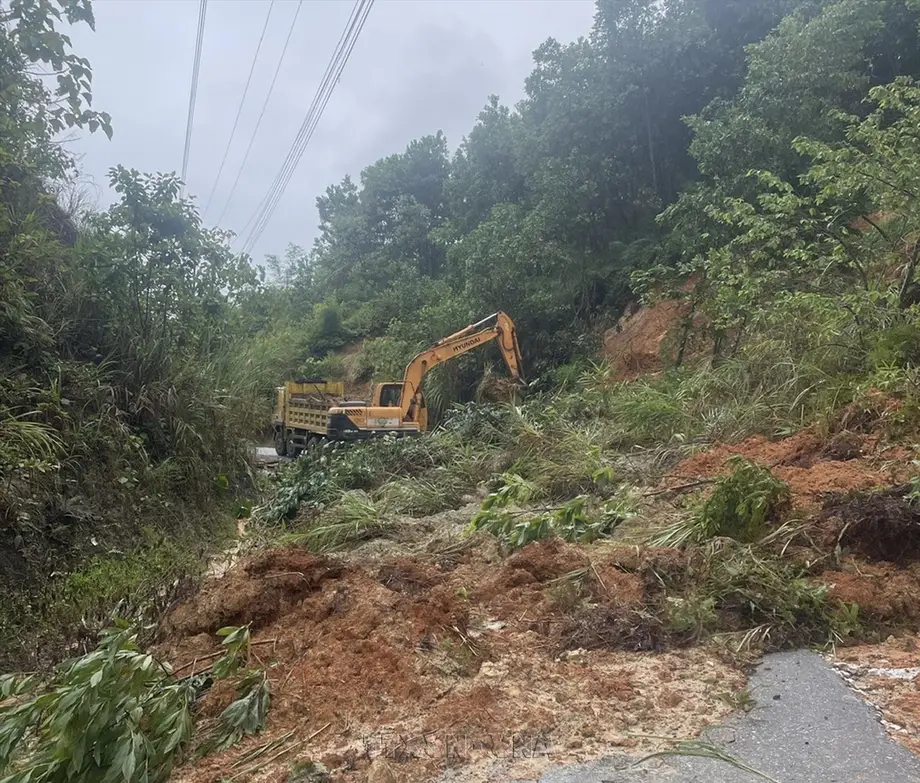
Thanh Hoa and Ninh Binh Bear Most of the Housing Damage
Floods have inundated 16,310 homes across five Vietnamese localities, with Thanh Hoa and Ninh Binh accounting for more than four fifths of the total. A disaster assessment recorded three deaths in a landslide in Phu Tho, while a subsequent account reported at least four deaths after the discovery of a university student in Hanoi.
Contents
- Thanh Hoa and Ninh Binh Bear Most of the Housing Damage
- Why the Reported Death Toll Differs
- Rainfall and Disruption Across Several Days
- Farmland Figures Show Damage Beyond the Headline Total
- River Defenses Under Pressure and Families Evacuated
- Road Closures, Train Suspensions and School Disruption
- Fresh Warnings Extended Beyond the Worst Hit Provinces
- The Wider Outlook Includes Both Storms and Water Shortages
- Key Points
The Vietnam Disaster and Dyke Management Authority, under the Ministry of Agriculture and Environment, put the housing total at 16,310 as of 17:30 on September 17. The flooding also damaged farmland, aquaculture areas, irrigation canals and schools, while landslides and standing water disrupted roads and the railway connecting Hanoi with Ho Chi Minh City.
Thanh Hoa had 8,419 inundated homes, followed by Ninh Binh with 4,787, Hanoi with 2,204, Nghe An with 749 and Phu Tho with 151. Together, Thanh Hoa and Ninh Binh accounted for 13,206 flooded homes, approximately 81 percent of the recorded total. Thanh Hoa alone accounted for just over half.
Four houses collapsed in Thanh Hoa, and another 29 houses were reported damaged. Those figures were listed separately from inundated homes. Flooding a house does not necessarily mean it has collapsed, but it can still leave residents unable to occupy it and damage belongings, electrical systems and access routes.
The housing count captures only part of the emergency. Authorities also faced dangerous river levels, damaged flood defenses and blocked transport routes. Later reports described communities still underwater after rainfall had stopped, showing that the end of a downpour did not immediately end the threat.
Why the Reported Death Toll Differs
The September 17 assessment recorded three people killed by a landslide in Da Bac commune, Phu Tho province, northwest of Hanoi. A subsequent account put the death toll at at least four, including a student from Hanoi University of Mining and Geology whose body was found on Friday.
The student, described as being in his first year, had been missing since Thursday. His body was found at the entrance to a drainage system leading toward a river in southwest Hanoi. Residents had discovered his blue motorbike near the entrance. He was suspected of having been swept into the drainage system during flooding, but that account did not establish a confirmed sequence of events.
The additional death helps explain the difference between the totals of three and at least four. There is also a timing discrepancy concerning the Phu Tho landslide: the September 17 assessment listed its victims by 17:30, while the subsequent account placed the landslide on Thursday evening. Reports do not resolve that difference, so the accounts should not be treated as one fully reconciled chronology.
Rainfall and Disruption Across Several Days
Downpours began on September 14, with some locations receiving as much as 653 millimetres of rain, according to a reported government statement. That figure represents an accumulated depth of rain at the affected locations, not floodwater depth and not a uniform total across the region. The measurement sites and accumulation period were not specified.
The main dates and developments reported were:
- September 14: Heavy rain began across northern Vietnam.
- September 17, 17:30: The disaster authority recorded three deaths and 16,310 inundated homes.
- September 17: Some Hanoi schools switched to online classes or gave students the day off.
- September 17 and 18: Several services on the railway between Hanoi and Ho Chi Minh City were suspended.
- September 17, through 23:30: A separate warning forecast continued rain in Dak Lak and Khanh Hoa.
- Thursday afternoon and Friday: A subsequent account said rain stopped on Thursday afternoon, while flooding persisted and the missing student was found on Friday.
The September 17 damage assessment does not specify a year in its description. Reports discussing the wider disaster outlook refer to 2026. That distinction matters when interpreting the annual statistics and forecasts, which should not be confused with confirmed losses from this flood alone.
Farmland Figures Show Damage Beyond the Headline Total
The disaster authority listed 22,499 hectares of submerged or damaged rice, crops and vegetables, plus 2,172 hectares of other crops. Those two categories total 24,671 hectares. Another 1,175.62 hectares of aquaculture areas were affected, bringing the combined agricultural and aquaculture footprint to 25,846.62 hectares.
This breakdown is more precise than the description of nearly 25,000 hectares of crops and aquaculture. The crop categories alone approach 25,000 hectares; including aquaculture takes the total above that level. Aquaculture refers to areas used to raise fish or other aquatic organisms, so these losses concern a different form of food production from flooded fields.
A subsequent account reported more than 59,305 acres of affected rice, vegetables and other crops, equivalent to roughly 24,000 hectares, and 2,900 acres of aquaculture, approximately 1,174 hectares. The aquaculture estimate is close to the authority's figure, but the crop figure is not an exact conversion of the combined 24,671 hectares. Reports do not explain whether the difference reflects rounding, timing or category definitions.
Some 1,999 metres of irrigation canals were also eroded or damaged. Canal damage adds a repair need beyond the immediate loss of crops because these channels move water through agricultural areas. No monetary estimate, harvest loss assessment or repair timetable was given for the affected fields, aquaculture areas or canals.
River Defenses Under Pressure and Families Evacuated
Two incidents were recorded on the dyke system. In Ninh Binh, erosion affected a section of the dyke on the left bank of the Day River. In Hanoi, water overtopped 1.4 kilometres of dykes and embankments in Xuan Mai and Kieu Phu communes. Local authorities mobilised personnel to address both incidents.
Overtopping means water has risen above a barrier and flowed across it. It is different from a confirmed breach, in which the structure breaks open. The assessment described overtopping in Hanoi and erosion in Ninh Binh, without reporting that either incident had developed into a breach.
Along the Bui River southwest of Hanoi, dangerous water levels left dozens of households cut off. Authorities evacuated 150 families, comprising more than 500 people, from areas vulnerable to inundation. The evacuation figure documents one response operation; it is not a total for everyone displaced across the affected provinces.
Local authorities activated disaster response and search and rescue plans. In Thanh Hoa, more than 29,000 officials and soldiers were mobilised for emergency assistance. Reports did not provide a breakdown of their assignments or a total number of residents assisted.
Road Closures, Train Suspensions and School Disruption
Eleven landslide sites blocked national and provincial roads, including four on National Highway 15C and three on National Highway 217. Another 30 locations were inundated, causing congestion. These are counts of affected sites, rather than a measure of the total length of road closed.
The railway between Hanoi and Ho Chi Minh City was submerged by about one metre between Bim Son and Do Len. Passengers were transported by road through the affected section, and several train services were suspended on September 17 and 18. No confirmed date for full restoration was reported.
Road transfers provided an alternative to the flooded railway section, but the wider road network was itself affected by landslides and standing water. The reports do not establish which transfer routes were used or how many passengers experienced delays.
In Hanoi, floodwater reached as much as one metre in some streets, disrupting traffic in the city centre. Some schools moved lessons online or gave students September 17 off. Separately, the disaster assessment recorded 15 flooded schools across affected localities, without identifying them or stating when they could reopen.
Fresh Warnings Extended Beyond the Worst Hit Provinces
The National Steering Committee for Civil Defence instructed ministries, sectors and local authorities to monitor heavy rain, river flooding, flash floods and landslides, with particular attention to Hanoi, Ninh Binh, Thanh Hoa and Phu Tho. It called for urgent recovery work alongside continued precautions.
Authorities were told to monitor river levels, strengthen warnings about rapidly rising water and deep inundation, and evacuate people from areas exposed to floods or landslides. They were also instructed to maintain duty around the clock so information and response efforts could be coordinated.
The National Centre for Hydro-Meteorological Forecasting separately warned of rain in Dak Lak and Khanh Hoa through 23:30 on September 17. It forecast 20 to 50 millimetres, with local totals above 80 millimetres, and warned of flash floods on small rivers and streams and landslides on steep slopes.
Flash floods can rise quickly in smaller waterways, leaving much less time to move than slower river flooding. The forecasting agency urged authorities to review vulnerable locations and potential obstructions to water flow. Another forecast called for more rain from Thanh Hoa to Hue through the weekend, with some places expected to receive more than 100 millimetres.
The Wider Outlook Includes Both Storms and Water Shortages
A separate account of government statements placed Vietnam's disaster toll in 2026 at 63 people dead or missing, with losses of about 2.2 trillion dong, approximately S$108 million. It said financial losses were 84.9 percent lower than in the same period of 2025. These are national figures for multiple disasters, not the cost or death toll of the September flooding.
The comparison follows a year of repeated storms and floods. Tropical Storm Wipha brought heavy rain in July 2025, followed by flooding and landslides during Tropical Storm Kajiki in August. Typhoon Bualoi killed at least 26 people in September. Hue, Hoi An and much of northern Vietnam experienced flooding in October.
The outlook described up to five further storms off Vietnam's coast during the remainder of 2026, with one or two potentially reaching the mainland. It also projected that El Nino could reduce rainfall in central and southern Vietnam by 10 to 50 percent later that year, potentially affecting around 350,000 hectares of Mekong Delta rice fields. Severe water shortages were forecast in the central highlands, a major coffee growing region.
El Nino is a warming pattern in the tropical Pacific that can alter rainfall far beyond the ocean itself. A forecast of reduced seasonal rainfall does not rule out individual episodes of intense rain. The immediate task remained evacuation and recovery in flooded areas, while the wider outlook described risks to water supplies and farming later in the year. No consolidated recovery cost, full reopening schedule or final reconciled casualty count was reported.
Key Points
- The September 17 assessment recorded 16,310 inundated homes, approximately 81 percent of them in Thanh Hoa and Ninh Binh.
- The official assessment listed three landslide deaths in Phu Tho; a subsequent account reported at least four deaths including a Hanoi student.
- Listed crop damage covered 24,671 hectares, with another 1,175.62 hectares of aquaculture affected.
- Eleven landslide sites blocked roads, while 30 other locations were flooded and several train services were suspended.
- Authorities evacuated more than 500 people near the Bui River and mobilised more than 29,000 officials and soldiers in Thanh Hoa.
- Further rain warnings covered Dak Lak, Khanh Hoa and the area from Thanh Hoa to Hue.