A disappearing village shows what the delta faces
About 40 percent of Vietnam's Mekong Delta could be submerged by 2100, and more than half its residents could be directly affected if current trends continue, according to estimates widely cited by development agencies. The threat comes from two directions: rising seas and sinking ground. Nearly 20 million people live on this plain of about 40,000 square kilometers, where most land stands less than two meters above sea level.
Contents
- A disappearing village shows what the delta faces
- Why the ground is sinking
- The river is losing the material that builds land
- Saltwater is reaching farther into daily life
- Farmers face losses and difficult choices
- The economic risk extends beyond the harvest
- Vietnam's plan to live with seasonal water
- Mangroves and bamboo fences help rebuild the coast
- The delta needs cooperation beyond Vietnam
- Reducing pumping and coordinating investment
- Families need protection and a workable next decade
- The Bottom Line
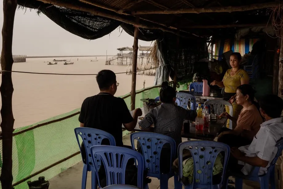
Outside Vinh Chau, restaurant owner Danh has already lost the village where she grew up. In August 2021, a spring tide tore through it in a single night. Waves reached the road and homes on both sides. When the water receded, little remained to rebuild.
Danh rebuilt a modest eatery on higher stilts. From there, she watches the tide briefly uncover tiles from an old washroom before brown water covers them again. Blackened concrete lies scattered across the mud. Recalling the destruction and the difficult months afterward, she said:
Everything was gone. The waves were very high. They reached all the way to the road. I lost everything that day.
The delta produces about half of Vietnam's rice and a large share of its aquaculture and fruit. Its vulnerability therefore reaches beyond coastal villages, threatening food production, exports, roads and household incomes. Salt is moving inland while the river brings less sand and silt to replace land lost through erosion and compaction.
Vietnam has begun shifting toward a strategy of living with nature, supported by a regional plan running to 2030 with a vision to 2050. The central challenge is to protect communities while restoring some of the seasonal water and sediment movements that built the delta in the first place.
Why the ground is sinking
Wells across the delta supply cities, farms and shrimp ponds. Pumping large amounts of groundwater from deep, soft layers causes the sediments to compress. As those underground layers become more tightly packed, the surface above them drops. This process is called subsidence.
International assessments estimate average subsidence at about 1.1 centimeters a year. Researchers have documented rates of two to three centimeters a year in areas with heavy groundwater extraction. At those rates, a house, road or canal bank can sit many centimeters lower relative to the tide after a decade, even if the structure itself has not moved sideways.
Global sea level is rising by about three millimeters a year. Expressed in the same units, the delta's average sinking rate is about 11 millimeters a year, more than three times that sea level figure. Local ocean conditions and subsidence can make the rise of water relative to the land greater still. Residents face the combined effect of water moving up and ground moving down.
Groundwater use is a pressure that Vietnam can address directly. Sinking can accelerate where pumping expands and slow where households and businesses move to cleaner surface water or piped supplies. Making that switch requires dependable alternatives for the people who currently rely on wells.
The river is losing the material that builds land
The Mekong built its delta over millennia by carrying sediment downstream and depositing it across wetlands and floodplains. Sand and silt are the raw materials that replenish riverbanks, mudflats and farmland. Today, the surface is compacting faster, sediment supplies have fallen, and the sea is rising.
Upstream hydropower dams trap sediment in reservoirs. Within the delta, intensive sand mining for construction removes more material and deepens river channels. Analyses by conservation groups and academic teams show that some riverbeds in the lower Mekong have been deepening by 200 to 300 millimeters a year.
Deeper channels allow tides to reach farther inland and grow taller within the river network. Salinity in certain channels has doubled in about 15 years. High dikes built to keep fields dry for multiple rice harvests also stop floodwater from spreading over the land, reducing the sediment and nutrients reaching farm soils.
Matt Kondolf, a professor of landscape architecture and environmental planning at the University of California, Berkeley, described the scale of the danger when he and colleagues assessed the delta's outlook in a major scientific review:
It is hard to fathom that a landform the size of the Netherlands and with a comparable population might disappear by the end of the century.
Sediment, water and elevation form one connected system. Fresh deposits can help build up land, while compaction lowers it. When deposits no longer keep pace with sinking ground, every high tide, storm surge and dry season advance of salt reaches a landscape that is lower relative to the sea.
Saltwater is reaching farther into daily life
Coastal erosion, stronger tidal reach and deeper saltwater intrusion are changing the delta's shoreline and waterways. In some exposed stretches without natural protection, observers have measured shoreline retreat of tens of meters a year. The damage is uneven, making conditions difficult to predict from one stretch of coast to another.
The 2016 drought, described as the worst in nearly a century, showed how severe the pressure can become during dry periods. Longer, hotter dry spells are especially damaging when river flows are low and upstream reservoirs hold back water. A string of harsh dry seasons has added to the stress.
Canals that once delivered fresh water to rice fields now remain brackish, a mixture of fresh and salt water, for long stretches of the dry season. Orchards can fail when salty groundwater reaches their roots. Fish cages and shrimp ponds become harder to manage when salinity changes more quickly between seasons.
Saltwater intrusion therefore affects more than the coast. A saline front that takes longer to retreat can delay planting farther inland. Farmers must match their crops and production schedules to water conditions that are becoming less dependable.
Farmers face losses and difficult choices
Severe saltwater episodes have caused devastating harvest losses in affected areas. Assessments have recorded damage to most rice plots in some salt affected tracts, with many fields failing entirely. The pressure on rice matters nationally because the delta supplies about half of Vietnam's production.
Climate modeling for Can Tho, a central city in the delta and a core rice growing area, projects lower yields across all three growing seasons by the middle of the century without adaptation. A detailed crop simulation study found average declines of about 5.5 to 8.5 percent when potential benefits from carbon dioxide fertilization were excluded.
Carbon dioxide fertilization refers to the possibility that additional carbon dioxide in the air helps crops grow. The study described those gains as uncertain under actual farm conditions, where ozone and heat waves can weaken them. Extra irrigation and fertilizer alone did not offset the projected yield losses.
Households in the Ca Mau peninsula and other coastal districts are changing what they produce. Many are replacing a third rice crop with aquaculture during the wet season, then returning to crops on soils enriched by flood silt. The change gives seasonal water a productive role rather than requiring fields to stay dry throughout the year.
Mangroves restored along pond edges can buffer waves, while shrimp from these systems can earn premium prices. Such changes need marketing support and clear rules to avoid excessive use of water and chemicals. They suit some locations better than others, depending on soil, water and access to buyers.
The economic risk extends beyond the harvest
Vietnam's rice bowl also anchors an expanding export economy in seafood and fruit. Recent economic analyses show that the delta bears a disproportionate share of the country's climate related losses. Even moderate temperature and sea level scenarios reduce land suitable for rice and threaten housing and roads on low ground.
Forests face fire risk during drought years. Storms cause less average damage in southern Vietnam than in central coastal provinces, yet strong events still destroy homes and leave high recovery costs. Without targeted adaptation, farming, infrastructure and household earnings face increasingly unstable conditions.
The delta's connected farms and waterways can spread a local problem across a much larger area. A blocked canal can deprive communities downstream of fresh water. Intensive sand mining in one location can undermine a bridge foundation many kilometers away. A delayed planting season can mean a harvest misses its market window.
Small farms dominate production and often lack the capital needed for equipment, salinity control or a switch to different crops. Regional planning, access to credit and practical technical support are therefore as necessary as physical defenses. Cold storage, processing and reliable transport also help adapted farming systems earn enough to sustain households.
Vietnam's plan to live with seasonal water
Vietnam adopted its living with nature strategy for the delta in 2017. It accepts floods, brackish water and seasonal change as parts of the landscape. In suitable areas, the approach moves away from squeezing in a third rice crop and toward production that benefits from seasonal inundation.
Farmers receive support to let fields flood during the wet season for aquaculture and then plant after the water recedes, using soils replenished by natural sediment. In floodplains, embankments are being designed to protect villages while allowing water rich in nutrients into designated fields, where it can be safely stored and used.
An integrated regional master plan coordinates water, land, agriculture, transport and industry to 2030, with a vision to 2050. Prepared with technical partners and extensive data, it sets four connected goals: agriculture with greater value, hubs for agricultural processing and industry, better transport and logistics, and water management organized around ecological zones.
Ecological zoning means planning around the water and environmental conditions of different areas. The plan focuses on livelihoods that can withstand climate pressures and on building with nature where possible. Digital tools and monitoring networks track river and coastal conditions to support decisions based on current evidence.
The major events and planning milestones span several years:
- 2016: A drought described as the worst in nearly a century exposed the damage caused by severe dry conditions.
- 2017: Vietnam adopted the living with nature strategy for the delta.
- 2020: A Mekong Delta coordinating council was created to align ministries and provinces.
- August 2021: A spring tide destroyed much of Danh's home village outside Vinh Chau.
- 2030 and 2050: The regional master plan sets its planning horizon and longer vision.
- 2100: Projections warn that about 40 percent of the delta could be submerged if current trends continue.
Mangroves and bamboo fences help rebuild the coast
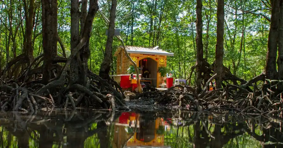
Mangrove restoration is already shaping coastal protection in several provinces. Belts of trees absorb wave energy and help shield roads and farms. Bamboo fences placed in shallow water slow waves and trap silt, allowing new mudflats to form and mangroves to take root again.
Some locations using these softer defenses have seen the shoreline advance seaward by well over a hundred meters. Results depend on local currents, sediment supplies and land use. Concrete walls remain necessary in places exposed to powerful waves and in densely populated urban areas.
Pilot projects point toward a combination of measures chosen for each stretch of coast. Restored trees and barriers that retain sediment can rebuild suitable areas, while stronger engineered defenses protect places where exposure and concentrations of people demand them.
Universities, local partners and development banks are also running training in agriculture suited to saline conditions. Farmers learn to select varieties that tolerate salt, manage water more efficiently and reorganize the steps that take crops from farms to markets. Early efforts have improved confidence in private investment in seeds, soil testing and storage.
The delta needs cooperation beyond Vietnam
The Mekong flows from China's highlands through five countries before reaching the sea. Choices about dam locations, reservoir levels and sand extraction affect the amount of water and sediment reaching Vietnam, as well as the timing of those flows.
The Mekong River Commission has joined Chinese partners in a study spanning several years to examine how climate and hydropower have altered river flows since the main period of dam construction. Its value depends on transparent data and a willingness to adjust operations to reduce harm downstream. No completion date was given.
Susanne Schmeier, an associate professor of water law and diplomacy at IHE Delft and a coauthor of a major scientific review, called for action across governments and other institutions:
Rapid and urgent action is needed. Efforts by national governments, regional organizations and international actors, as well as the private sector and civil society, are all needed if the Mekong delta is to have a chance. We need basin wide, fast and concerted cooperation among all partners.
Researchers and practitioners have identified practical changes. Dams can be located and operated to pass more sediment. Recycled materials and manufactured aggregates, construction materials made to replace natural sand, can reduce demand for river mining. Extraction that continues needs tight licensing and monitoring.
Inside the delta, lowering or changing selected dikes would let floods deposit silt in designated areas while protecting critical assets. Along suitable coasts, mangrove restoration and soft barriers can be expanded where they provide the best return for the money spent and the length of shoreline protected.
Reducing pumping and coordinating investment
Vietnam can slow subsidence by expanding piped water from cleaner surface sources, improving treatment and fixing leaks. Reliable supplies would give households and businesses a reason to move away from private wells. More careful licensing of new wells and closure of illegal ones would limit further pressure in stressed districts.
Urban plans can store rainwater in parks, ponds and restored wetlands. Those spaces help recharge shallow underground water layers and reduce local flooding. Groundwater prices that reflect the real cost of extraction can also encourage users to choose alternatives.
The Mekong Delta coordinating council, created in 2020, is responsible for aligning the work of ministries and provinces. The regional master plan provides a framework for investment, while international partners support risk mapping, community engagement and innovation.
Development agencies identify tens of billions of dollars in potential investment in renewable energy, agriculture adapted to climate conditions, processing and logistics in southern Vietnam. Programs helping micro and small enterprises adopt technology can raise incomes while reducing their exposure to climate risks.
Families need protection and a workable next decade
Erosion and subsidence have already pushed some villages inland. Authorities in other places have helped elderly residents relocate, while younger households seek work in towns or other provinces. The losses include community ties and local culture as well as damaged buildings.
Disaster management has expanded, but early warnings, evacuation support and recovery finance still need to reach the smallest hamlets. Danh's experience shows how a single destructive tide can leave a family facing months of recovery and a permanently changed home.
Farmers and fishers bring knowledge of channels that are silting up and banks close to collapse. Their involvement in decisions about canal deepening, mangrove restoration, bamboo fences and concrete walls can help projects last longer and cost less. Training in saline agriculture and support for cooperatives also help small producers reach markets that reward quality and sustainable practices.
Research and field projects identify measurable priorities for the early 2030s. Reducing groundwater pumping in districts most vulnerable to sinking requires expanded piped surface water and closure of illegal wells. Passing more sediment through key dams during periods of high flow and limiting mining where riverbeds are deepening fastest would address the loss of land building material.
Other priorities include restoring wide mangrove belts, placing soft barriers where they can build mudflats, and changing selected dikes so fields receive silt without exposing towns and roads. Farmers need support to adjust crop calendars and move toward aquaculture or crops that tolerate salt where local conditions require it.
Monitoring tides, salinity and groundwater, and publishing current readings, would help farms and municipalities make decisions. Better logistics, cold storage and processing could secure fair prices for products such as mangrove shrimp and fruit from orchards enriched by floods. Cooperation across borders, through shared data and joint planning, would connect these local efforts to the river system that sustains them.
The Bottom Line
- Nearly 20 million residents face the combined pressure of rising seas, sinking ground, erosion and saltwater intrusion.
- Average subsidence is about 1.1 centimeters a year, reaching two to three centimeters in heavily pumped areas.
- Dams, sand mining and flood excluding dikes reduce the sediment available to replenish land and farm soils.
- About 40 percent of the delta could be submerged by 2100, with more than half its residents directly affected if current trends continue.
- Rice, seafood and fruit production face growing risks, while some farmers are adapting through aquaculture and crops that tolerate salt.
- Vietnam's living with nature strategy and regional plan combine changes in farming, water management, infrastructure and coastal protection.
- Reducing groundwater use, restoring sediment flows and strengthening cooperation across the Mekong basin are central priorities.