A National Network Connects Air, Water, Soil and Sea
China has unveiled an environmental monitoring system spanning more than 330,000 stations, supported by satellites, drones and automated laboratories, as it works toward a more digital and intelligent network by 2030. Developed under the leadership of the China National Environmental Monitoring Center (CNEMC) and the Chinese Academy of Sciences, the system brings together information about the country's air, water, soil and marine environments.
Contents
- A National Network Connects Air, Water, Soil and Sea
- How Measurements Reach a Central Platform
- Four Layers Extend the Network's Reach
- Automation Changes How Samples Are Collected and Checked
- A Satellite Record Reaches Back to 1985
- Air and Water Figures Show Progress
- Administrative Reform Supports the Technology
- International Cooperation Extends Beyond China's Borders
- What China Plans to Change by 2030
- A Parallel Effort Watches the Space Environment
- Key Points
The network is presented as the world's most advanced environmental monitoring system and a potential model for other countries. Its central idea is straightforward: collect measurements across a vast area, bring them together quickly and use them to guide decisions about pollution and ecological protection.
China's environmental figures show the scale of the changes accompanying this effort. National PM2.5 levels fell by more than 35% between 2015 and 2022. In 2024, average PM2.5 density across 339 major cities was 29.3 micrograms per cubic meter, while more than 90% of the country's surface water was classified as fairly good.
Monitoring provides authorities with measurements to identify problems, direct action and follow the results. The broader approach combines technology with changes in environmental administration, pollution controls and international cooperation.
As of July 31, 2025, China was also addressing gaps in coverage, dependence on imported advanced instruments in some regions and the difficulty of keeping measurements reliable across such a large network. Those practical issues sit alongside its ambition to connect observations from space, the air, the ground and the sea.
How Measurements Reach a Central Platform
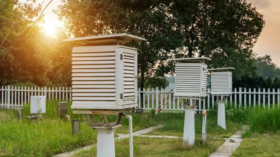
More than 330,000 monitoring stations form the physical foundation of the system. Satellites, unmanned drones and automated laboratories extend its reach and add different kinds of observations. Together, they collect information that would be difficult to obtain through individual stations alone.
The network covers several groups of measurements:
- Air pollutants, including PM2.5, PM10, sulfur dioxide, nitrogen dioxide, ozone and carbon monoxide.
- River water chemistry and surface water quality.
- Soil contamination and changes in land use.
- Ocean currents, marine pollution and emissions from ships.
Data flows in real time to a central platform described as a smart brain. Artificial intelligence and predictive models process the incoming measurements, look for patterns and turn them into information that authorities can use. The aim is to support early warnings, assessments of ecological health and forecasts of climate trends with greater speed and accuracy.
Dr. Dawei Zhang, director of the CNEMC, described intelligent monitoring as a necessity and argued that combining immediate measurements with analysis can help authorities act before environmental damage spreads:
Intelligent environmental monitoring is no longer a luxury—it's a necessity. Our experience shows that when real-time data is integrated with smart analytics, we can predict, prevent, and even reverse environmental damage. This system is not just a national achievement—it's a scalable, collaborative tool that can help the global community respond more effectively to ecological challenges.
Four Layers Extend the Network's Reach
Satellites and other remote sensing technologies provide frequent observations over large areas. Their measurements cover vegetation, land cover and atmospheric conditions, giving authorities a broader view than a single monitoring site can offer.
Ground stations and automated laboratories provide measurements at city and regional levels, particularly for air and water quality. Drones and marine sensors extend observations into remote or hazardous areas. The four connected domains are intended to reduce gaps between what can be seen from above and what is happening at a particular location.
Beijing has introduced artificial intelligence systems described as fish face recognition to support river water monitoring. The city has also deployed more than 200,000 smart technology spots to track conditions affecting air, water and soil.
At sea, China's domestically developed omnidirectional ship monitoring system provides visibility through 360 degrees. It combines visible light and infrared sensors for continuous detection of maritime hazards and pollution sources in different weather conditions. Ship monitoring supports both maritime safety and pollution control.
Automation Changes How Samples Are Collected and Checked
Artificial intelligence and big data tools process large streams of measurements, identify unusual readings and help locate pollution sources. Predictive models use those patterns to anticipate environmental risks so authorities can consider action before conditions worsen.
Automated laboratories conduct rapid, standardized testing of air, water and soil samples. Their purpose is to shorten response times and reduce operating costs while making testing procedures more consistent. Smart sampling and remote diagnostics also allow newer monitoring stations to operate autonomously with less direct human intervention.
Satellites and drones supply images with fine detail from places that may be difficult to reach. Those observations support analysis of land use, biodiversity tracking and disaster response. Remote sensing, in this setting, means gathering information about a place without needing to take every measurement directly on the ground.
IPv6 networks provide the communications framework for connections between monitoring points. Their adoption supports real time data exchange, data integrity and the ability to expand the network. Traceable workflows and immediate alerts for unusual readings help operators follow how information was collected and identify measurements that need attention.
These technologies are designed to make the network responsive as well as extensive. A station must produce usable information, while the wider system must be able to combine it with other measurements and adapt to emerging environmental problems.
A Satellite Record Reaches Back to 1985
China released an annual Leaf-On Landsat composite dataset in 2024 covering the years 1985 to 2023. It gives researchers and policymakers a long record for examining vegetation, changes in land use and climate impacts.
The dataset combines satellite observations into annual images intended to provide seamless coverage. Cloud cover and differences between sensors can interrupt such records, so the processing uses techniques including medoid compositing and gap filling to improve consistency and data quality.
Medoid compositing selects a representative observation from a group of measurements. Gap filling addresses missing portions of the record. Together, these methods help make images from different years more useful for comparison and support environmental assessments across large areas.
The main dates and periods behind the monitoring effort and its reported results are:
- 1985 to 2023: the period covered by the annual Leaf-On Landsat composite dataset released in 2024.
- 2013 to 2024: Beijing's annual average PM2.5 density fell by nearly 66%.
- 2015 to 2022: national PM2.5 levels dropped by more than 35%.
- 2024: average PM2.5 density in 339 major cities reached 29.3 micrograms per cubic meter.
- 2030: the target year for further digitalization and more intelligent operation of the environmental monitoring network.
Air and Water Figures Show Progress
China's average PM2.5 density of 29.3 micrograms per cubic meter in 339 major cities in 2024 marked five consecutive years below the interim national standard of 35 micrograms per cubic meter. PM2.5 refers to fine particles in the air, with density expressing how much of that material is present in a given volume.
The 2024 average was 5.7 micrograms per cubic meter below that standard, or about 16% lower. The proportion of days with fairly good air quality reached 87.2%, while more than 90% of surface water was classified as fairly good.
Beijing recorded a nearly 66% reduction in annual average PM2.5 density between 2013 and 2024. Its approach included comprehensive analysis of pollution sources and interventions directed at those sources. Identifying where pollution comes from helps authorities decide where controls and enforcement should be concentrated.
Water cleanup achievements included the elimination of black and odorous water bodies in urban areas and treatment of 80% of severely polluted water bodies in county seats. These measures address places where poor water conditions directly affect nearby communities.
Soil contamination monitoring, marine pollution tracking and biodiversity assessments have also benefited from the integrated network. The ability to locate pollution sources and follow changes in real time supports environmental policy responses and public health protection.
Administrative Reform Supports the Technology
China's monitoring expansion operates alongside environmental vertical management reform, known as EVMR. The reform shifts authority for environmental protection from local governments to provincial governments, changing who supervises environmental work and how responsibility is organized.
The reform has strengthened regulatory capacity, improved law enforcement and increased corporate compliance with environmental, social and governance standards, commonly called ESG. In practical terms, the governance structure affects how monitoring findings are followed up and how companies respond to environmental requirements.
Implementation remains uneven, and provincial governments can lack incentives to carry out reforms effectively. Central oversight, clearer incentives and continued investment in technological innovation are identified as requirements for sustaining progress.
The network's value therefore depends on both measurements and administration. Authorities need dependable information, institutions able to investigate problems and a working process for turning findings into action.
International Cooperation Extends Beyond China's Borders
Digital laboratories and sensing tools have been deployed in Belt and Road countries, where their use has been associated with a doubling of laboratory efficiency and lower operating costs. This extends parts of China's monitoring approach beyond its domestic network.
The architecture is designed to support data sharing and cooperation through initiatives including the Group on Earth Observations and the Global Environmental Monitoring Partnership. Shared measurements and common working methods can help countries respond to environmental threats that cross national borders.
China's approach offers other countries an example of combining a large physical network with automated testing, digital communications and government supervision. Its ability to expand and adapt is central to the argument that the system could serve as a model for environmental governance elsewhere.
International cooperation also gives a practical purpose to consistent data management. Measurements become more useful across borders when participating institutions can understand how they were collected and use them in joint assessments.
What China Plans to Change by 2030
The Ministry of Ecology and Environment aims to accelerate the digitalization and intelligent operation of the monitoring network by 2030. Its plans include closer integration of aerial, terrestrial and maritime systems and development of a central smart brain for environmental governance.
Future equipment is intended to extend biodiversity tracking and noise monitoring. Policy support will also promote environmental protection robots and equipment that can be operated remotely, expanding the tasks that can be performed without personnel being continuously present at a monitoring site.
Some regions still rely on imported advanced instruments. Remote and less developed areas also have gaps in network coverage. Expanding the system therefore involves both installing equipment in more places and strengthening the technical capacity needed to operate it.
Data quality and standardized operations remain priorities as artificial intelligence, robotics and advanced remote sensing become more closely integrated. A large network needs consistent procedures so that readings from different places can be combined and compared.
The 2030 goal sets the direction for modernization. Individual deployment dates for the planned technologies were not specified.
A Parallel Effort Watches the Space Environment
The Chinese Meridian Project (CMP) is another part of China's wider monitoring ambitions. Its network on the ground tracks interactions between the Sun and Earth, space weather and geomagnetic activity.
These observations support scientific research and international cooperation. CMP data is shared globally, filling gaps in space environment monitoring and supporting initiatives such as the International Meridian Circle Program.
The project broadens the scientific picture beyond pollution measurements in air, rivers and seas. Its focus is the space environment and the processes connecting solar activity with conditions around Earth.
Across these different efforts, China's approach combines observations, data processing and institutions responsible for using the results. Cleaner air and improved water conditions accompany that broader program, while coverage gaps, equipment needs and uneven implementation remain practical challenges.
Key Points
- China's environmental network combines more than 330,000 monitoring stations with satellites, drones and automated laboratories.
- The CNEMC and the Chinese Academy of Sciences led development of a system connecting observations from space, the air, the ground and the sea.
- National PM2.5 levels fell by more than 35% between 2015 and 2022. The 2024 average in 339 major cities was 29.3 micrograms per cubic meter.
- Beijing's annual average PM2.5 density fell by nearly 66% between 2013 and 2024.
- Artificial intelligence, automated testing, remote sensing and IPv6 communications support data collection, analysis and early warnings.
- Administrative reform shifts environmental authority toward provincial governments, while uneven implementation and limited incentives remain concerns.
- China aims to further digitalize its network by 2030, with plans covering biodiversity, noise, robotics and remote operation.
- International data sharing and deployments abroad extend the program's reach, while the Chinese Meridian Project contributes observations of the space environment.