A larger city plans for a different kind of growth
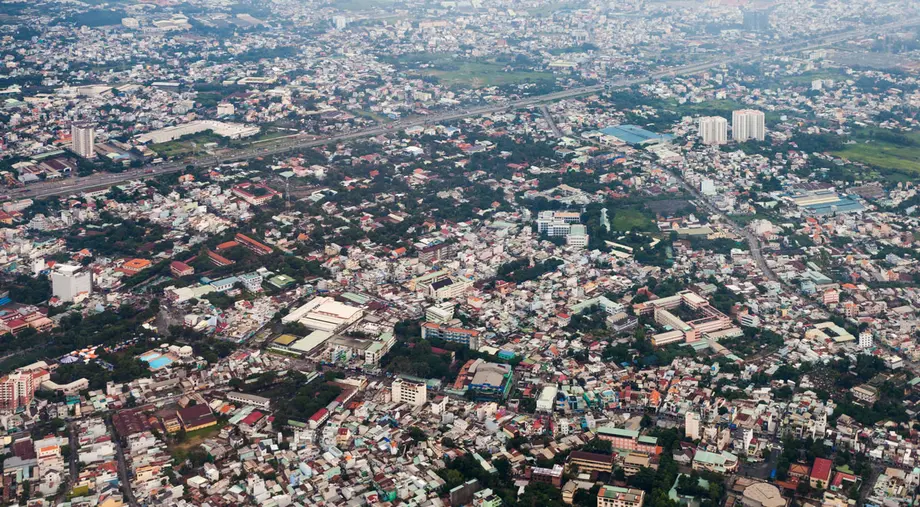
Ho Chi Minh City's People's Council approved a master plan on October 30, 2026, that projects more than 27 million residents by 2050 and seeks to spread jobs, housing and public services across a network of connected urban centers. The plan includes targets for 18 urban railway lines stretching about 961 kilometers and a further 450 kilometers of light rail and tramways.
Contents
- A larger city plans for a different kind of growth
- Five growth poles, with different jobs
- Railways will shape where neighborhoods grow
- Ports and factories need connections beyond the city
- Higher value industries and a larger maritime economy
- Flood protection and development above and below ground
- Canal relocation brings a major housing task
- Population forecasts draw calls for caution
- Universities and hospitals face large expansion targets
- Approval must now become funded projects
- The milestones stretch from 2030 to 2075
- Key Points
Approved at the council's sixth session, the framework covers 2025 to 2050 with a strategic vision extending 100 years. Its territory spans about 6,772.59 square kilometers and 168 administrative units, reflecting the enlarged city following the incorporation of Binh Duong and Ba Ria-Vung Tau in July 2025.
The council passed 47 resolutions at the session. The master plan gives different parts of the city distinct economic roles, while linking development to transport, education, healthcare and protection against flooding. For residents, its practical consequences will include where new homes are built, how neighborhoods around railway stations change and where hospitals and universities expand.
The approved population trajectory reaches about 18 million in 2030, 25 million in 2045 and more than 27 million in 2050. Between the first and last of those milestones, the city would gain more than 9 million residents, an increase exceeding 50%. Providing services for that growth is central to the plan.
Vice Chairman of the municipal People's Committee Nguyen Manh Cuong presented the proposal on October 29. Planning began in early 2026 and incorporated more than 1,526 comments before submission to the council.
Five growth poles, with different jobs
The plan replaces a model concentrated mainly in the historic urban core with several connected centers. A growth pole is an area where related businesses, infrastructure and services are grouped to support economic activity.
Five poles form the main structure:
- The Saigon, Cho Lon and Thu Thiem core will focus on international financial services.
- The eastern pole will concentrate on innovation and technology.
- The northern pole will develop industry, advanced manufacturing, high technology and logistics.
- The southern pole will combine seaports, free trade, international logistics and energy industries.
- The western pole will focus on urban development, education and healthcare.
Five satellite centers will support this structure: Con Dao, Long Hai-Ho Tram, Hoc Mon-Cu Chi, Bau Bang and Bac Tan Uyen. The more detailed description identifies the last center as Tan Uyen-Bac Tan Uyen.
The city will also establish 10 development management zones based on local functions, land conditions, infrastructure, environmental needs and identity. Five strategic connection systems will link the centers through transport corridors, production and logistics networks, urban infrastructure and ecological spaces.
Cuong outlined four principles: putting people at the center of development; linking research with commercial use; creating internationally competitive policies; and organizing urban space around infrastructure connecting land, sea and air transport.
Railways will shape where neighborhoods grow
By 2050, the city aims for public transport to carry 55% to 65% of passenger travel. Alongside the rail targets, the plan sets a minimum interregional road density of 2.22 kilometers per square kilometer.
Urban and interregional railways, mass public transport and links between ports, airports, industrial zones and logistics centers receive priority. North-south and east-west corridors are intended to connect the different economic areas rather than direct every journey through the historic center.
Development around stations will follow transit-oriented development, or TOD. This means concentrating homes, jobs and services near public transport so that more daily trips can begin or end close to a station.
Truong Trung Kien, director of the Department of Planning and Architecture, said the council had adopted Resolution No. 26 on TOD. Planned development areas are expected to extend roughly 1,000 meters from metro and light rail stations.
Decisions about retaining or clearing existing homes within those areas will come during detailed planning, after surveys and assessments. Buildings that can be upgraded to meet the development requirements may be retained; other locations may be selected for new projects.
Delegate Nguyen Anh Tuan called for early consultation with local authorities and communities. Station locations and development boundaries will affect existing neighborhoods, so agreement on infrastructure priorities and local responsibilities will matter before construction begins.
Ports and factories need connections beyond the city
The plan's study area extends beyond municipal boundaries to Tay Ninh, Dong Nai, Dong Thap and Lam Dong provinces, together with relevant maritime areas. That wider scope reflects the movement of workers, goods and investment across the region.
Council delegates proposed connecting the eastern innovation area, including Thu Duc, Thuan An, Di An and Bac Tan Uyen, with Long Thanh International Airport. They also recommended a dedicated freight railway between the Cai Mep-Thi Vai port cluster and industrial and logistics hubs. These were proposals raised during deliberations.
Cu Chi's four existing and four planned industrial parks were cited as a foundation for advanced manufacturing. Delegates also proposed distinguishing the northwest, with domestic logistics connections to Ring Roads 3 and 4, the Ho Chi Minh City-Moc Bai Expressway and the Saigon River, from the southwest gateway serving the Mekong Delta.
Kien said the northern manufacturing area would also contain research, training and business support functions, explaining its relationship with the eastern innovation pole:
While the eastern zone holds a higher concentration of innovation and research, the northern area incorporates research and development (R&D) centres, advanced training facilities, and manufacturing support services within its spatial layout,
Higher value industries and a larger maritime economy
Advanced manufacturing, regional finance, digital services and artificial intelligence, and advanced logistics are identified as four major growth drivers. The city wants economic expansion to depend more on productivity, technology and knowledge, rather than primarily on additional land, investment and workers.
The workforce is projected to reach 8.2 million in 2030, 10.7 million in 2045 and 11.3 million in 2050. That represents an increase of 3.1 million workers between 2030 and 2050, or about 38%, compared with population growth exceeding 50% over the same period.
Projects envisaged include an international financial center, a free trade zone connected to international logistics, a national energy industry center, high technology zones and data centers. A coastal special economic zone in the Vung Tau area is also proposed for longer term study.
Maritime development will connect Ganh Rai Bay, Can Gio and Cai Mep with Thi Vai, Vung Tau and Con Dao. The intended mix includes ports, logistics, technology industries, energy, urban development and marine tourism. The plan also sets criteria and potential locations for offshore wind power and sea reclamation projects.
Flood protection and development above and below ground
The Saigon and Dong Nai rivers will anchor a connected network of green spaces and waterways. The plan calls for controlling urbanization in sensitive, low lying areas and protecting ecological assets, including the Can Gio forest.
Proposed measures include relocating homes along canals and creeks, using redeveloped Saigon River land for parks and urban service complexes, and creating water regulation lakes. Such lakes temporarily hold rainwater, helping reduce the amount flowing into streets and drainage systems at once.
Urban space will be organized at ground level, underground and above ground. Underground development around centers and transport hubs is divided into shallow space from 0 to 20 meters, deep space from 20 to 40 meters, and very deep space below 40 meters.
Construction land is projected at about 280,000 to 290,000 hectares in 2030 and 360,000 to 390,000 hectares in 2050. Average construction land per resident is targeted to fall from 150 to 155 square meters to 135 to 140 square meters, consistent with the plan's preference for more compact development.
Canal relocation brings a major housing task
Ho Chi Minh City plans to relocate 41,540 homes along rivers, canals and waterways through 94 projects during 2026 to 2030. Estimated investment exceeds VND404.185 trillion, approximately US$15.7 billion.
The city also plans 18 resettlement housing projects providing 18,654 apartments across 20 sites. Four projects using public investment require VND4.962 trillion. The Department of Construction proposed a social housing fund to accommodate eligible people displaced by projects, with housing within roughly 5 to 7 kilometers of the affected sites.
The proposed apartment total is about 45% of the number of homes scheduled for relocation. The figures put the scale of housing preparation in focus, alongside the need to determine suitable arrangements for affected households.
Affordable housing is identified as a key policy, with priority for social housing, rental accommodation and worker housing connected to employment and public transport. Residents facing relocation will need workable access to jobs, schools and healthcare as neighborhoods change.
Population forecasts draw calls for caution
The approved plan projects more than 27 million residents by 2050; the Ho Chi Minh City Real Estate Association, or HoREA, discussed an earlier draft projecting 22 million to 23 million and urged consideration of a slower growth scenario of 21 million to 22 million.
HoREA Chairman Le Hoang Chau called for population assumptions to account for declining fertility, aging and changing migration. The association said the former city attracted about 200,000 migrants annually over the previous two decades, mostly workers with limited formal skills, while growing employment opportunities elsewhere could reduce future inflows.
HoREA also cited projections of more than 3 million residents aged 65 or older by 2038 and about 4.6 million by 2048. It called for specific social and rental housing targets, access to public services across development zones and planning that accounts for international tourist growth.
The population debate matters to the size and location of housing, hospitals, schools and transport capacity. An older population also changes service needs, including accessible homes and nearby healthcare, even where the total number of residents grows more slowly.
Universities and hospitals face large expansion targets
By 2050, Ho Chi Minh City aims to become a leading Asian center for higher education, vocational training, science and technology, with 2 million students. It plans to add 1,400 to 2,000 hectares for higher education between 2030 and 2050.
Healthcare development will include hospitals at city gateways, specialized medical clusters and connections between medical services and tourism. Preventive medicine, local healthcare, digital systems and medical and pharmaceutical industries are also priorities, alongside adaptation to an aging population.
The 2045 target is 45 hospital beds and 35 doctors per 10,000 residents. Applied to the projected population of 25 million that year, those ratios imply approximately 112,500 beds and 87,500 doctors. These are the totals implied by the targets, not figures for current capacity.
The plan also seeks to develop cultural industries, preserve heritage, support community cultural activity and expand both recreational and competitive sports. An advanced social welfare system forms part of the ambition to become one of the world's most livable cities by 2045.
Approval must now become funded projects
People's Committee Chairman Nguyen Van Duoc said the administration would translate the framework into programs, action plans, project lists and implementation resources. Public investment would guide development, supported by private capital, public-private partnerships, municipal bonds and mechanisms to capture increases in land value associated with infrastructure.
Land value capture means using part of the increase in land value created by a public project, such as a railway, to help finance development. Public-private partnerships divide agreed responsibilities and costs between government and businesses.
Duoc described the immediate task facing the administration:
The master plan, once approved, must quickly become operational as an effective tool for resource allocation and long-term development drivers,
Of the 47 resolutions approved, 17 implement the Urban Development Law. They cover economic policy, free trade and human resources; bonds; street naming; culture and the arts; and finance and budgeting.
Administrative preparation has already fallen short of a separate submission target: the People's Committee presented 17 items, comprising 15 draft normative resolutions and two individual resolutions, against 31 planned. Duoc demanded explanations for delays, clear responsibilities and completion schedules. He also instructed agencies to prepare the 2027 project portfolio and move capital away from projects unlikely to spend their allocations.
Council Chairman Vo Van Minh called for named lead agencies, partners, tasks and deadlines. Authorities across the city's 168 administrative units must align land, investment, infrastructure and urban decisions with the framework. He said performance should be measured by actual results rather than the production of plans and guidance documents.
The milestones stretch from 2030 to 2075
Executive approval was expected to be signed in November after delegates' feedback was incorporated. An exact signing date was not given. Agencies were also instructed to begin preparing resolutions scheduled for December and 2027.
The development timetable sets successive priorities:
- 2026 to 2030: Focus on technology, innovation, strategic infrastructure and urban services, aiming to become a leading modern city in Southeast Asia by 2030.
- 2031 to 2035: Improve the effectiveness of core infrastructure and raise productivity.
- 2036 to 2045: Move toward an economy based more on knowledge, with the city becoming an Asian economic, cultural, scientific and innovation center by 2045.
- 2050: Plan for more than 27 million residents, expanded rail networks and 2 million students.
- 2075 and beyond: Pursue the longer term ambition of a modern, smart global metropolis comparable with leading world cities.
The detailed milestones place the global city ambition at 2075 and beyond, while the broader development narrative describes movement toward that status after 2045. The nearer commitments concern project preparation, transport connections, housing and public services, where implementation will first affect daily life.
Key Points
- The council approved the 2025 to 2050 master plan on October 30, 2026, with a vision extending 100 years.
- Five growth poles, five satellite centers and 10 management zones will organize development across the enlarged city.
- The approved population projection exceeds 27 million by 2050; HoREA has urged more cautious demographic scenarios.
- Transport targets include 961 kilometers of urban railway and about 450 kilometers of light rail and tramways by 2050.
- The city plans to relocate 41,540 riverside and waterway homes during 2026 to 2030.
- Implementation requires funded project lists, detailed planning, assigned responsibilities and schedules.