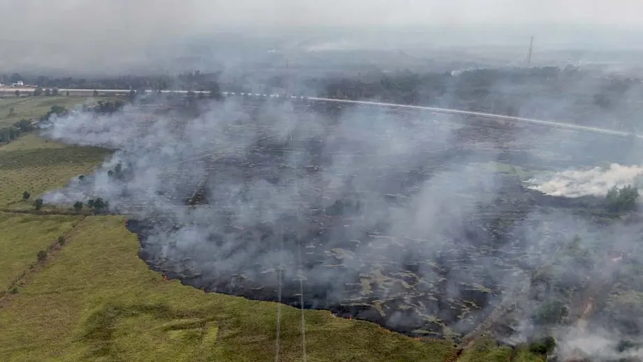
Repeated fires expose the limits of emergency response
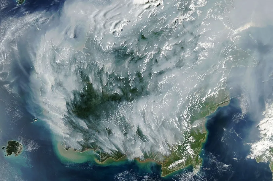
Seven South Sumatra districts that burned during Indonesia's 2015 fire disaster are burning again in 2026, while satellite analysis has identified 22,690 hotspots inside company concessions. In Palembang, visibility fell below 300 meters on October 8, disrupting 30 flights. The return of fires to areas targeted for peatland restoration is putting government prevention efforts, corporate responsibilities and public health protection under scrutiny.
Contents
- Repeated fires expose the limits of emergency response
- What the satellite numbers actually measure
- OKI remains the main concentration of risk
- How the fire season developed
- Why ground crews remain essential
- Brazilian suppressant trial adds another tool
- Rewetting must account for local livelihoods
- Hazardous air reaches homes and transport routes
- Concession audits and legal cases test accountability
- A new peat agency faces an unresolved mandate
- Key Points
The Indonesian Forum for the Environment, known as Walhi, identified the affected districts as Ogan Komering Ilir (OKI), Banyuasin, Musi Banyuasin, Muara Enim, Penukal Abab Lematang Ilir (PALI), Musi Rawas and Musi Rawas Utara. Galang Suganda, Walhi South Sumatra's head of advocacy and campaigns, said on October 9 that much of the peatland burned in 2015 had caught fire again.
A national decline in satellite detections has provided some relief without ending the provincial emergency. The Forestry Ministry's October 9 statement recorded 130 hotspots with high confidence in South Sumatra at 9:10 p.m. Western Indonesia Time on October 8, down from 224 the previous day. The province still had the highest count among six priority provinces.
The central issue is whether suppression can be followed by changes that keep peat wet and prevent another cycle of burning. Authorities are testing a Brazilian suppressant, reinforcing ground operations and proposing canal blocks. Environmental groups want those measures paired with concession audits, enforcement and protection for residents breathing hazardous air.
What the satellite numbers actually measure
Walhi's spatial analysis of Forestry Ministry SiPongi data for September 1 to October 2 found 10,411 hotspots across 18 forest utilization or industrial timber plantation concessions, and 12,279 across 63 plantation concessions. Separately, its analysis of South Sumatra's peat hydrological units found 16,685 hotspots, including 11,845, or 70.99 percent, in peat dome areas.
A peat hydrological unit is a connected landscape whose water movements need to be managed together. A peat dome is a raised accumulation of peat within that landscape. The concentration of detections there makes water management a central part of the investigation, rather than treating each visible fire as an isolated event.
These figures are not counts of separate fires or hectares burned. The Forestry Ministry says hotspots indicate surface temperature anomalies detected by satellites. One fire can generate several detections, and checks on the ground are needed to establish what is happening.
Other totals cover different periods, areas and confidence levels. SiPongi data cited for September 1 to October 7 identified about 59,275 detections with medium or high confidence across South Sumatra's 17 districts and cities. Walhi said visits to selected locations confirmed fires at sites with medium confidence detections, but that does not establish that every detection was a fire.
The ministry's October 8 national snapshot used several satellite systems and counted only detections with high confidence. Its national total fell from 1,176 to 387, a decline of about 67 percent. South Sumatra's decline from 224 to 130 was about 42 percent. These daily changes cannot be directly compared with cumulative totals collected over weeks or months.
OKI remains the main concentration of risk
Hutan Kita Institut (HaKI) recorded 4,386 hotspots in South Sumatra's peatland and mangrove areas between January 1 and October 4, using NASA MODIS Terra and Aqua satellite data. OKI accounted for 2,005, approximately 46 percent of that total.
The remaining detections were in Banyuasin, with 885; Musi Banyuasin, 619; Muara Enim, 535; PALI, 197; Musi Rawas Utara, 139; and Musi Rawas, six. HaKI mapping technician Bayu Prima said the figures could help determine where restoration or sustainable management should be directed.
Reports describe OKI as South Sumatra's leading fire district since the 1997 disaster. Estimates of its peatland area differ: one gives approximately 769,000 hectares of peat swamp, while Governor Herman Deru cited about 600,000 hectares within a provincial peatland total of 1.26 million hectares. The definitions and mapping behind those estimates have not been reconciled.
Risk also extends beyond land classified as peat. Ogan Ilir, described as having no peat swamp, recorded 390 hotspots in 2026 and experiences repeated fires in agricultural and plantation areas on swamp land. Smoke near the Palembang–Indralaya and Palembang–Kayuagung toll roads has reduced visibility, particularly in the morning and afternoon. HaKI wants Ogan Ilir included in restoration or sustainable management efforts.
How the fire season developed
Reported burned area expanded sharply between late July and mid September. One account placed South Sumatra's cumulative total at 1,926.23 hectares by July 31 and 6,552.31 hectares by September 14. That is an increase of 4,626.08 hectares, taking the total to about 3.4 times its July level.
The figures are not fully consistent across reports. Another account cited approximately 1,926 hectares through August 23. An October operational update recorded 73 incidents covering 390.61 hectares as of October 7, but did not establish a reporting period comparable with the cumulative September figure. It cannot be read as a reduction in total land burned.
- July 31: Reported cumulative burned area reached 1,926.23 hectares.
- September 14: The cumulative estimate rose to 6,552.31 hectares.
- October 2: Palembang driver Hardiansyah died after breathing difficulties; a connection to smoke has not been medically established.
- October 6: Palembang's reported Air Pollutant Standard Index reached 832, in the hazardous category.
- October 7: Deputy Environment Minister Diaz Hendropriyono inspected fire sites and met concession companies.
- October 8: Palembang visibility fell below 300 meters, while South Sumatra's daily hotspot count declined.
- October 9: A Brazilian suppressant was tested in Banyuasin.
In September, South Sumatra meteorological coordinator Wandayantolis said most areas had experienced nearly 60 consecutive days without rain, with Ogan Ilir exceeding 81 days. He linked the prolonged dry conditions to El Niño and expected broader natural rainfall around late October or early November. That forecast was an operational planning assumption, not a guarantee that fires would end then.
Why ground crews remain essential
On September 14, ground teams reportedly extinguished about 289.97 hectares, compared with approximately 30 hectares handled through helicopter water drops. Another 84.25 hectares remained under suppression. Ground teams therefore accounted for nearly ten times the area attributed to aircraft that day, although this is not a controlled comparison of their performance.
South Sumatra's ground task force had 12,285 personnel. National Disaster Mitigation Agency (BNPB) chief Suharyanto called for at least one additional team of 15 personnel in each district or city, with further reinforcement where needed. Governor Herman Deru proposed a regional task force to support existing crews. Twelve of the province's 17 administrative areas had been designated priorities.
Air operations continue alongside that work. The Forestry Ministry said the government had placed 61 aircraft on standby nationally, including 17 for patrols and weather modification and 44 for water bombing. These were national resources, not a fleet assigned entirely to South Sumatra. Weather modification attempts to encourage rain from suitable clouds, so a lack of those clouds restricts its use during drought.
Peat presents a different problem from a surface vegetation fire. Embers can persist and spread underground after visible flames disappear. Ferdian Krisnanto, head of the Forest Fire Control Center for the Sumatra region, said saturating underground cavities can take dozens of minutes for just one square meter. Limited water supplies and difficult access make continued wetting and cooling indispensable.
Brazilian suppressant trial adds another tool
BNPB said Realiza Anti-Chamas, a suppressant supplied by Brazil, was tested in Banyuasin on October 9. One description identified it as a powder dissolved in water before spraying, while another described a liquid mixed with water. Both accounts said the mixture was applied to fires to restrict their spread.
Coordinating Minister for Political and Security Affairs Dudung Abdurachman said the suppressant had also been tested in Kalimantan. Describing the assistance and trials, he said:
We have received assistance from Brazil in the form of a sprayed, settling liquid to extinguish the fires. We have tested this liquid in South Sumatra and Kalimantan. Hopefully, these efforts can extinguish the fire quickly,
No measured trial results, application quantities or assessment of its performance against underground peat combustion were disclosed in those accounts. The trials therefore establish that another method is being tested, not that it has resolved the limitations of existing suppression efforts.
Presidential Chief of Staff Listyo Sigit Prabowo said President Prabowo Subianto had instructed the military, police, local governments and relevant ministries to continue firefighting. Authorities were also expanding public education and reviewing regulations. Dudung planned visits to affected areas, including South Sumatra, but no firm schedule was given.
Rewetting must account for local livelihoods
Deputy Environment Minister Diaz Hendropriyono called for canal blocks to raise groundwater levels in dry peatland. During his October 7 visit, he inspected two peat fire sites in Talang Kelapa and discussed weather modification, water bombing and continued ground suppression.
Explaining the prevention measure, Diaz said:
We need to raise groundwater levels in peatlands experiencing drought by constructing canal blocks,
Canal blocks slow drainage so that water remains in the peat landscape. Where canals lack water, Diaz proposed drawing from nearby rivers through intake systems and using centrifugal pumps to move it into canals in vulnerable concession areas. The Environment Ministry provided five pumps to Palembang for local authorities, the disaster management agency and community fire groups, and distributed masks to nearby residents.
Implementation is not simply a matter of installing structures. Authorities were still mapping suitable blocking locations and water sources. Diaz said some residents opposed the infrastructure because changes to waterways could obstruct transport of agricultural and plantation products. He called for village governments and environmental offices to discuss the plans with communities.
A coordination meeting involved 43 companies holding concessions in hotspot areas. Ryllian Chandra, a researcher in the politics of water governance at UIN Raden Fatah Palembang, argued that drying peat as though it were mineral soil creates conditions for drought and fire. He said peat should be kept wet and agricultural crops selected for their ability to grow in those conditions. This connects restoration to land use decisions, not just firefighting equipment.
Hazardous air reaches homes and transport routes
Thick haze affected Palembang, Prabumulih and much of PALI for roughly two weeks, according to Walhi. On October 8, meteorological observations put Palembang visibility below 300 meters at 6 a.m. and below 1,000 meters until 3:30 p.m. Sultan Mahmud Badaruddin II Airport reported disruption to 17 departing and 13 arriving flights.
Ferdian said satellite imagery indicated smoke from OKI was moving from southeast to northwest, affecting Palembang and neighboring provinces as far as North Sumatra. This makes the consequences of land management in one district much wider than the burned area itself.
Palembang's reported Air Pollutant Standard Index reached 832 on October 6. Greenpeace and Perkumpulan Rawang volunteer Zelvan Ramadhan separately cited PM2.5 concentrations of 300 to 400 micrograms per cubic meter. PM2.5 consists of particles small enough to enter deep into the lungs. These concentration measurements and the air quality index are different measures and should not be treated as interchangeable numbers.
Health reports also differ. Palembang's city health service was cited as recording 17,434 acute respiratory infection cases in September. A separate provisional provincial dataset listed 10,965 Palembang cases within a South Sumatra total of 40,555 for that month, with reporting still underway. The difference has not been explained.
The provincial health service recorded 348,708 respiratory infection cases from January through August, including 113,883 in Palembang. Those counts cannot all be attributed to smoke, because respiratory infections have several causes. A 2022 Environmental Health study estimated annual smoke exposure across Sumatra and Kalimantan was associated with 33,100 premature adult deaths and 2,900 infant deaths. Those estimates describe a broader modeled burden, not confirmed deaths in South Sumatra's current emergency.
Hardiansyah, a 41 year old driver in Palembang with a history of asthma, died on October 2 after breathing difficulties. His family described worsening symptoms during the haze. Walhi also cited two suspected deaths in Palembang and OKI, but acknowledged that medical examination was necessary. Governor Deru said Hardiansyah's cause of death could not be established without an autopsy. There is no confirmed official smoke death total.
Concession audits and legal cases test accountability
South Sumatra police handled 50 fire cases from January through September, including 34 involving individuals and 16 involving corporations. Six corporate cases were in OKI. The 16 corporate cases had reached the investigation stage, with IPB land and environmental damage specialist Basuki Wasis assisting investigators. Investigation does not establish guilt.
Ferdian alleged that some fires clear community land later acquired by concessions, and that repeated fires around Palembang development areas are followed by sales of cleared plots. These are allegations requiring investigation. Hotspots inside concession boundaries identify places needing scrutiny, but do not establish who lit a fire or whether an operator breached its duties.
Governor Deru supported strict action against proven violations, including revoking licenses within provincial authority and recommending revocation where authority rests with the central government. Walhi called for audits of prevention duties, water management, equipment readiness, fire histories and restoration obligations.
The province's cases are separate from a national Forestry Ministry update describing 46 legal subjects in 10 provinces: 17 at preliminary inquiry, 27 under investigation and two ready for trial. Walhi also reported 372 companies as potentially involved in fires to national authorities. These groups must not be added together as though they were one set of proven offenders.
Government funding reports need similar care. One account referred to Rp30 billion for South Sumatra but then listed district allocations totaling Rp70 billion. Another specified Rp100 billion across the region: Rp30 billion for the provincial government, Rp20 billion each for OKI and Musi Banyuasin, and Rp15 billion each for Ogan Ilir and Banyuasin. The second breakdown separates provincial support from the wider regional package.
A new peat agency faces an unresolved mandate
The recurring fires have renewed attention on a proposed National Peatland and Mangrove Management Agency, known as BPGMN, following the dissolution of the Peatland and Mangrove Restoration Agency (BRGM) at the end of 2024. Accounts differ on whether BPGMN has already been established or is still being prepared. No founding instrument, confirmed mandate or operational timetable is identified here.
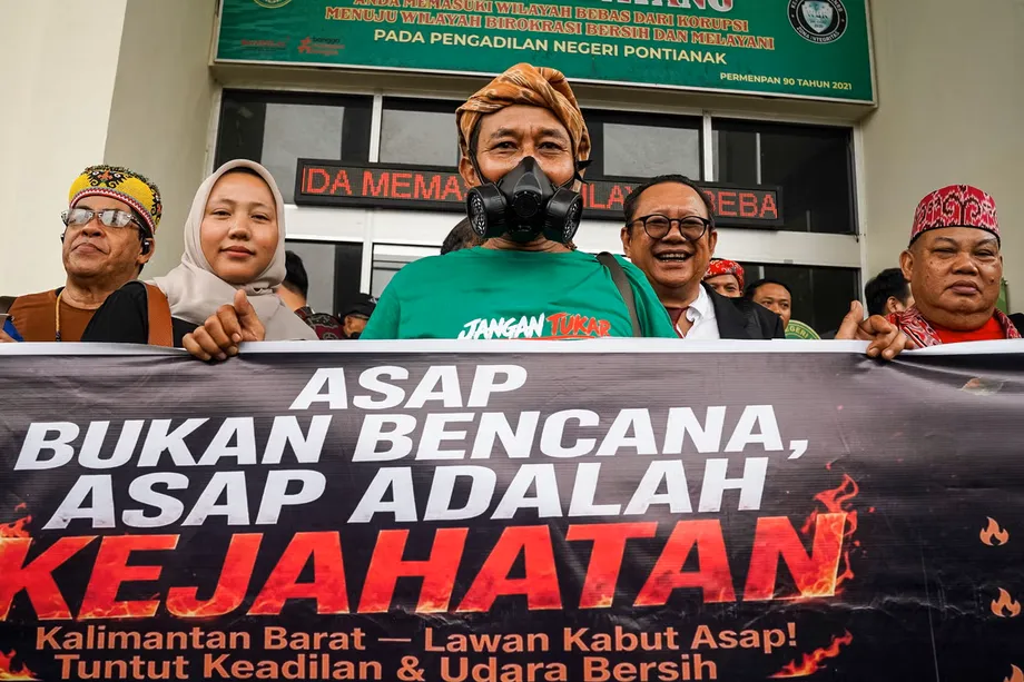
Walhi wants the institution's work measured by restored peat water functions, an end to repeated fires, corporate responsibility and protection from smoke, rather than the number of programs, pumps or canal blocks installed. Its demands also include shelters free from smoke, accessible health services, protection for vulnerable residents and publication of air quality and enforcement information.
The Forestry Ministry advises residents to follow official air quality updates, reduce outdoor activity when conditions worsen and use masks when going outside. Children, pregnant women, older adults and people with respiratory or chronic illnesses require particular protection. Its national response also includes wildlife rescue: at least 272 animals in Kalimantan had received assistance, showing that the emergency extends beyond South Sumatra.
The next practical tests are whether peat remains wet, suppression reaches persistent underground fires, investigation results become public and communities receive effective health protection. The late October to early November rainfall forecast is the next weather marker identified, but no firm dates have been announced for corporate case decisions, suppressant results or the new agency's full operation.
Key Points
- Seven South Sumatra districts affected by the 2015 disaster are burning again in 2026.
- Walhi identified 22,690 hotspots inside company concessions, but detections require field verification.
- About 71 percent of hotspots in Walhi's peat hydrological analysis were in peat dome areas.
- Palembang haze disrupted 30 flights on October 8, while health totals and suspected deaths require careful interpretation.
- Ground suppression, peat rewetting and a Brazilian suppressant trial are being pursued together.
- Sixteen corporate fire cases were under investigation in South Sumatra; guilt has not been established.
- The status and mandate of the proposed peat and mangrove agency remain unresolved in public accounts.