Faster Forecasts Meet the Test of Extreme Weather
Hong Kong is expanding its use of artificial intelligence to forecast typhoons and heavy rain after promising results during Tropical Cyclone Wutip in June and an August downpour that produced the city's highest daily rainfall since records began in 1884. The Hong Kong Observatory (HKO) has announced significant investment in the technology, seeking more accurate forecasts and earlier warnings for tropical cyclones, rainstorms and other severe weather.
Contents
- Faster Forecasts Meet the Test of Extreme Weather
- Why Hong Kong Needs More Precise Warnings
- How AI Learns to Forecast the Weather
- What Wutip Revealed About Typhoon Tracks
- Heavy Rain Is a Harder Local Test
- Why Storm Strength Remains Difficult
- What Comparisons Between Models Show
- How the Observatory Is Putting AI to Work
- Taiwan's Experience and the Wider Technology Push
- People Still Turn Forecasts Into Warnings
- Key Points
The Observatory's current generation of AI models draws on approximately 40 years of global reanalysis data, amounting to about 25 trillion data points. Reanalysis combines past weather observations with computer modelling to build a consistent picture of how the atmosphere changed over time. AI systems learn from that history to predict how weather may develop next.
Two AI models gave a more accurate indication of Wutip's eventual route than the conventional forecasts described during its approach. During the August rain, AI also identified the development of a rainband along the Guangdong coast about a week beforehand. Those results offered useful guidance, although predicting the exact location and strength of dangerous weather remains difficult.
Hong Kong's experience captures both the promise and the limits of the technology. A forecast can identify where a typhoon is heading while still underestimating its winds. It can anticipate a broad area of heavy rain while struggling to locate the streets and slopes facing the greatest danger.
The Observatory is therefore combining AI forecasts with traditional models and the judgment of meteorologists. Its growing investment forms part of a wider shift across the region and the world, with Taiwan, international research institutions and technology companies also using machine learning to improve disaster preparedness.
Why Hong Kong Needs More Precise Warnings
Hong Kong's subtropical location puts it in the path of Pacific typhoons, which can bring destructive winds, torrential rain, flooding and landslides. Its dense population and complex infrastructure make accurate warnings especially valuable. Even small improvements can help save lives, reduce economic losses and give emergency services more time to organise their response.
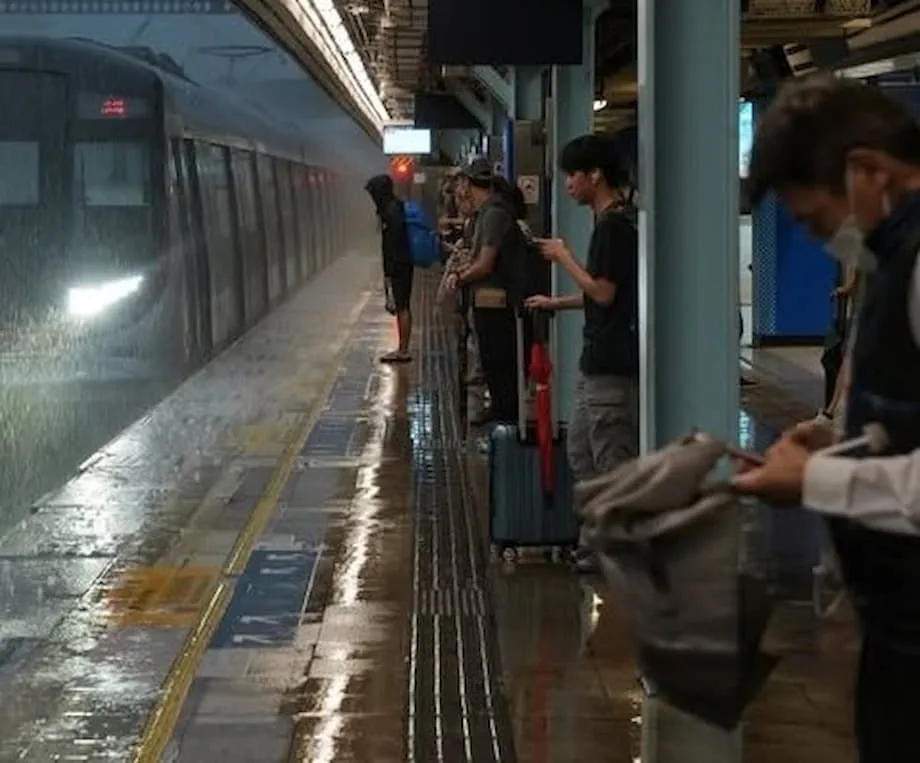
The August downpour brought the city's highest daily rainfall since records began in 1884 and triggered its second longest black rainstorm warning. Severe flooding, landslides and widespread disruption followed. The event showed why anticipating rainfall across a region and predicting its precise local effects are both necessary.
Nearby areas have also faced serious consequences from extreme weather. Deadly floods in Gansu province and mass evacuations in Guangdong underline the need for earlier warnings across the wider region.
Climate change is intensifying storms and increasing the unpredictability of weather patterns. For forecasters, the pressure is to improve both the advance notice they can provide and the accuracy of the information people use to prepare. Traditional methods remain useful, but predicting a cyclone's exact path and a sudden increase in its strength continues to be difficult.
How AI Learns to Forecast the Weather
Traditional numerical weather prediction (NWP) uses equations describing atmospheric physics to simulate how the weather will change. These calculations require powerful computers. AI forecasting takes a different approach: machine learning systems study large collections of historical weather data and learn relationships between conditions at one point in time and what happens afterward.
Lo Ka-wai, a scientific officer at the Hong Kong Observatory, explained how the extensive training dataset supports those predictions:
By learning from this extensive dataset, the AI models can identify the patterns and relationships of weather evolution, which can then be used to predict future weather changes.
The roughly 25 trillion data points used by the current generation of models provide examples of changing weather across approximately four decades. By recognising patterns and subtle signals within those examples, the models can predict the evolution of weather systems, including typhoons.
Once trained, AI models can produce forecasts in minutes, compared with hours for models based on physical equations. They also require much less computing power to generate those forecasts. Their speed and lower energy requirements make them attractive tools for weather agencies that need timely information.
AI can also identify developing patterns early enough to give authorities and the public more time to prepare. Its usefulness depends on the quality and completeness of the data it learns from, however. Missing observations or inaccurate historical records can limit its performance.
What Wutip Revealed About Typhoon Tracks
Tropical Cyclone Wutip gave the Observatory a practical test in June. As the storm threatened Hong Kong, forecasters examined both conventional and AI predictions to assess its likely route.
A European model predicted that Wutip would approach the southern coast of China, while an American model suggested it would come closer to Hong Kong. Two AI models instead indicated a route farther west, closer to the path the storm eventually followed.
Hong Kong avoided a direct hit. The more accurate AI guidance helped inform the Observatory's warnings, supporting timely decisions and helping avoid unnecessary disruption. The result demonstrated the value of comparing several forecasts when their predictions differ.
AI models have repeatedly matched or exceeded conventional models in forecasting typhoon tracks, particularly in the Western Pacific. The Observatory has expanded its use of systems including FuXi, developed by Fudan University; Pangu-Weather, developed by Huawei; and the Artificial Intelligence Forecasting System (AIFS) from the European Centre for Medium-Range Weather Forecasts (ECMWF).
For residents and emergency planners, a more accurate track forecast means a better indication of which places a storm may approach. The storm's strength and the location of its heaviest rain still require their own assessment, making track prediction one part of a much larger forecasting task.
Heavy Rain Is a Harder Local Test
He Yuheng, acting senior scientific officer at the Observatory, said AI models successfully predicted the development of a rainband that brought heavy rain to the Guangdong coast about a week before the August downpour. A rainband is an elongated area of rainfall, so identifying its development can give forecasters advance notice of a broad threat.
The models were less precise about where the heaviest rain would fall. Even so, their predictions provided a useful basis for timely warnings and preparations for emergency responses. The practical challenge is to turn a forecast covering a large area into information about the places most likely to flood or experience landslides.
The record rainfall in September 2023 exposed similar limits. AI models provided useful guidance but struggled to capture the full amount of rain and its exact location. Rare events are particularly difficult for systems trained largely on what has happened before.
The Hong Kong Observatory explained why predictions of extreme weather still need careful assessment:
The capability of AI models in predicting extreme weather events has yet to be verified because of their rare occurrence in history, not to mention record-breaking weather events were not present in AI models' training data.
Historical data can contain many examples of ordinary weather while offering far fewer examples of exceptional conditions. That makes the ability to forecast unprecedented rainfall an important area for continued testing, even as AI becomes useful in everyday operations.
Why Storm Strength Remains Difficult
AI models tend to underestimate the intensity of tropical cyclones, particularly when storms strengthen rapidly. Rapid intensification means that a storm's wind speeds increase dramatically over a short period, leaving less time for people and authorities to adjust their preparations.
Nearly 80% of major hurricanes and typhoons undergo rapid intensification, and the number of these events is rising because of climate change. Forecasting that sudden strengthening remains a major challenge for both AI and traditional methods.
Predicting peak wind speeds is another unresolved task. For a city exposed to tropical cyclones, the difference between a reasonably accurate route and an accurate estimate of storm strength matters directly to preparedness. Forecasters need to judge both where a storm may go and how dangerous it may become.
Rare or unprecedented events create a related difficulty. If the conditions behind an extreme event are poorly represented in the training data, an AI system has fewer examples from which to learn. Better data and models that represent weather at greater local detail are therefore central to improving forecasts of intense storms, flash floods and landslides.
What Comparisons Between Models Show
Scientific studies examining East Asia and the Western Pacific have compared five major AI weather models: Pangu-Weather, FourCastNet v2, GraphCast, FuXi and FengWu. The evaluations considered both typhoon tracks and intensity, allowing researchers to assess different parts of the forecasting problem.
FengWu emerged as the most accurate for predicting tracks in those comparisons. FuXi and GraphCast also performed well. All five models struggled with intensity forecasts, showing that progress in predicting a storm's route has moved faster than progress in predicting its strength.
Ensemble approaches have shown promise in improving forecast reliability. An ensemble brings together predictions from multiple models, giving forecasters a range of possible outcomes rather than relying on a single forecast. Comparing those outcomes helps them assess how much agreement there is about a developing storm.
The findings support further research into regional models with higher resolution, meaning models that describe weather over smaller areas and in greater detail. Continued collaboration between AI researchers and meteorological agencies is also needed to address weaknesses in intensity forecasting and local impact prediction.
How the Observatory Is Putting AI to Work
The Hong Kong Observatory introduced several AI models into trials using current weather conditions from mid-2023. Their forecasts became available to the public through the Earth Weather webpage and the MyObservatory app.
The Observatory's use of AI extends beyond typhoon tracking. The models also predict rainfall, wind, temperature and humidity up to 15 days ahead. Those forecasts allow staff to examine developing weather patterns before deciding how they may affect Hong Kong.
The main developments span several periods:
- From mid-2023, the Observatory introduced several AI models into trials using current weather data and made their forecasts publicly available.
- In September 2023, AI offered useful guidance during record rainfall but struggled with rainfall amounts and location.
- In June, two AI models forecast a more westerly route for Wutip that was closer to its eventual path.
- Before the August downpour, AI predicted the development of a rainband along the Guangdong coast about a week in advance.
The Observatory is also working with international partners and private companies. Google DeepMind's Weather Lab and ECMWF's AIFS are being tested alongside local models, giving forecasters additional tools to evaluate and compare.
The amount of the newly announced investment was not specified. The operational direction is to improve forecast accuracy through continued research and model development while retaining expert interpretation of the results.
Taiwan's Experience and the Wider Technology Push
Taiwan's Central Weather Administration (CWA) has also adopted AI models to track typhoons. During Typhoon Gaemi, AI forecasts predicted a direct hit eight days in advance, outperforming conventional models and giving authorities additional preparation time.
Lu Kuo-Chen, deputy head of the CWA, described the benefit for the agency and those responsible for responding:
AI boosted forecasters' confidence and gave authorities more time to prepare.
Taiwan's experience illustrates why advance warning is valuable even before the details of local impacts become clear. Earlier recognition of a likely typhoon threat gives authorities a longer period in which to prepare, while forecasters continue refining the expected path and strength.
Nvidia, Google and Microsoft are developing advanced AI weather models and partnering with meteorological agencies around the world. Private sector involvement is accelerating innovation, including work aimed at improving intensity forecasts and predictions of local impacts.
Hong Kong's adoption of multiple systems fits this wider regional and global development. Its experience offers lessons for other cities exposed to severe weather, particularly the value of international collaboration and public engagement alongside technical improvements.
People Still Turn Forecasts Into Warnings
Meteorologists remain essential to interpreting AI outputs, especially when dangerous weather could affect large numbers of people. Human oversight helps bring together forecasts from different systems and assess their relevance to warnings and emergency planning.
The Observatory and its partners are continuing research, model development and public education. Their goal is to improve accuracy while building public trust and ensuring that people understand warnings and act on them.
Hong Kong's investment also forms part of its effort to cope with a changing climate. Earlier and more accurate forecasts can help communities prepare for increasingly intense and unpredictable weather, reduce losses and support sustainable development. The most immediate value is concrete: more time to organise a response and better information about where danger may develop.
AI is becoming an increasingly central forecasting tool, but its strongest results remain in predicting broader weather patterns and cyclone tracks. Better forecasts of sudden strengthening, extreme rainfall and local damage will require continued testing, better data, models with greater local detail and the expertise of forecasters.
Key Points
- Hong Kong is investing in AI forecasting after useful results during Wutip and the August downpour.
- The current generation of AI models learns from about 40 years of global reanalysis data, containing approximately 25 trillion data points.
- Two AI models predicted a more westerly route for Wutip that was closer to its eventual track.
- AI anticipated a Guangdong coastal rainband about a week before the August rain but struggled to pinpoint the heaviest rainfall.
- AI forecasts can be generated in minutes and use less computing power, while cyclone intensity and rare extremes remain difficult.
- The Observatory publishes AI forecasts through Earth Weather and MyObservatory and uses models predicting conditions up to 15 days ahead.
- Taiwan's AI forecasts predicted a direct hit from Gaemi eight days in advance.
- Human expertise, international cooperation and continued research remain central to turning forecasts into effective warnings.