A familiar Tokyo outing with a rising rescue count
Japan's National Police Agency recorded 131 people stranded in the Mount Takaosan area in 2024, about 50 percent above the five year average of 86. The total exceeded the 83 recorded on Mount Fuji and the 66 in the Hotaka range, despite Takao's modest summit of roughly 599 meters and its reputation as an accessible day out.
Contents
- A familiar Tokyo outing with a rising rescue count
- Where a short walk turns into trouble
- What visitors are seeing at the mountain's base
- Which route matches your day?
- Heat and rain change the difficulty
- Short days, ice and bear sightings
- Build a plan around the return journey
- What belongs in a small hiking bag?
- What to do when someone is lost or injured
- A realistic day out, or a longer mountain walk
- What to Know
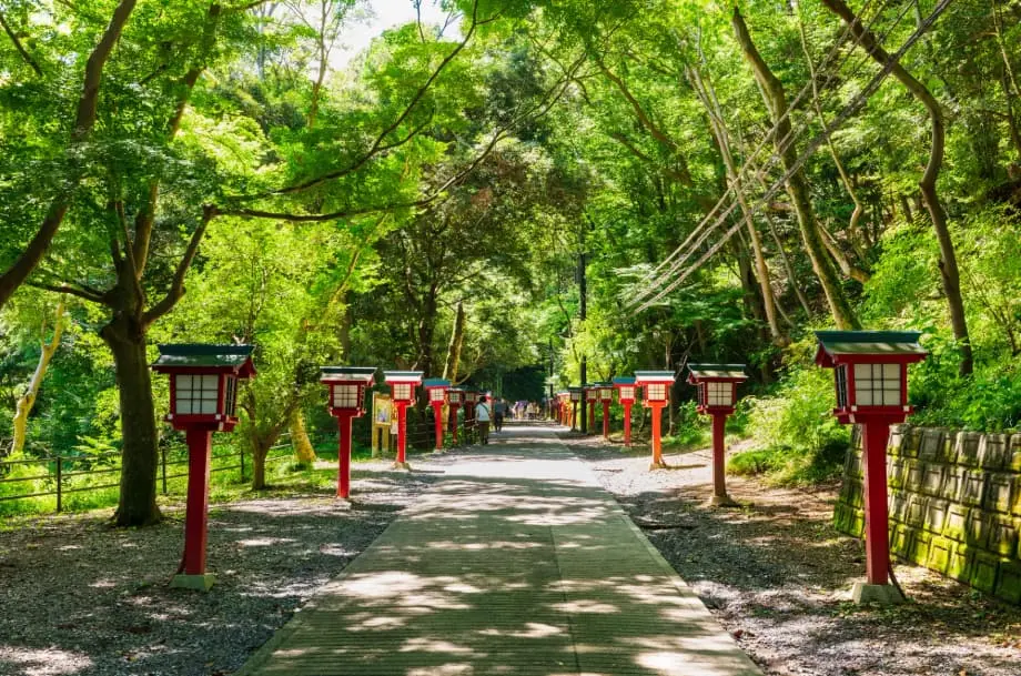
On Tokyo's western edge, less than an hour by train from Shinjuku, Mt. Takao attracts up to four million visitors in a typical year. Families, students and travelers fill its trails on clear autumn weekends. A paved main route, cable car and chair lift make the mountain feel approachable, while Yakuoin temple and statues of the tengu mountain deities give the walk a cultural and spiritual draw.
As of October 19, 2025, the warning for visitors is straightforward: convenient transport and busy paths can hide a demanding climb. People become exhausted below the cable car's upper station, fall while descending or find themselves on unfamiliar trails after sunset.
The national figures show the wider setting. In 2024, Japan recorded 2,946 mountain accidents involving 3,357 people, the third highest total since records began. Three hundred people were dead or missing, and 1,390 were injured. People in their 50s, 60s and 70s made up the majority of victims, while 135 of those involved were visitors from abroad.
Takao's popularity brings many people onto the mountain, including walkers with little equipment or recent hiking experience. The practical challenge is to prepare for the slope, weather and return journey with the same care as for a less familiar destination.
Where a short walk turns into trouble
Getting lost remains the leading cause of mountain emergencies across Japan. On Takao, falls and fatigue are becoming more common causes, and many rescues involve middle aged and older climbers. Most incidents happen on or near Trail 1, the broad paved route that almost everyone uses for at least part of a visit.
Trail 1 runs beside the funicular, a railway pulled by cable whose maximum grade reaches 31 degrees, the steepest in Japan. The walking route itself has long, winding slopes that tax legs and lungs. Some hikers abandon the climb before reaching the upper cable car station; others lose their balance during the descent.
Pavement encourages some visitors to wear light footwear or begin late, expecting a quick stroll. Crowds can also disguise the effort involved. When other walkers thin out, the main route still feels developed, but adjoining paths are narrower and quieter. A wrong turn at a junction can lead onto a ridge heading away from the main routes.
Transport creates another deadline. Missing the final cable car or chair lift leaves a tired visitor with a walk down, possibly in darkness. An afternoon outing can then become a night search.
The pattern is useful to understand in sequence:
- In 2024, the NPA recorded 131 stranded people in the Takao area, compared with a five year average of 86.
- During 2025, repeated bear sightings across Tokyo's mountains added wildlife precautions to hiking plans.
- By October 19, 2025, shortening autumn days made departure times, sunset and the final transport services especially important.
What visitors are seeing at the mountain's base
Booths near trailheads have been renting emergency transmitters and radios, while nearby shops offer boots and warm layers. Staff who equip hikers warn that the route is steeper than it first appears. Such preparations matter even when the summit looks close and the weather in central Tokyo feels comfortable.
A staff member at a small hotel near the base advised visitors to respect the slope despite the mountain's low elevation, wear good boots and pace themselves. The advice addresses a common mismatch: a short journey from the city can still lead to sustained physical effort.
Wildlife concerns are also visible. A woman in her 60s visiting in October carried a small bell on her pack after reports of bears across Japan and noticed many other walkers doing the same. Repeated sightings in Tokyo's mountains, including the Takao area, have made noise and awareness part of the outing.
Which route matches your day?
Takao has eight main route options, alongside ridges that continue toward other peaks. Their surfaces, lengths and demands vary. Choosing by available time and fitness is more useful than assuming that every path leads to the same kind of walk.
- Trail 1 is broad, mostly paved and lined with cultural stops, tea houses and viewpoints. Average walkers take about 90 minutes from the base to the summit. Its steady slope can be hard on knees during the descent. Strollers are suitable only on broad paved areas in dry conditions.
- Trail 2 forms a short loop near the upper cable car station, showing the contrast between the mountain's sunny and shaded sides. It suits a gentler walk.
- Trail 3 is a quieter forest path through katsura groves. With fewer crowds and less pavement, it calls for shoes with grip.
- Trail 4 includes the Miyama suspension bridge. Improvements in recent years have helped, although parts can still feel narrow.
- Trail 5 loops near the summit, providing short diversions and access to viewpoints and stands of Egawa cedars.
- Trail 6, the Water Course, follows a stream past Biwa-taki waterfall. Stepping stones, damp rocks and a steep final climb make it more technical than Trail 1. It can be slippery after rain and sometimes operates as an ascent route only during peak autumn foliage.
- The Inariyama Course follows a southern ridge with long stair sections and broader views of Tokyo on clear days. It is less crowded than Trail 1 and feels more like a mountain hike.
- The Takao to Jinba traverse covers roughly 15 kilometers, linking summits including Shiroyama and Kagenobuyama before reaching Mt. Jinba and its white horse statue. It suits intermediate to experienced hikers with a very early start, a headlamp and transport arrangements at the far end.
Facilities become less frequent away from the main path. Beyond the summit, signs may be farther apart, and some signs away from the main route are in Japanese only. An outdated guidebook or a phone without a signal can turn a detour into hours of extra walking. Check current trail notices for maintenance and temporary direction rules before setting out.
Heat and rain change the difficulty
Summer heat and humidity can make even Takao's lower slopes exhausting. Temperatures in the mid 30s Celsius are common, and people starting around midday can reach the steeper sections already flushed, dizzy and short of water. During recent hot spells, hikers who began at noon reported headaches, nausea and confusion, symptoms associated with heat exhaustion.
An early departure, regular rests and enough water with electrolytes help manage the strain. Electrolytes replace salts lost through sweating. A towel can help manage sweat, as many local walkers do. A shaded ascent such as Trail 6 may offer relief from direct sun, although its wet footing and steeper sections still require care. Turn back at the first signs of heat stress.
Rain changes the footing across several routes. The Water Course and stone steps become slick, stream crossings demand attention, and the Inariyama ridge turns muddy. A lightweight rain jacket leaves hands freer than an umbrella on a narrow path.
Autumn typhoon forecasts also deserve attention before departure. Wet leaves can form a slippery layer even on paved sections, making a familiar descent harder to control. Footwear, pace and route choice need to match the surface underfoot.
Short days, ice and bear sightings
Autumn and winter reduce the time available for a comfortable return. Both the cable car and chair lift stop in the early evening on most days, often before dinner on weekdays. Check the final departures for the date of your visit and allow time for delays, rests and the walk to the station.
Shaded slopes facing north stay cold, and black ice can form on paved inclines, especially near the cable car station. A small headlamp belongs in the bag even for a planned daytime outing. Light traction for shoes is worth considering when temperatures approach freezing.
Bears have been reported repeatedly across Tokyo's highlands in 2025, including the Takao area. Walkers can make noise by talking with their group or carrying a small bell, keep food sealed and avoid approaching wildlife.
Anyone encountering a bear at close range should give it space and back away slowly while facing it. Sightings should be reported to local authorities once it is safe to do so. Wildlife precautions sit alongside the more routine demands of staying on route and returning before dark.
Build a plan around the return journey
A climbing plan gives authorities or someone at home a basic record of where you intend to go and when you expect to return. Submit one to the authorities if possible, or at least tell someone your route and return time. Check weather, sunset and the last cable car and chair lift departures before leaving.
Allow a buffer for Yakuoin temple, a meal or a long stop for photographs. A schedule that works only without breaks can leave little room for fatigue or a slower companion. Set a realistic time to turn back while daylight remains.
Navigation needs its own preparation. Take a paper map from the visitor center or download a reliable map that works without a signal. Check each junction, particularly beyond the summit. A phone is useful only while its battery lasts, so preserve power with airplane mode when appropriate and carry spare power.
Families should keep children close in crowded sections and avoid peak hours where possible. Strollers belong on the broad paved areas, rather than the narrower mountain paths. Children using the chair lift must sit still, and staff instructions are strict for safety.
Beer Mount, the seasonal beer garden near the upper cable car station, is another popular destination. The climb can be tiring on very hot days. Visitors planning to drink should descend by cable car rather than attempt steep slopes after alcohol.
What belongs in a small hiking bag?
Equipment should cover a longer or colder outing than expected. Shops and vendors are convenient, but queues can be long and kiosks may close early. Carrying the basics avoids making the day's safety depend on an open counter.
- Water and food: Bring at least one liter per person in cool weather, more in heat, and salty snacks or a light meal.
- Light and power: Pack a headlamp, spare batteries and enough phone power for navigation and an emergency call.
- Clothing: Wear sturdy shoes with grip. Carry a light rain jacket and a warm layer, including on sunny spring and autumn days.
- Navigation: Bring a paper map or a reliable map available offline, and take time to read signs at junctions.
- Emergency supplies: A whistle, small first aid kit and light emergency blanket add little weight and can help during a delay.
- Money and transport: Carry cash and a transit card for the cable car, chair lift, food and the onsen at the base.
Emergency transmitters and locator rentals near the trailhead can help rescuers find someone more quickly. A submitted climbing plan and a headlamp are also simple preparations that reduce the risk of an outing becoming an extended emergency.
What to do when someone is lost or injured
Stop and assess the situation before moving farther. A tired hiker taking a steep shortcut can slip, while leaving a marked route can make a search more difficult. Stay on the trail rather than trying to descend directly down a slope or scramble beside a cliff.
In Japan, call 110 for police or 119 for fire and ambulance assistance. Explain injuries, the condition of the surrounding trail and the last location you can identify. A trail number, Yakuoin temple, Biwa-taki waterfall or a nearby cable car or chair lift station can help describe where you are.
Share a phone map pin if possible. Conserve battery by dimming the screen and closing background apps. A whistle, bright clothing or a light after dark can help make your position easier to find.
If moving is unsafe, stay in place, keep the group together and remain warm and dry. An emergency blanket can help prevent a chill while waiting. The priority is to avoid adding another fall or another wrong turn to the original problem.
A realistic day out, or a longer mountain walk
A first visit during peak foliage season is easier to manage with an early start on a weekday, avoiding the largest crowds. For hikers comfortable with uneven, sometimes damp ground, Trail 6 offers a forest ascent. A summit stop can include a snack and, on a clear day, views of Mt. Fuji.
Returning by Trail 1 brings walkers past Yakuoin temple. If legs are tired, the chair lift or cable car provides an alternative descent while services are operating. At the base, the onsen and free nature museum can round out the visit.
The roughly 15 kilometer ridge walk to Mt. Jinba is a different commitment. On a cool, dry day, its quieter paths and views of Mt. Fuji can reward a dawn departure, but the route calls for extra water, food, a headlamp and knowledge of bus connections at the far trailhead.
If weather or time begins to work against that longer plan, turn around and return toward Takao's summit while plenty of light remains. The same principle applies to the shorter routes: choose the walk that fits the people making it, and preserve enough energy and time to get down safely.
What to Know
- The NPA recorded 131 stranded people in the Takao area in 2024, about 50 percent above the five year average of 86.
- Most Takao incidents occur on or near Trail 1; falls and fatigue are rising causes.
- The funicular beside Trail 1 reaches a maximum grade of 31 degrees. The paved walking route also has demanding slopes.
- Older adults form a large share of mountain accident victims nationwide, and visitors from abroad are among those needing help.
- Heat, slippery surfaces, early darkness, winter ice and bear sightings require different preparations.
- Check route notices and final transport departures, share a climbing plan, and carry water, rainwear, a map and a headlamp.
- Call 110 or 119 in an emergency, describe your location and stay on marked trails while awaiting assistance.
- Early starts and realistic return times help keep a short Tokyo outing from becoming a rescue.